Map size in jpg-format: 31.3727MiB
Click to open in high resolution (open in new tab).
With Text in English!
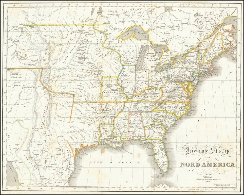
Rare German edition of Melish's map of the United States, extending west to include all of Texas, the Rocky Mountains, the Columbia River, Salt Lake and the Colorado River, considerably farther west than Melish's map.
The map extends west to the Great Salt Lake (Timpanogos) and the Columbia River.
Includes some names not normally found on any edition of the Melish, including the Great American Desert and the Black Hills. Most of the Nomenclature is in English.
From Carl Bernhard's Reise durch Nord Amerika.
If you are a student, write to us in telegram: @antiquemaps and indicate what material you need and for what work you need a map in high detail. We are ready to provide material on special terms. For students only!

![[Signed Political Satire Artwork] Vietnam ... Vietnam ... Vietnam ...](/map/small/68726.jpg)
