Map size in jpg-format: 265.853MiB
Click to open in high resolution (open in new tab).
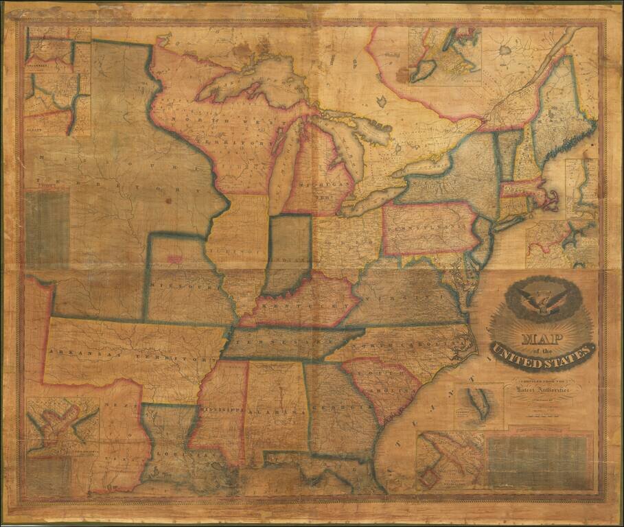
Very rare map of the United States by Vermont mapmaker Lewis Robinson.
Historically important wall map of the United States and a portion of the Republic of Texas, extending from Texas and the Missouri Territory to the East Coast, including parts of Canada.
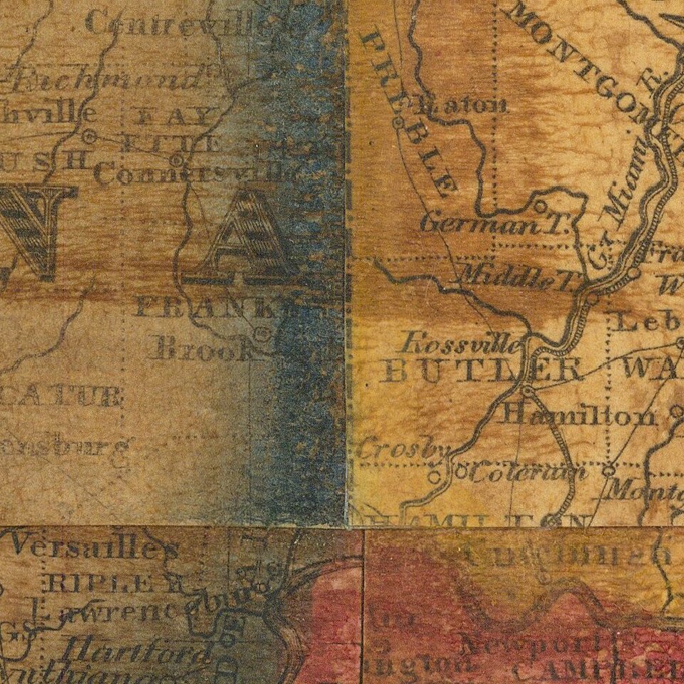
The present example highlights the Military Bounty Lands in north central Missouri, just above the city of Jefferson.
This map curiously features Texas labeled both as part of Mexico and as Texas. A large Missouri Territory and Northwest Territory (soon to be Northwest Territory) are shown and many American Indian tribes and villages are noted
There are inset maps of Washington DC, Boston, South Florida, Philadelphia, New York, Niagara Falls, Cincinnati, and Albany, as well as a number of statistical tables.
The map is decorated with a patriotic American Eagle title cartouche. This map was first issued in Reading, Vermont, in 1833 with recorded updates in 1835, 1836, 1842, and 1846.
If you are a student, write to us in telegram: @antiquemaps and indicate what material you need and for what work you need a map in high detail. We are ready to provide material on special terms. For students only!

![[Signed Political Satire Artwork] Vietnam ... Vietnam ... Vietnam ...](/map/small/68726.jpg)
