Map size in jpg-format: 32.9805MiB
Click to open in high resolution (open in new tab).
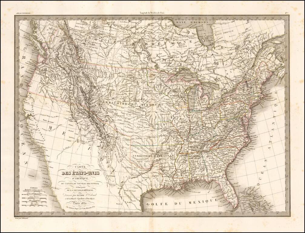
Highly detailed map of the United States from coast to coast. Includes an excellent 54-40 or fight Oregon Territorial Border, terrific post-Lewis & Clark, post-Zebulon Pike view of the Rocky Mountains and excellent treatment of the Southwest and Missouri Valley.
The details of the Lewis & Clark and Hunt & Randel expeditions are in evidence. The two mythical rivers extending from lakes Timpanogos and Teguayo to the Pacific Ocean are shown, based upon the lost Walker map. While the map was issued in the early 1830s, the Jedidiah Smith reports are not yet in evidence. Double wide Arkansas Territory shown. Texas is named. Nice detail throughout the Rocky Mountains. The Upper California Spanish Missions are named. The Rio Colorado falls short of the Sea of Cortez. Many Indian Tribes and early forts are named. An excellent early coast to coast map of the US.
If you are a student, write to us in telegram: @antiquemaps and indicate what material you need and for what work you need a map in high detail. We are ready to provide material on special terms. For students only!

![[Signed Political Satire Artwork] Vietnam ... Vietnam ... Vietnam ...](/map/small/68726.jpg)
