Map size in jpg-format: 6.16325MiB
Click to open in high resolution (open in new tab).
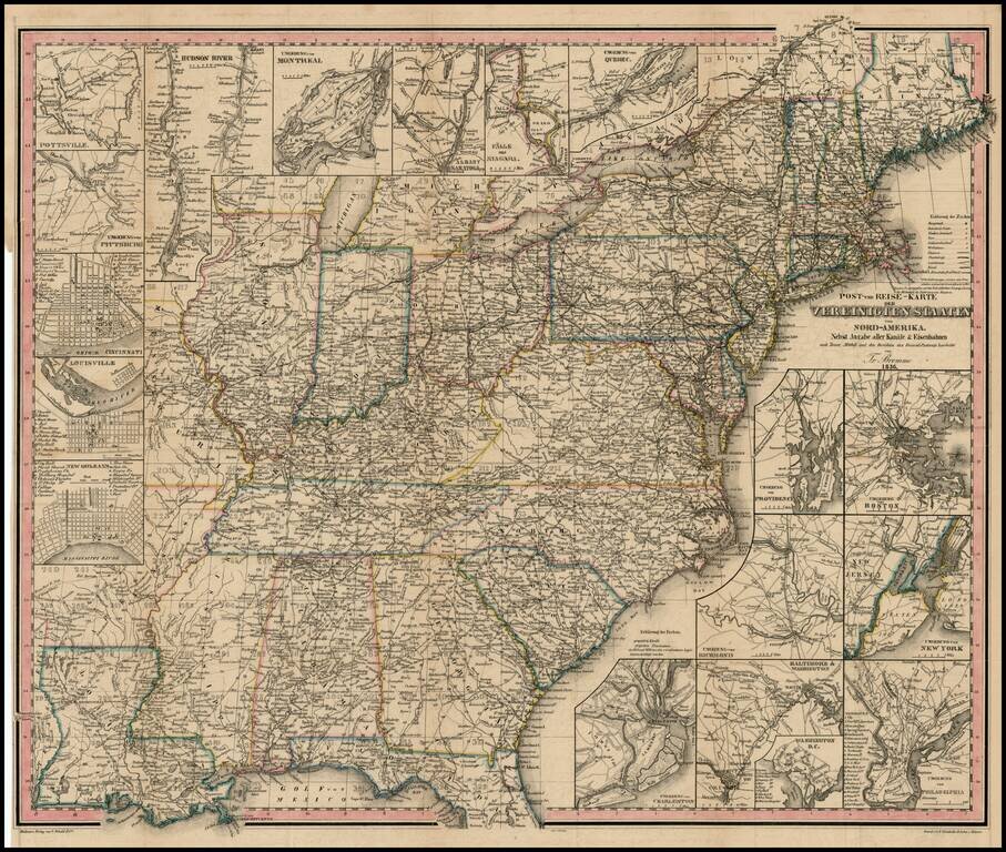
A very early example of one of Traugott Bromme's travel maps of the US.
Early map and scarce U.S.-published item from the most prolific German travel writer on America. The inclusion of railroads, postal routes and canals makes the map of particular note, especially for a non-English language map printed in the US.
Though engraved on stone in Meissen, this map likely was printed in Baltimore for a travel guide to German emigrants and also issued separately. Bromme credits Tanner, Mitchell and the General Post Office. The map includes 17 insets: areas of Niagara Falls, Albany/Saratoga, Montreal, Hudson River, Pittsburg, Cincinnati, Louisville, New Orleans (plan), Charleston, Baltimore/Washington with its own inset plan of Washington; Philadelphia, Richmond, New York, Providence, Boston...and Pottsville, PA. Even inns are shown.
Bromme was one of the most prolific German Travel writers from the 1830s to 1850s. His guides to German Emigrants, issued in many forms and abridgements, are now highly coveted. In a few of these guides, Bromme offered deluxe editions of the Guide, with a map published by JE Woerl. This is the earliest example of the map which we have ever seen, predating the examples which show counties in Texas. Rumsey has high marks for the map, calling it a beautifully engraved map of the US, from Coast to Coast, based upon Brue's map of Mexico from 1834 and Brue's Map of North America from 1833, although lacking Smith's Route.
If you are a student, write to us in telegram: @antiquemaps and indicate what material you need and for what work you need a map in high detail. We are ready to provide material on special terms. For students only!

![[Signed Political Satire Artwork] Vietnam ... Vietnam ... Vietnam ...](/map/small/68726.jpg)
