Map size in jpg-format: 122.5MiB
Click to open in high resolution (open in new tab).

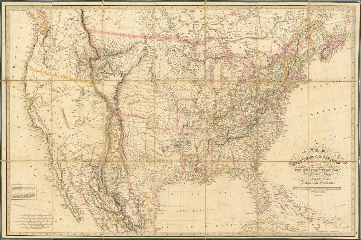
Rare 1836 edition of Laurie's Fredonia, which has been substantially updated in Texas and the West.
First issued in 1830, the map faithfully incorporates information from all important early explorations, including Lewis & Clark, Stephen Long, and the 1810 Arrowsmith Mexico map.
Fredonia was the named coined by Senator Samuel L. Mitchell and given significant consideration during the early 19th Century, although Laurie probably borrowed it (along with Cabotia for Canada) as a novelty to promote the map. Rumsey notes editions of 1832, 1833, 1834, 1836 and 1849, but doesn't reference the 1839.
The changes in the late editions are of significant note, as Laurie has incorporated important new information from Arrowsmith's map of British North America in 1834, especially in California and Texas. Among the most notable improvements in Texas is the clear delineation of the Colorado & Red River Land Co. lands, which are drawn directly from David Burr's seminal map of Texas.
A note in California has been added, noting that it only rains in the winter, except in Monterrey (drawn from Coulter's paper submitted to the Royal Geographical Society in 1835). There are many other major revisions in Upper California & Oregon.
In 1834, the map added a number of new details in western Michigan, including:
In 1834, a number of improvments are made in Indiana, including:
Numerous new towns and settlements are also added in the 1834 edition in Southern Illinois and Missouri.
This is the first example of the 1836 map we have seen on the market.
Provenance: Warren Heckrotte Collection: PBA March, 2016.
If you are a student, write to us in telegram: @antiquemaps and indicate what material you need and for what work you need a map in high detail. We are ready to provide material on special terms. For students only!

![[Signed Political Satire Artwork] Vietnam ... Vietnam ... Vietnam ...](/map/small/68726.jpg)
