logo

1837. United States (and Texas)

  • United States (and Texas)

United States (and Texas) information:

Year of creation: 
Resolution size (pixels): 
 6602x4734 px
Disk Size: 
 8.4409MiB
Number of pages: 
 1
Place: 
 n.p.
Author: 

Print information. Print size (Width x height in inches):
Printing at 72 dpi 
  91.69 х 65.75
Printing at 150 dpi 
 44.01 х 31.56
Printing at 300 dpi 
 22.01 х 15.78

An example of detailing the file of this map of in a printable high-resolution:

Click to open in high resolution (open in new tab).
Attention! this is just the central piece (central area 960x960 px) of the map file!
This is an example, so that you can see and study the level of detail of a given map. The entire Map will be fully available after payment!

United States (and Texas)

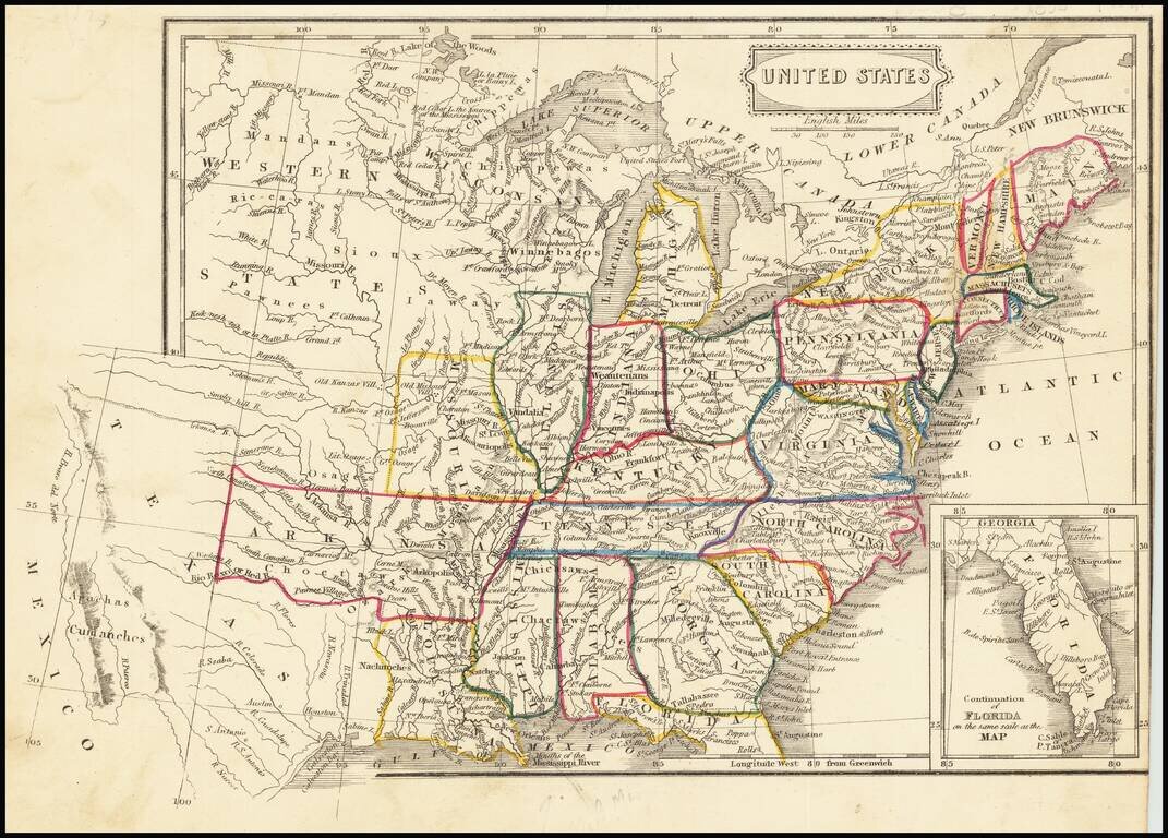
Fascinating map of the United States and Texas, published about the time Texas became a Republic.

The map names "Wisconsan", suggesting the map was published about the time Wisconsin was becoming a Territory.

In Texas, the Houston and Austin are named, the latter of which was incorporated in 1837.


Special conditions for students!

If you are a student, write to us in telegram: @antiquemaps and indicate what material you need and for what work you need a map in high detail. We are ready to provide material on special terms. For students only!

Item information:

Year of creation:
Size:
6602x4734 px
Disk:
8.4409MiB
Number of pages:
1
Place:
n.p.
Author:
Anonymous.
$14.99

Related item