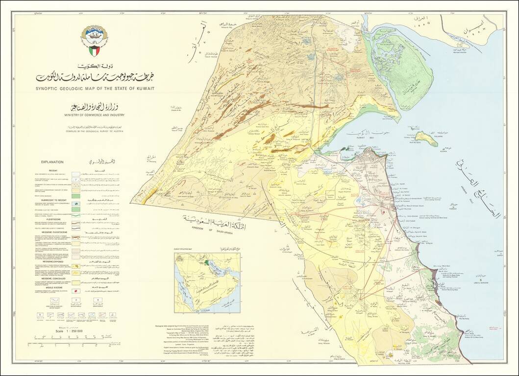
Rare geological map of Kuwait showing international boundaries, transportation, pipelines and populated places. This is a large version of the first geological map of Kuwait, made in 1969 in cooperation with the Geological Survey of Austria. The map...
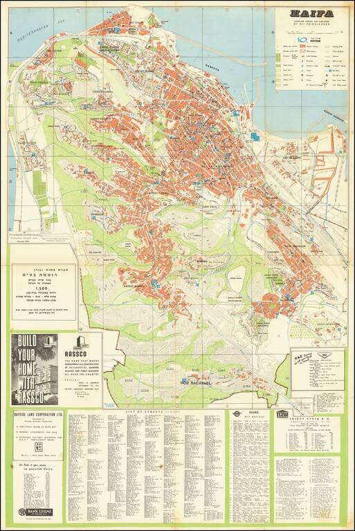
Mid-century map of Haifa depicting a city rapidly growing. Includes extensive detail on the city center, which was built mostly during British colonial rule. Details neighborhoods, amenities, port services and parks. A major focus of this map is on the...
![[Pictorial Map of the United Arab Republic] Kharitat Musawwarat al-Jumhuriya al-'Arabiya al-Muttahida / خريطة مصورة الجمهورية العربية المتحدة](/map/small/55146.jpg)
Fine Pictorial Map of the United Arab Republic Tourist map of the United Arab Republic, published by the Ministry of Tourism in Egypt in 1969. The map shows what is now Egypt during its short time as the United Arab Republic, as well as the boundaries...
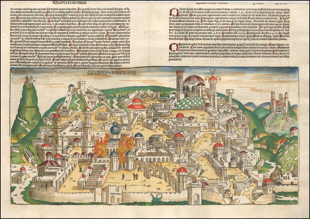
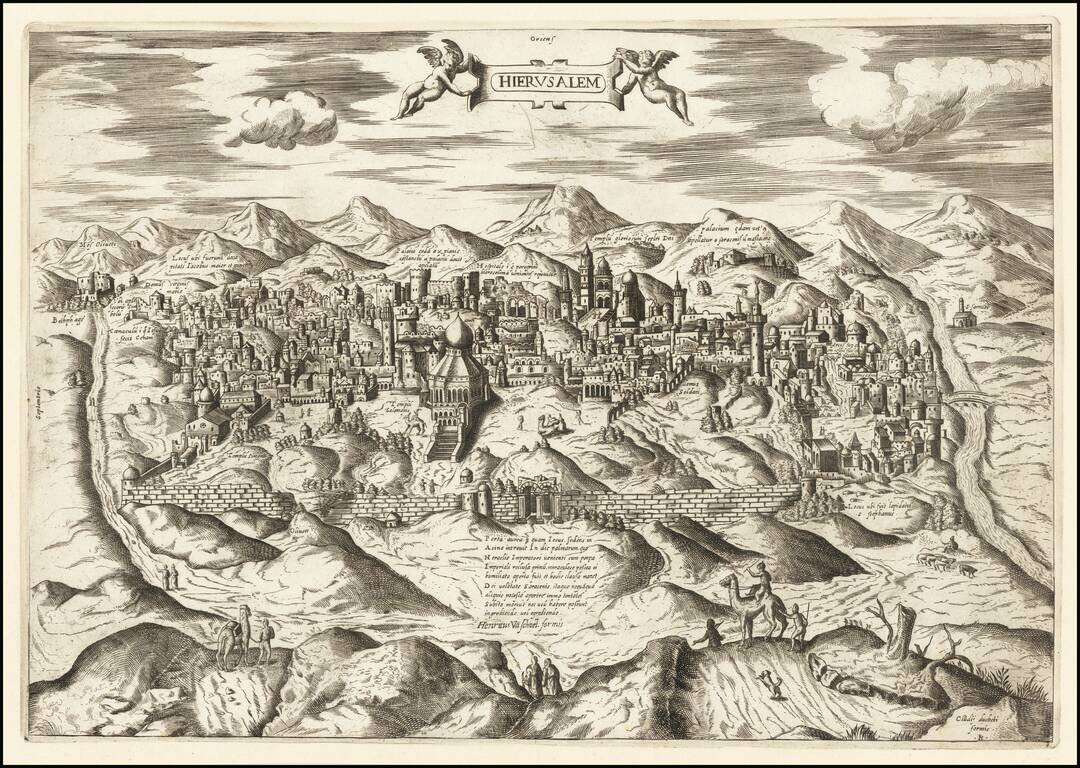
Gorgeous example of Hartmann Schedel's incunable view of Jerusalem from a German edition of Schedel's Liber Chronicum, perhaps the single most influential secular illustrated book of the 15th century and one of the landmark printed works of the 15th...
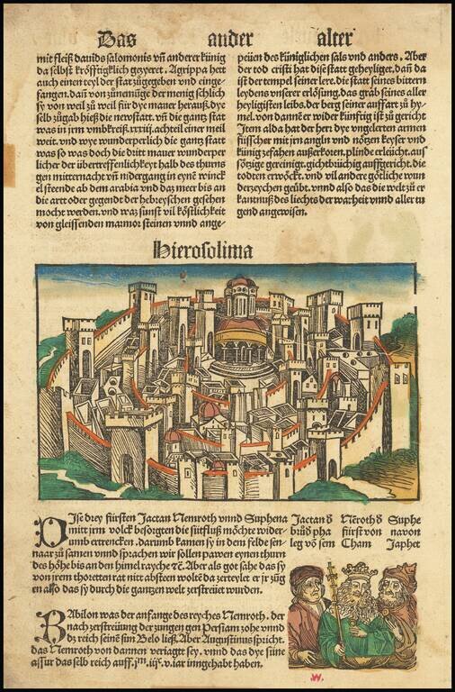
One of the earliest obtainable views of the City of Jerusalem, from Schonsperger's miniature edition of Schedel's Liber Chronicum. The Liber Chronicum (Nuremberg Chronicle) was first published in the summer of 1493 in Latin. The German edition...
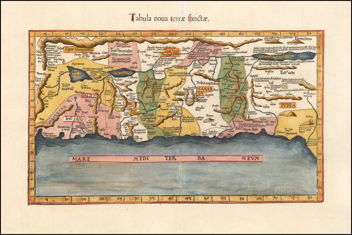
Waldseemuller's Modern Map of the Holy Land. Nice example of Waldseemuller's modern map of the Holy Land. This work was based on the manuscript maps of Sanuto and Vesconte of c.1320, which were updated by Nicholaus Germanus in 1482 to include more...
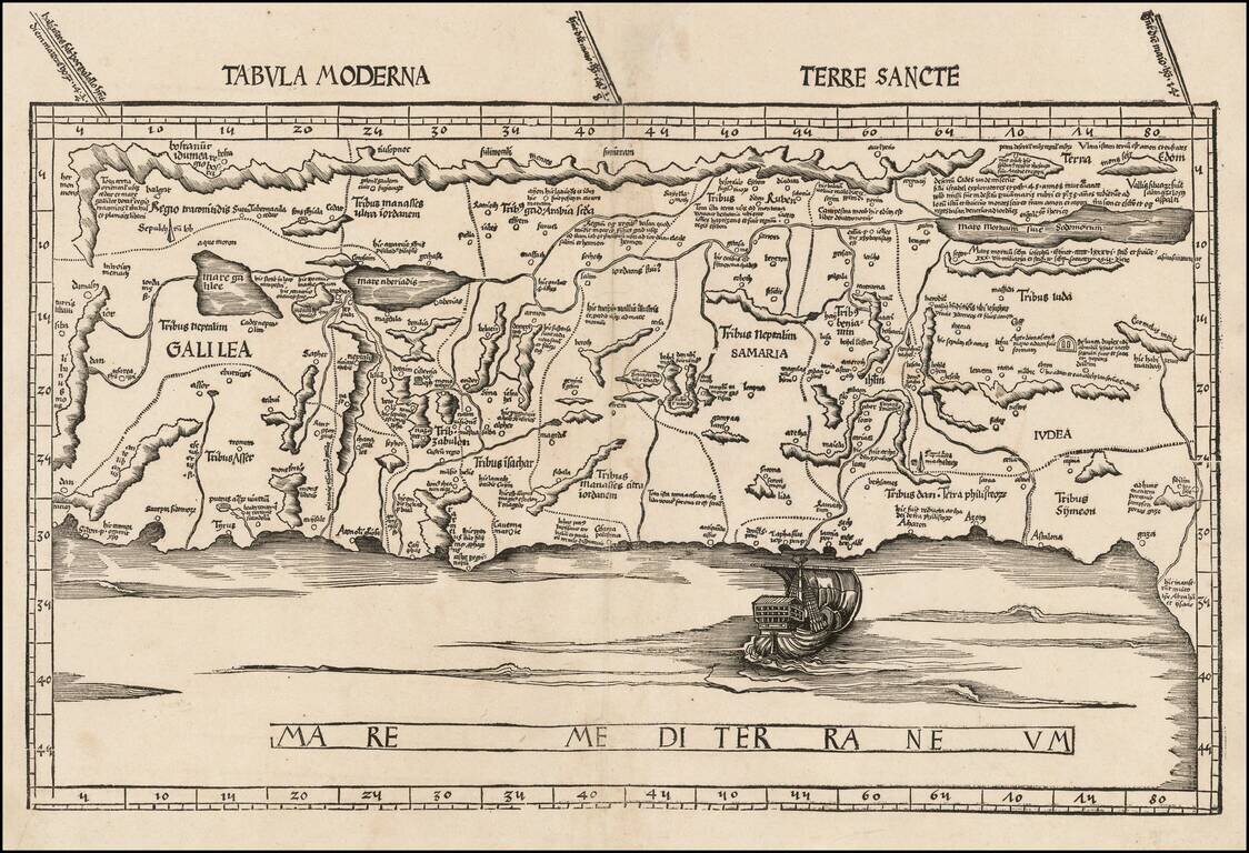
Rare early state of Fries's edition of the landmark Sanuto-Vesconte map, the most influential modern map of the Holy Land published in the 15th Century. As noted by Nebenzahl, the Sanuto-Vesconte map " was destined to provide the basic image of the...
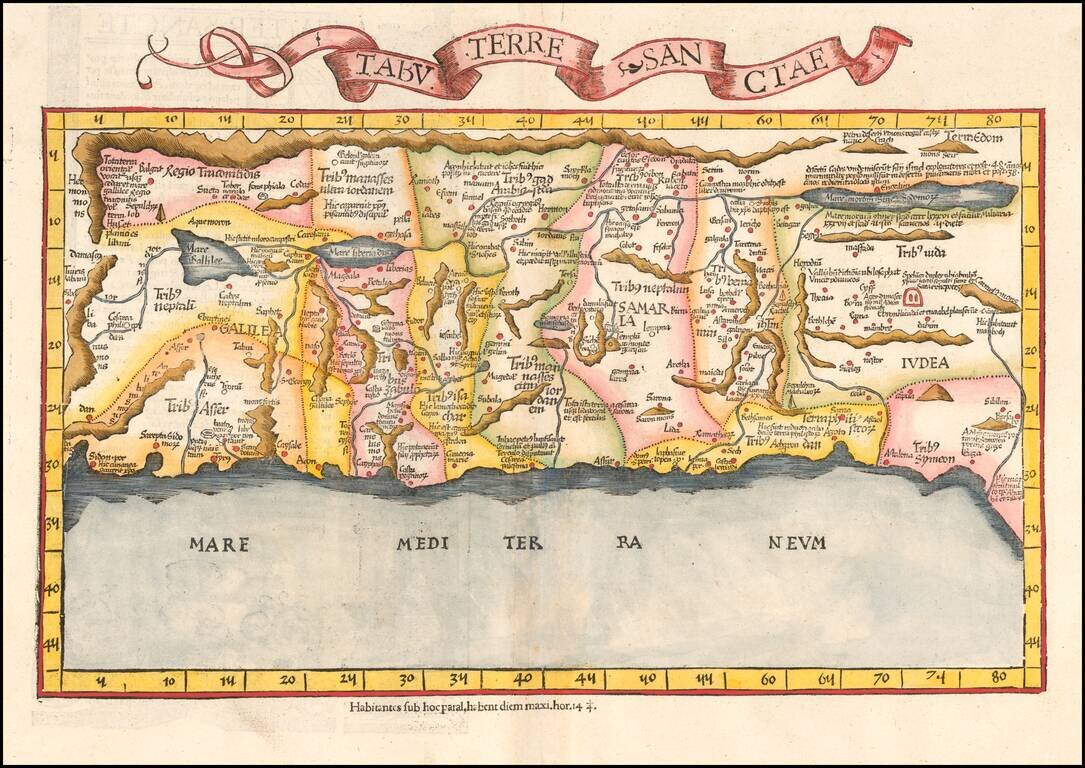
An Early Modern Map of the Holy Land Finely colored example of Fries's edition of the landmark Sanuto-Vesconte map, the most influential modern map of the Holy Land published 15th Century. As noted by Nebenzahl, the Sanuto-Vesconte map " was destined...
![[Jerusalem] Die Heilige Statt Jerusalem Contrafehtet nach Form und Gestalt wie sie Ietz Erbauwen ist](/map/small/68292.jpg)
Fine Sixteenth-Century View of Jerusalem From Münster's Highly Influential Work An early and finely-engraved view, titled ‘The Holy City’, depicting Jerusalem surrounded by its ancient walls. Religious sites and important landmarks are clearly...
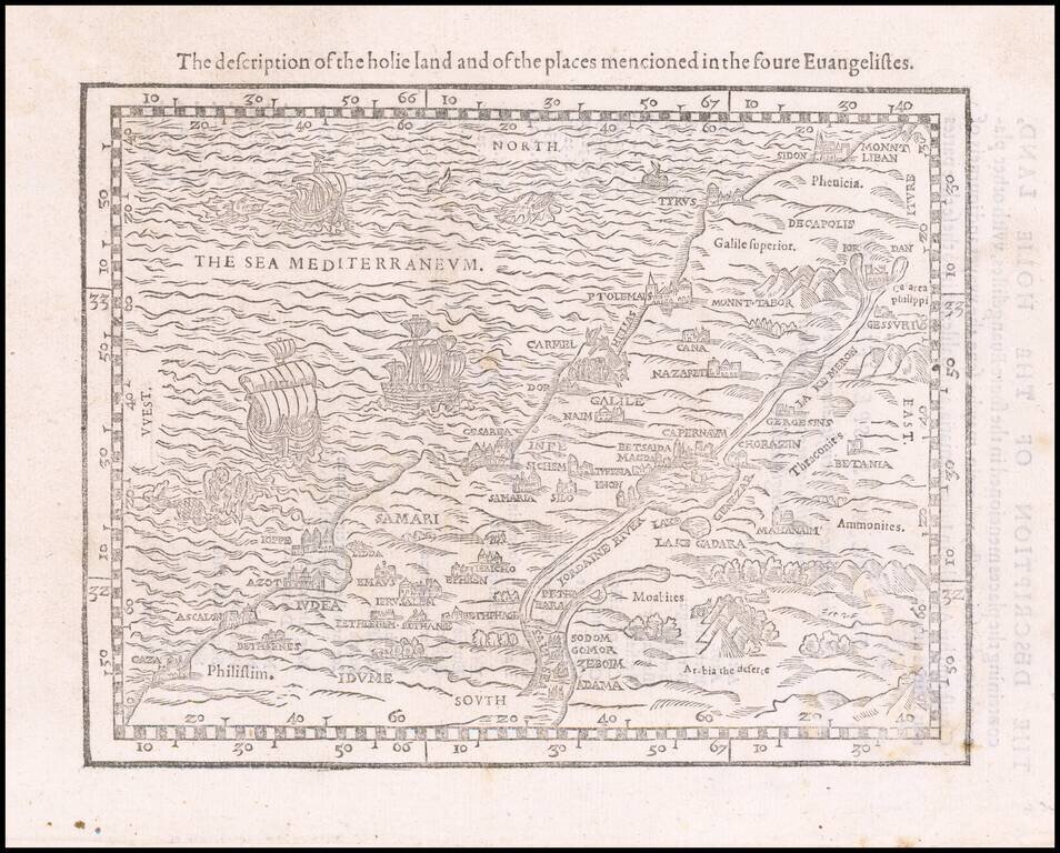
Rare early map of the Holy Land, one of the earliest printed maps of the Holy Land in English. The map covers the Levant from Gaza north to Sidon. From an English language Bible, the woodblock shows major locations with numerous vignette illustrations...
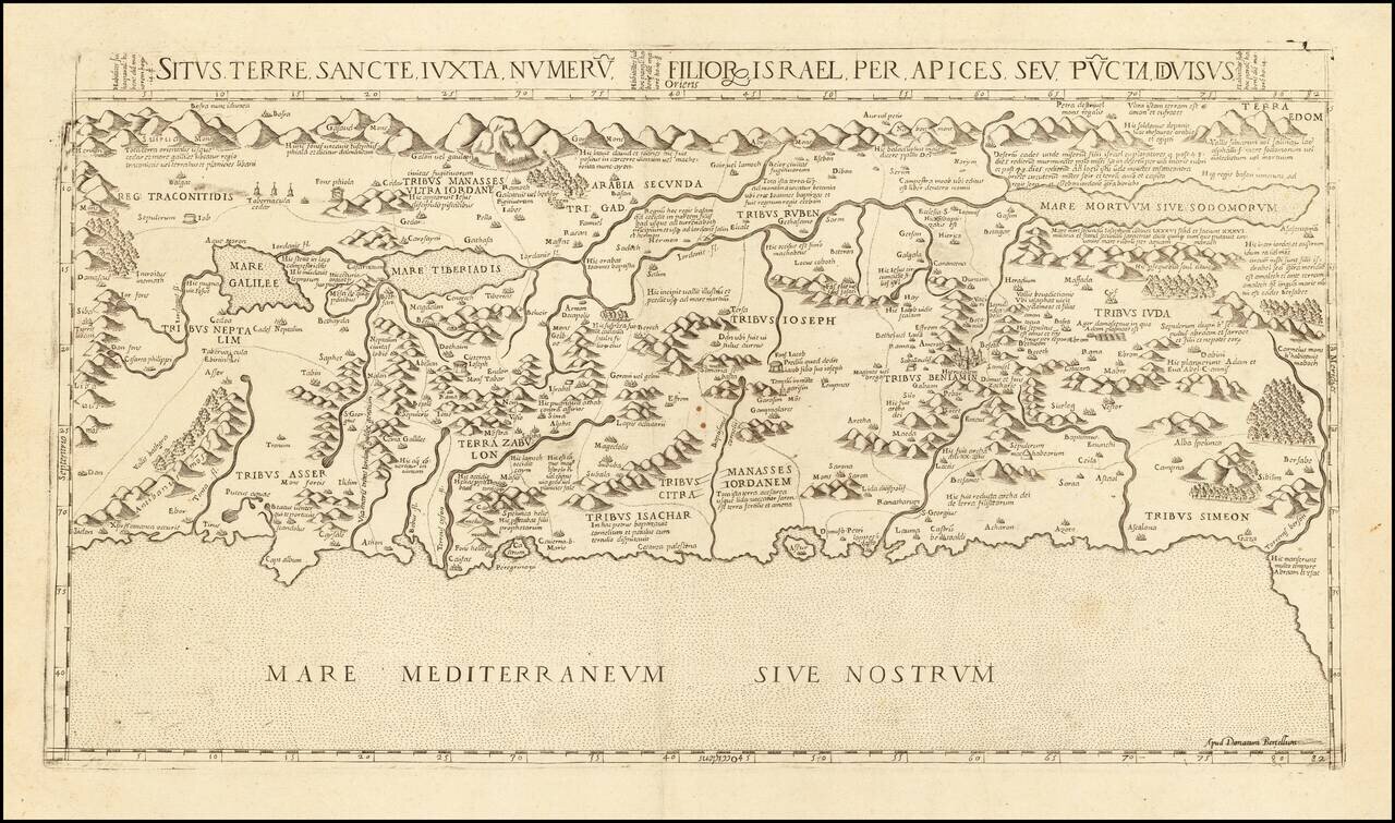
A Holy Land Rarity The only known example of Donato Bertelli's map of the Holy Land, being a previously unknown state of Francesco Camocio's map of 1565. Camocio's map, itself extremely rare, is a faithful copy of an earlier map by Antonio Salamanca,...
Fine example of Claudio Duchetti's rare view of Jersualem. Duchetti's fine modern view of Jerusalem shows the City from the West. Laor noted that the view is likely based upon Stefano Du Perac's view of 1570, also published in Rome. The map is richly...
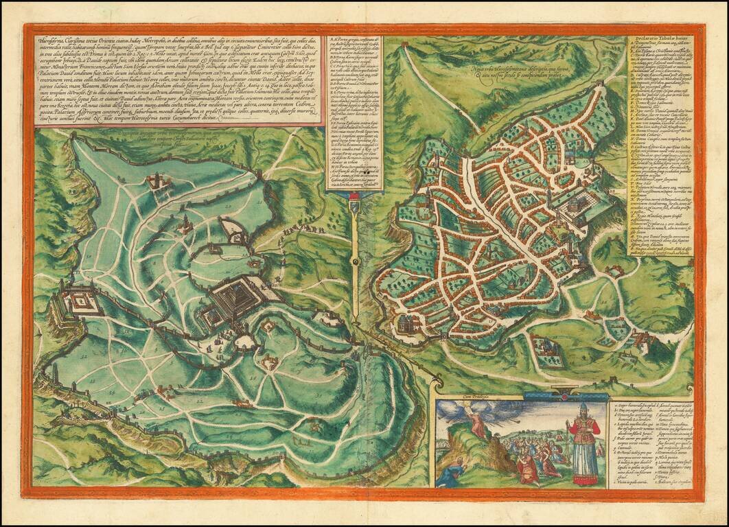
A Superb Example of One of Braun & Hogenberg's Views of Jerusalem. Striking early plan of Jerusalem, from Braun & Hogenberg's Civitates Orbis Terrarum, the most famous and influential book of town plans published in the 16th century. The view...
A nice example of Ortelius' map of the Holy Land, from his Theatrum Orbis Terrarum, the first modern atlas. The map shows all of the Holy Lands with Egypt. In the upper left is a text box describing the region. In the bottom right is a fine title...
![Ierusalem Description de la Cite Ierusalem . . . . [and] Nouvelle description de la Cite de Ierusalem . . .](/map/small/64363.jpg)
Fine early view of Ancient and Modern Jerusalem, from Francois De Belleforest's Cosmographie Universelle de Tout le Monde, published in Paris in 1575. De Belleforest's map of Jerusalem is drawn from Braun and Hogenberg's plan of Jerusalem, published...
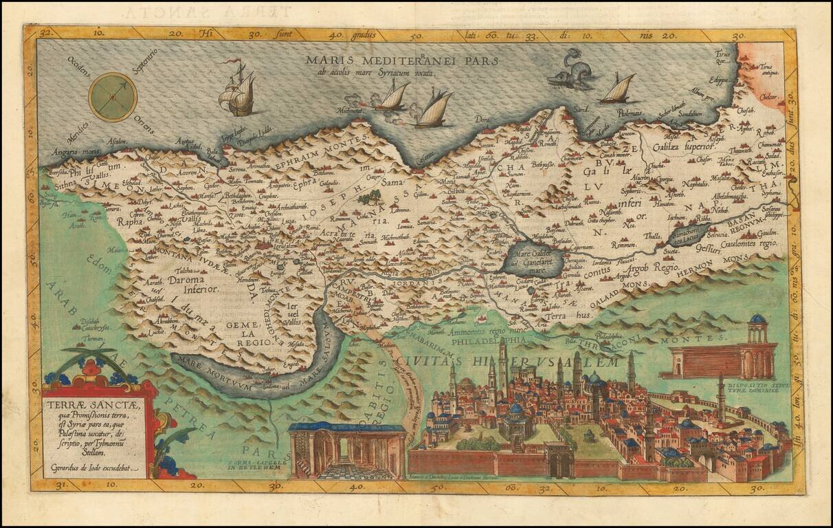
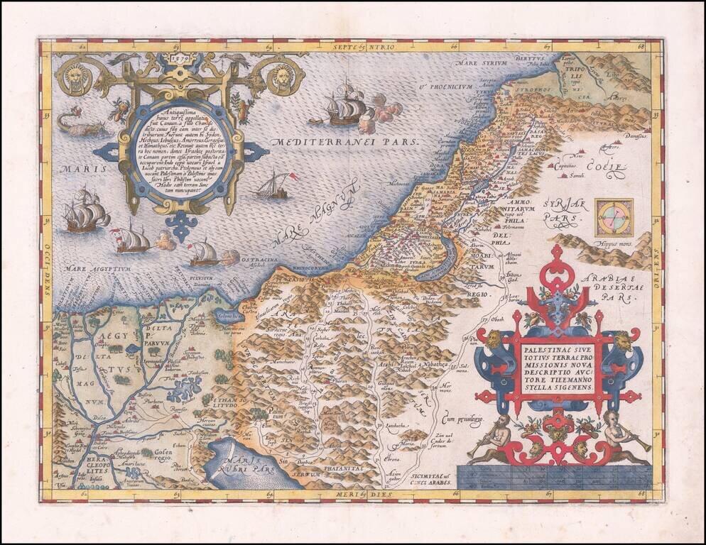
Fine old color example of the rare first edition of De Jode's map of the Holy Land. The map is based upon the map of Tilemannus Stella and is oriented with west at the top. The shoreline is irregular and runs from Tirus to Beersheba. The Dead Sea is a...