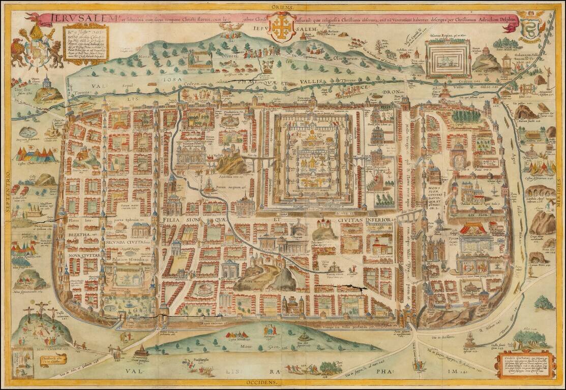
Decorative hand-colored example of Christan Van Adrichom's plan of ancient Jerusalem and its suburbs at the time of Jesus Christ, which was later copied by a number of early mapmakers for their works on the Holy Land. The plan was originally issued in...
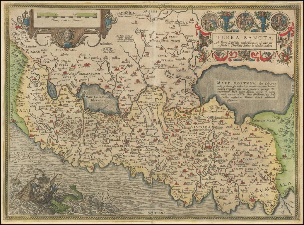
Abraham Ortelius's Modern Map of the Holy Land The most modern of Ortelius' maps of the Holy Land, which first appeared in Ortelius' Theatrum Orbis Terrarum in 1584. The map is based on a 9 sheet map of Palestine by Christian Sgrothen (Christian...
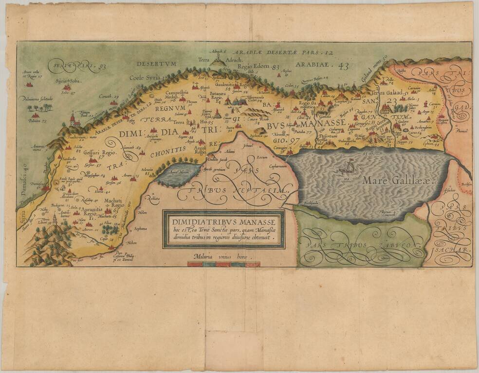
The Lands of Gilead, Assigned by Mose to the Tribe of Mansseh . Nice old color example of the map of the lands of Gilead, one of the Territories of ancient Holy Land, from Van Adrichom's Theatrum Terrae Sanctae, first publshed in 1590. The map shows...
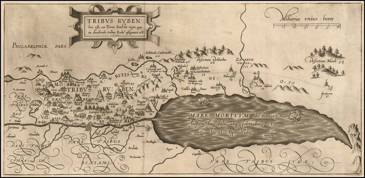
Detailed map of the lands of the Tribe of Ruben in the Holy Land, from Christian van Adrichom's Theatrum Terrae Sanctae, first published in 1590. The Theatrum Terrae Sanctae, was an atlas and history of the Holy Land and was Adrichom's most important...
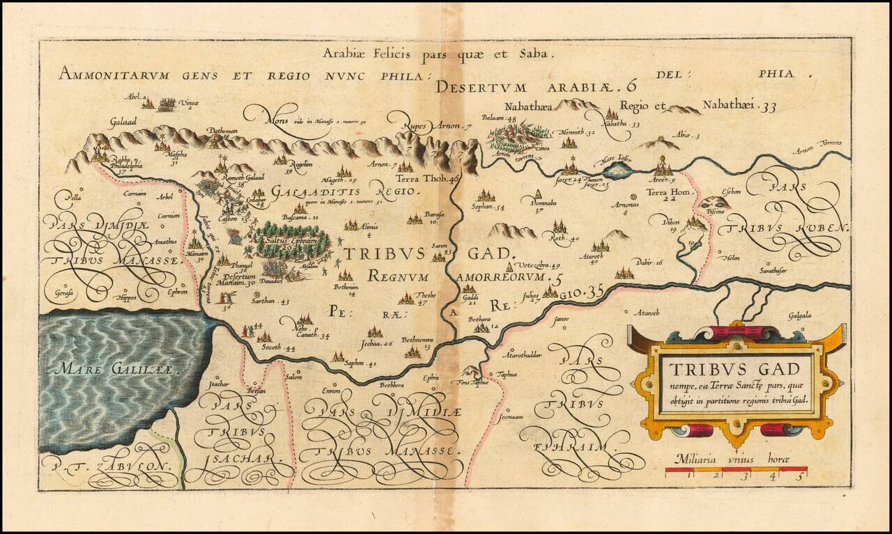
Detailed map of the lands of the Tribe of Gad in the Holy Land, from Christian van Adrichom's Theatrum Terrae Sanctae, first publshed in 1590. The Theatrum Terrae Sanctae was an atlas and history of the Holy Land and was Adrichom's most important and...
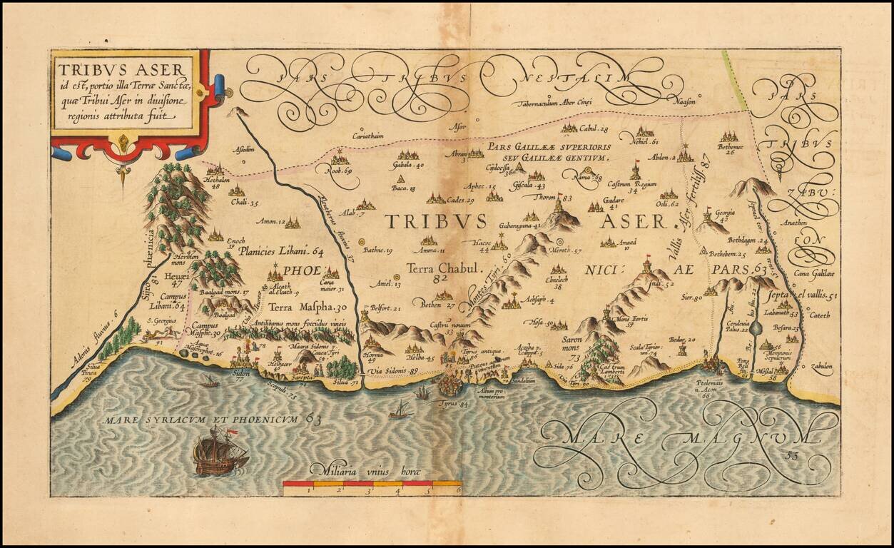
Detailed map of the lands of the Tribe of Asher in the Holy Land, from Christian van Adrichom's Theatrum Terrae Sanctae, first publshed in 1590. The map shows the lands assigned to the Tribe of Asher, by Moses. Numerous biblical sites are depicted...
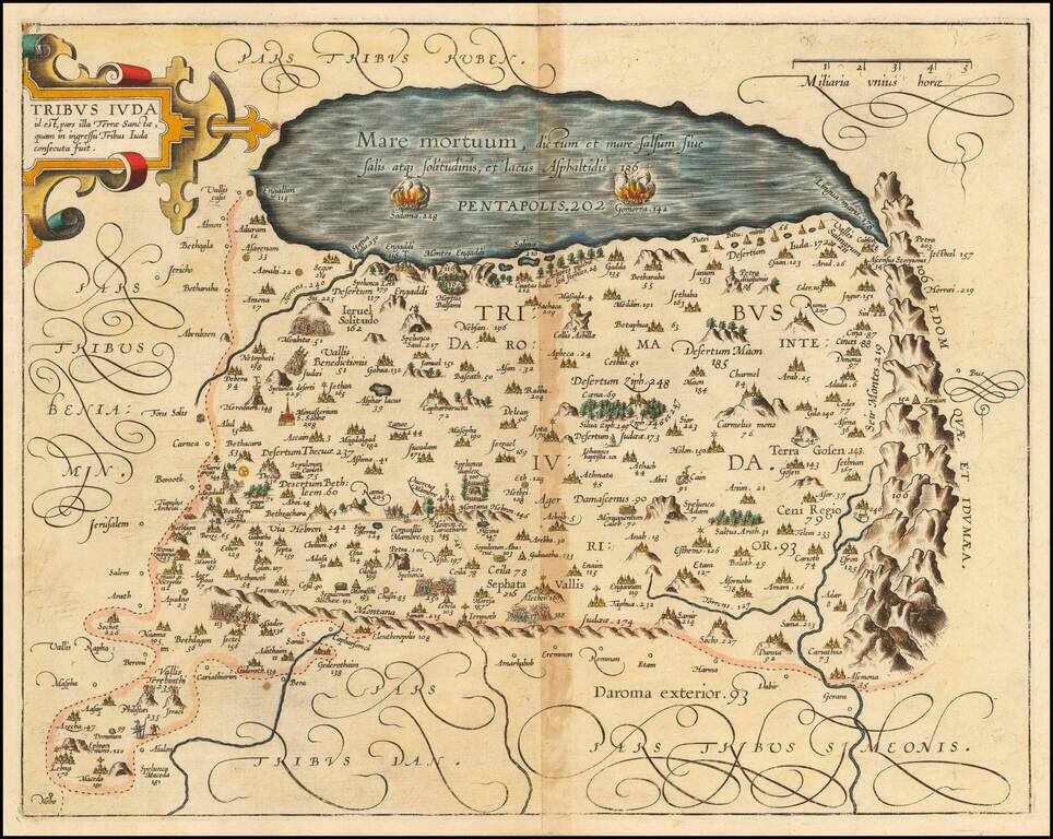
Detailed map of the lands of the Tribe of Judah in the Holy Land, from Christian van Adrichom's Theatrum Terrae Sanctae, first publshed in 1590. The map extends to the Dead Sea. Numerous biblical sites are depicted and identified by both name and...
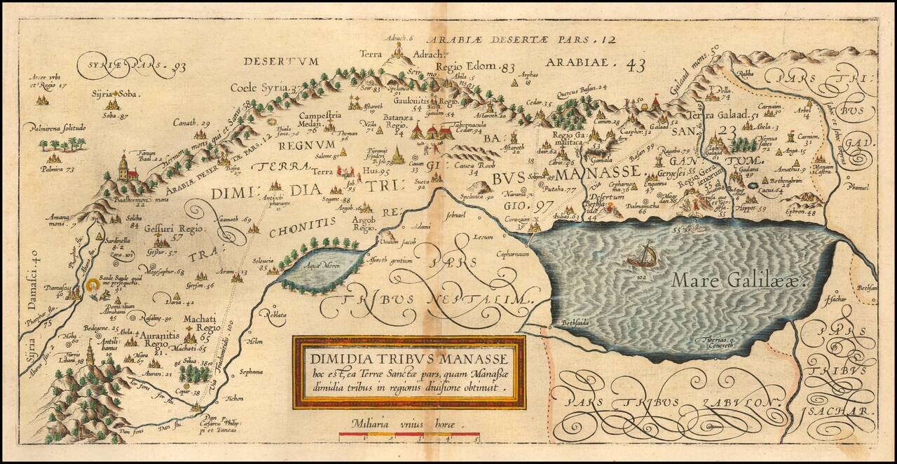
Detailed map of the lands of the Tribe of Manasseh in the Holy Land, from Christian van Adrichom's Theatrum Terrae Sanctae, first publshed in 1590. The map shows the lands in the northern part of Israel, bordering with Damascus and the Sea of...
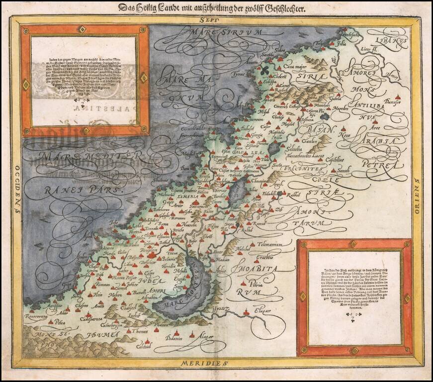
Second edition of Munster's map of the Holy Land. The map has been significanlty updated from Munster's first map of the Holy Land and reflects a knowledge of the work of Abraham Ortelius.
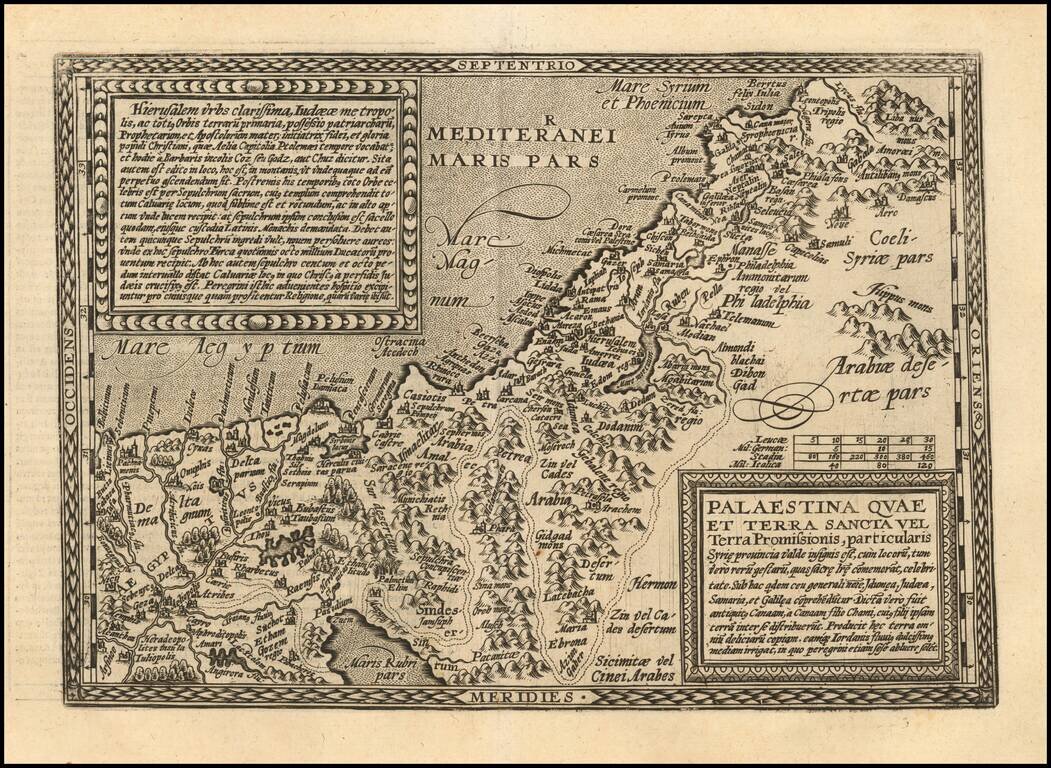
A nice example of Ortelius' map of the Holy Land, from the 1592 Latin edition of his Theatrum Orbis Terrarum, the first modern atlas. The map shows all of the Holy Lands with Egypt. In the upper left is a text box describing the region. In the bottom...
Striking example of Gerard De Jode's map of the Holy Land, which appeared in the 1593 edition of Cornelis De Jode's Speculum Orbis Terrarum. Oriented with east at the top, De Jode's map of the Holy Land is noteworthy for its inclusion of dozens of...
Scarce early map of the Holy Land, engraved in Cologne by Johann Bussemacher for Quad.
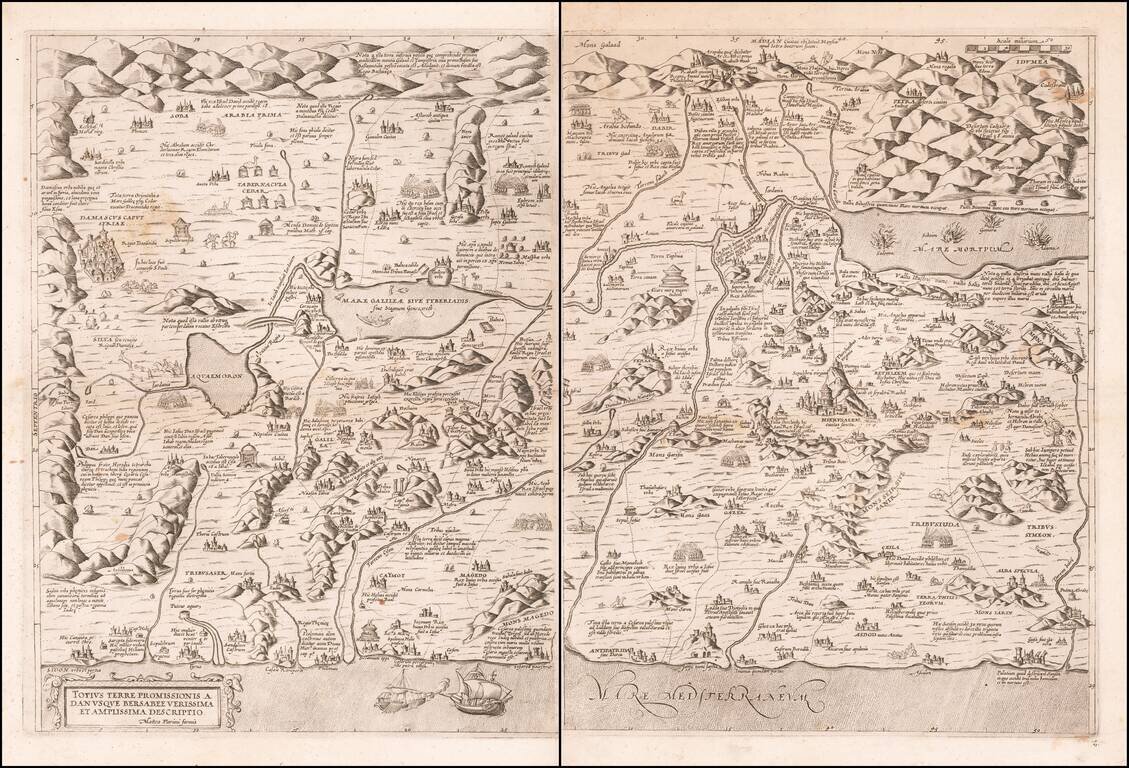
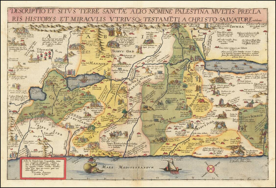
A 16th Century Italian Rarity Highy detailed early map of the Holy Land, based upon an earlier map by Claudio Duchetti. The important cities and noted with the buildings represented and the different episodes mentioned in the Bible are explained....
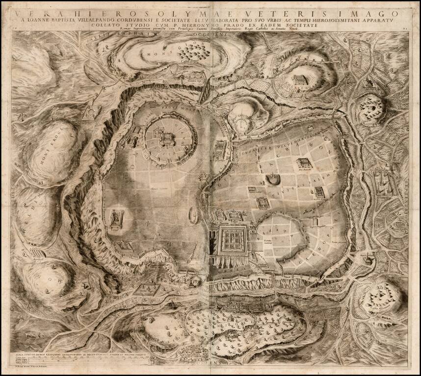
Nice example of Juan Batista Villalpando's rare 2-sheet plan of Jerusalem, based upon Ezekiel's prophecies in the Old Testament. Villalpando was a Spanish Jesuit scholar & architect, who drew reconstructions of the classical city based on the...
![[Holy Land]](/map/small/37930.jpg)
Fine example of the earliest printing of Pietro Vesconte's celebrated circa 1320 map of the Holy Land. Johann Bongars's rare map is the first true, or unedited printing of the Vesconte map of the Holy Land (circa 1320), one of the most important and...
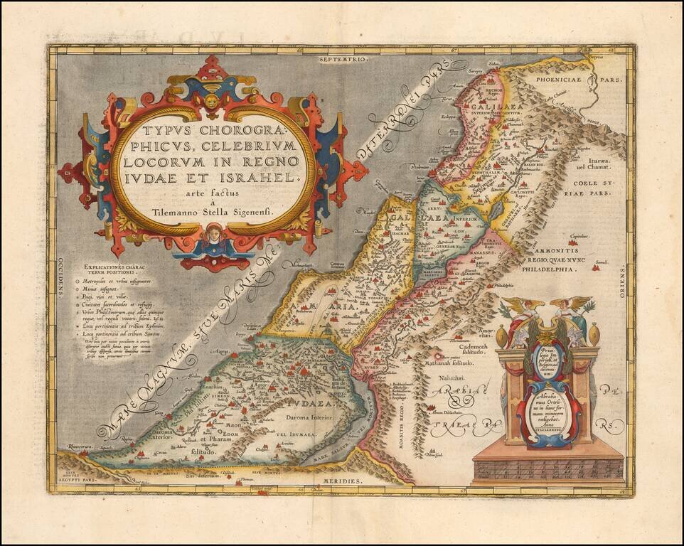
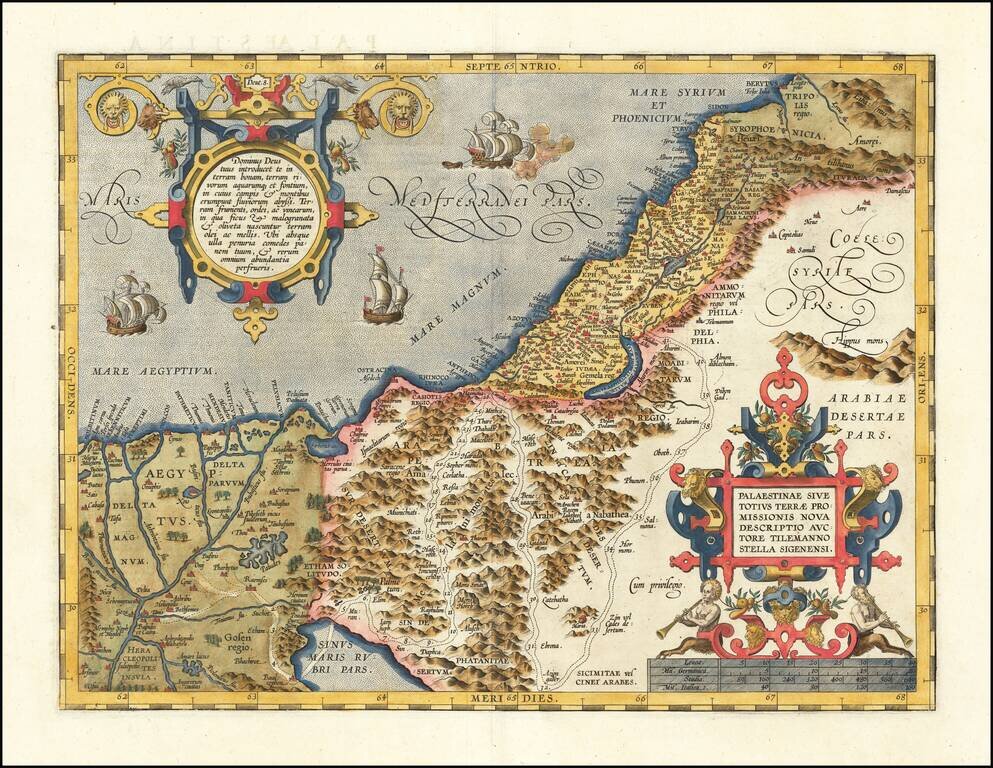
Detailed Ortelius Map of the Holy Land, Based on Tilemann Stella’s Extremely Rare Holy Land Maps Nice example of Ortelius' map of the kingdoms of Judah and Israel from the Parergon, an atlas depicting both secular and religious histories of the...