Fine old color example of Sanson's map of the Holy Land, from the 1683 edition of his atlas. Includes an elaborate allegorical vignette, with symbols of Judaica, etc.
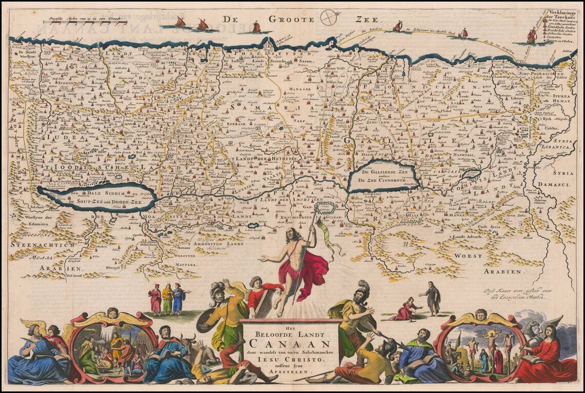
Detailed map of the Holy Land, showing the travels of Christ and the Apostles, including Paul's travel's at sea and numerous sailing vessels. An excellent example of a Dutch Bible map of the Holy Land.
Rare Theodore Danckerts Map of the Holy Land Striking old color example of this rare map of the Holy Land. Decorative full color title cartouche and second cartouche scale of miles. Rarity Theodorum Danckerts maps are rare on the market.
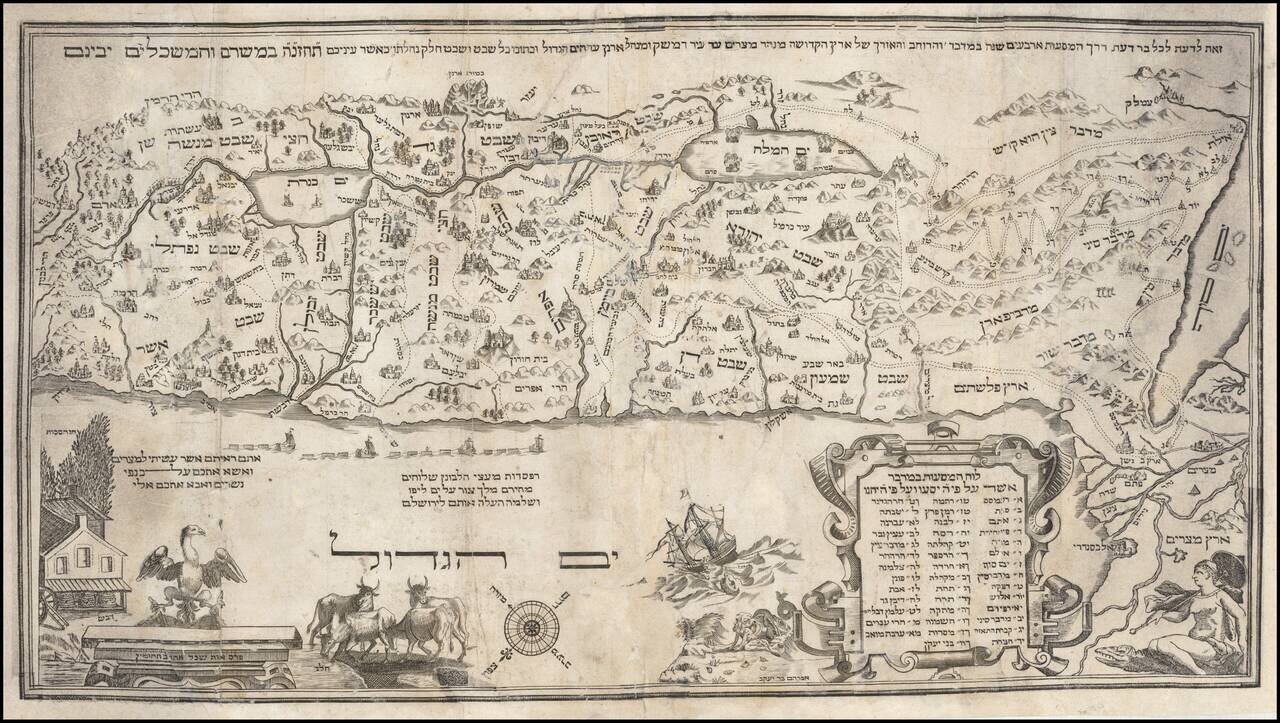
Good example of the 1712 Amsterdam Haggadah and map of the Holy Land, the first obtainable map of the Holy Land to utilize entirely Hebrew lettering. [Seder Haggadah sel Pesah] 4to, modern half red leather over marbled boards (marbled paper torn...
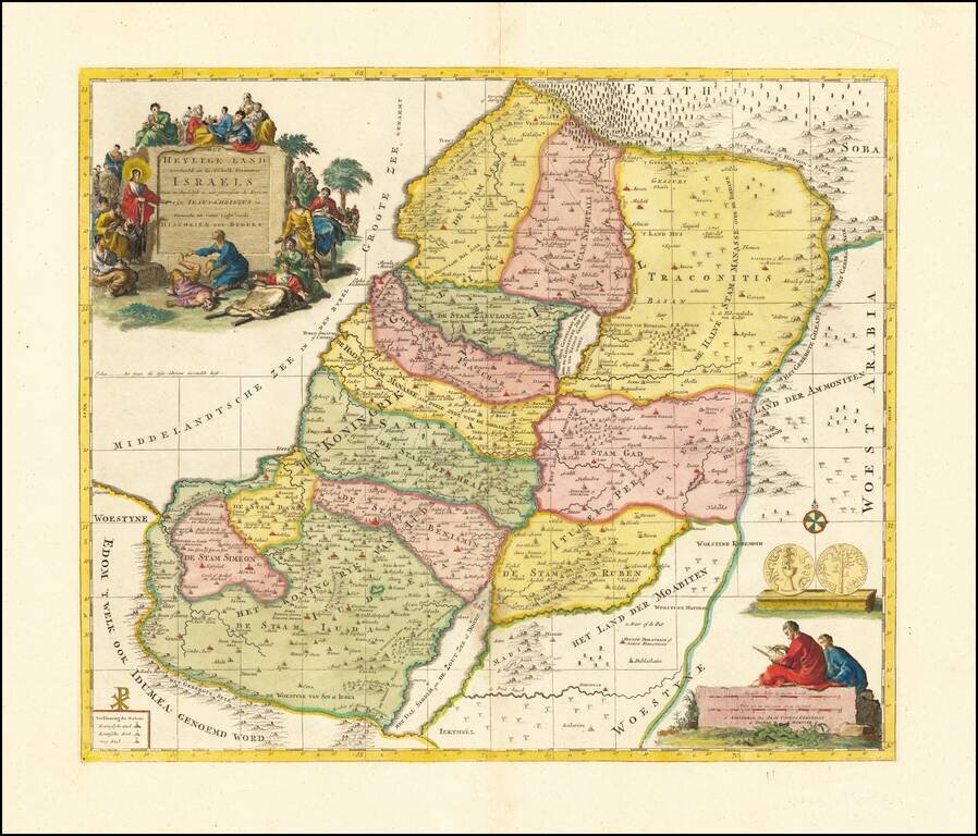
Old color example of Schenk's map of the Holy Land, showing the 12 Tribes of Israel. Includes a finely engraved allegorical cartouche.
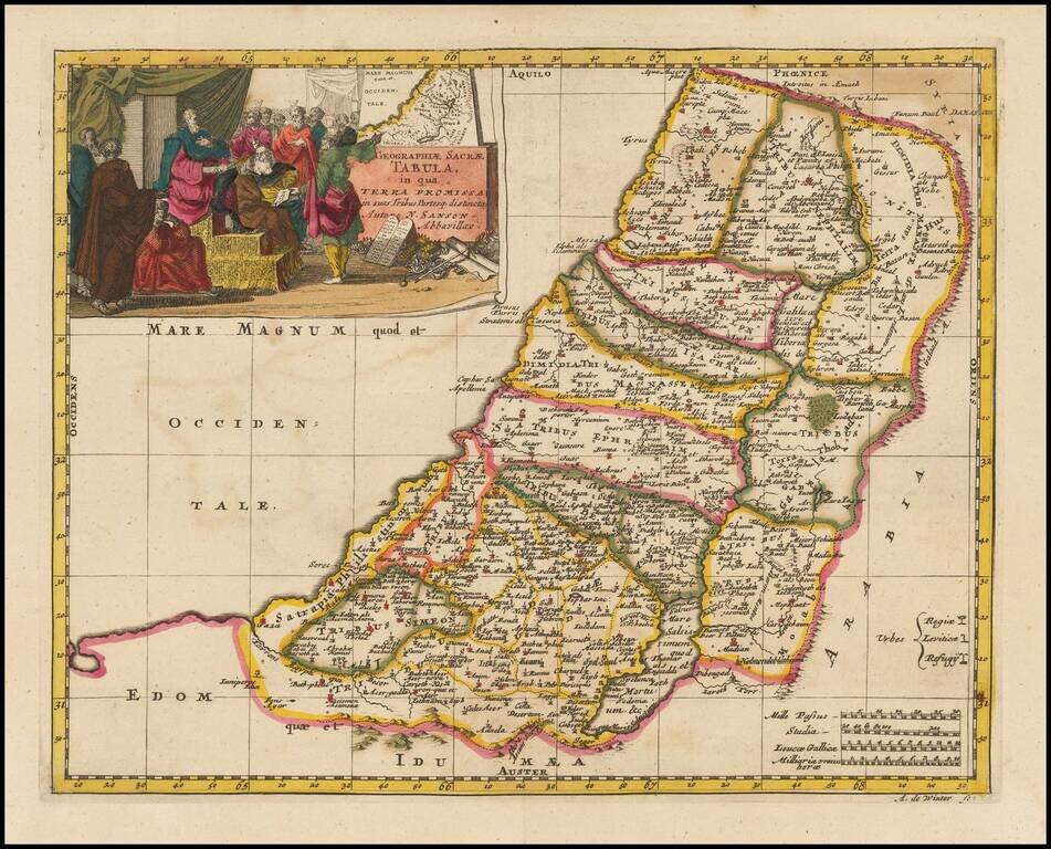
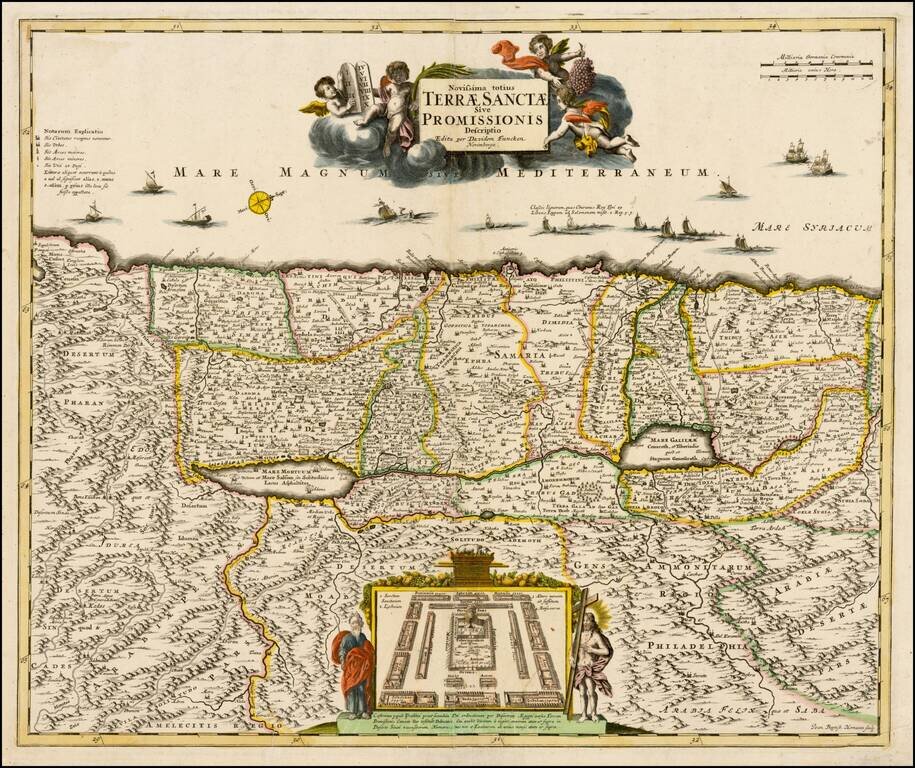
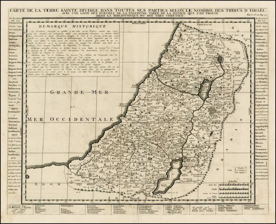
Striking large format map of the Holy Land, with tribal divisions and a wealth of place names and topographical detail, including the locations of royal and priestly cities, and sanctuaries. Decorated with two fine cartouches. The title cartouche...
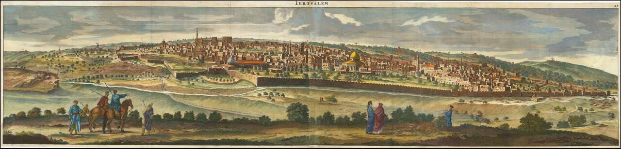
A Fine Panoramic View of Jerusalem Striking view of Jerusalem, from De Bruyn's Reizen van Cornelis de Bruyn . . . . A spectacular panorama of Jerusalem taken from the Mount of Olives. Engraved by Henrik van Krooneveld. Cornelius van Bruyn...
Rare example of David Funcke's richly detailed map of the Holy Land, published in Nuremberg. The map is oriented with west at the top, in the style of Van Adrichom. Shows the encampment of the Israelites, flanked by Moses & Jesus. One of the most...
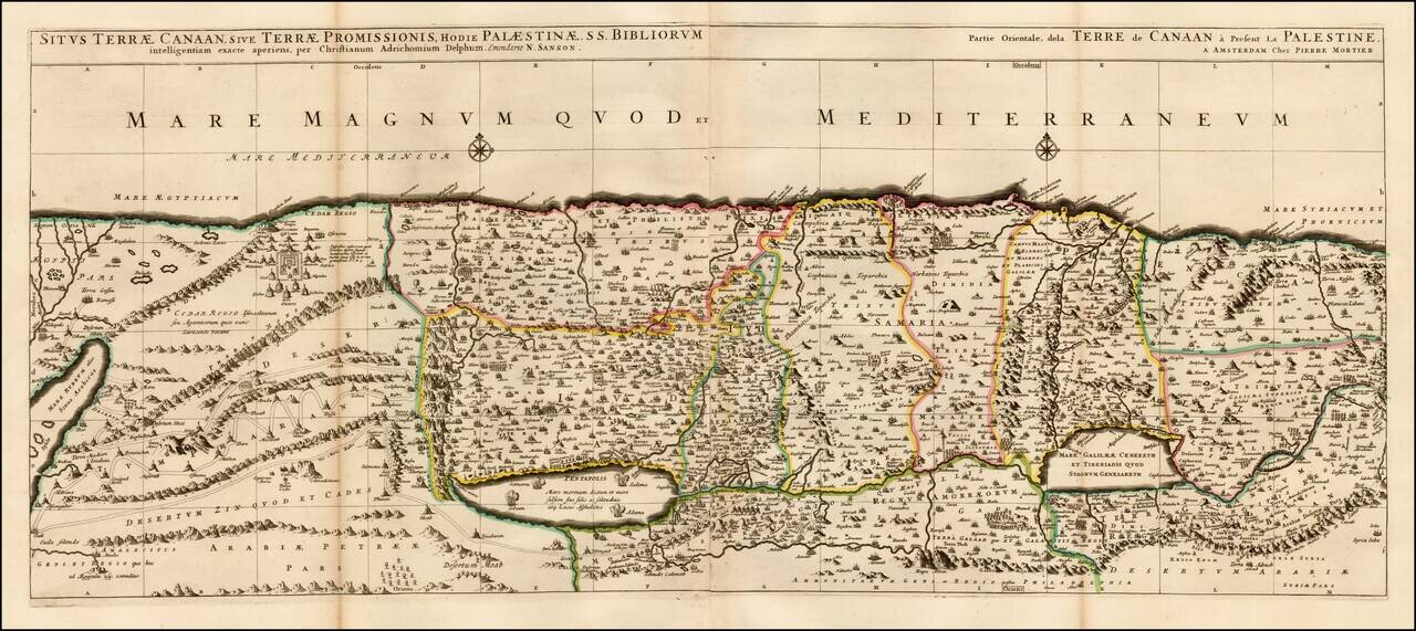
Fine 2 sheet map of the Holy Land, first issued by Pierre Mortier circa 1700. The map is based on the Holy Land on Christiaan van Adrichom's stunning map, Situs Terrae Promissionis, however with the Mediterannean oriented at the top of the map. The...
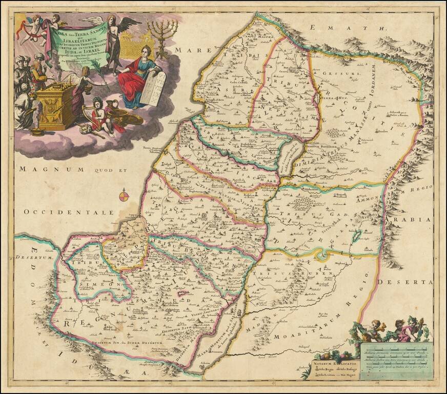
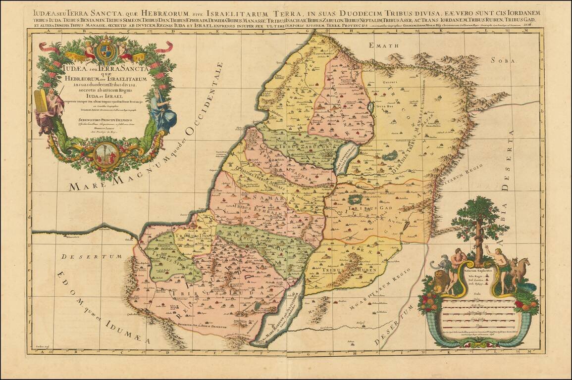
Finely engraved map illustrating the 12 Tribes of Israel, published in Amsterdam by Covens & Mortier.
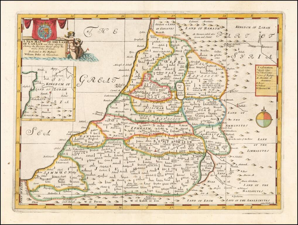
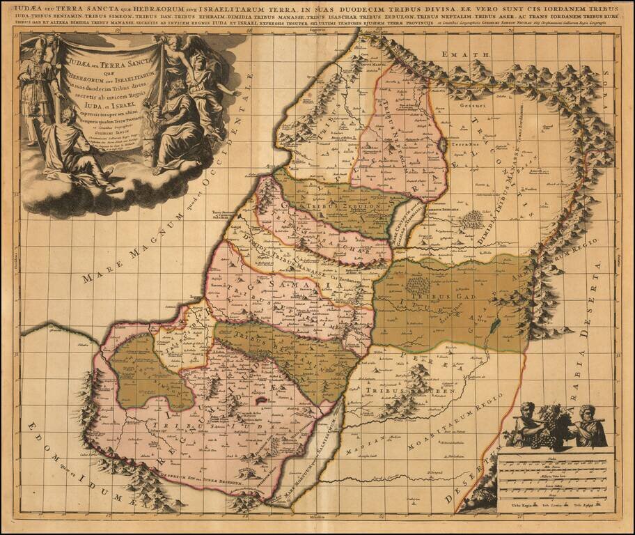
Map of the Holy Land, Published For The Education of A Future King of England. Decorative map of the Holy Land, colored by Tribes. The map was part of an atlas dedicated to the Duke of Glocester, who was then attending school in Oxford. The maps...
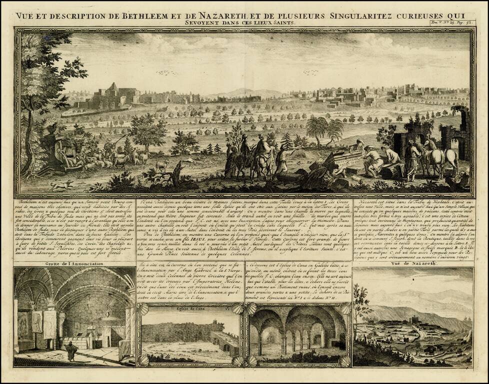
Decorative birdseye view of Bethlehem and Nazareth, from Chatelain's monumental 7 volume Atlas Historique. The view includes 4 smaller views, including the Hall of the Annunciation, Church of Cana and a second view of Nazareth.
Detailed map of the Holy Land, from Chatelain's Monumental Atlas Historique et Methodique. The map extends from Gaza to Sidon and identifies the 12 Tribes and many other historical features.
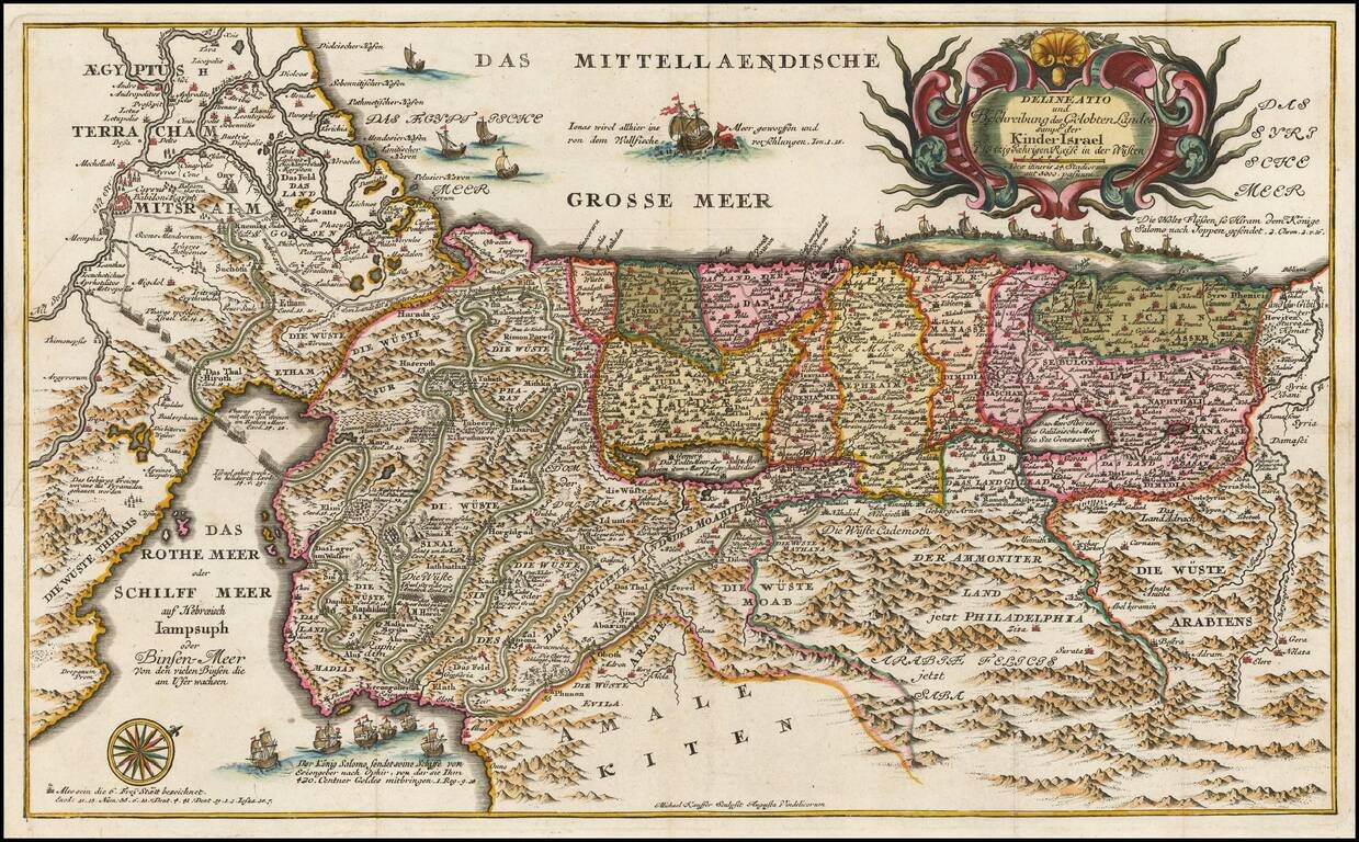
Rare map of the Holy Land, published in Berlin and engraved by Michael Kauffer. The map shows the Exodus of the Chidren of Israel from Egypt, along with images of Jonah and the Whale. The map also shows King Solomon's Naval force conducting trade...
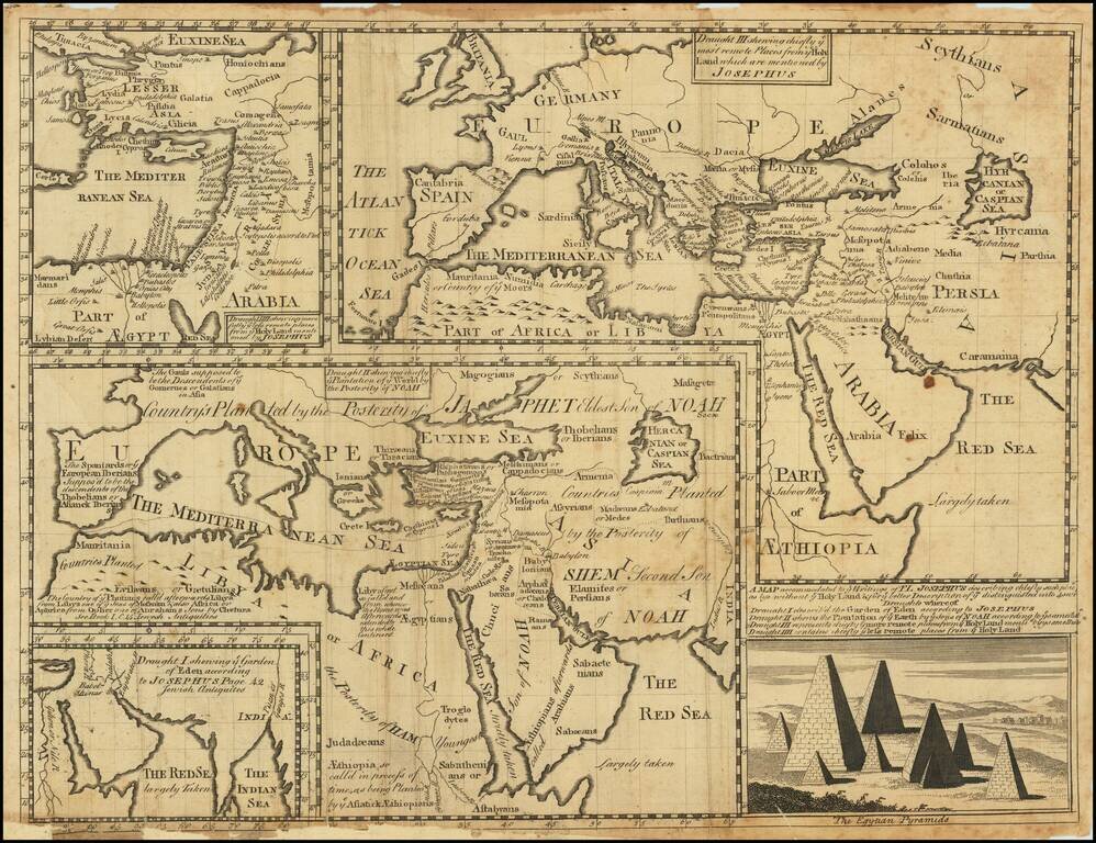
Engraved mapsheet, featuring four maps related to the writings of the Romano-Jewish historian Josephus. The map was issued in Oxford at the beginning of the 18th century. It includes the following sub-maps: Draught I shewing ye Garden of Eden...
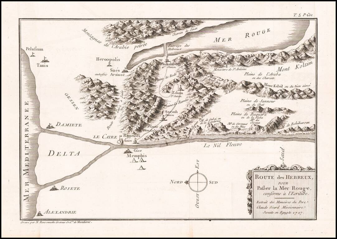
Antique Map Showing the Exodus of the Jews from Egypt Rare map showing the Exodus from Egypt by the Hebrews, across the Red Sea. Oriented with East at the top. What makes this map unusual is that it does not cover the Exodus beyond the Red Sea...