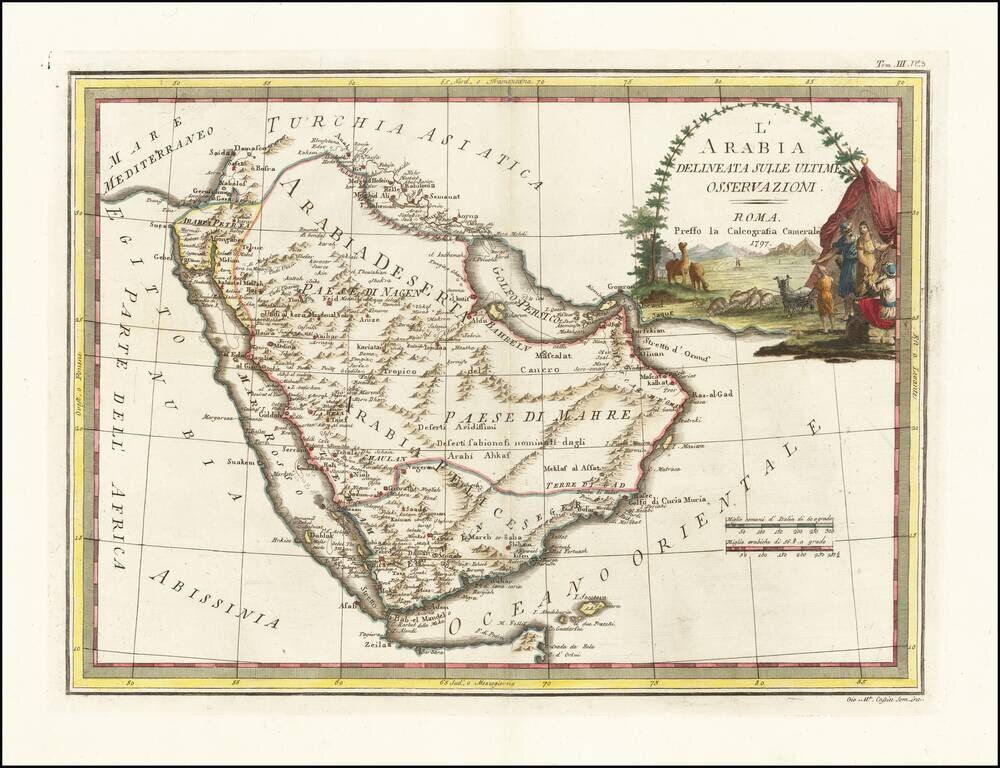
Decorative 18th Century map of the Arabian Peninsula, published in Rome by Cassini. The map extends from the Red Sea to the Persian Gulf, Straits of Hormuz and Indian Ocean, centered on Arabia, which is divided into several regions, including Paese di...
![[Arabia / Ottoman Empire] Gli Imperi Antichi Parte Occidentale (and) Gli Imperi Antichi Parte Occidentale](/map/small/70452.jpg)
Scarce pair of maps comprising a remarkable decorative map of Arabia, published in Rome by Cassini. The map covers the Turkish Empire centered on Arabia, from the 'Nuovo Atlante Geografico Universale', with a decorative title cartouche on each sheet....

Highly detailed map of Egypt, the Holy Land and part of the Saudi Peninsula. Shows tracks of explorers and caravan routes. Key translates Arabic names. Includes Jerusalem in the east.
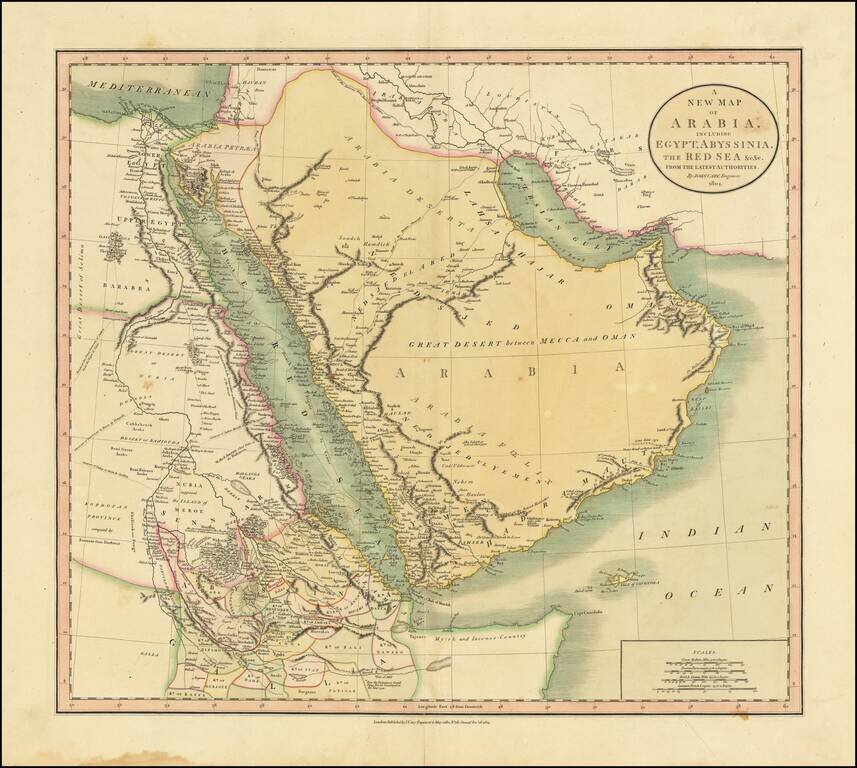
Includes The Caravan Routes To Mecca Large detailed map of the region, centered on the Saudi peninsula and the Red Sea. In the Arabian Peninsula, the map notes the Route of the Indian Caravans from Katif (El Qatif) to Mecca and the Route of the...
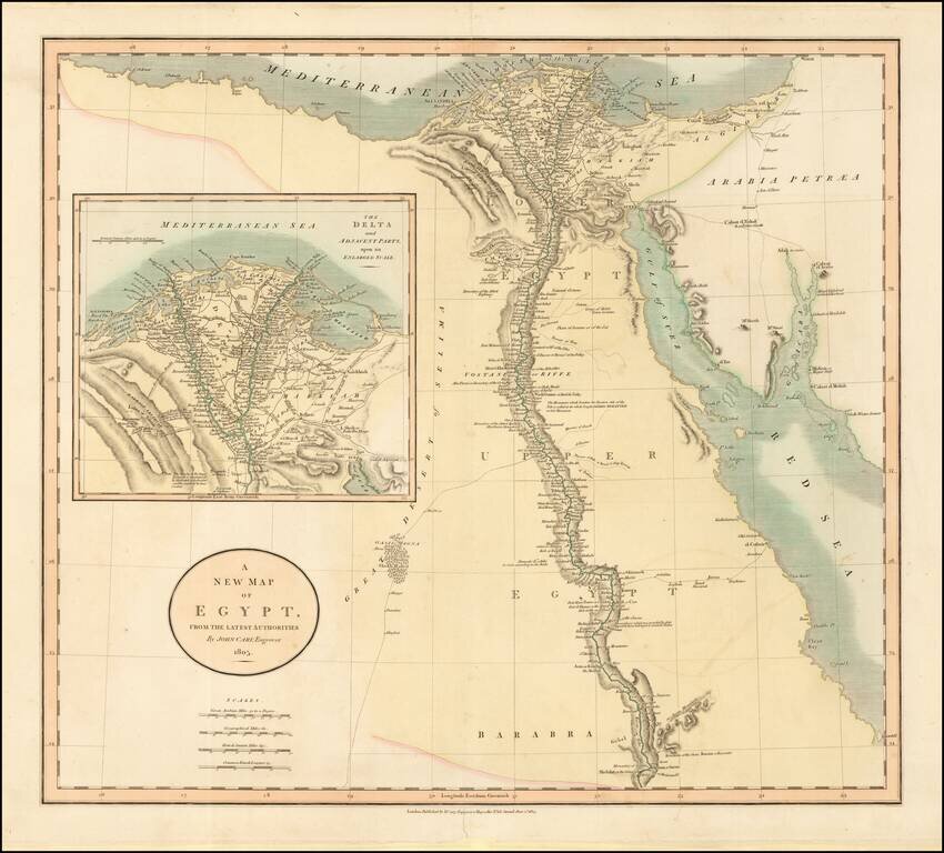
Fine example of this striking map of Egypt, the Gulf of Suez, Red Sea and the Course of the Nile, with a large inset of the Nile Delta, published by John Cary in London. Extends from Oasis Magna and Shek Haled to Arabaia Petraea. Includes various trade...
![Turkey in Asia . . . [shows Cyprus]](/map/small/52736.jpg)
Delightful regional map of Asia Minor, Cyprus, Kurdistan, Turcomania, Karaman Amasia and Natolia, with nice details. Robert Wilkinson was active in London as a cartographic publisher from 1785 to 1825. He produced a number of nice works, including a...
![[Ottoman Province of Syria] Map of Syria Ancient and Modern . . . 1843](/map/small/68463.jpg)
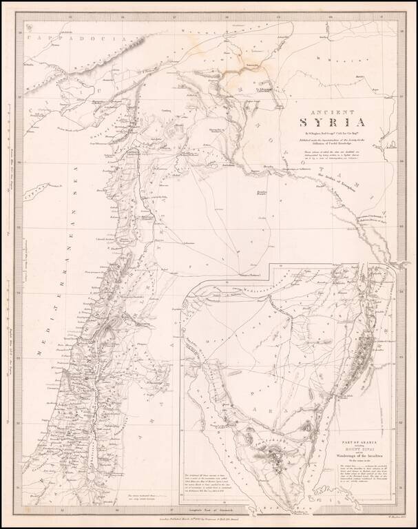
The Ottoman Province of Syria Scarce separately published map of Syria, published in London by John Wyld. Published at a time when the region was under the control of the Ottoman Empire, "Modern and Ancient" Syria extends to the modern regions of...
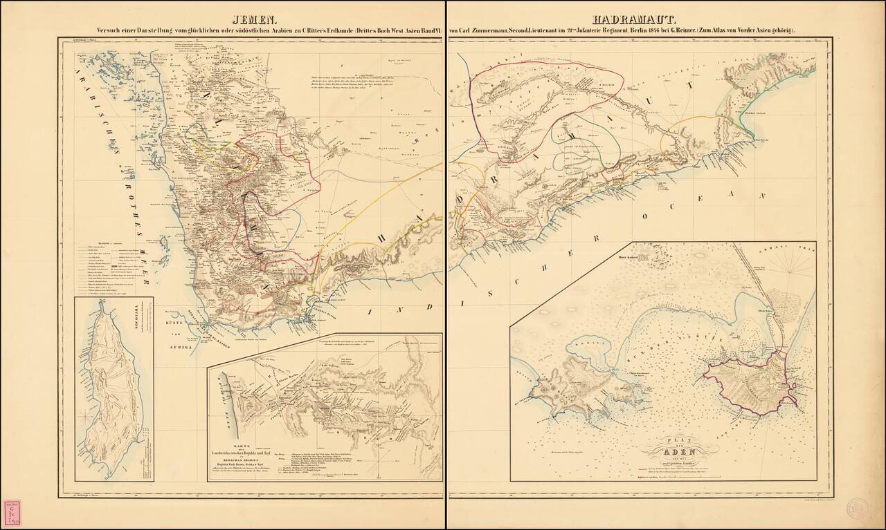
Fine large format map of the southern portion of the Arabian Peninsula. Includes a large inset plan of Aden, and smaller inset maps of the island of Socotara and a smaller map of the routes to Mecca. Illustrates the indigenous peoples, towns,...
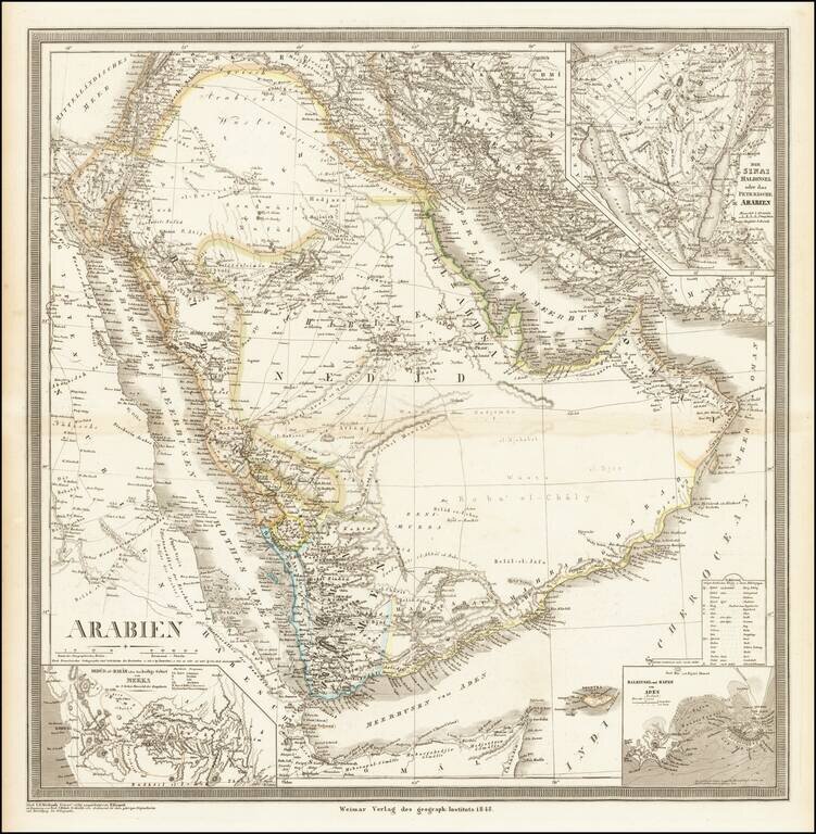
Striking, Detailed Map of the Arabian Peninsula Fine large map of the Arabian Peninsula and its environs, published by German mapmaker Heinrich Kiepert in Weimar. Keipert's map of Arabia is one of the most detailed and accurate maps of the period....
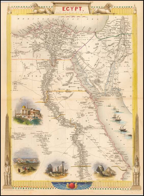
Gorgeous full color example, with large vignettes showing the Mosque of the Sultan Hassan, Alexandria, Ruins of the Great Temple Karnac, Great Sphinx, Ghizeh and sail boats in the Red Sea. Engraved for R. Montgomery Martin's Illustrated Atlas. Tallis...
![Syria [shows Cyprus]](/map/small/51574.jpg)
Striking full color example of this marvelous map of Syria. Highly detailed with decorative vignettes of Jerusalem, Arabs and the Baggage Camels. From R. Montgomery Martin's Illustrated Atlas, one of the last great decorative atlases of the 19th century.
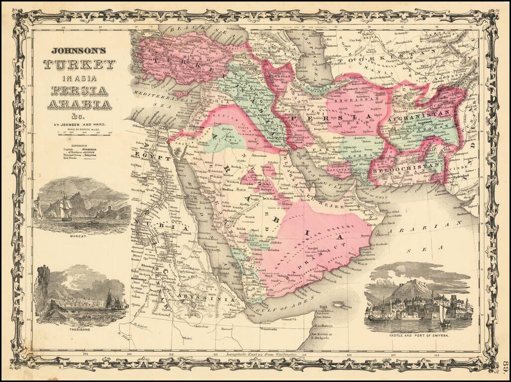
Decorative map of Turkey, Persia, Arabia, Afghanistan, Beloochistan and contiguous regions, with large inset views of Smyrna, Trebisond and Muscat. Shows excellent detail, including towns, rivers, mountains, deserts, roads, etc.

Fine example of this detailed map of Ancient Arabia and contiguous regions, excerpted from the Spruner-Menke Atlas of Antiquity. The map illustrates the region centered on the Arabian Peninsula, relying upon historical information from antiquity to...
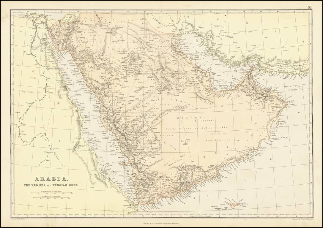
Detailed map of the Arabian Peninsula and Middle East, published by Edward Weller. The map includes a number of overland routes across the Arabian Peninsula. The map also locates Abou-Thubbi (Abu Dhabi), Debai (Dubai) and Sharja, as well as El Biddah...
![[Mocha, Yemen] Arabia -- Red Sea -- Mokha Road Surveyed by Commander Aldrich assisted by Lieutenants Pullen, Helby, Keary and Cust, H.M.S. Fawn 1882. [With an early View of Mocha!]](/map/small/68944.jpg)
Detailed map of the area around the town and port of Mocha in Western Yemen, published by the British Admiralty. The map includes extensive offshore soundings and coastal features, including the location of the city pier, 3 minarets, 4 mosques and...