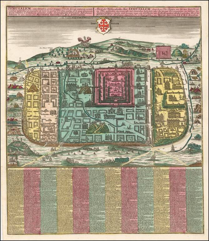
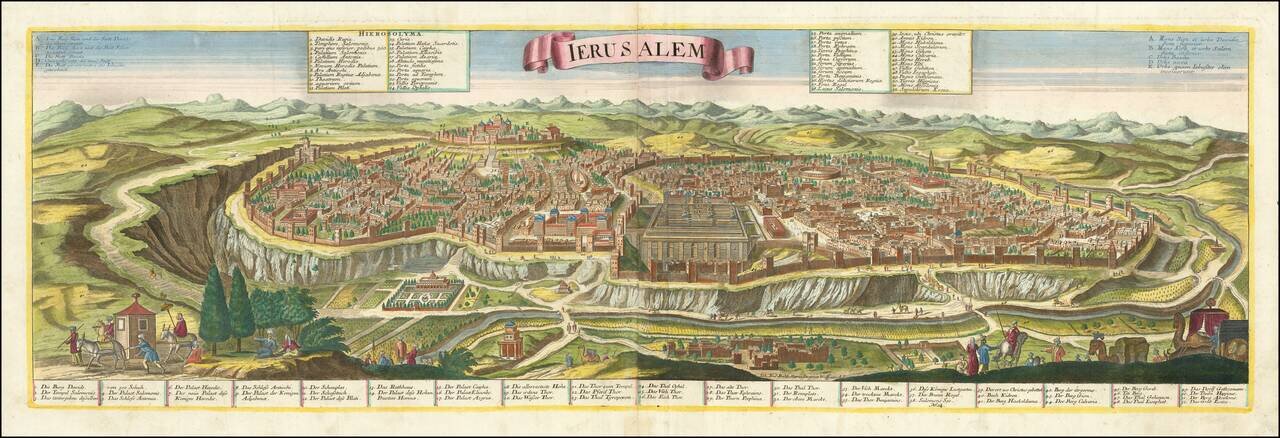
Fine full color example of Seutter's plan of the city of Jerusalem, based upon the 16th century map of Christian van Adrichom. The plan includes a key locating 254 major points of interest in the Holy City. Van Adrichom's plan was originally issued...
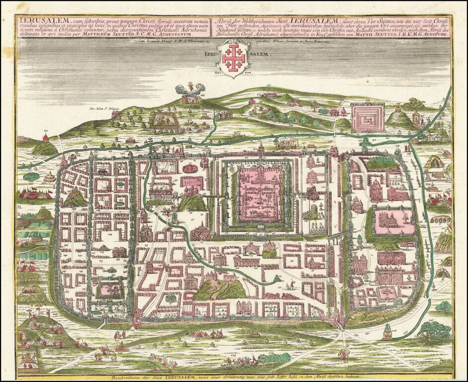
A fine full-color example of Seutter's plan of the city of Jerusalem, based on the 16th-century map of Christian van Adrichom. Most buildings shown are numbered and can be referenced to an index included with some copies of this map. The view is a very...
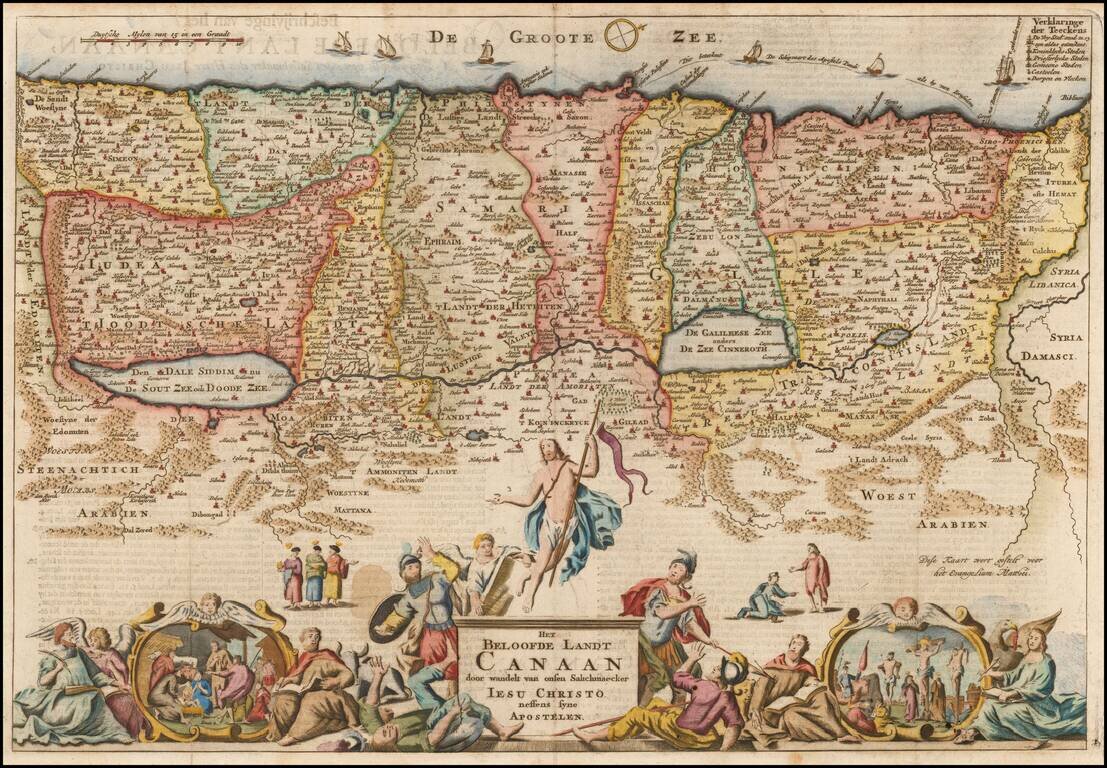
Detailed map of the Holy Land, showing the travels of Christ and the Apostles, including Paul's travel's at sea and numerous sailing vessels. An excellent example of a Duch Bible map of the Holy Land.
Detailed map of the Holy Land and Exodus, from Seutter's Atlas Minor.
Striking example of the scarce Jermiah Wolff edition of Probst's fine large format view of Jerusalem. Printed on 2 sheets, the map shows Jerusalem from the east. Includes matching Latin and Germans key locating 52 important places within the view,...
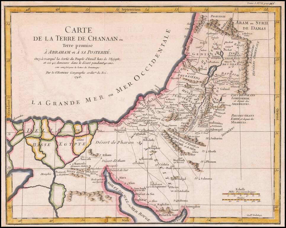
Detailed map of Ancient Canaan and the Nile River Delta. Includes the route of Moses and the Israelites as they wandered the Desert for 40 years.
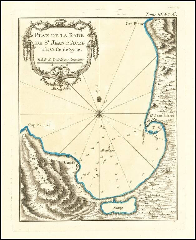
Finely engraved map of the area around the city of Acre in Israel, from Jacques Nicolas Bellin's Le Petit Atlas Maritime Recueti de Cartes et Plans des Quatre Parlies du Monde en Cinq Volumes, first published in Paris in 1764. Acre was the scene of...
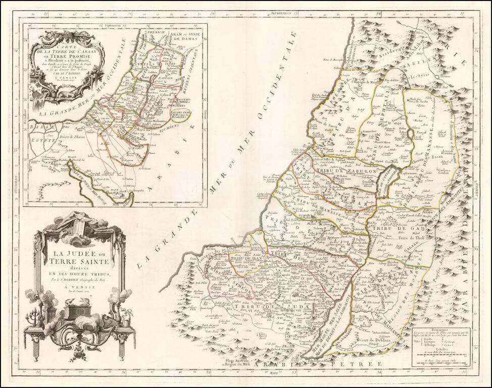
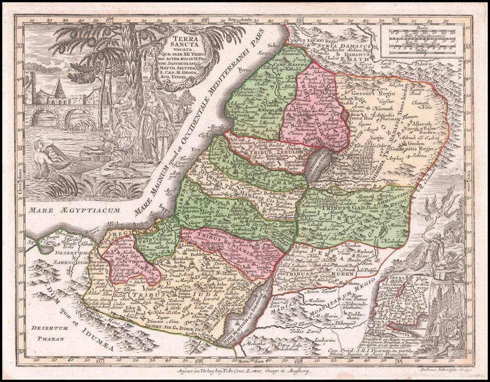
Fine large format map of the Holy Land, published in Venice, in 1779, by Santini and engraved by Remondini. The map presents a fine detailed depiction of Judea or the Holy Land, divided into the regions controlled by the 12 Tribes of Israel. A large...
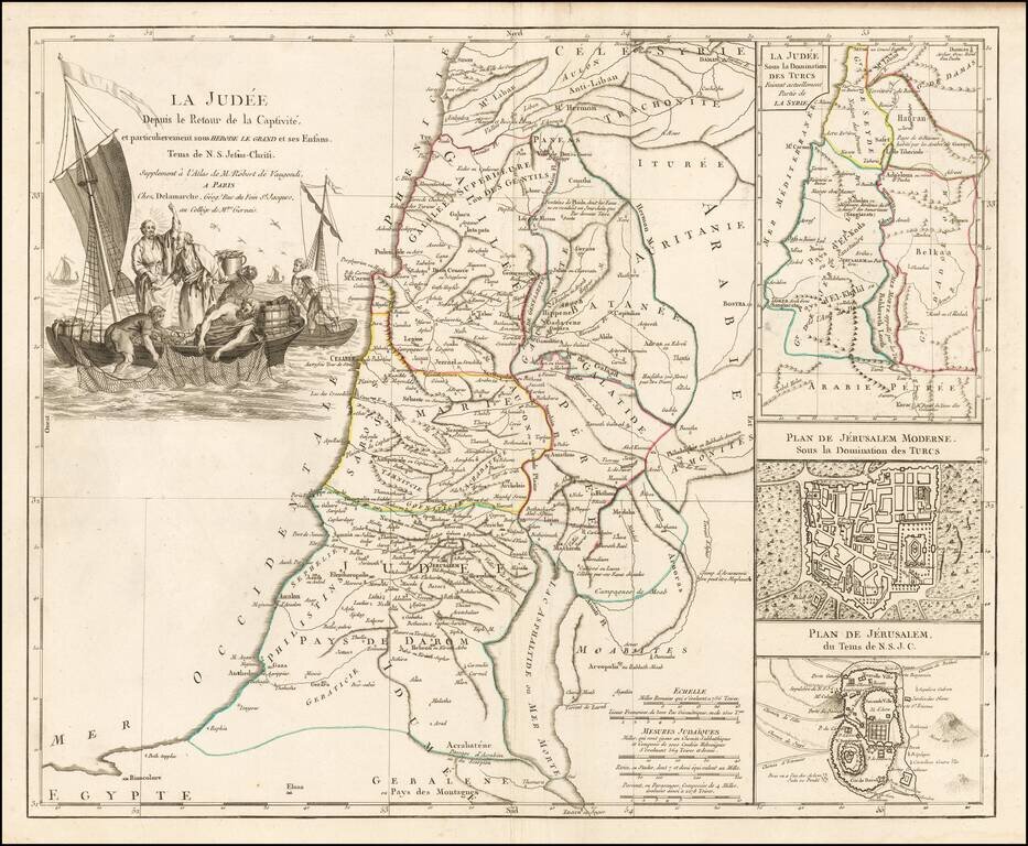
Decorative map of the Holy Land, published in Paris by Delamarche. The map includes large insets of Ancient and Modern Jerusalem and the Holy Land at the time of the domination by the Turks. Large striking cartouche.
![Carta de la Tierra de Chanaam y de Promission Ofrecida A Abraam y a su posteridad y la tierra de Pharan... [bound in:] Historia Cronologica del Pueblo de Dios...](/map/small/66627.jpg)
Scarce 18th-century Spanish-language map of the Holy Land published in Alcalá in 1792. The engraved map includes a plan of Jerusalem, the family trees of Adam and Noah, a plan of the camp of the Israelites in the desert, and a map of their...
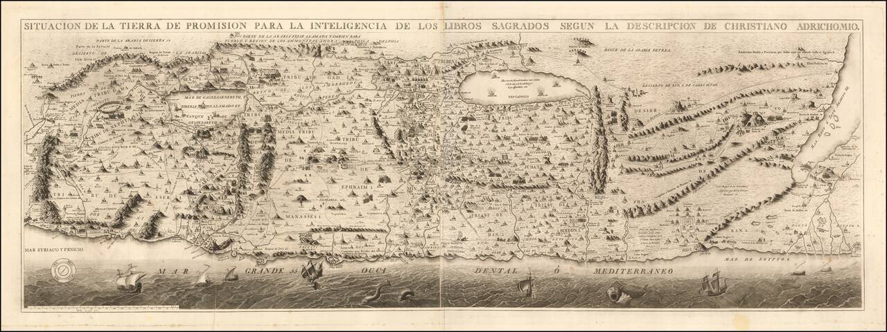
Rare Spanish Edition Rare separately issued Spanish edition of Christian Van Adrichom's map of the Holy Land, first published in Cologne in 1584. Little is known about this finely engraved Spanish edition of Van Adrichom's map. While Spanish editions...
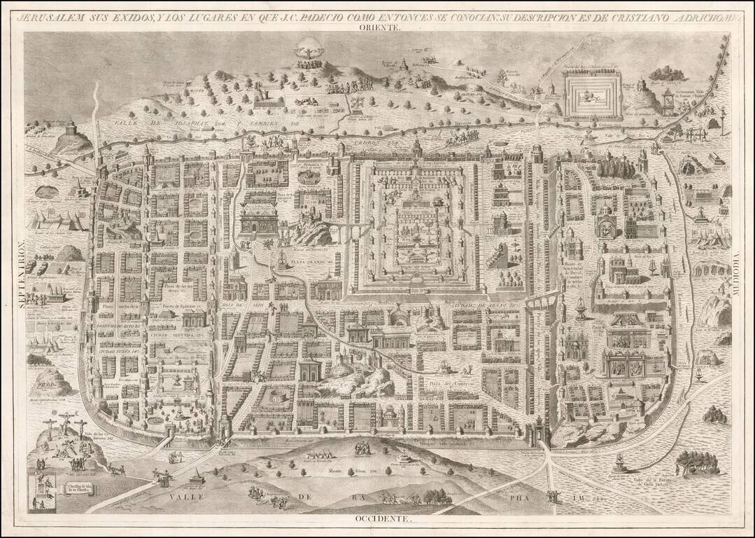
A Rare Spanish View of Jersulem Rare separately issued view of the Holy Land, published in Madrid by Manuele Navarre. The view is based upon the work of Christian Van Adrichom, whose work is perhaps the most influential visual representation of the...

Rare Wall Map of the Holy Land By A German Orientalist Scholar Finely executed map of the Holy Land, including 96 pictorial vignettes illustrating events from Biblical History. This is German Orientalist and Historian EFK Rosenmuller's edition of the...
Rare separately pubilshed map of the Holy Land, engraved by J & C Walker for Peter Graham. The map shows a number of important early routes, including: the Roman Road the Routes of the Israelites toward the promised lands the Hadj or...

Detailed map of Palestine and Lebanon, colored by the various provinces. Shows towns, roads, rivers, mountains, islands, etc. Large inset of environs of Jerusalem. Also, Remarks on the Dead Sea and the River Jordan. This map is from an early edition...
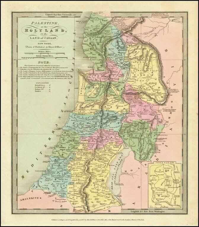
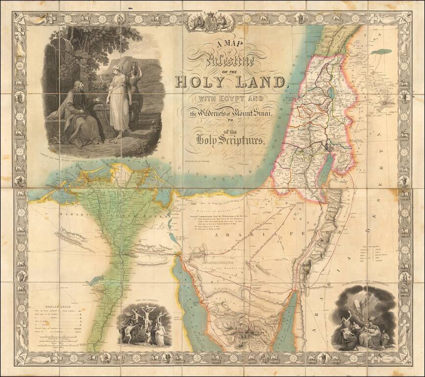
Nice wash color example of David Burr's map of the Holy Land. Includes an inset of the area around Jerusalem and several annotations.