Map size in jpg-format: 64.962MiB
Click to open in high resolution (open in new tab).
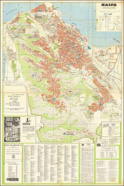
Mid-century map of Haifa depicting a city rapidly growing. Includes extensive detail on the city center, which was built mostly during British colonial rule. Details neighborhoods, amenities, port services and parks. A major focus of this map is on the yet to be developed inland plots of land, showing a city that has potential for more growth. This is accentuated by two advertisements displayed on the map, one from RASSCO telling the audience to "Build your home with RASSCO," and one by the Bayside Land Corporation. Includes an index of streets, bus routes, buildings and government offices.
If you are a student, write to us in telegram: @antiquemaps and indicate what material you need and for what work you need a map in high detail. We are ready to provide material on special terms. For students only!

![[Europe, Mediterranean, Asia Minor and the Persian Empire]](/map/small/43558.jpg)
