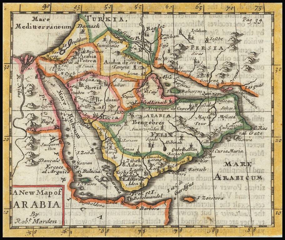
Rare early English map of Arabia, extending from the Mediterranean to the Red Sea to the Persian Gulf, with many kingdoms, place names, etc. shown. Mecca and Medina area located.
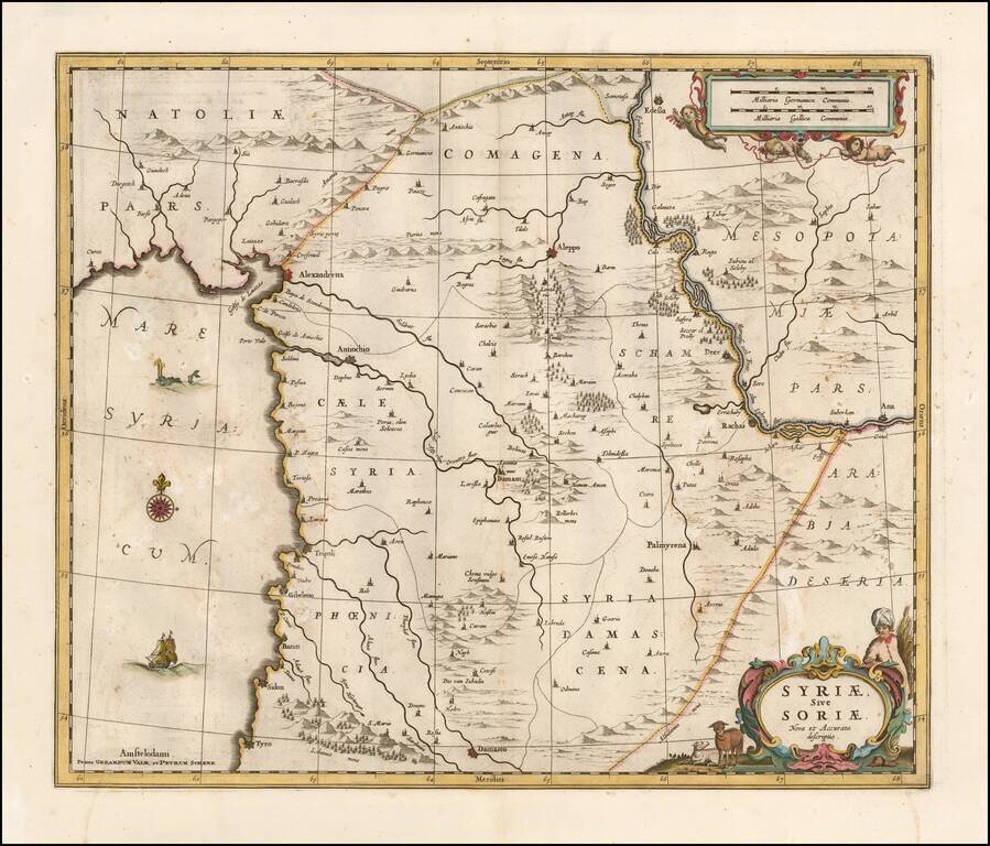
Detailed late 17th Century map of Syria published in Amsterdam. The map extends from Damascus and Sidon in the south, to Edessa, Alexandretta, and Antioch in the north as well as to Aleppo, Palmyrena, Damant, etc. The map also extends from the...
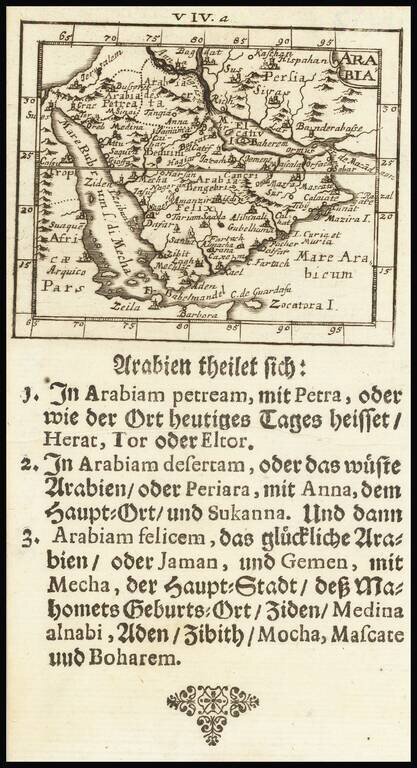
Rare map of the Arabian Peninsula, published by Johann Ulrich Muller. The Arabian Sea is called M[are] El Catif, with the Island of Bahrain shown. The Red Sea is alternatively named Sea of Mecha. Many other early place names. Many other interesting...
Nice example of the second edition of Mercator's Ptolemaic map of the Middle East, first issued in the 1695 edition of Mercator's Geographia, based upon the works of Claudius Ptolemy. Mercator's map was a landmark in the mapping of the Arabia...
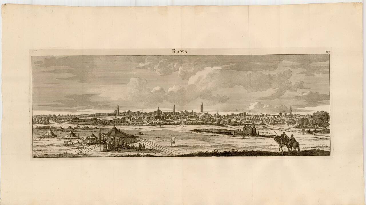
Striking view of the City of Ramallah, from De Bruyn's Reizen van Cornelis de Bruyn . . . .
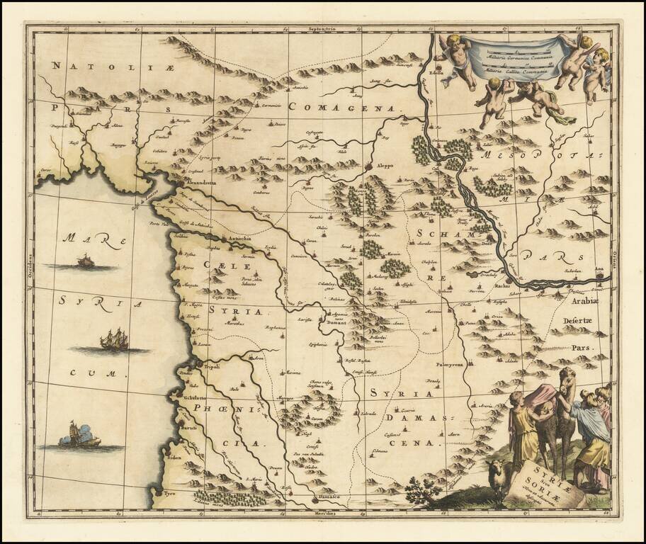
An attractive antique map of Syria, embellished with a decorative cartouche including a camel. The map stretches from Damascus to the Anatolian Peninsula and extends to Mesopotamia in the east, showing the Euphrates. The cities shown include Aleppo,...
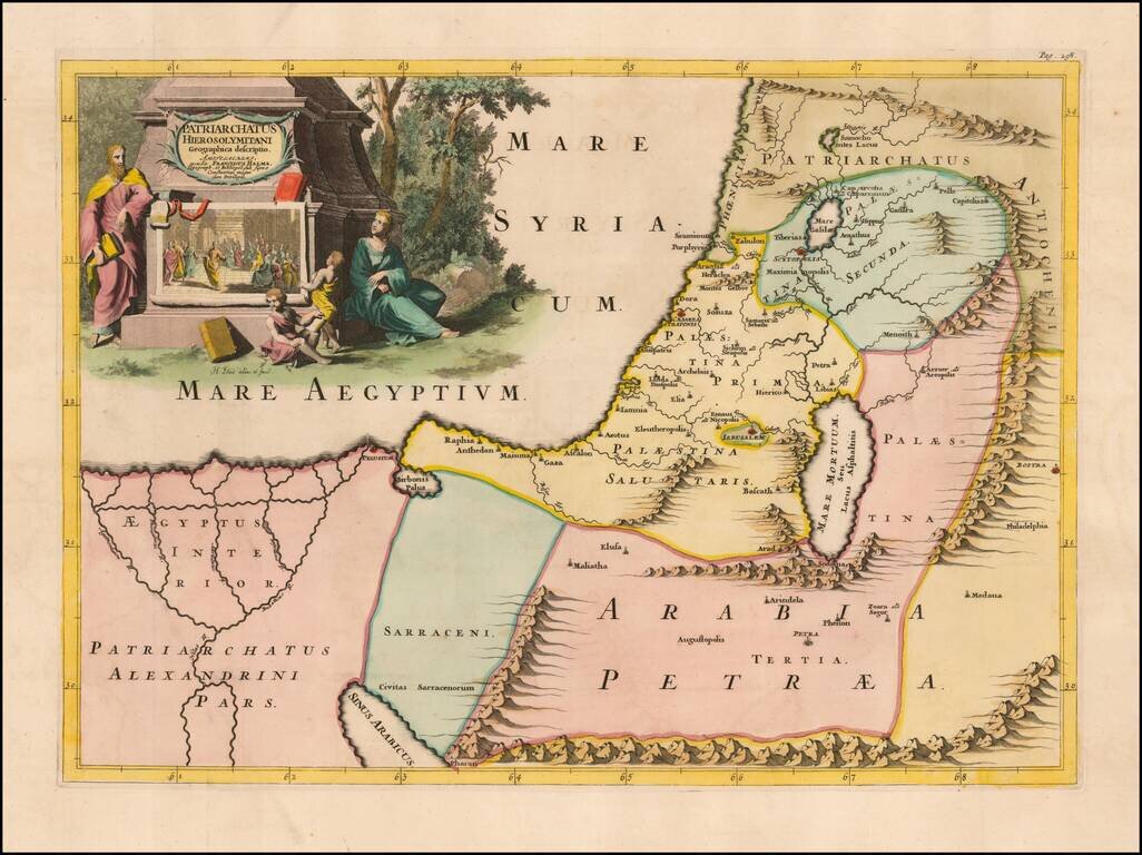
Fine example of Francois Halma's map of the Latin Patriarchate of Jerusalem. Latin Patriarchate of Jerusalem is the title of the see of Roman Catholic Archbishop of Jerusalem. It was originally established in 1099 with the Kingdom of Jerusalem...
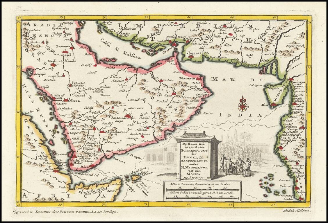
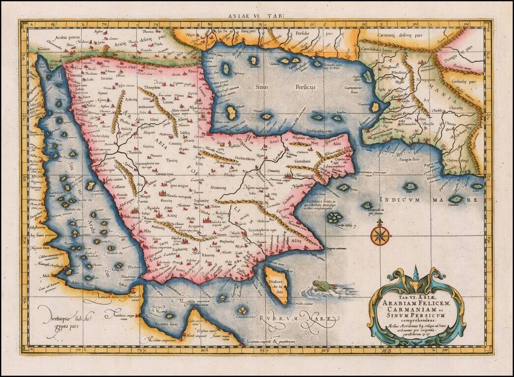
This is an interesting map centered on the Arabian peninsula. The title of the map refers to the (supposed) sixth voyage of Sir Henry Middleton on behalf of the East India Company. The map shows the Arabian peninsula in full, Abyssinia, the Horn of...
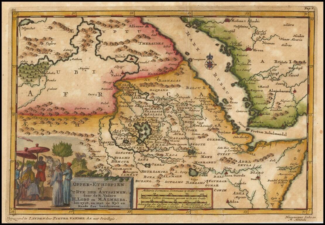
Decorative map centered on the Red Sea and the Sources of the Nile River, published by Vander Aa. The map shows the explorations of Jeronimo Lobo. Jerónimo Lobo (1595– 1678) was a Portuguese Jesuit missionary. He took part in the unsuccessful...
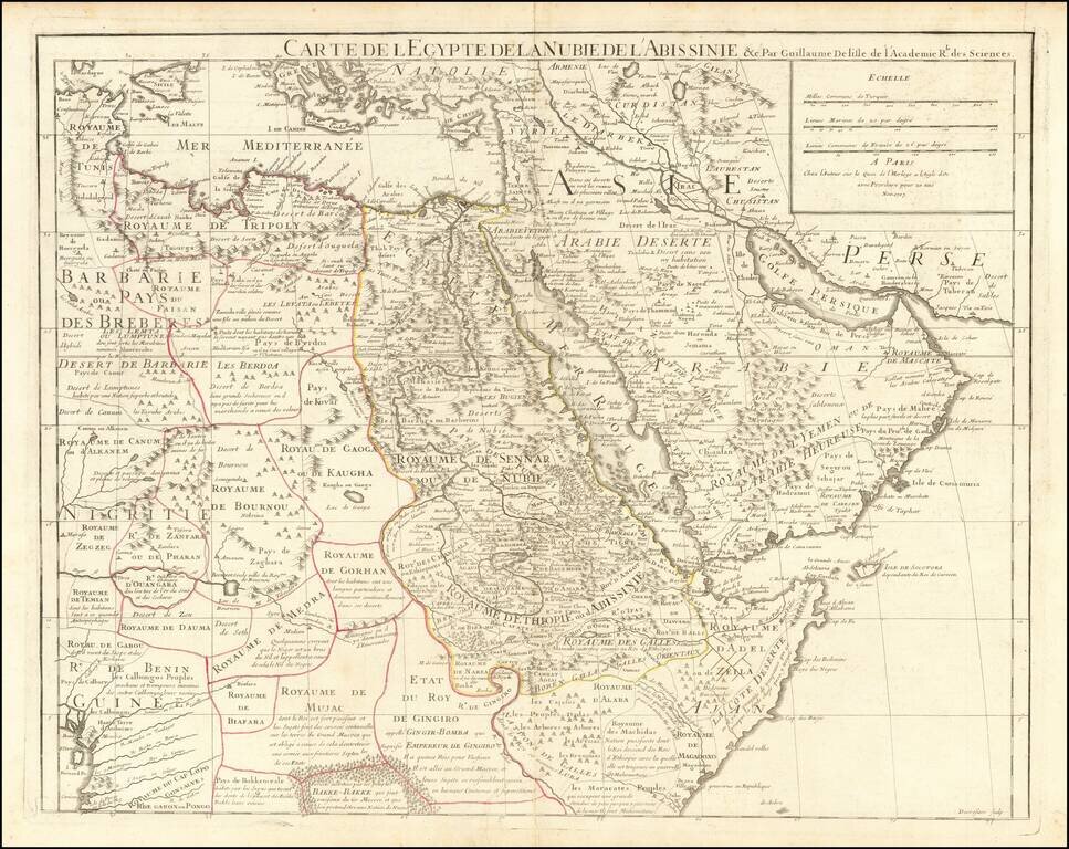
Nice example of Guillaume De L'Isle's highly detailed map of the region between the Arabian Peninsula, Egypt and the Horn of Africa, centered on the Red Sea. The map extends west to include Sicily, the Southeastern Mediterranean Coastline of Africa....
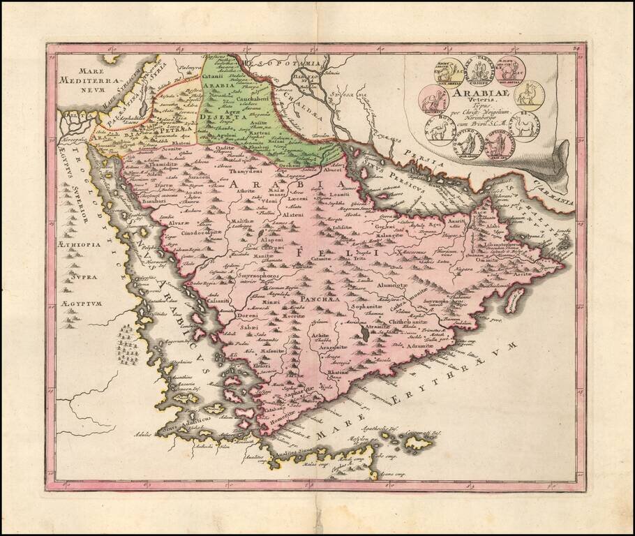
Striking map of the Arabian Peninusla featuring the geographical features known to the ancients and decorated with a vignette and 9 medallions. An interesting and highly decorative map.
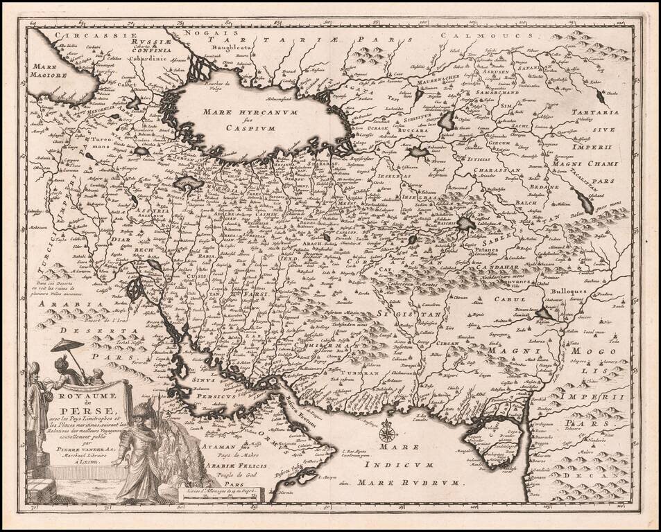
Scarce map of the Persian Empire showing the area that is now Iran, Afghanistan and Iraq with a portion of Oman near the Persian Gulf. The Sinus Persicus is remarkable distorted. The cities and mountains are graphically depicted and a beautiful...
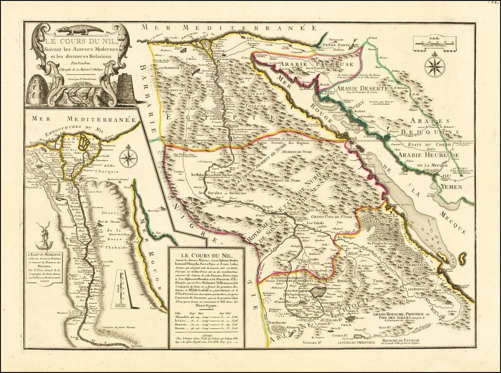
Striking large format map of the Nile, Egypt, the Red Sea and contiguous regions, from De Fer's Atlas ou Recueil de cartes geographiques. De Fer's highly detailed map shows the course of the Nile River from Abyssinia through Egypt to the Mediterranean...
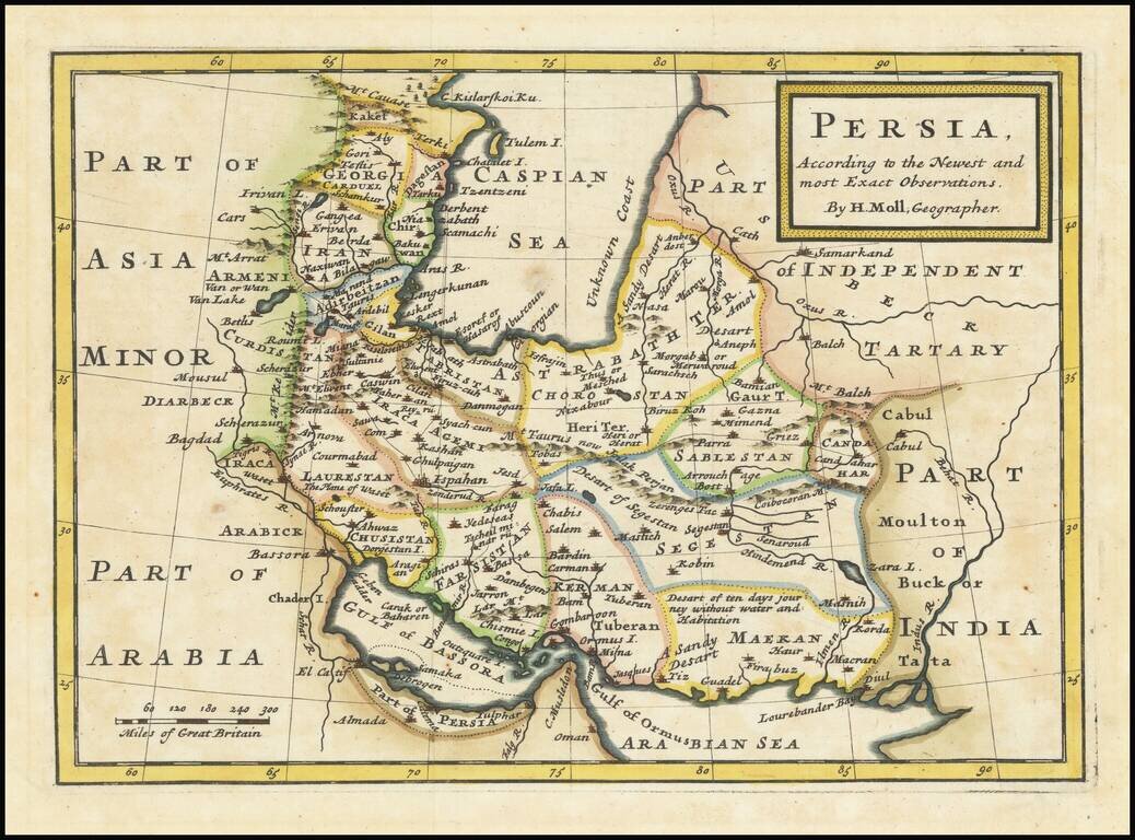
Beautiful 18th-century British map of Persia, published by Herman Moll in London, circa 1740. The Persian Gulf is referred to as the "Gulf of Bassora" and much of the Emirati, Qatari, and Saudi Gulf Coast described as "Part of Persia". Persian...
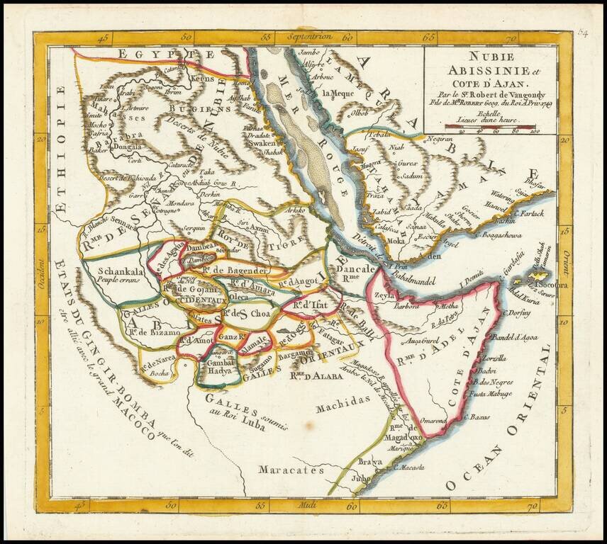
Detailed map of part of the area centered on the Red Sea and the Horn of Africa, featuring modern-day Somalia and Ethiopia. The map features numerous small kingdoms, including the "Rme. de Magadoxo" in Somalia, presumably related etymologically to...
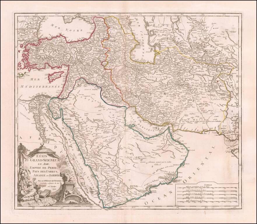
Detailed map of the Turkish Empire, extending to the Black Sea, Georgia, the Caspian, Usbekistan, The Indian Ocean, Saudi Arabia, Egypt and the Red Sea. Large decorative cartouche.