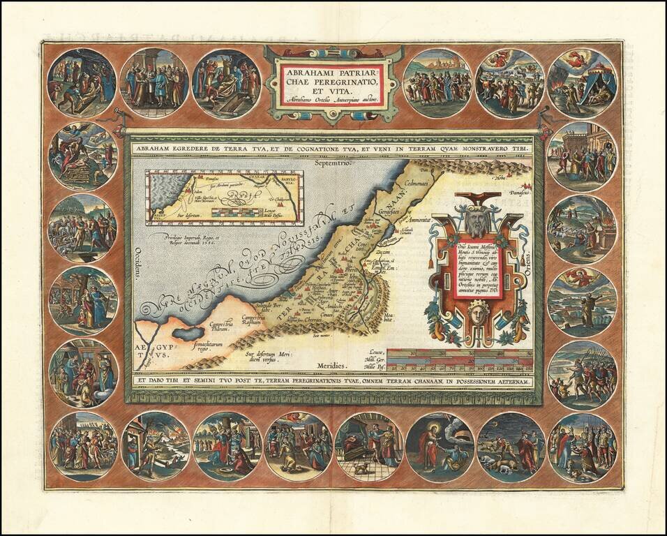
Finely colored example of this decorative map of the Holy Land, illustrating the life of Abraham. The Wanderings of Abraham is among Oretelius' most elaborate productions. It demonstrates his combined talents as mapmaker, artist and historian. This is...
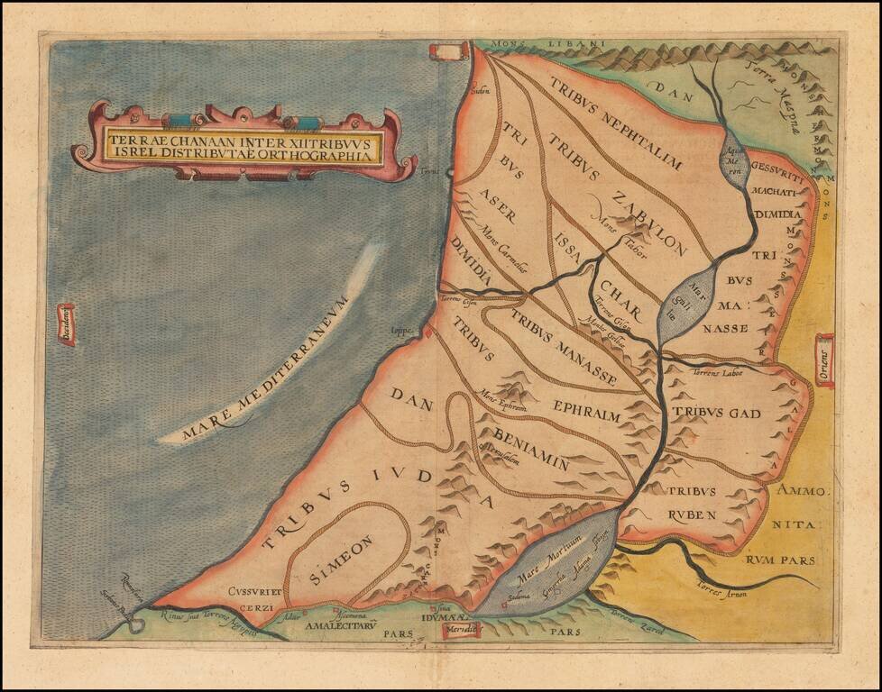
Finely colored example of this early map of the Holy Land, showing the distribution of the 12 Tribes of Israel within the Holy Land. The present example is a rare re-issue of the original 1611 map, with "Isrel" spelled incorrectly in the title.
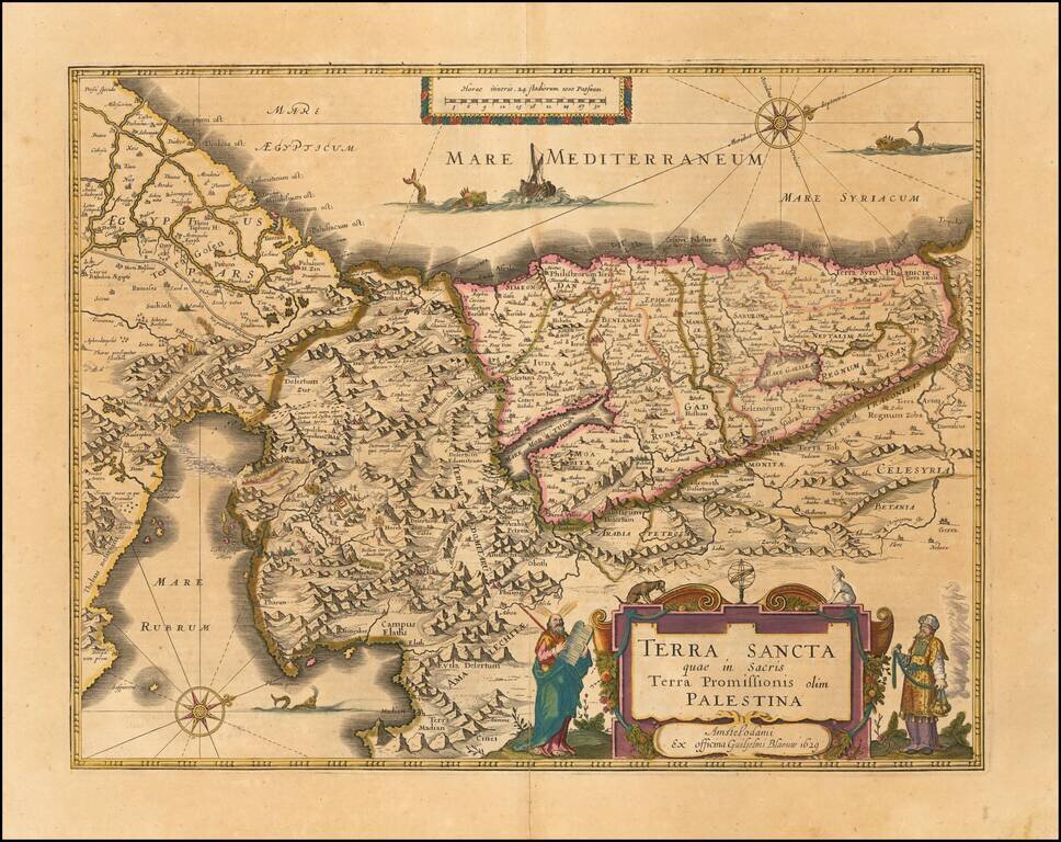
Old color example of Blaeu's map of the Holy Land. Includes large cartouche, two compass roses, sea monsters and other embellishments. One of the most decorative Holy Land maps of the period. Oriented with west at the top.
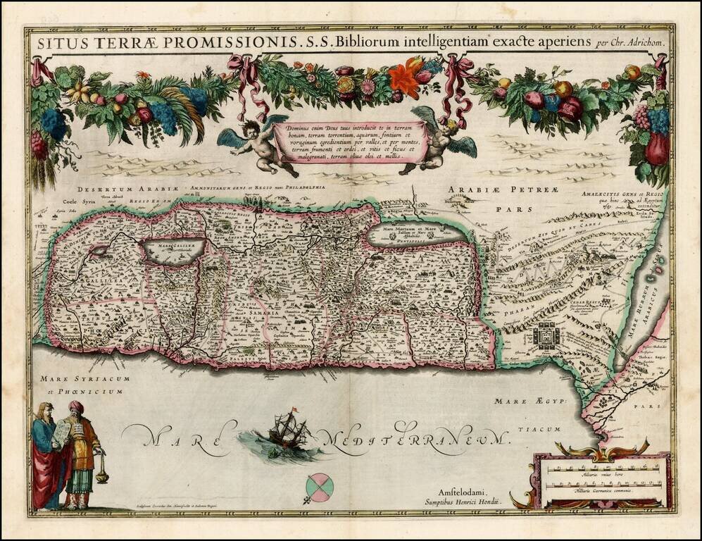
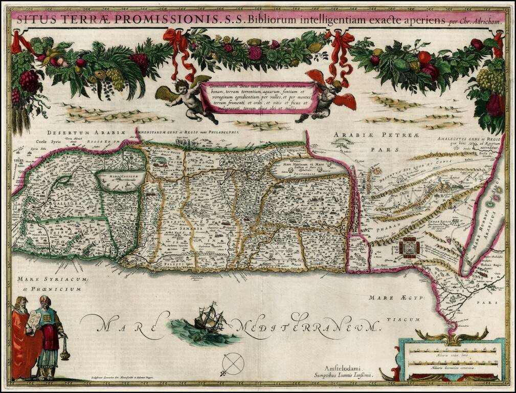
Early edition of Hondius' map of the Holy Land, based upon the report of Christian Van Andrichom, then the most influential holy land cartographer. The map was subsequently copied by Janssonius, who adds his imprint to the map sometime around 1645.
Fine old color example of Jansson's map of the Holy Land, based upon the report of Christian Van Andrichom, then the most influential holy land cartographer.
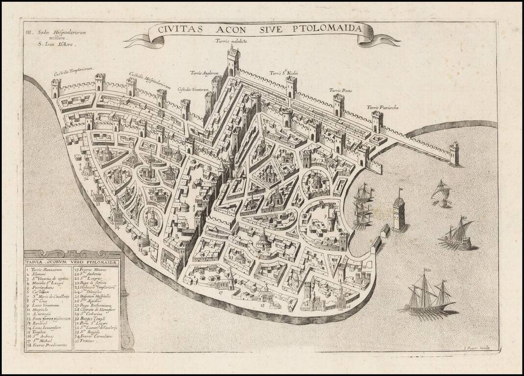
Extremely rare plan of Acre, based upon the Vesconte-Sanuto plan, intended to illustrate a period when the town was under the control of the Knights of St. John. Shows extensive fortifcations, town plan, buildings and a key identifying significant...
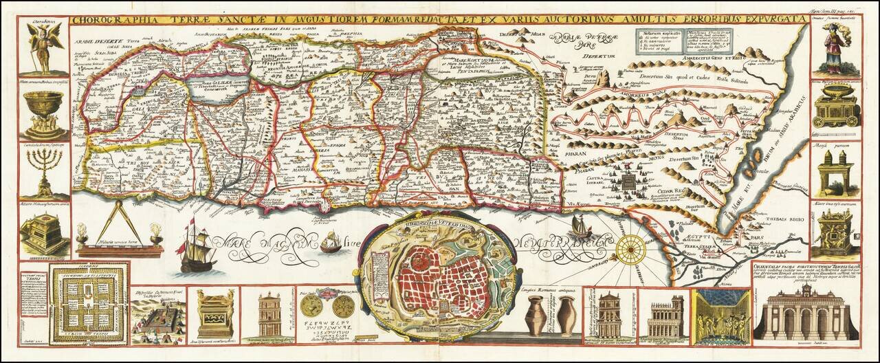
Finely colored and highly decorative map of the Holy Land, embellished with 18 decorative vignettes showing scenes of Moses from Exodus and a view of Jerusalem. Based upon Van Andrichom, the map is oriented to the East, divided into the tribes on both...
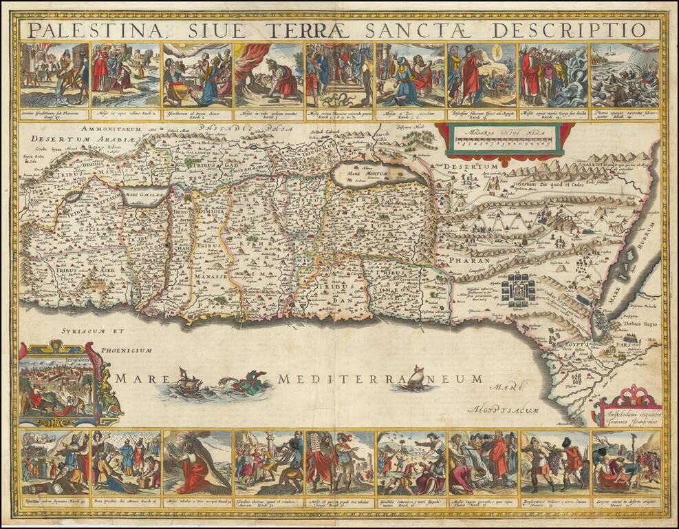
Scarce map of the Holy Land, with inset of Villaplando's Jerusalem. Shows 16 Old Testament vignettes, Moses' exodus and many other biblical events. Colored by tribes. Attractive compass rose and several sailing ships. After Christian Van Adrichom. A...
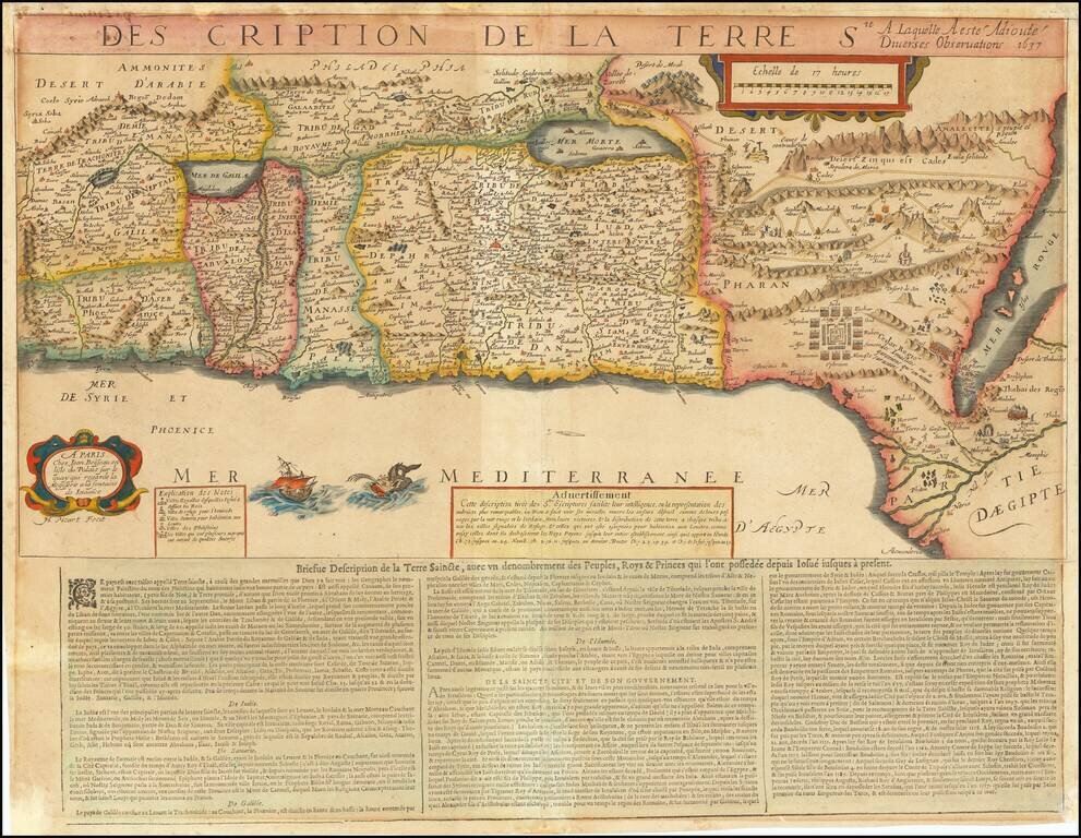
Extremely rare map of the Holy Land based upon the writings in the Old Testament, published by Jean Boisseau and engraved by Jean Picart in Paris. The map includes descriptive text at the bottom entitled: Briefue Description de la Terre Saincte. The...
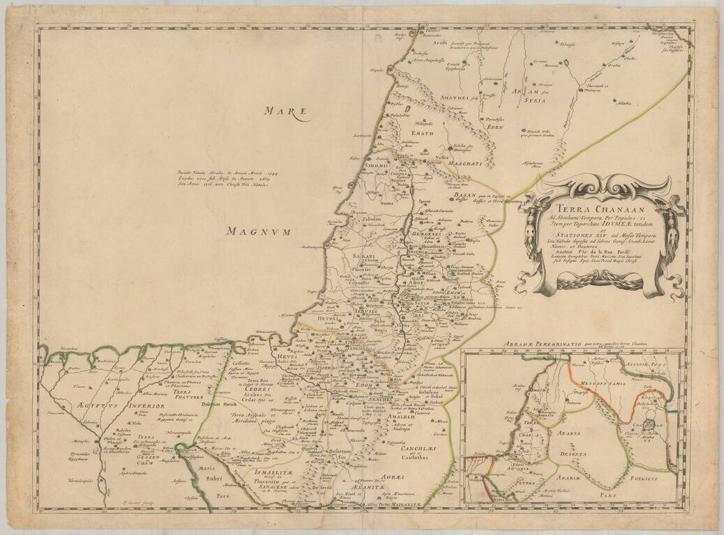
First edition of Phillipe de la Rue's scarce map of the Holy Land and contiguous regions. The map depicts the Holy Land as it appeared during the time of the Old Testament, based upon the books of Genesis, Exodus. Levitcus, Numbers and Deuteronomy....
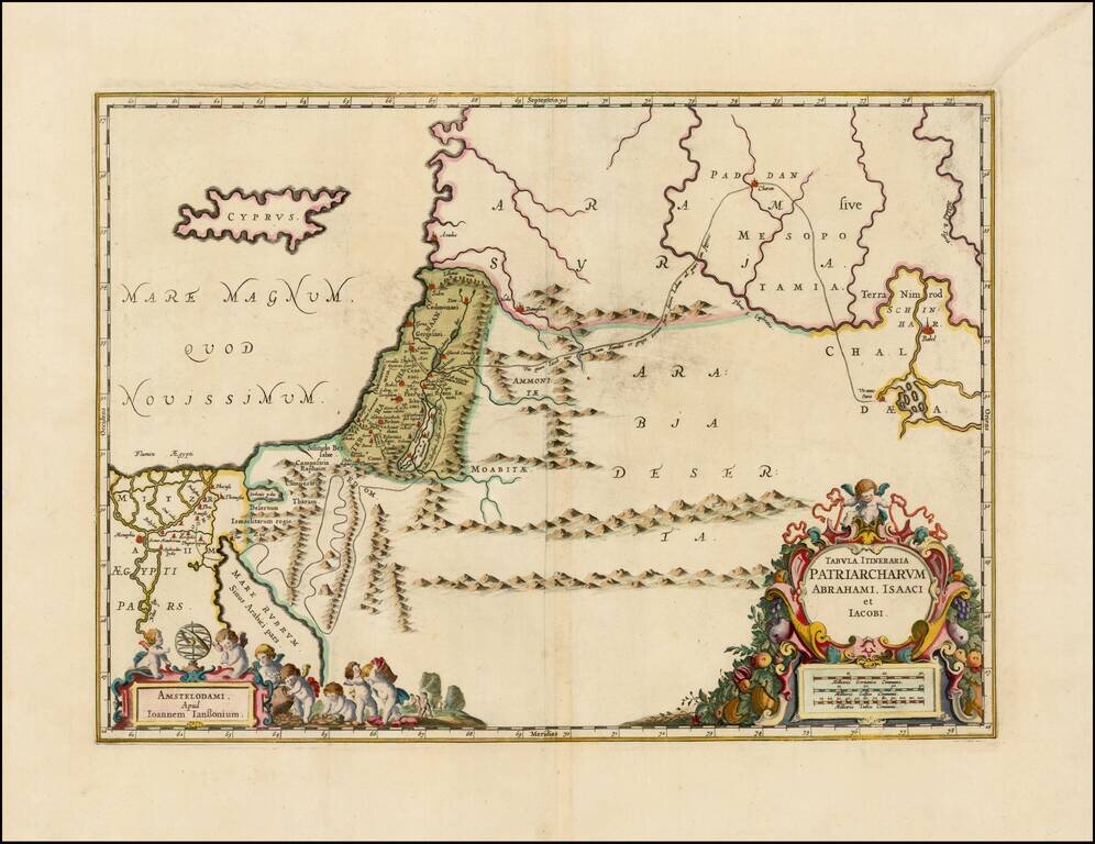
Decorative regional map of the Holy Land, showing the travels of Abraham, Isaac and Jacob. Includes nice details, topography and a line tracing the route travelled.
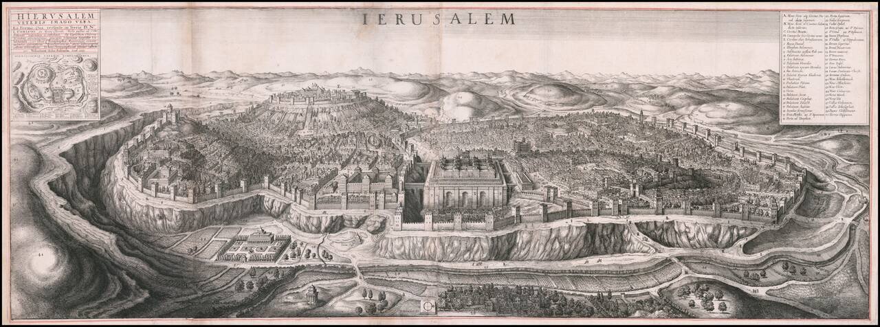
Fine large birdseye view of Jerusalem, published in London by Wenceslaus Hollar. One of the most impressive engraved views of Jerusalem. The representation of the Jewish Temple at Jerusalem is based on the engravings in H. Prado and J.B....
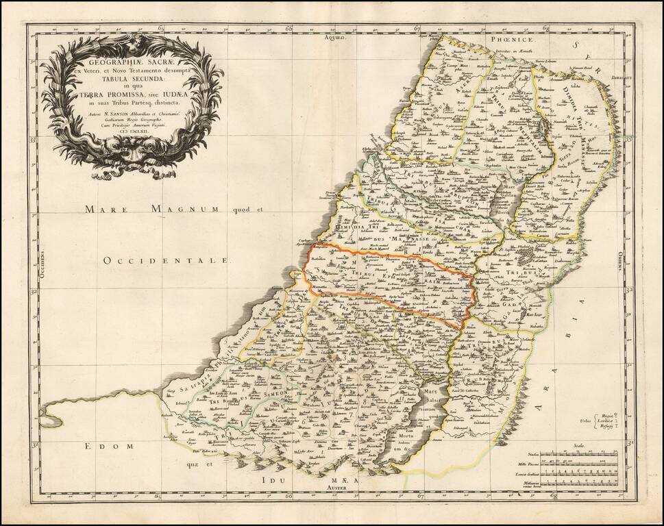
Nicolas Sanson's decorative and highly detailed 17th-century map of the Holy Land, colored to show the Twelve Tribes of Israel. The map was published by Nicolas Sanson, the Geographer to the King of France, and the most important French mapmaker of...
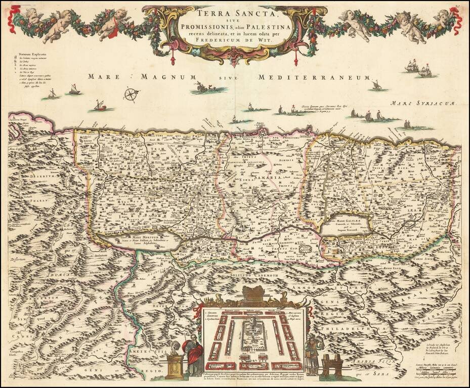
Old color example of De Wit's map of the Holy Land, oriented to the West, and divided among the Tribes of Israel on both sides of the Jordan. The shore line runs from Sidon to Egypt. The Kishon River connects Haifa Bay to the Lake of Tiberias. Along...
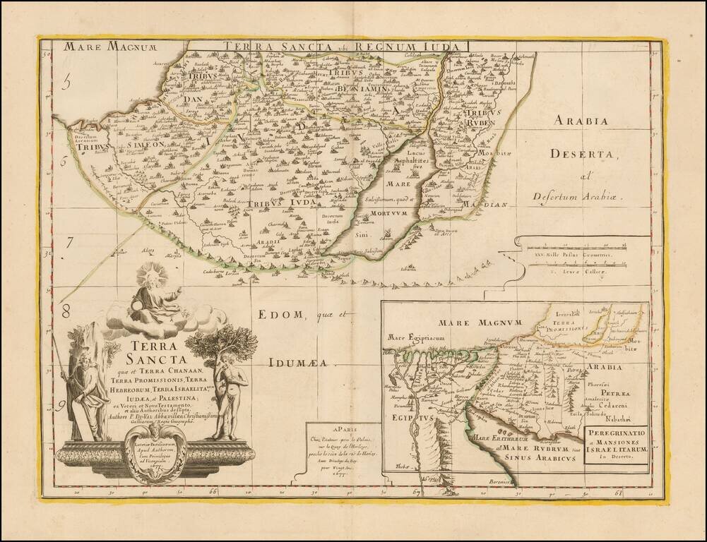
Southern half of Du Val's scarce 2 sheet map of the Holy Land. The map is centered on the Dead Sea and includes a large map showing the 40 years of wandering of the House of Israel through the desert after leaving Egypt.
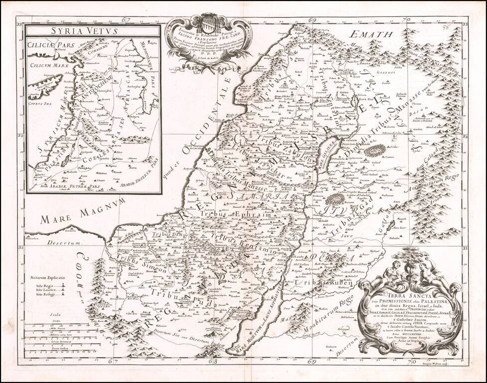
Decorative map of the Holy Land, published by Giacomo Rossi in Rome in 1679. The map includes an elaborate title cartouche and a large inset map of Ancient Syria.