![[Empire of Alexander The Great] Antiquor? Imperiorum Tabula in qua prae caeteris, Macendonia seu Alexandri Magni et Expeditiones exarantur . . .](/map/small/70608.jpg)
Tracking the Expeditions of Alexander the Great Detailed map of the Middle East, Asia Minor and part of Central Asia, showing the region conquered by Alexander the Great. The map detailed the expeditions of Alexander the Great, with a dashed line...
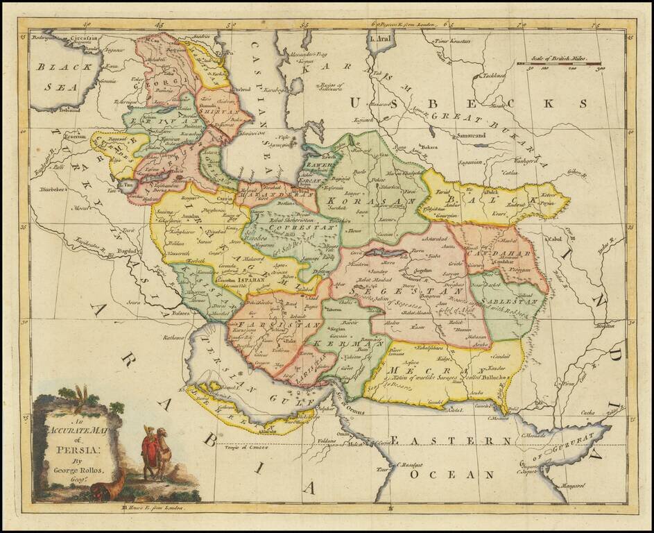
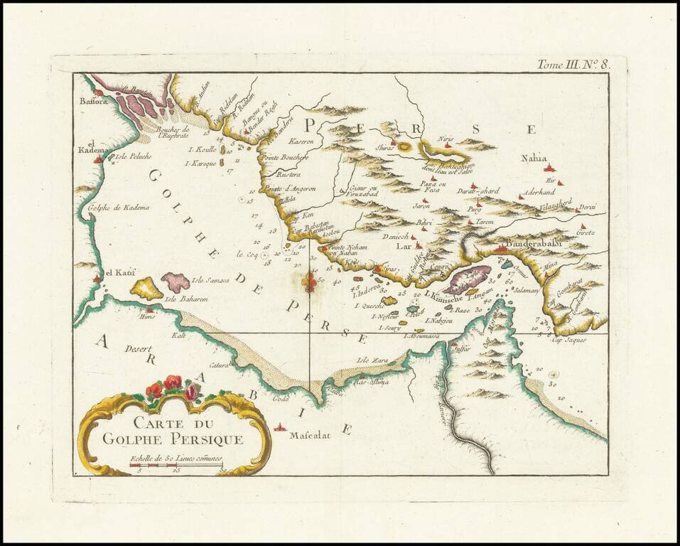
Striking map of Persia, with decorative cartouche.
![[Sidon, Lebanon] Plan de Seide en Syrie](/map/small/61410.jpg)
Finely engraved map of of Sidon in Lebanon, from Jacques Nicolas Bellin's Le Petit Atlas Maritime Recueti de Cartes et Plans des Quatre Parlies du Monde en Cinq Volumes, first published in Paris in 1764.
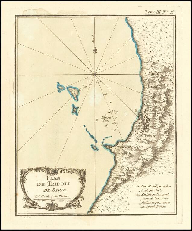
Finely engraved map of the area around Tripoli, on the northern coast of Lebanaon, from Jacques Nicolas Bellin's Le Petit Atlas Maritime Recueti de Cartes et Plans des Quatre Parlies du Monde en Cinq Volumes, first published in Paris in 1764. The map...
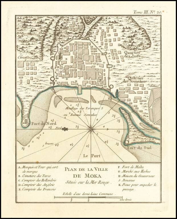
Finely engraved map of Mocha, Yemen, from Jacques Nicolas Bellin's Le Petit Atlas Maritime Recueti de Cartes et Plans des Quatre Parlies du Monde en Cinq Volumes, first published in Paris in 1764.
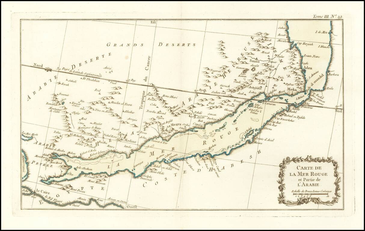
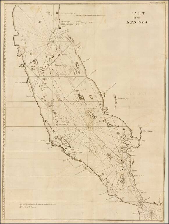
Finely engraved map of the Red Sea and Southern part of the Arabian Peninsula, from Jacques Nicolas Bellin's Le Petit Atlas Maritime Recueti de Cartes et Plans des Quatre Parlies du Monde en Cinq Volumes, first published in Paris in 1764.
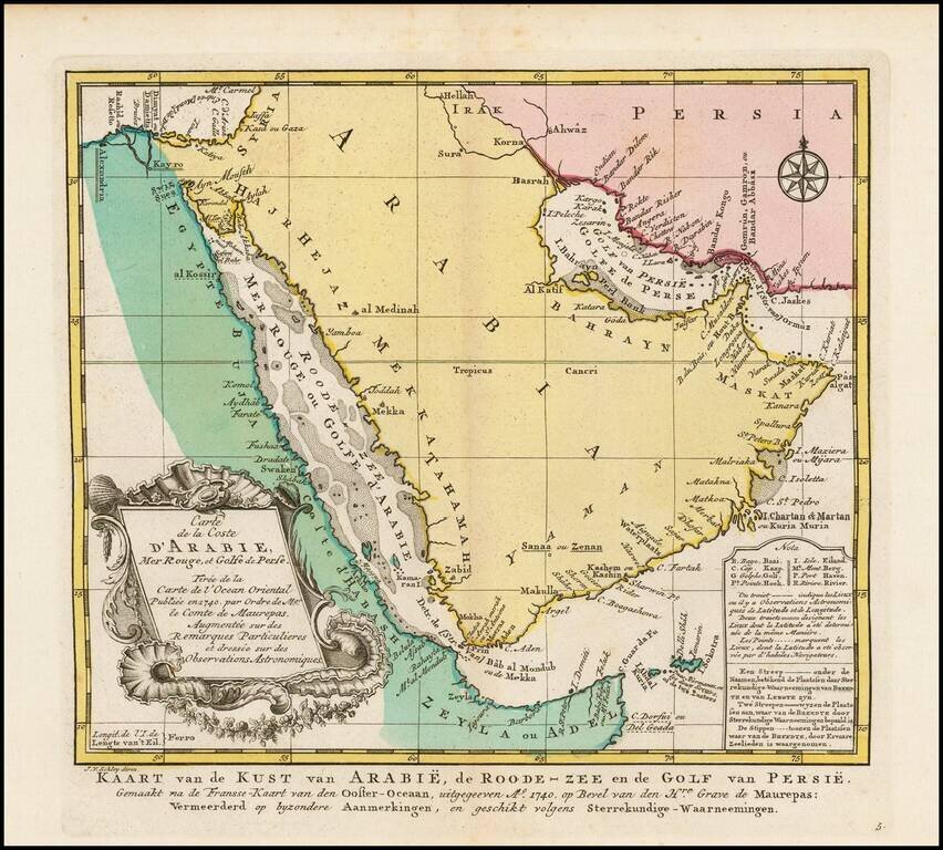
Names "Catura" (Qatar). Finely engraved map of the Persian Gulf, from Jacques Nicolas Bellin's Le Petit Atlas Maritime Recueti de Cartes et Plans des Quatre Parlies du Monde en Cinq Volumes, first published in Paris in 1764. Names the following...
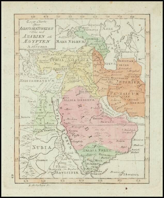
Rare map of the Ottoman Empire, published in Stockholm. The map appeared in the Atlas juvenilis . . . , first published in Stockholm in 1768.
Striking full color example of the Dutch edition of Bellin's fine map of the Arabian Peninsula. Includes an elaborate cartouche and detailed charting of the coastline of the Arabian Peninsula, Red Sea, Straits of Ormuz, etc. The Red Sea is...

Detailed map of the region centered on the Red Sea, Upper Nile River and Gulf of Aden, from Jean Lattre's Atlas Moderne.
Finely executed map of the southern part of the Red Sea, which was published in A Letter to the Rev. Mr. Maskelyne, Astronomer Royal, F. R. S. Accompanying a New Chart of the Red Sea, with Two Draughts of the Roads of Mocha and Judda, and Several...
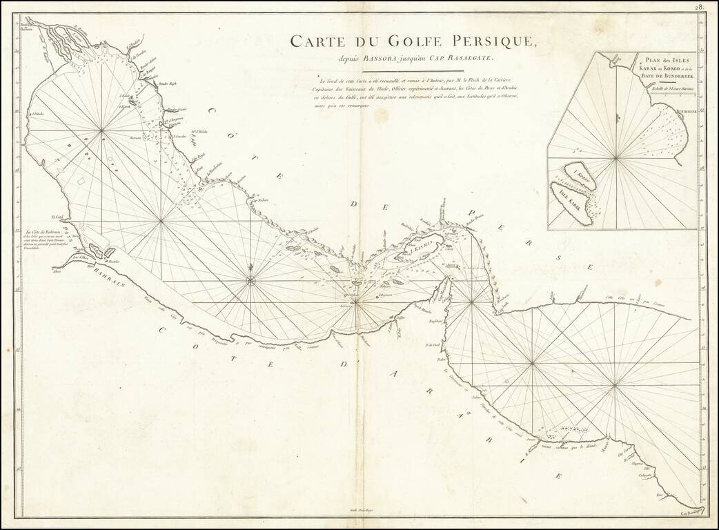
A rare antique map of the Persian Gulf and Gulf of Oman. Designed for navigational use by the French East India Company, this map is neatly designed and shows rhumb lines, bathymetric soundings, prevailing currents, and shoals. This chart is designed...
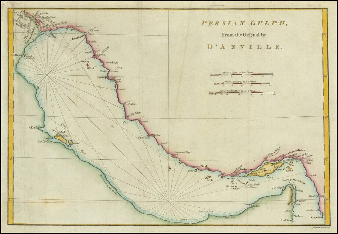
Scarce English Map of the Gulf Scarce coastal chart of the Gulf, from Basra to Cape Jask and Kursekian. The map shows several toponyms in the UAE, including Julfar, la Pagode blache, and Zaka. The map shows a lot of detail around Bahrain and Qatar,...
Detailed map of the Turkish Empire, extending to the Black Sea, Georgia, the Caspian, Usbekistan, the Indian Ocean, Saudi Arabia, Egypt and the Red Sea, published in Venice by Santini. Large decorative cartouche. The map is based upon an earlier map...
Decorative Map of the Arabian Peninsula. Detailed map of Saudi Arabia, the Red Sea, Persian Gulf, and the Gulf of Aden. "Golfo Persico" is named, as are the "I Baharem" and "I Samak" (Bahrain and Qatar). There is excellent topographical detail. The...
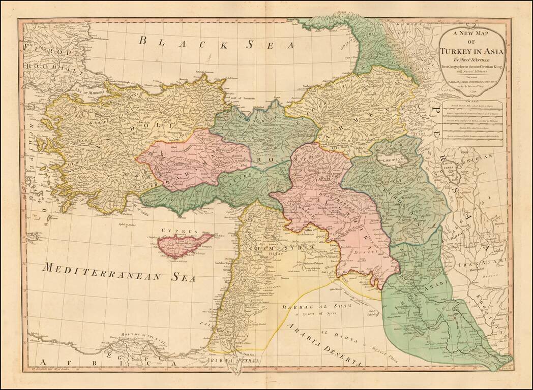
Double-page engraved map of Asia Minor, showing Cyprus, the eastern Mediterranean, and much of the Middle East. The map has old outline hand-color. D'Anville is credited as the source of the map. Laurie & Whittle Robert Laurie (ca. 1755-1836)...