Map size in jpg-format: 128.208MiB
Click to open in high resolution (open in new tab).
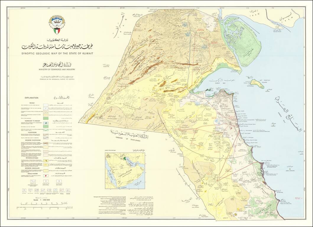
Rare geological map of Kuwait showing international boundaries, transportation, pipelines and populated places.
This is a large version of the first geological map of Kuwait, made in 1969 in cooperation with the Geological Survey of Austria. The map was accompanied by text, written by H.F. Holzer, T.E. Gattinger and W. Fuchs, which was published in Vienna.
The map include an extensive geological explantion, along with several other interesting topics, including symbols showing the locations of:
The bases for a number of oil companies are shown, including Arabian Oil Co., Aminoil, and Getty Oil, A number of Oil Fields (red letters) are shown, including:
This is one of the earliest maps of Kuwait, following its Independence from Great Britain. In June 1961, Kuwait became independent with the end of the British protectorate. Sheikh Abdullah Al-Salim Al-Sabah became an Emir. Under the terms of the newly drafted constitution, Kuwait held its first parliamentary elections in 1963. Kuwait was the first Arab state in the region to establish a constitution and parliament.
If you are a student, write to us in telegram: @antiquemaps and indicate what material you need and for what work you need a map in high detail. We are ready to provide material on special terms. For students only!

![[Europe, Mediterranean, Asia Minor and the Persian Empire]](/map/small/43558.jpg)
