
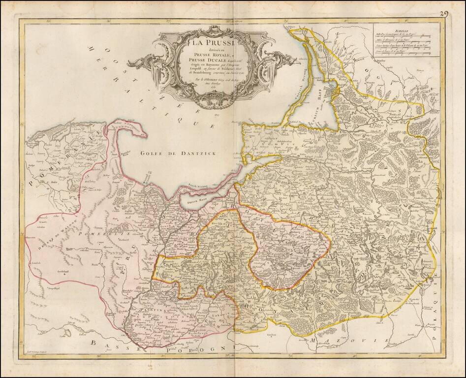
Detailed map of Prussia, including much of Poland and the Baltic Countries, published by De Vaugondy in Paris.
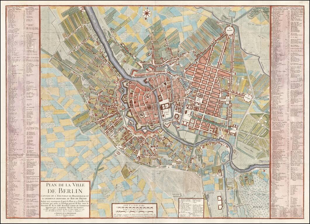
Fine plan of Berlin, reduced from Von Schmettau's 4 sheet plan of Berlin published in 1753. The map includes an extensive key of public places, gardens, bridges, markets, churches and streets, etc. on either side of the map. A finely execute map in...
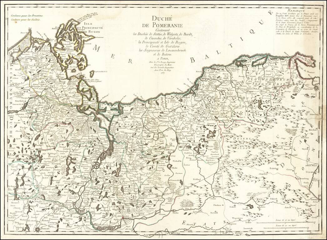
Scarce large format map of Pomerania and Szczecin, including the northwestern part of Poland, published by Le Rouge in Paris. Includes several roads, as well as towns, rivers, woods and lakes and other local details. The map is based on early maps by...
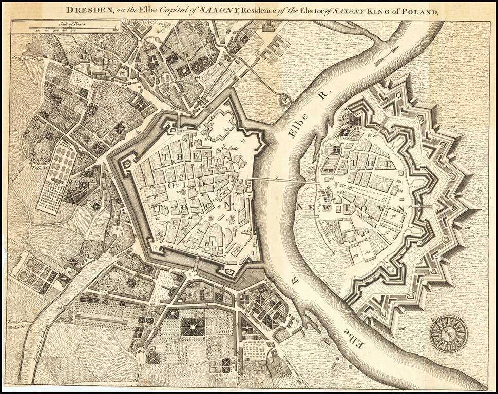
Fine early plan of Dresden was published in the supplement to the December 1759 issue of Universal Magazine, and accompanied an article on the city, with a focus on the treasures held within the Grünes Gewölb (Green Vault), a museum that holds the...
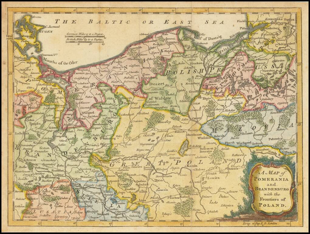
An attractive map of Poland and Northeastern Germany, with great detail of the small villages, forests, rivers, lakes and roads. Covers most of northern Poland with a bit of Germany, including Berlin and Frankfurt on the Oder River.
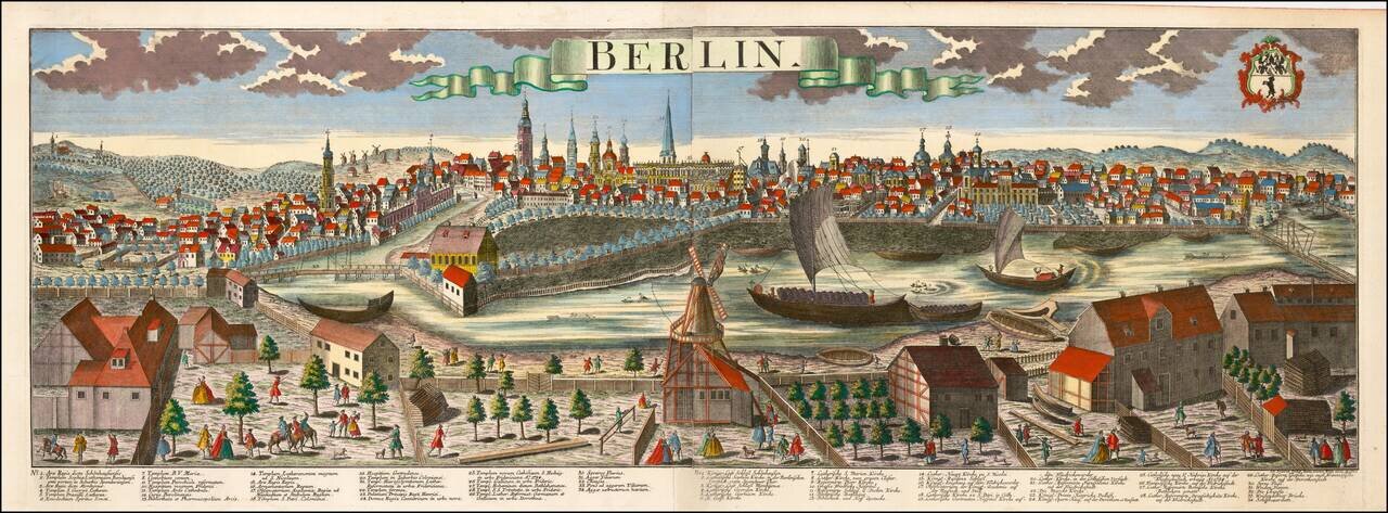
Striking large format view of Berlin, showing the town with the river in the foreground and the town beyond. Includes a key locatng 34 places on the view. The present example also bears the name of Johann Friedrich Probst.
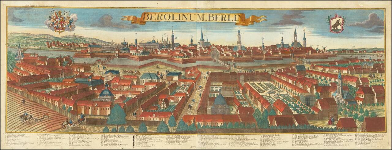
Fine panoramic view of Berlin, engraved by Balthasar Probst in Augsburg. The view includes keys in Latin and German, identifying 50 places, along with two coats of arms in the sky.
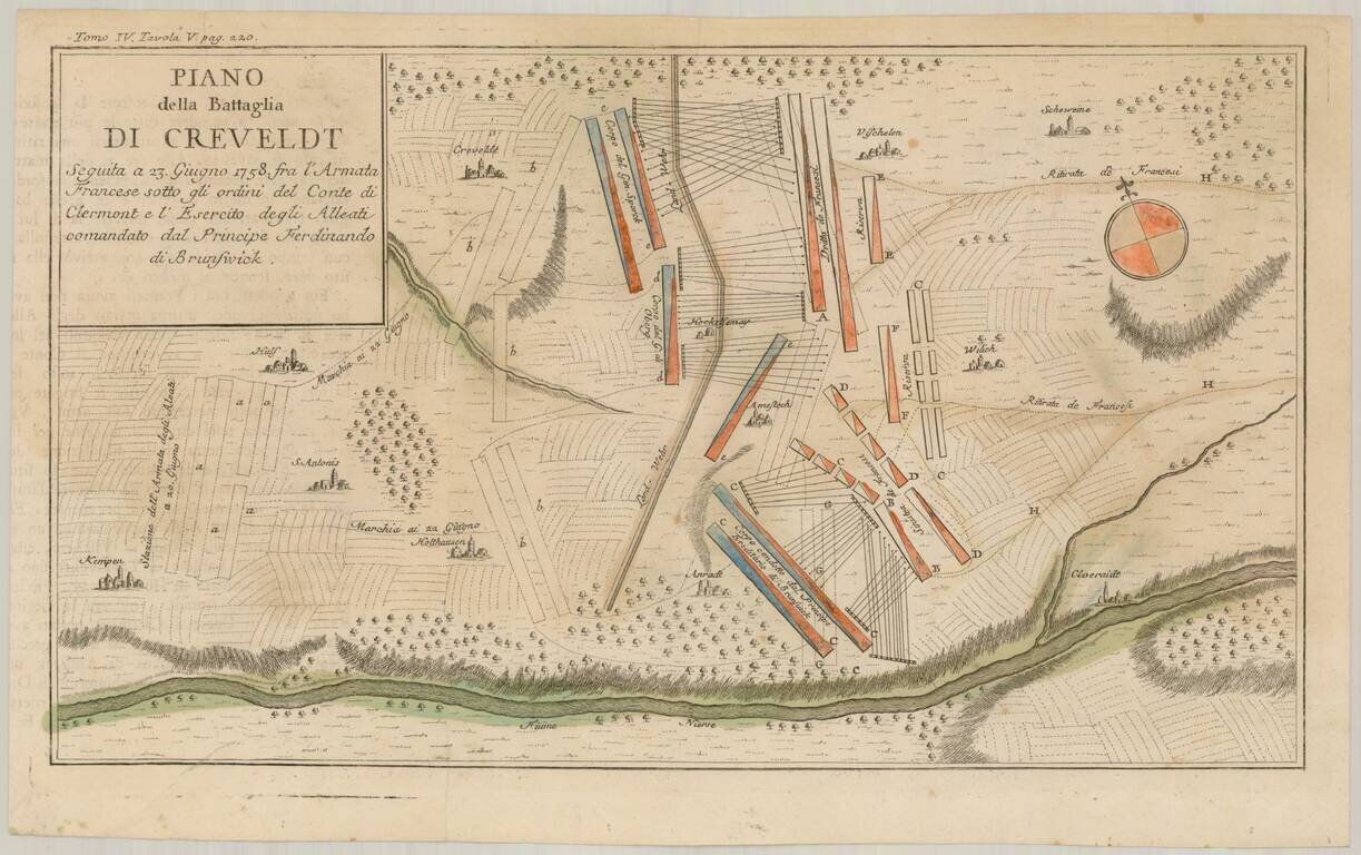
Scarce Italian language battle plan of the Battle of Krefeld, fought in Krefeld, present-day North Rhine-Westphalia on June 23, 1758, during the Seven Years War. The Hanoverian army led by Ferdinand, brother of the duke of Brunswick, had driven the...
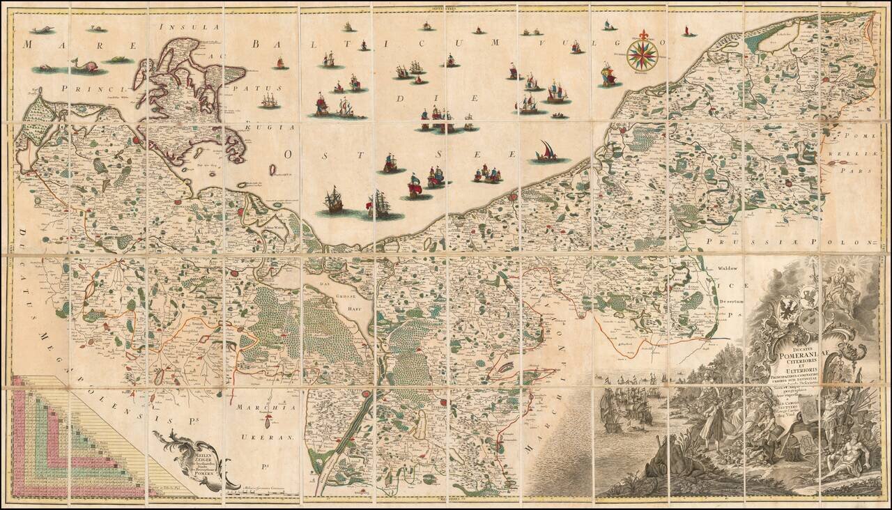
Fine example of the first state of Albrecht Carl Seutter's 6-sheet map of Pomerania, first published in about 1760. Seutter's map was based upon the so-called 'Lubin Map' and was created by the Rostock scholar, Eilhard Lubin, on behalf of the Duke...
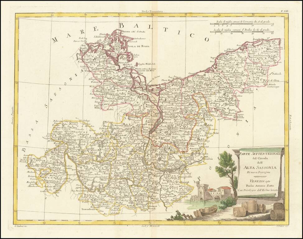
Detailed map of Upper Saxony (Obersachsen), published in Venice by Antonio Zatta in 1780.
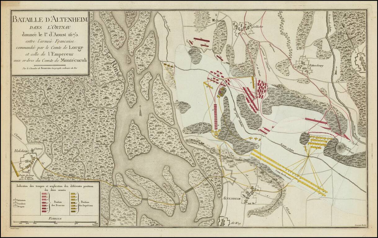
A Map with Flaps -- Beaurain's Progress Map of the Battle of Altenheim. Fascinating depiction of the Battle of Altenheim (Konzer Brücke), by Beaurain, the Royal Geographer. This is one of Beaurain's celebrated "map with flaps." This map of...
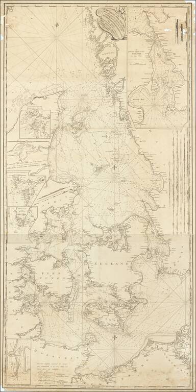
Signed By the Captain of the USS Congress Rare English Sea chart, published in London by John Hamilton Moore. The chart shows the region between Sweden and Denmark, extending to Rugen and the German coastline. John Hamilton Moore (1738-1807) was a...
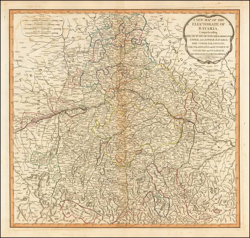
Detailed map of Bavaria, in present-day Germany, by the esteemed English mapmaking firm of Laurie & Whittle. The map highlights the political divisions and subdivisions of Bavaria in attractive original hand-color. Laurie & Whittle Robert...
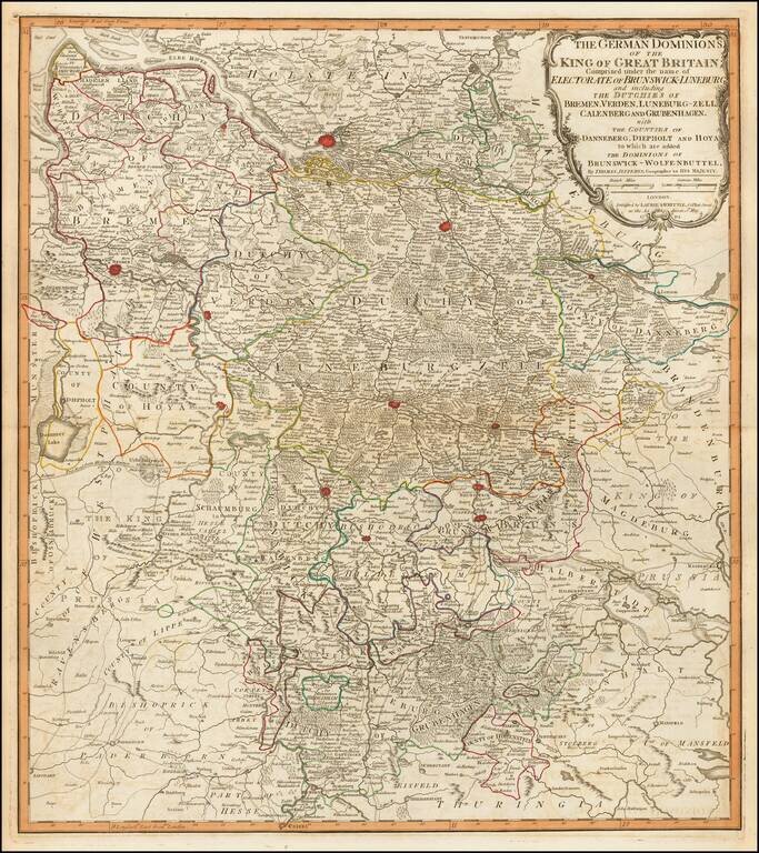
Fine engraved map of the territory in the west of Germany that constituted some of the inherited lands of George III. The chief cities on the map are Hamburg, Bremen, and Hanover, although many others are also shown. Laurie & Whittle Robert...
Detailed map of the dismembered parts of Poland and the Baltic Region, extending from Prussia in the West to Smolensk in the East. Divided by regions. Highly detailed.
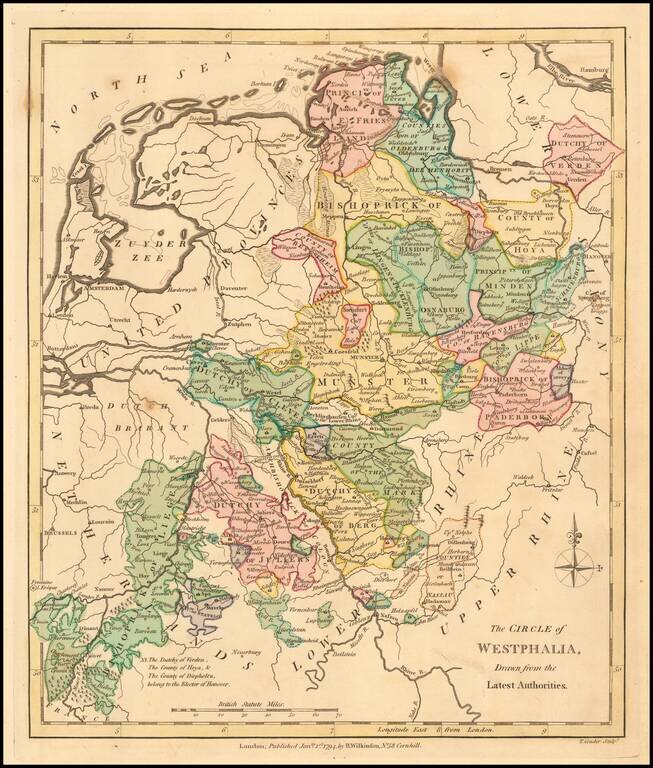
Detailed map of Westphalia, spanning from the Bishoprick of Liege to Friesland and Verden. Divided by regions, which are individually colored.