
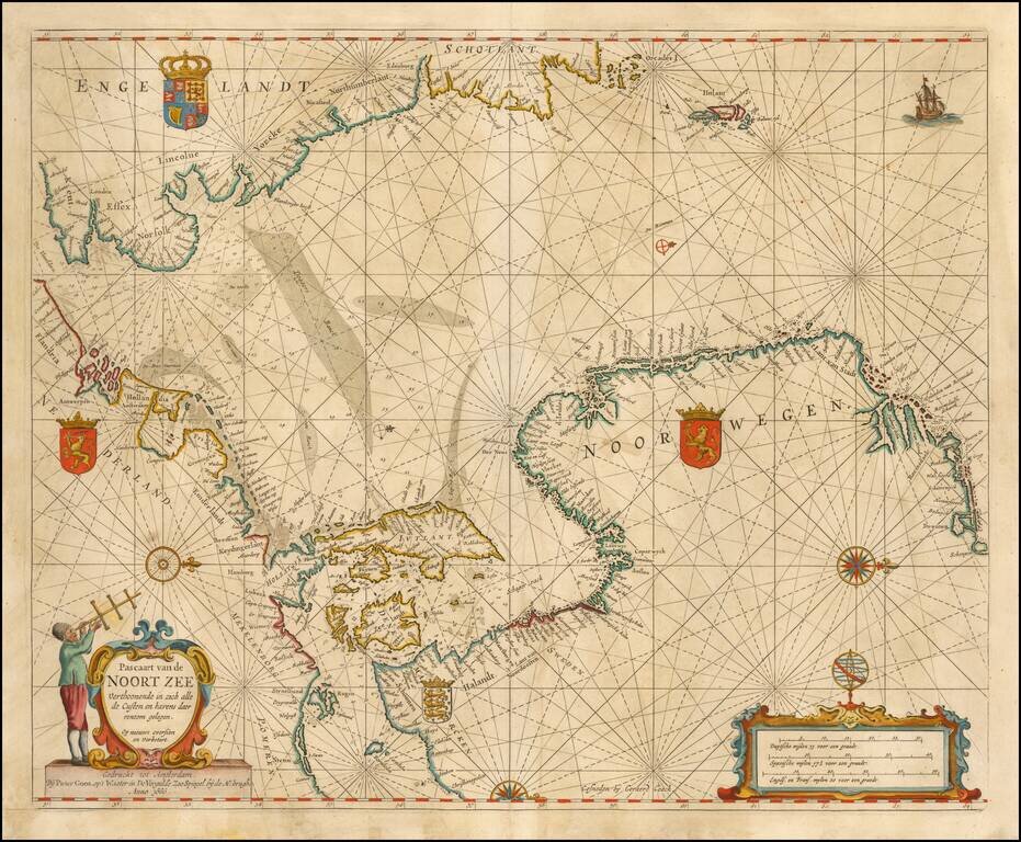
Nice example of Goos' Sea Chart of the Noort Zee, extending from the Mouth of the Thames and the English Channel and Calais and Dunkirk to Stetin and Christianopolen on the Baltic and Dronten and Schogen in Norway. The chart is oriented with north at...
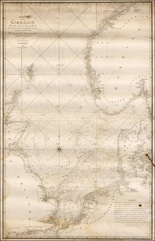
Rare Swedish chart of the region between the British Isles, Scandinavia and the Netherlands, published in Stockholm. Covers England's south coast in the south and east coast of Scotland in the west, Trondheim in the north and Wismar - Stromstad in the...
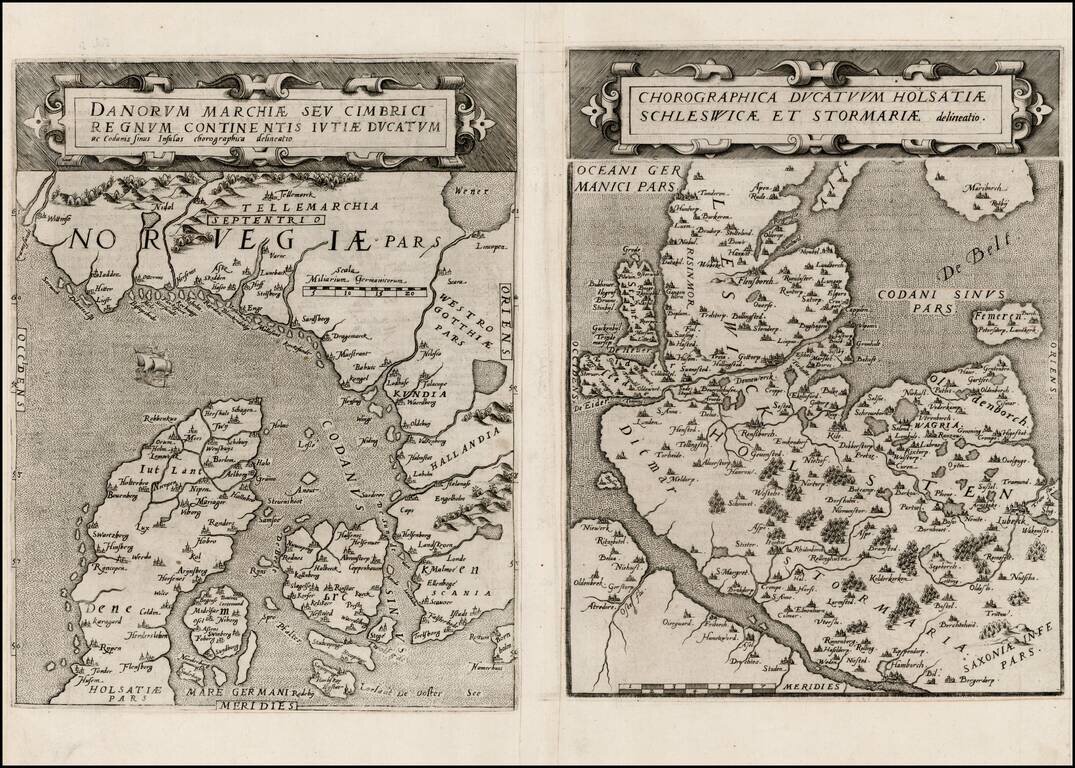
Rare pair of maps showing Norway and Denmark in one sheet and Denmark and Schleswig-Holstein in the second, from the second edition of De Jode's rare Speculum Orbis Terrae. While at first glance, the map appears somewhat similar to Ortelius's map of...
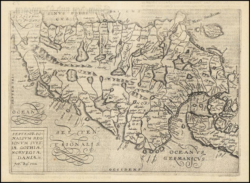
Nice example of this scarce map of Scandinavia, published in Cologne. The map is oriented with east at the top. The present map was produced by one of the primary Cologne School mapmakers, Johann Bussemacher. The Cologne School of cartography was...
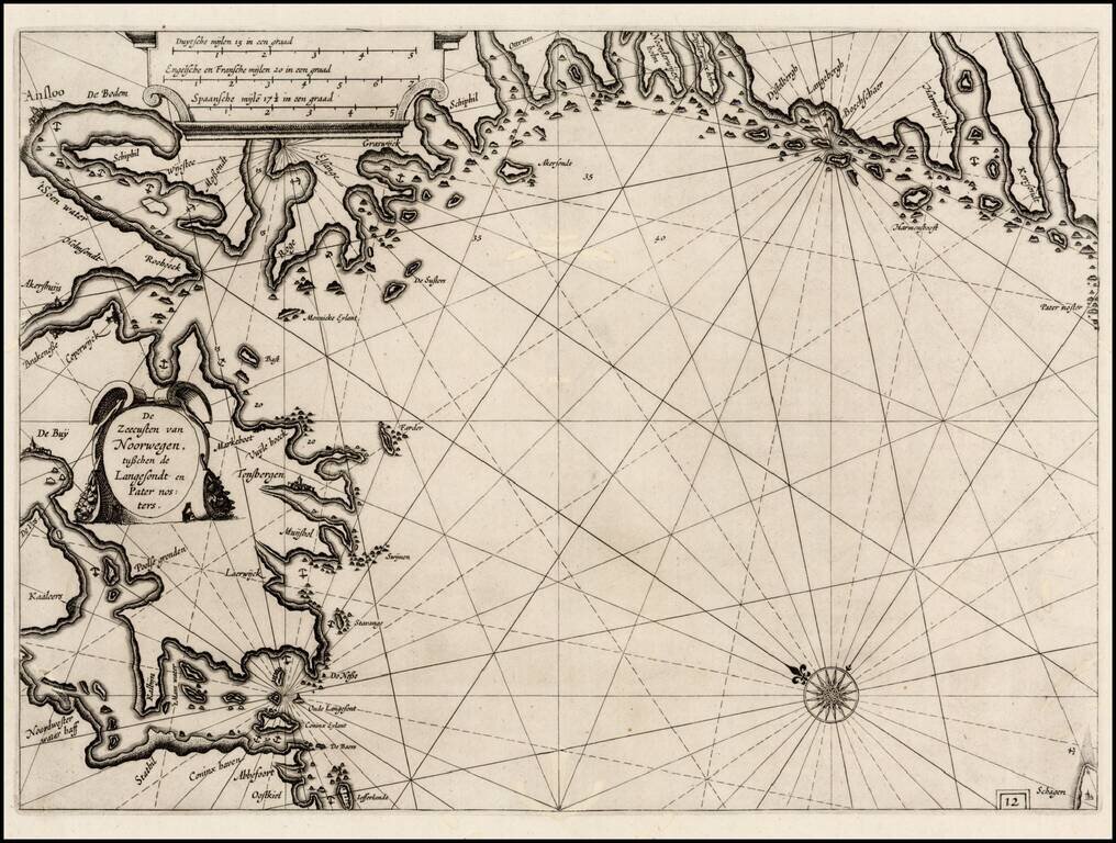
First edition of Blaeu's chart of part of southwestern Norway, from Blaeu's Zeespiegel, Inhoudende Een Karte Onderwijsinghe in de Konst de Zeevaert, en Eene beschrijvinghe der Seekusten van de Oostersche, Noordsche, en Westersche Schipvaert. The map...
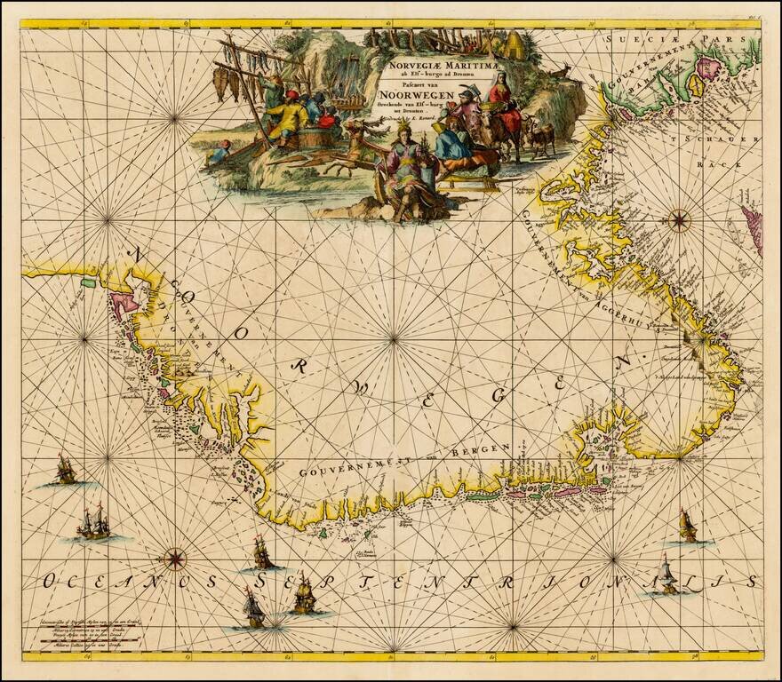
Finely colored map of Louis Renard's sea chart of Norway, with east oriented at the top. Striking sea chart, with detailed treatment of the coastal regions, rhumb lines, compass roses, elaborate cartouches and sailing ships.
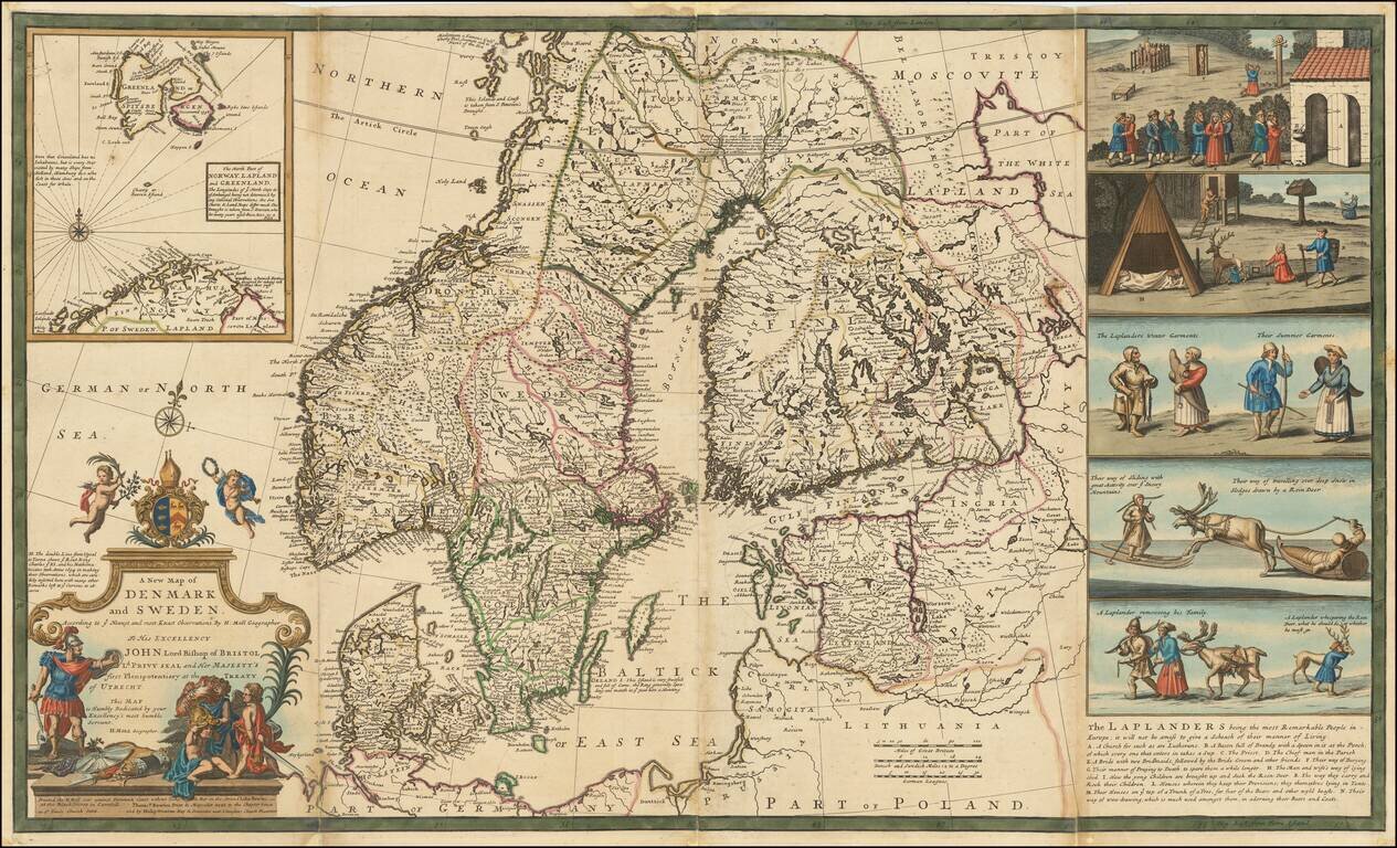
Nice example of Herman Moll's map of Scandinavia, with a large inset map and 5 wonderful vignettes, including a very early example of skiing. A very interesting note on the Laplanders below the vignettes and other notes throughout. This example of...
![[Map of Sweden and Norway] Карта Швеціи и Норвегіи](/map/small/66784.jpg)
Detailed and very rare Russian-language map of Scandinavia, published in Saint Petersburg in 1836. Rarity The map is very scarce. We have been unable to find any other examples in sales databases, libraries and archives, nor in general online...
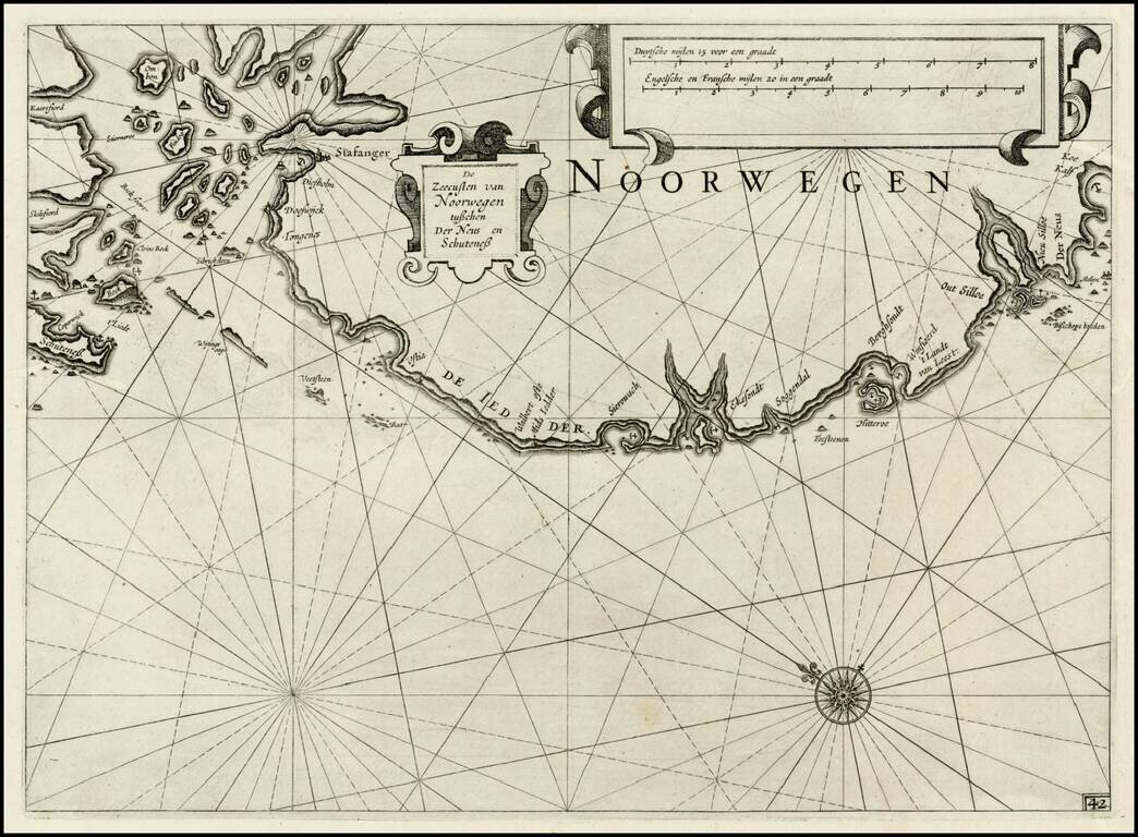
First edition of Blaeu's chart of part of southwestern Norway, from Blaeu's Zeespiegel, Inhoudende Een Karte Onderwijsinghe in de Konst de Zeevaert, en Eene beschrijvinghe der Seekusten van de Oostersche, Noordsche, en Westersche Schipvaert. The map...