
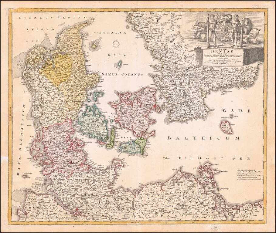
Fine dark impression of Homann's map of Denmark, Slesvig-Holstein and contiguous parts of Germany. Striking large cartouche includes elaborate coat of arms.
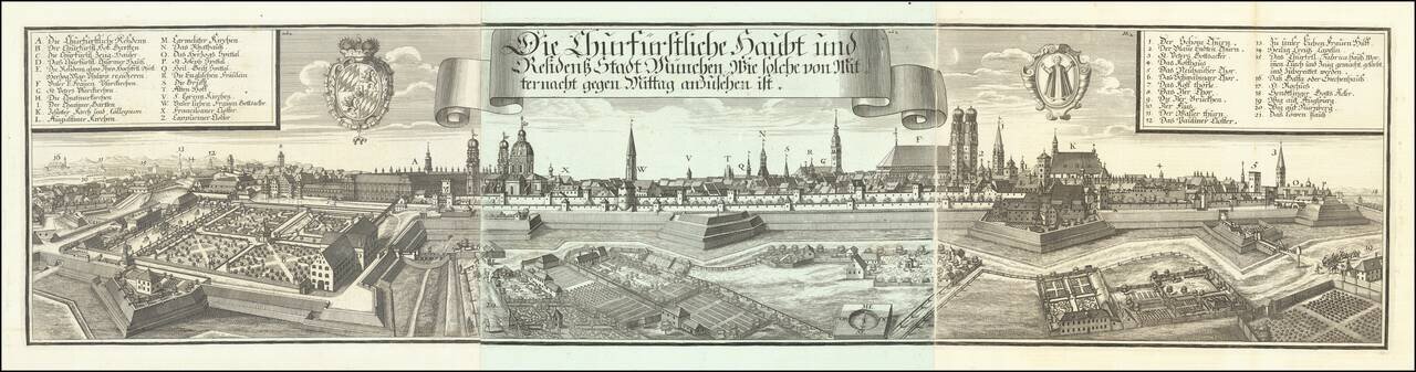
Very decorative and large panoramic view of Munich, published by Michael Wening. The city is shown surrounded by a massive palisade, glacis, mote, and walls. Inside, large buildings, churches, gardens, etc. can be seen. Landmarks inside and outside...

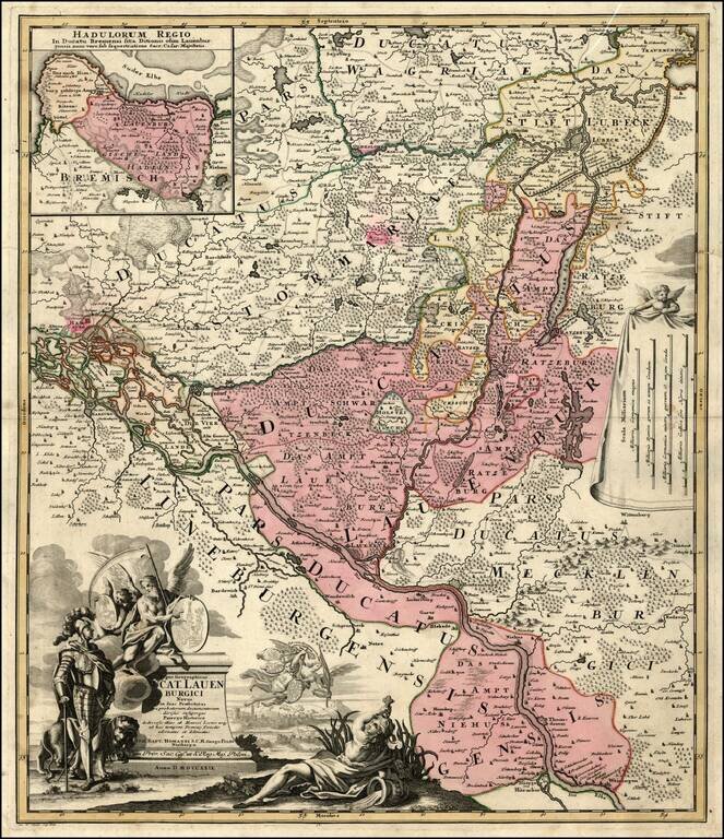
Rare map of the region between Lubeck and Lauenberg, illustrating the region claimed by the Dukes of Lauenburg and the cities of Lübeck and Hamburg.
Detailed regional map, tracking the Elbe River from Hitzger to Hamburg and extending north to beyond Lubeck. Several eleborate decorative cartouches.
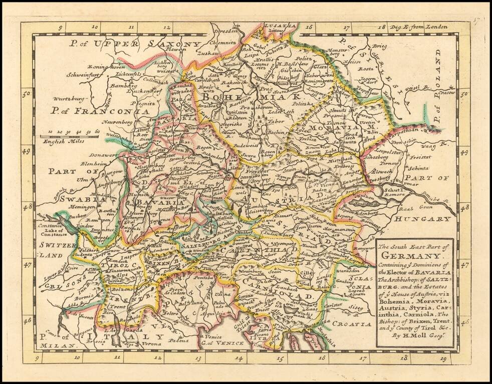
Interesting early 18th Century map of southeastern Germany. The map was published by one of London's leading mapmakers, Herman Moll.
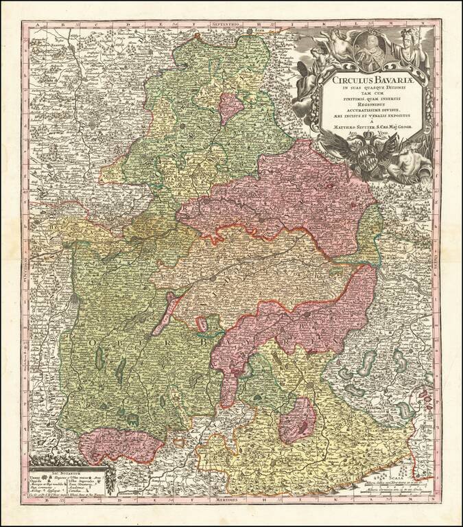
Detailed map of Bavaria, published in Augsburg by Seutter. The map extends from Obere Phaltz, Ober Bayern, Ertzstift Saltzburg, Burkhausen, Stift Passau, Freisingische Gr. Werdenfels, Hertzogt Neuberg, Pfalz Neuberg and a number of other German...
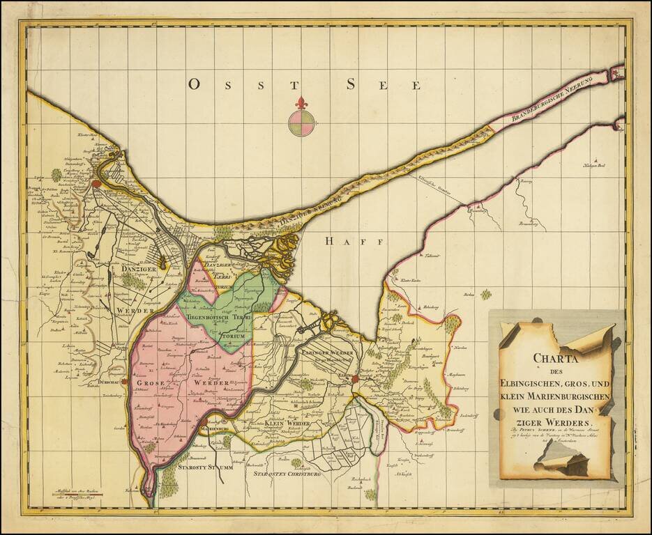
Scarce regional map of the area including Danzig, Elbang and Marienburg (Malbork), published in Amsterdam by Peter Schenk.
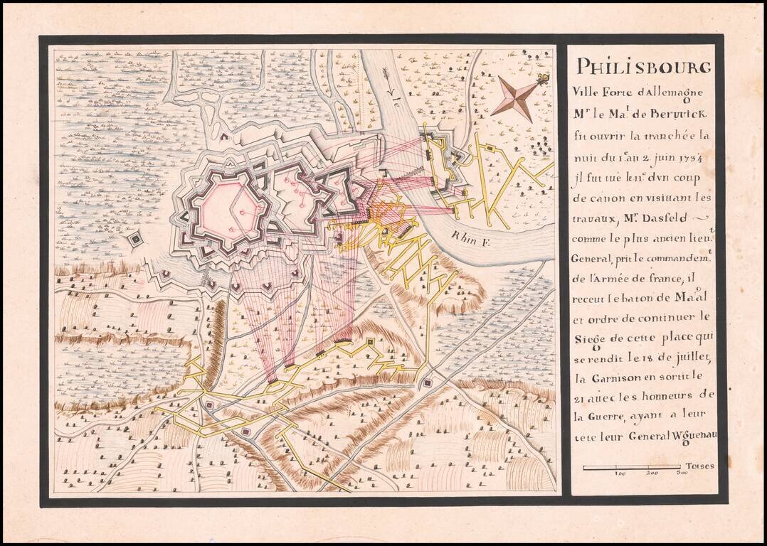
Manuscript Plan of The Siege of Philippsburg - June 1-July 18, 1734 Finely executed battle plan, illustrating the Siege of Philippsburg in 1734. The map and description at the right provide an excellent retrospective explanation of the Siege,...
![[Geographisches Kriegs Theatrum der Kayserlichen und Reichs - wie auch Frantzösischen Armee am Rhein-Strom ... alle Marchen beider Armeen, so Anno 1734 geschehen, angezeiget worden]](/map/small/67037.jpg)
Lower two sheets of Felsecker's 4 sheet map of the theater of war around the Rhine River, published in Nuremberg. The map illustrates the Theater of the War of the Polish Succession, with a large inset of Philippsburg, which was the subject of a...
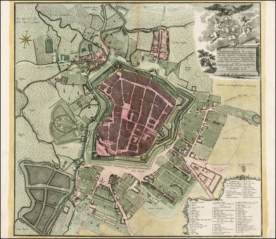
Scarce plan of Leipzig, from one of Germany's leading publishers of the 18th Century. Includes a key locating more than 50 points of interest.
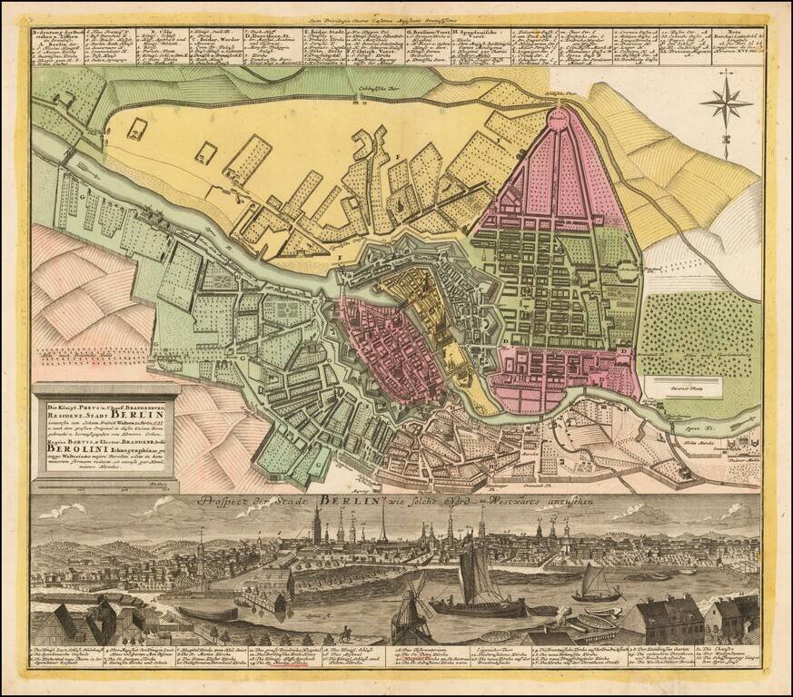
Striking plan of Berlin, with a detailed panoramic view of the city at the bottom, with a key locating 33 landmarks. Homann engraved views of a number of the major European cities during the early 18th century, which were added to his composite atlases.
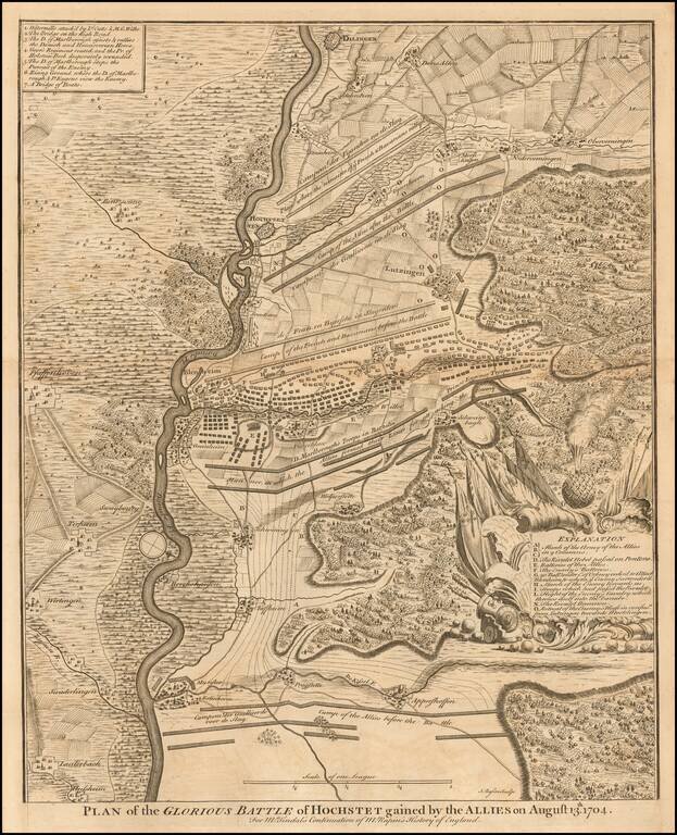
Detailed map of the Battle of Blenheim in 1704. The Battle of Blenheim was a major battle of the War of the Spanish Succession. The overwhelming Allied victory ensured the safety of Vienna from the Franco-Bavarian army, thus preventing the collapse of...
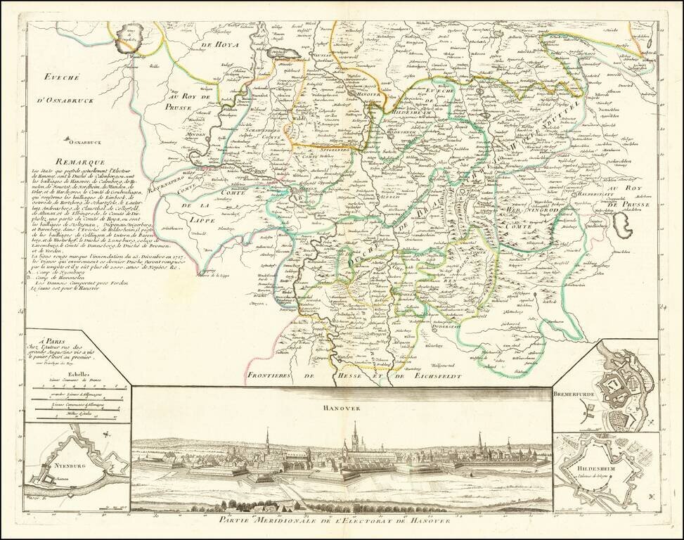
Southern half of this attractive map of the Electorate of Hanover, with a large view of Hanover at the bottom. Includes smaller plans of Nyenburg, Bremerfurde and Hildesheim.
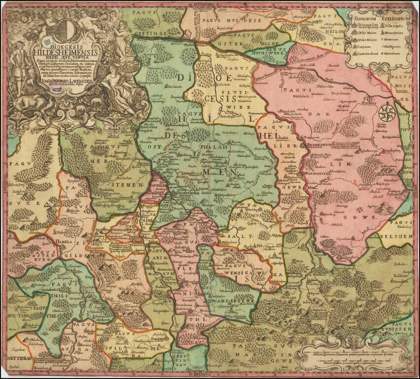
Rare map of the Diocese of Hildesheim by Joachim Lavenstein. Hannover, Brunswick and Wolfenbuttel also appear on the map. This is the first time we have ever seen the map. The mapmaker is not listed by Tooley.
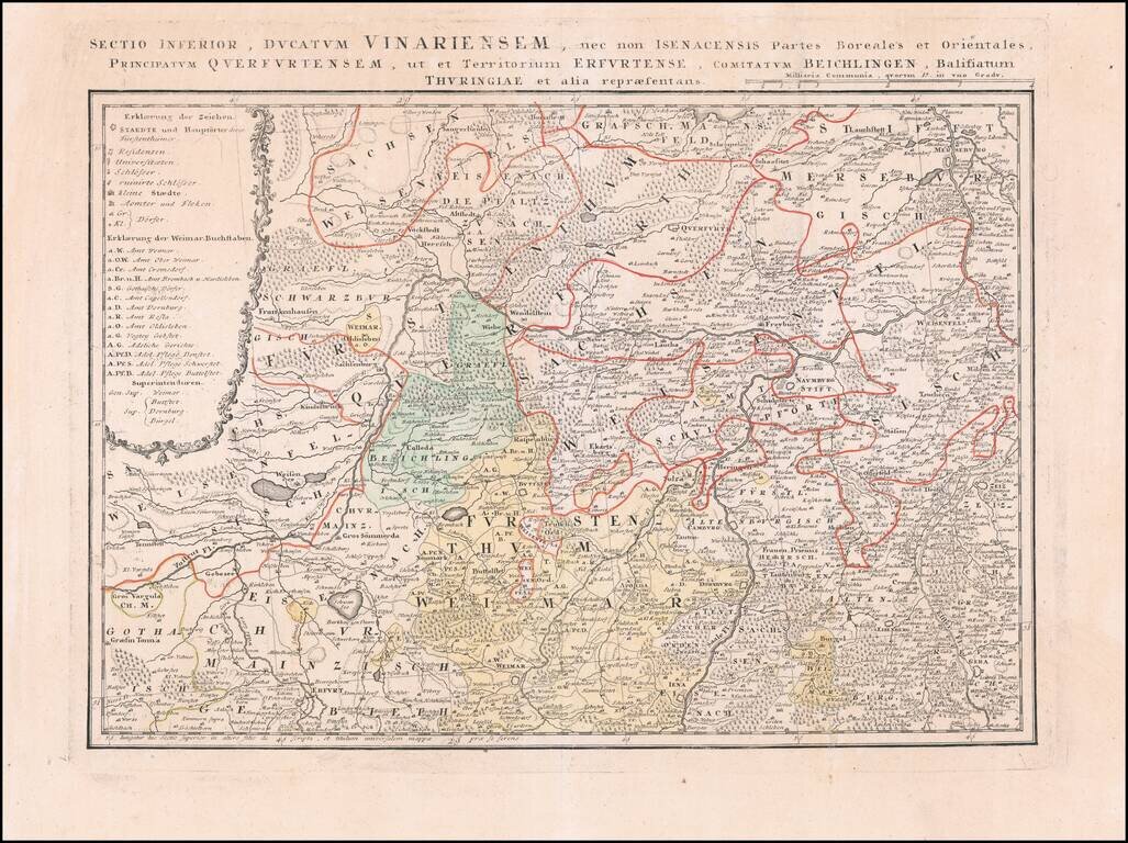
Detailed regional map of a part of the Thuringia region of Eastern Germany.
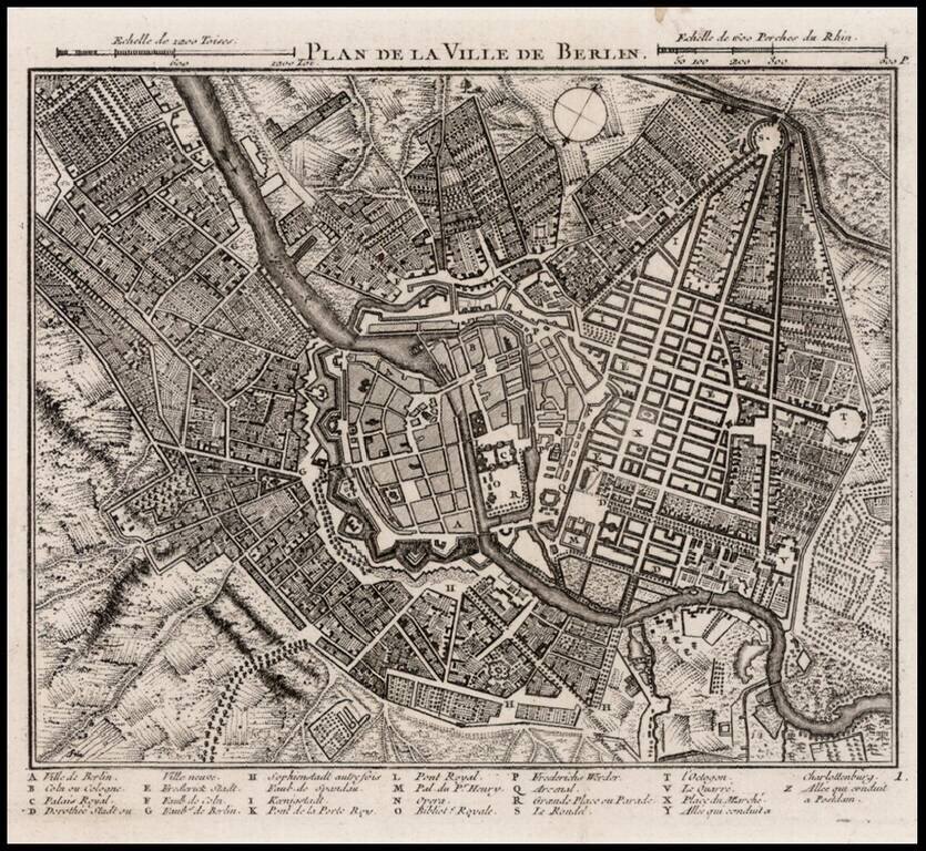
Detailed map of Berlin, with a key at the bottom showing approximately 25 place names.