Map size in jpg-format: 4.83515MiB
Click to open in high resolution (open in new tab).

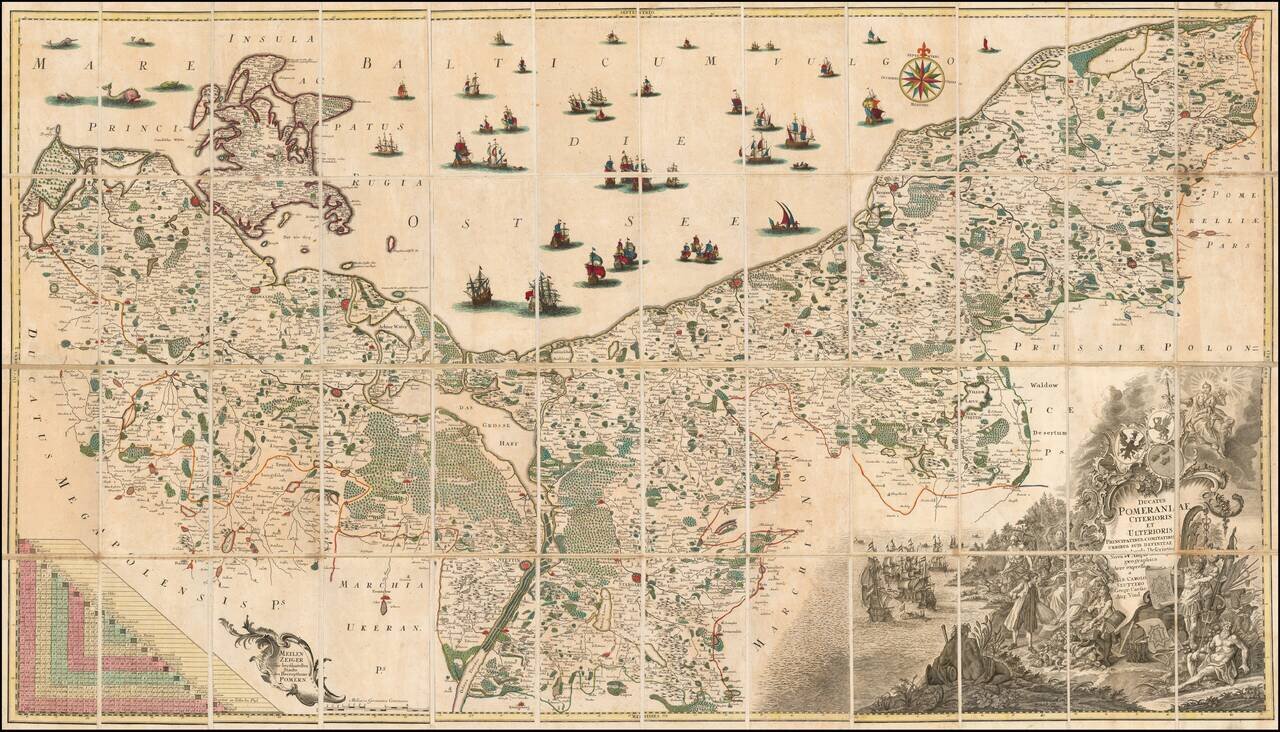
Fine example of the first state of Albrecht Carl Seutter's 6-sheet map of Pomerania, first published in about 1760.
Seutter's map was based upon the so-called 'Lubin Map' and was created by the Rostock scholar, Eilhard Lubin, on behalf of the Duke Phillip II of Pomerania, between 1610-18. It is considered the first complete map of the Duchy of Pomerania. The map was engraved by Nicolas Geilkerckius. A second edition was published after 1758, in which the borders were marked in various colors.
Seutter's map is a simplified version of the map, issued in approximately the same scale, but with numerous revisions and improvements.
The first edition of this map by Seutter is quite rare. The map was later re-issued by Conrad Tobias Lotter, with the title re-engraved.
Eihard Lubinus
Eilhard Lubinus (March 1565 -1621) was a German Lutheran theologian and philosopher, also known as a classical scholar, mathematician and cartographer. His actual name is Eilhard Lübben. Born in Westerstede in 1565, Lubinus was son of a pastor in the Duchy of Oldenburg. He studied at Leipzig and other universities, and in 1595 became Professor of Poetry, in the University of Rostock. In 1605, he transferred to the Chair of Theology there.
In 1610, Phillip II of Pomerania commissioned him to make a map (the present map of Pomerania), which is still considered one of the greatest wall maps of the 17th Century: https://commons.wikimedia.org/wiki/File:Lubinus_Duchy_of_Pomerania_Map_1618_monocromatic.jpg
If you are a student, write to us in telegram: @antiquemaps and indicate what material you need and for what work you need a map in high detail. We are ready to provide material on special terms. For students only!


