
![Pomeraniae, Wandalicae Regionis Typ [with] Livoniae Nova Descriptio [with] Ducatus Oswieczensis, et Zatoriensis, Descriptio](/map/small/43172.jpg)
Finely colored example of Ortelius' maps of Pomerania, Latvia and part of Southern Poland above the Carpathian Mountains, from Ortelius Theatrum Orbis Terrarum.
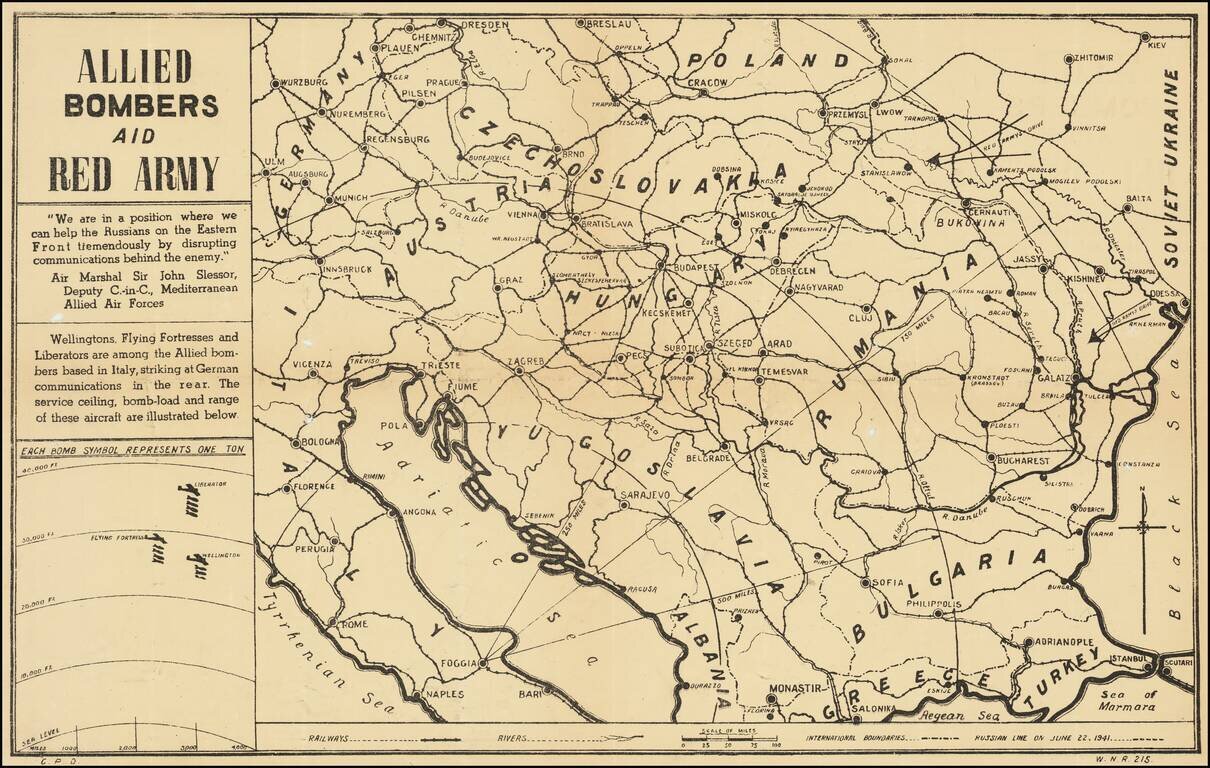
Anti-Nazi Propaganda Broadside Published in the British Empire Fascinating WWII broadside propaganda map, published in India, in order to keep the local populous informed about the War. The map provides a graphic overview of the Allied bombing...
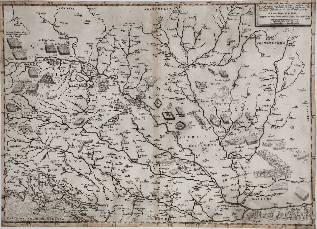
Rare Early Lafreri School Map of Hungary, Austria and the Balkans Region Nice example of Paolo Forlani's rare map of Austria, Hungary, Transylvania and adjacent regions. The map depicts the military activities in the region, between the...
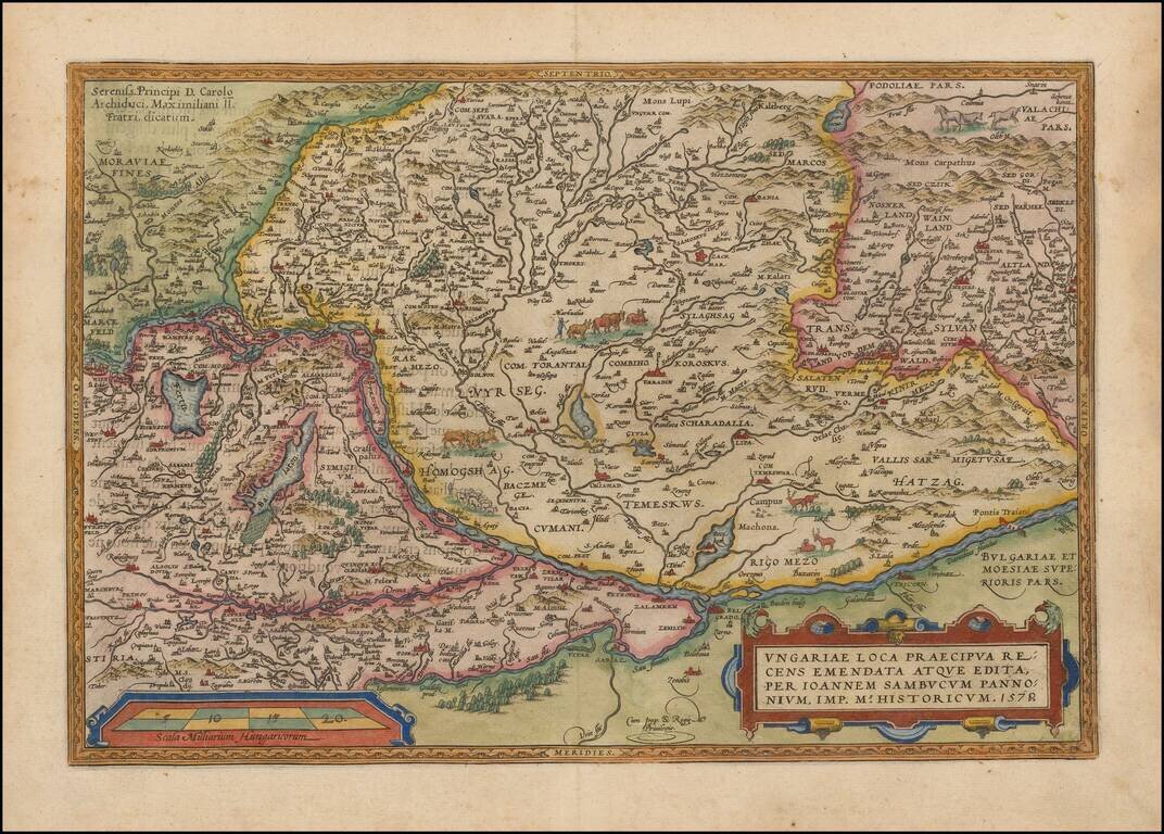
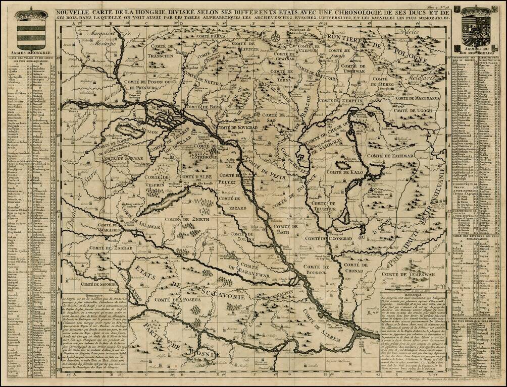
Nice full color example of Ortelius' map of Hungary and surrounding regions. Highly detailed regional map with decorative cartouche, coat of arms and migratory animals in the middle of the map. The map appeared in Ortelius' Theatrum Orbis Terrarum,...
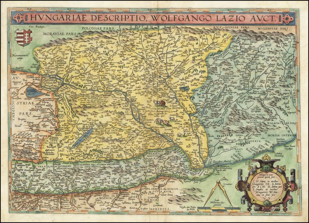
Striking full color example of Ortelius' map of Hungary and surrounding regions, which appeared in Ortelius' Theatrum Orbis Terrarum, the first modern atlas of the World. Highly detailed regional map with decorative cartouche, coat of arms and...
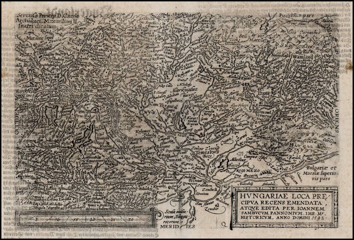
Detailed map of the the region bounded by Vienna in the West and following the course of the Danube to Belgrade. Decorative early region map, centered on Hungary.
Detailed large format map of the Hungarian Empire, extending to Bosnia, Slovenia, Temeswar, and the Saw River in the south to Moravia, and the Frontiers of Poland in the north, centered on the course of the Danube from Vienna to Belgrade. Includes...
![[Ottman Empire] Partes confines Trium Magnorum Imperiorum Austriaci Russici et Osmanici Foliis VI compreshensa ex novissimis observationibus, dimensionibus optimisque tabulis geographicus descripta . . . Anno MDCCLXXXV](/map/small/52715.jpg)
Three Empires At War -- Austrian, Russian and Ottoman Fine 6 sheet map published in Berlin in the midst of the Austro-Turkish and Russo-Turkish wars, between the Austrian, Russian and Ottoman Empires. Centered on the Black Sea, the map shows the...
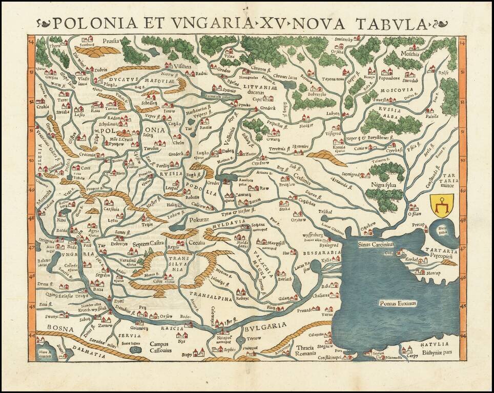
The Earliest Obtainable Map of Poland, Ukraine, Belarus, Hungary, etc. Rare early state of Munster's map of Poland, Lithuania, the Ukraine, Moscovy and the Balkans, extending from Prussia, Vilna and Smolensky in the north to Bosnia, Bulgaria,...
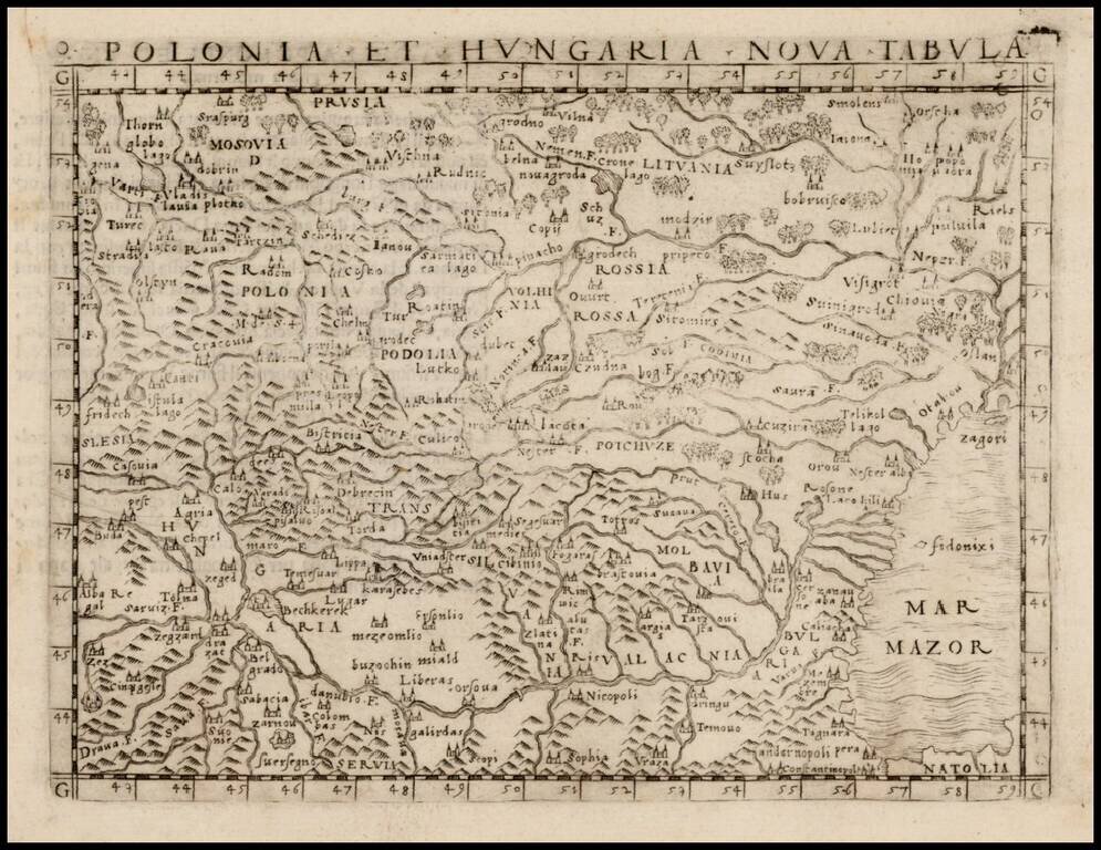
Nice example of one of the earliest obtainable modern maps of Poland, Lithuania and Hungary, published in Venice by Gastaldi. Gastaldi's maps are considered important early maps for regional collectors. Giacomo Gastaldi was one of the most important...
![[Poland, Croatia, Slovenia, Hungary, Serbia, Romania, Ukraine, Bulgaria] (La discrittione della Transylvania et parte del l'Ungaria, et il simil della Romania)](/map/small/59225.jpg)
Middle section of Paolo Forlani's rare 3-sheet map, covering South Poland, Croatia, Slovenia, Hungary, Serbia, Romania, Ukraine, Bulgaria, with Transylvania in the center. Krakow appears in the north, with the Danube River crossing from the northwest...
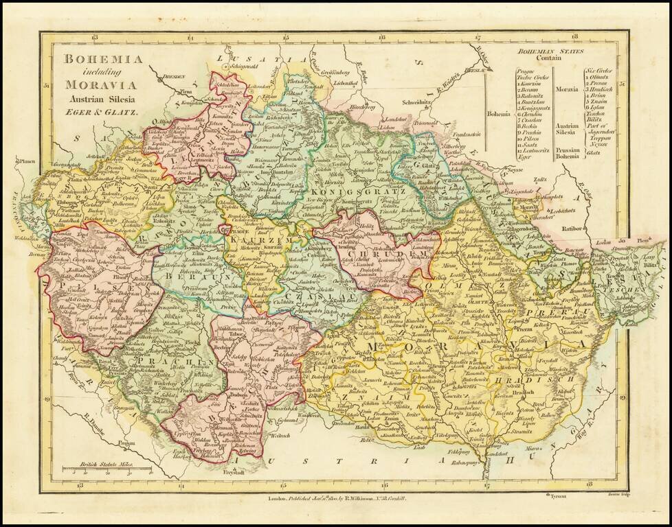
A fabulous regional map of Bohemia, Moravia, Silesia, Eger and Glatz, showing many long lost provincial borders, including Pilsen, Saatz, Leutmeritz, Buntzlau, Konigsgratz, Glatz, Olmutz, Chrudim, Cazslau, Kaurzim, Beraun, Rakonitz, Prachin, Bechin,...
![Secunda Asie Tabula [Ukraine, Russia, Black Sea]](/map/small/55578.jpg)
Fine old color example of this remarkable early map of the Russia, Ukraine and the Black Sea region, from the 1486 Ulm edition of Ptolemy's Geographia. The map is drawn from the work of Nicolas Germanicus, whose manuscript maps were created to...
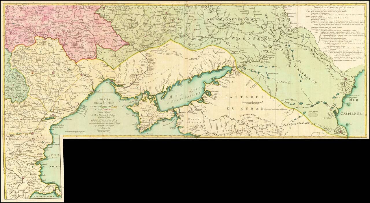
Fine old color example of this rare map illustrating the Theater of Russo-Turkish War (1768-1774). The map emphasizes the territories located on the north and west coasts of the Sea of Azov and the Black Sea and Crimea, namely Bulgaria, Romania,...
![[Ochakov] Plan veritable de la fameuse Forteresse d'Oczakow Prise d'assaut sur les Turcs par l'Armee Russie Sous le Commandement de S. Exc. Mr. le Marechal Comte de Munich le 2 Juillet 1737 et deffendue vaillammant par Mr. le Major General de Stoffel, con](/map/small/62883op.jpg)
Exceptional Original Color Finely colored example of Antoine du Chaffat's exceedingly rare map of the Siege of Ochakov, published in Augsburg. The plan includes a detailed treatment of the fortifications and 7 item key in French and German locating...
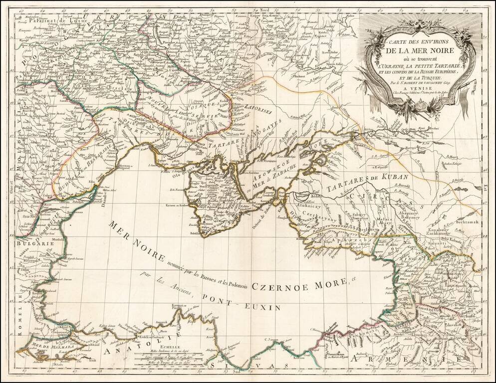
Scarce regional map centered on the Black Sea, published in Venice by Francois Santini. One of the most detailed maps of the region published in the mid-18th century.