

A Dane Eyes the East Coast of Britain. First edition of this very rare Danish atlas of the North Sea. Paul de Löwenörn (1751-1826) was a Danish mariner, later Adjutant-General, Captain-Lieutenant, and Director of the Royal Danish Marine Archives,...
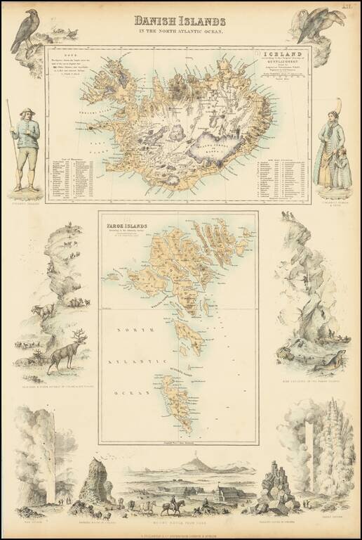
Two detailed maps (Iceland and the Faroe Islands) surrounded by decorative vignettes
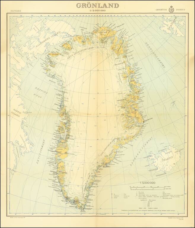
An attractive mid-century map of Greenland published by the Danish state-run cartographic institute. Greenland is shown in detail, and parts of Iceland, Baffin Island, and Svalbard are also shown. A legend is included, and the insignia of the...

Rare Early Map of Northern Europe Important early map of Northern Europe, Scandinavia and the British Isles, which first appeared in the 1507-1508 Rome edition of Ptolemy's Geography, Claudii Ptholomei Alexandrini. Cosmographia..., created under the...
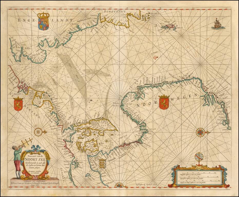
Nice example of Goos' Sea Chart of the Noort Zee, extending from the Mouth of the Thames and the English Channel and Calais and Dunkirk to Stetin and Christianopolen on the Baltic and Dronten and Schogen in Norway. The chart is oriented with north at...
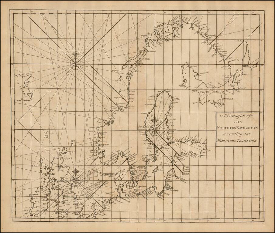
Fine Chart of the Far North Atlantic from an Influential Atlas Scarce sea chart of the north Atlantic covering the British Isles, North Sea, Scandinavia, Iceland (here "Iseland"), the German coast, and the Baltic. This chart is on a Mercator...
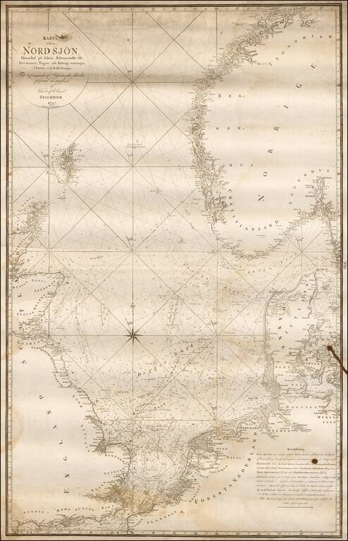
Rare Swedish chart of the region between the British Isles, Scandinavia and the Netherlands, published in Stockholm. Covers England's south coast in the south and east coast of Scotland in the west, Trondheim in the north and Wismar - Stromstad in the...
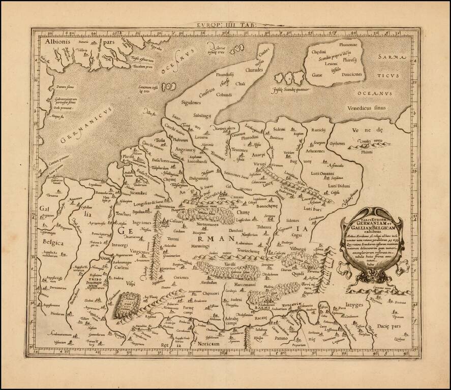
Attractive map of Denmark, Germany, Netherlands and Belgium, on the Ptolemaic model. Mercator originally published this map in his 1578 edition of Ptolemy's great Geography. The present example is the second edition of the map, first issued in 1698....
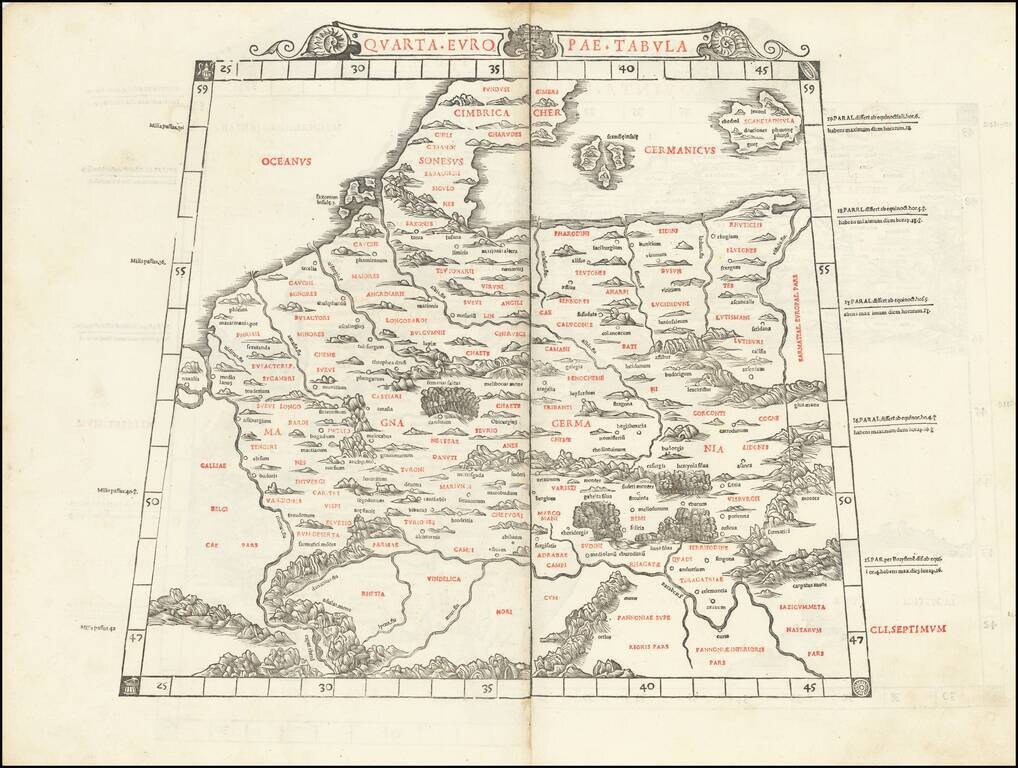
This is Sylvanus's scarce map of northern Europe, depicting the region encircled by the Rhine in the west, the Danube in the south, and the Vistula in the east. One of the earliest obtainable maps of the region, and the first printed in two colors,...
![Daniae Regni Typus [with] Oldenburg Comit.](/map/small/49941.jpg)
A nice full-color example of Ortelius' maps of Denmark and Oldenburg, which first appeared in the 1584 edition of his Theatrum Orbis Terrarum. This is the second of Ortelius' maps of Denmark. It shows many more details within Denmark and was improved...
Striking example of the scarce French edition of Waghenaer's sea chart showing the coastlines of Northern Germany and Denmark. The chart includes the modern cities of Greifswald, Stalsund, the island of Rugen, Barth, Wismar, Rostock, and Lubeck and...
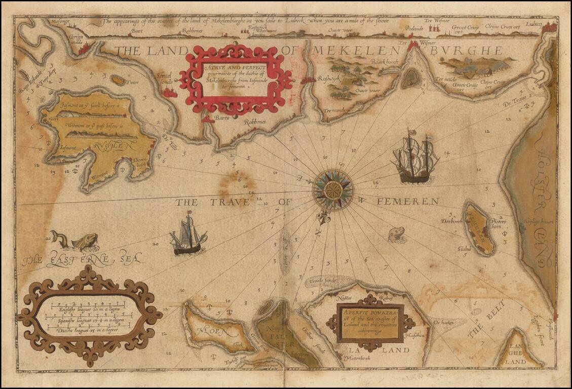
Striking example of the scarce English edition of Waghenaer's sea chart showing the coastlines of Northern Germany and Denmark. The chart includes the modern cities of Greifswald, Stalsund, the island of Rugen, Barth, Wismar, Rostock, and Lubeck and...
Rare English Waghenaer Map of Southwestern Swedish Coastline Old color example of this scarce English edition of Waghenaer's sea chart showing the coastlines of Sweden, centered on Marstrand and the coastline west of Gothenberg. The chart is oriented...
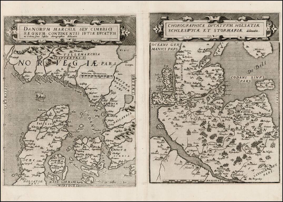
Rare pair of maps showing Norway and Denmark in one sheet and Denmark and Schleswig-Holstein in the second, from the second edition of De Jode's rare Speculum Orbis Terrae. While at first glance, the map appears somewhat similar to Ortelius's map of...
![Daniae Regni Typus [with] Cimbricae Chersonese nunc Iutiae descriptio ..](/map/small/63315.jpg)
A nice full color example of Ortelius maps of Denmark and Jutland, along with Fiona, Alsen and Langeland. This is Ortelius' third map of Denmark, first issued in 1595. It shows many more details within Denmark and was improved cartographically as...
![[Mecklenburg-Vorpommern, Rugen, Bornholm, Lubeck, Sonnderborg,Svendborg, Zealand] Beschrijvinghe vant zuijder deel vande Belt, en hoemen de Custen van Mekeleborch Pomeren, met de Lande daer tegen over tusschen emeren en Bornholm geleghe besijlen en all](/map/small/61988.jpg)
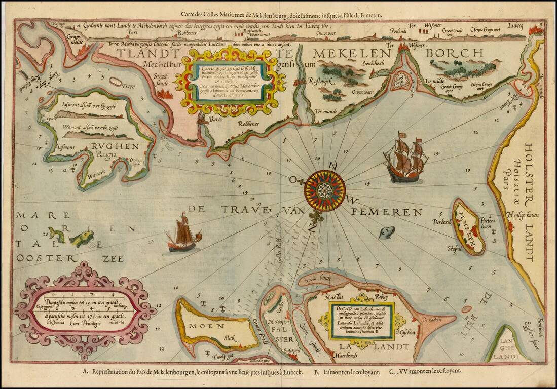
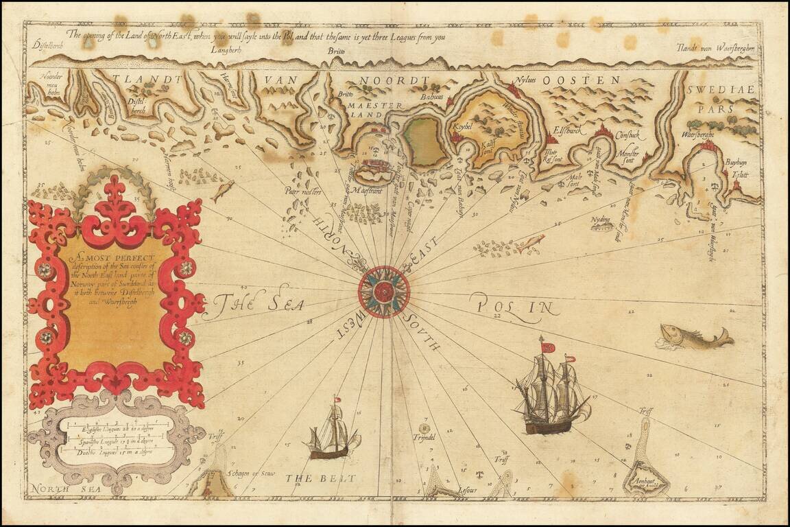
Fehmarn Belt -- An Early Sailing Chart Rare sea chart of the Fehmarn Belt, a strait connecting the north coast of Germany and the island of Lolland off south coast of Denmark, oriented with south at the top, which appeared in Blaeu's Het Licht der...