
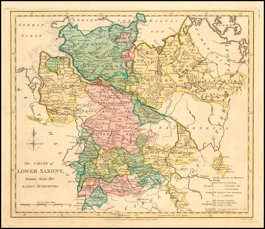
An interesting regional map, showing the Dutchys of Bremen, Holstein, Mecklenberg, Schwerin, Gustro, Magdeburg, Verden, Saxe Launberg, the County of Dannenberg, a group of southern Principalities including Calenburg, Grubenhagen, Haaberstadt,...
An interesting regional map showing the Dutchys of Bremen, Holstein, Mecklenberg, Schwerin, Gustro, Magdeburg, Verden, Saxe Launberg, the County of Dannenberg, a group of southern Principalities including Calenburg, Grubenhagen, Haaberstadt,...
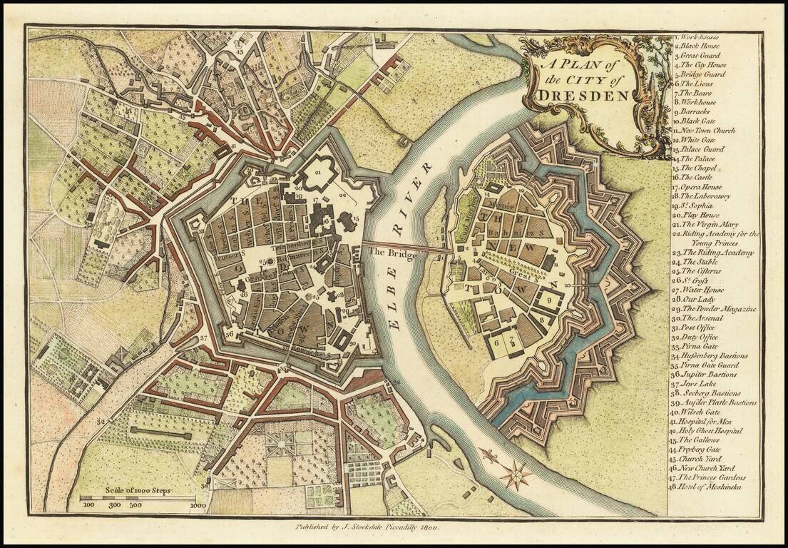
Finely colored map of Dresden at the end of the 18th Century. The map illustrates the fortified old and new towns on either side of the Elbe River, with an extensive key locating 48 places.
Highly detailed map of northern Germany, published by William Faden, one of England's leading mapmakers in the late 18th Century. The map provides an exceptionally detailed image of the region, including roads, towns, rivers, islands, lakes, etc.
![[Spandau] Spandow](/map/small/58956.jpg)
A Napoleonic Era French Map of Spandau Detailed manuscript map of the fortifications around Spandau and its Citadel, including French text, almost certainly indicating that it was prepared during the French occupation of the region, between 1806 and...
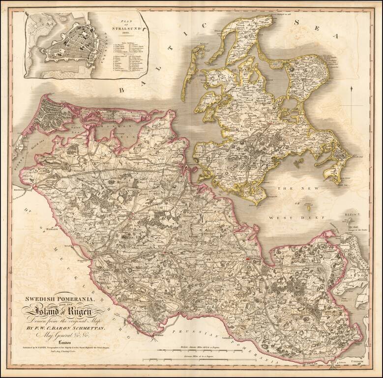
Nice example of Faden's double-page engraved map of Rugen and Swedish Pomerania, a Dominion under the Swedish Crown from 1630 to 1815, which was situated on what is now the Baltic coast of Germany and Poland. The map includes an inset town plan of...
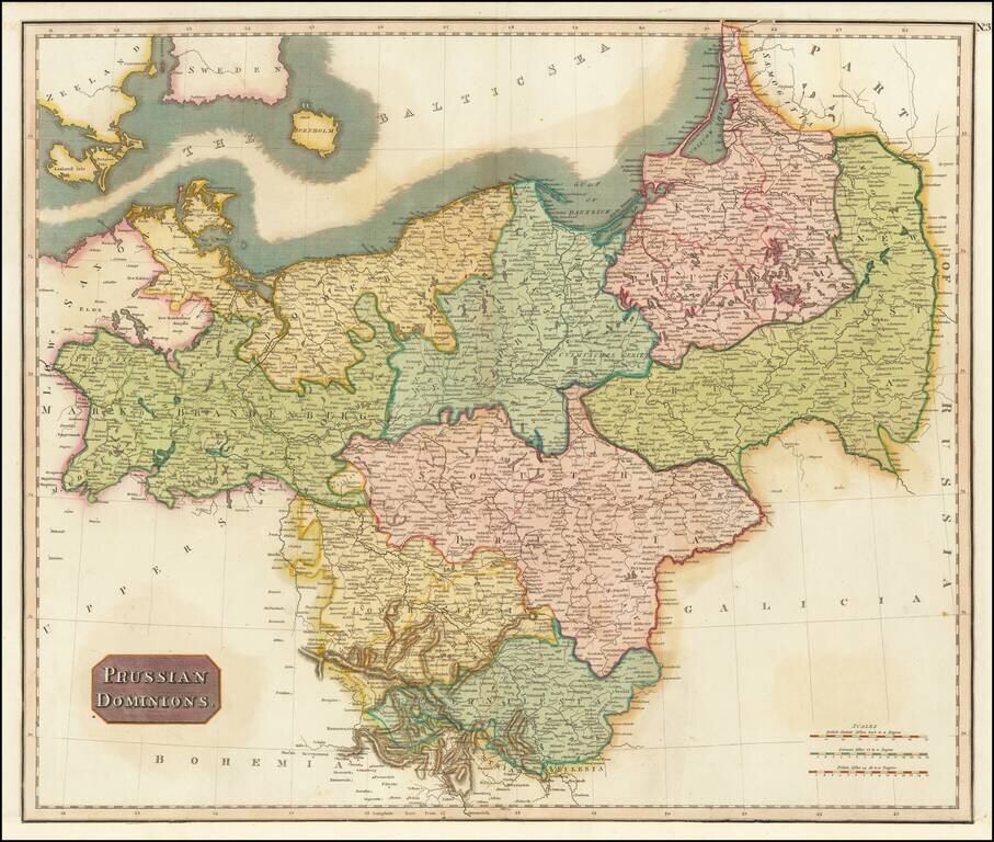
Detailed map of the Prussian Dominions, including parts of the former Kingdom of Poland. Colored by provinces. Excellent detail. One of the best large format English atlas maps of the period. Pinkerton's maps reflect the fine copperplate engraving...
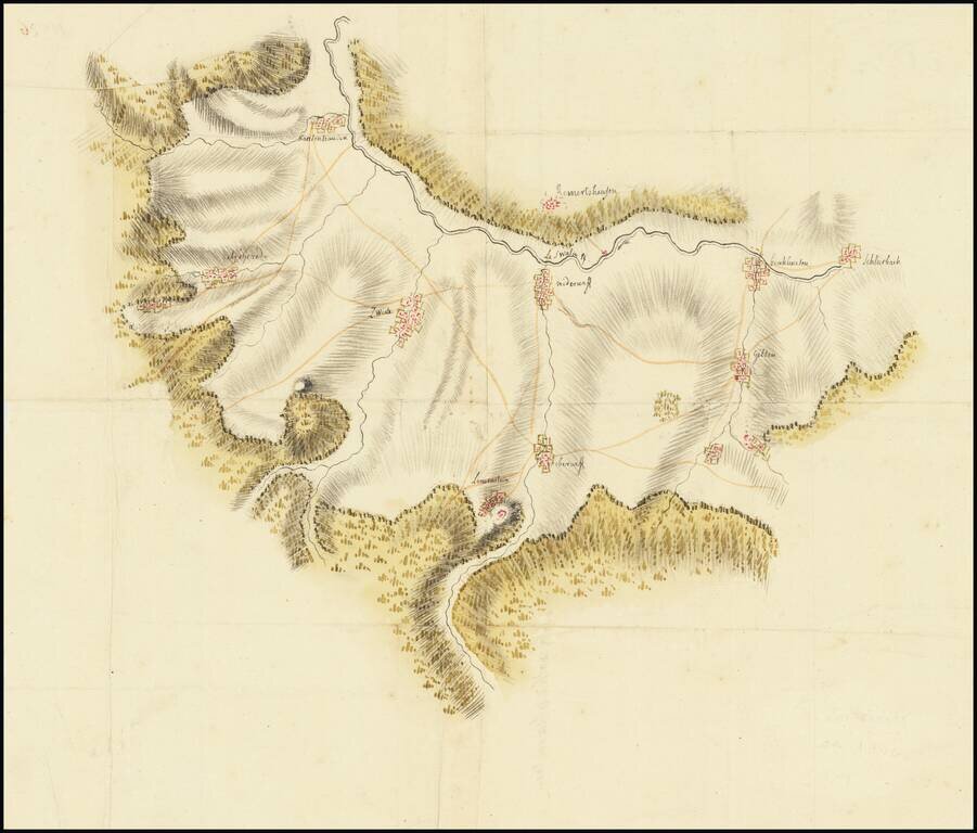
Manuscript Map Showing Land in the German State of Hessen Finely-wrought topographic manuscript map showing the Schwalm-Eder-Kreis, or the Schwalm-Eder district. The document, on the verso, is titled “Gorge de Karlenhausen,” the name of one of...
![Munich [München]](/map/small/68836.jpg)
Highly detailed plan of Munich, with a large birdseye view of the City from the East across the Isar River. One of the best 19th Century English town plans of Munich to appear in a commercial atlas.
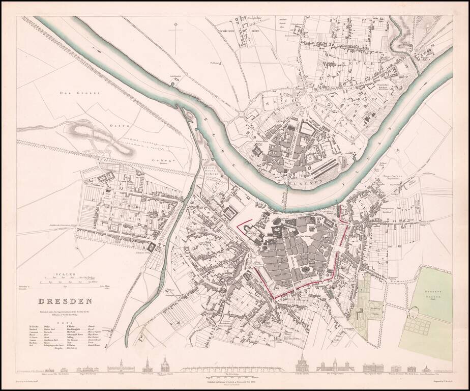
Highly detailed town plan of Dresden, with profile views of 12 major buildings, churches and the Elbe Bridge. One of the best plans of Dresden to appear in a 19th Century commercial atlas.
![[Map of the Kingdom of Prussia and the Kingdom of Poland] Карта Королевства Прусского и Царства Польского](/map/small/66819.jpg)
Shows the Free, Independent, and Strictly Neutral City of Cracow with its Territory! Detailed and very rare Russian-language map of Poland, Prussia, and the Free City of Krakow, published in Saint Petersburg in 1836. This map shows Krakow as the Free...
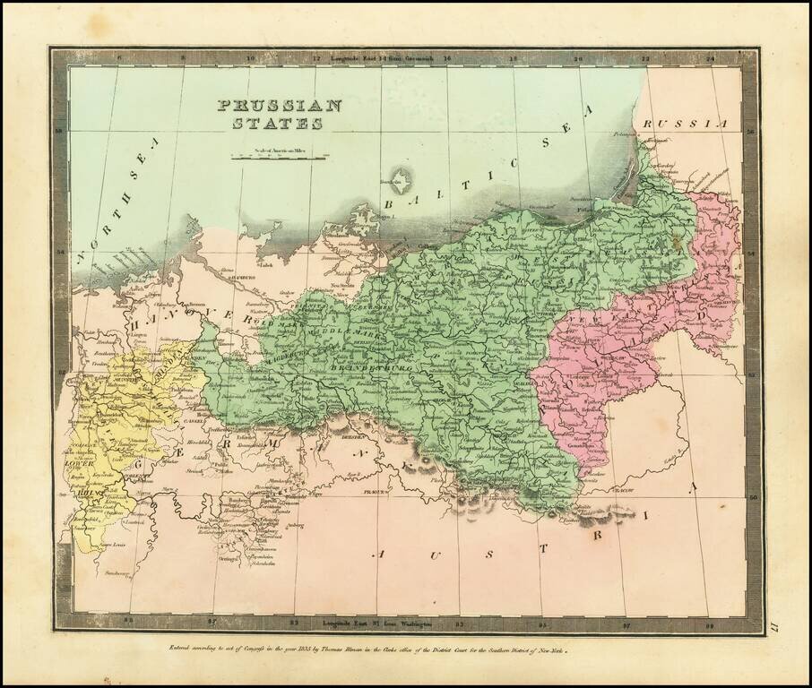
Attractive engraved antique map of Prussia (part of modern-day Poland and Germany), published by David Burr in New York in 1836. The map extends from the Lower Rhine in the west to central Poland in the east. Numerous towns are named, such as Leipzig,...
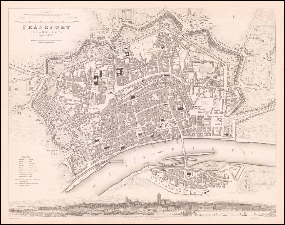
Striking plan of Frankfurt, with a large panoramic birdseye view of the town from Sachenhausen. One of the best 19th Century English town plans to appear in a commercial atlas.
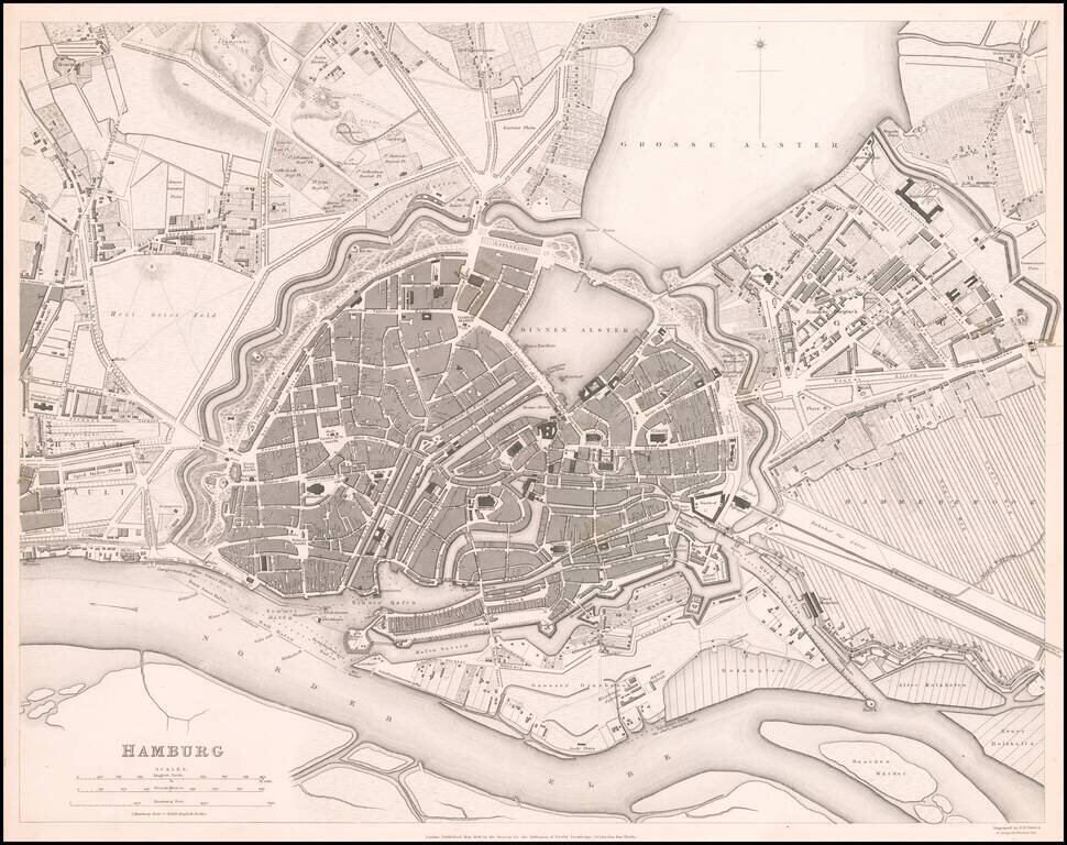
Detailed plan of Hamburg, including its many canals, streets, buildings, and other places. Marvelous detail. One of the best 19th Century English town plans to appear in a commercial atlas.
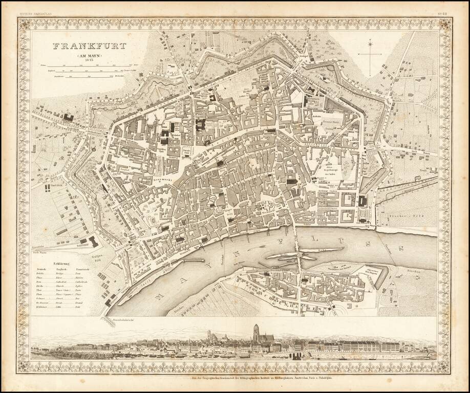
Striking plan of Frankfurt Am Main and Sachsenhausen across the river. Includes a large panoramic view of the city from the river at the bottom.

Detailed Cadastral map of Bremen, prepred by Johann Thajenhorst in 1851. Thatjenjorst and Eberhard Klüver undertook a detailed cadastral survey of Bremen from 1826 to 1850 to further the Hanseatic City's land tax collection and for future city...