

Striking map of the German Empire, including the Low Countries, Switzerland, Austria, and part of the Balkans prepared by Johan Baptiste Vrients for the very late editions of Ortelius' Theatrum Orbis Terrarum, the first modern atlas of the world. The...

This is a scarce map encompassing Poland and parts of the grater Baltic Region, Russian, and Ukraine. The map extends from the Gulf of Riga to the Black Sea at the mouth of the Dniepr. The map includes an attractive cartouche. This is only the second...

Scarce 18th-century American map of Scandinavia, from Mathew Carey's General Atlas. Engraved by Samuel Hill in Boston.
![Повстанцы 1863 Года [(Polish) Insurgents of 1863]](/map/small/52719.jpg)
Three Vilnius-Published Prints of the January Uprising -- Polish National Uprising in 1863. A highly unusual, early Lubki (popular graphic) series, locally-published in Vilnius, Lithuania and depicting a contemporary nationalist revolt by the...

Willem Barentsz's Map of the Polar Regions, drawn from his observations during his third voyage of 1596-97 and engraved by Baptiste Van Deutecum. The Barentsz map of the polar regions is a major landmark in Arctic cartography, depicting the details...

Willem Barentsz's Map of the Polar Regions, drawn from his observations during his third voyage of 1596-97 and engraved by Baptiste Van Deutecum. The Barentsz map of the polar regions is a major landmark in Arctic cartography, depicting the details...
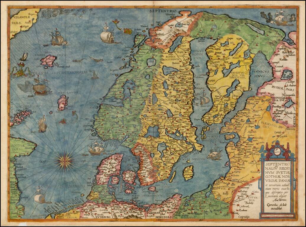
Colored example of De Jode's map of Scandinavia, the Baltic and Gulf of Finland, extending from Iceland and the Coast of Scotland to Novograd, St. Petersburg and the Norwegian Sea. The map is richly engraved by Joannes and Lucas van Deutecum's,...
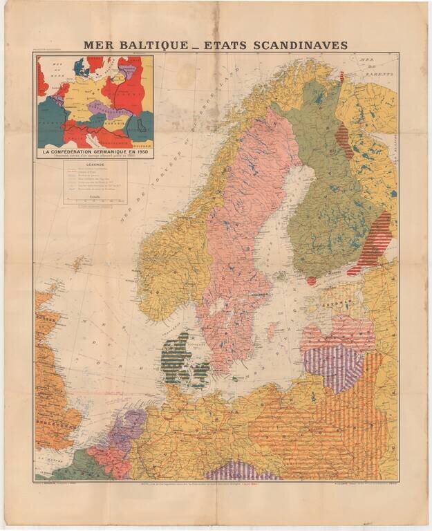
Large format map of the Theater of War in 1940, published in Paris. The inset map shows the German Confederation as it will appear in 1950, based upon a public German document from 1904. The areas identified in Striped regions have already been taken...
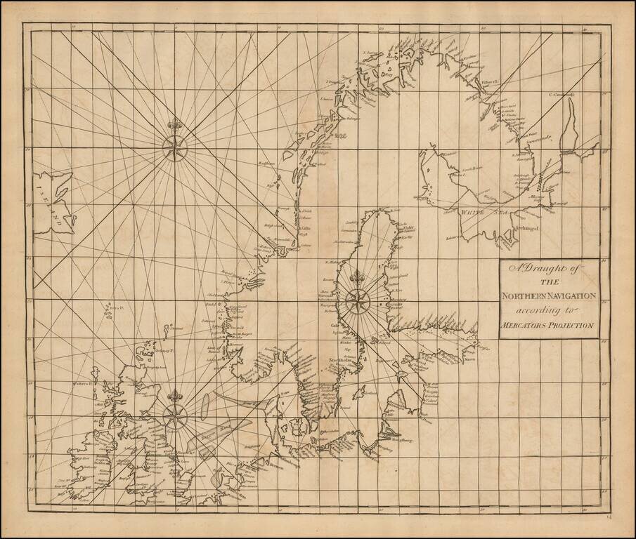
Fine Chart of the Far North Atlantic from an Influential Atlas Scarce sea chart of the north Atlantic covering the British Isles, North Sea, Scandinavia, Iceland (here "Iseland"), the German coast, and the Baltic. This chart is on a Mercator...
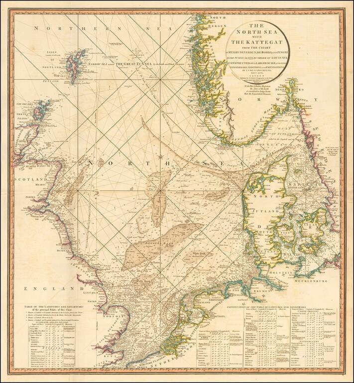
Striking and highly detailed sea chart of the North Sea from the Straits of Dover to the Shetlands and North Bergen in Norway, and east through the Kattegat to Copenhagen. Highly detailed sea chart, with extensive tables and annotations. Shows...
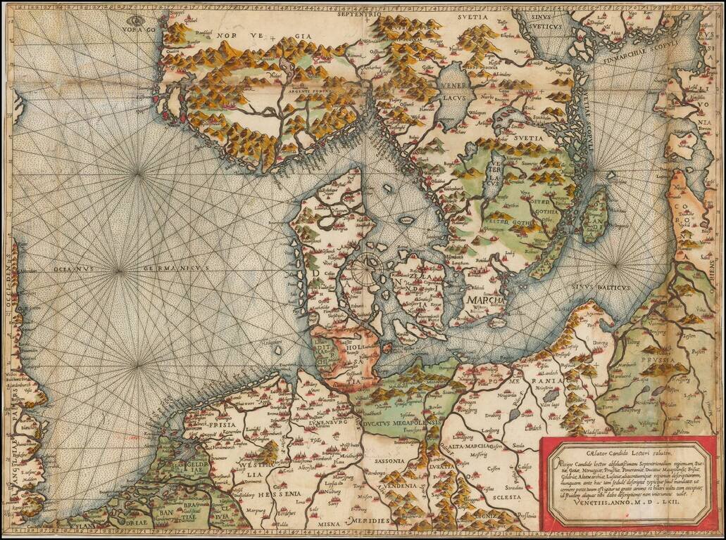
"Beyond all comparison the best map of the Southern Baltic and the North Sea." (A.E. Nordenskold) Extraordinary old color example of this rare Lafreri School Map of Scandinavia, the Baltic and contiguous parts of Poland, Germany, the Low Countries...
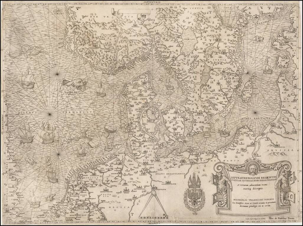
The most important modern map of Scandinavia and the Baltic Regions published in the mid-16th century. Rare and highly important early map of Scandinavia, the Baltic Sea and the North Sea by Michael Tramezini, based upon Cornelis Anthoniszoon's lost...
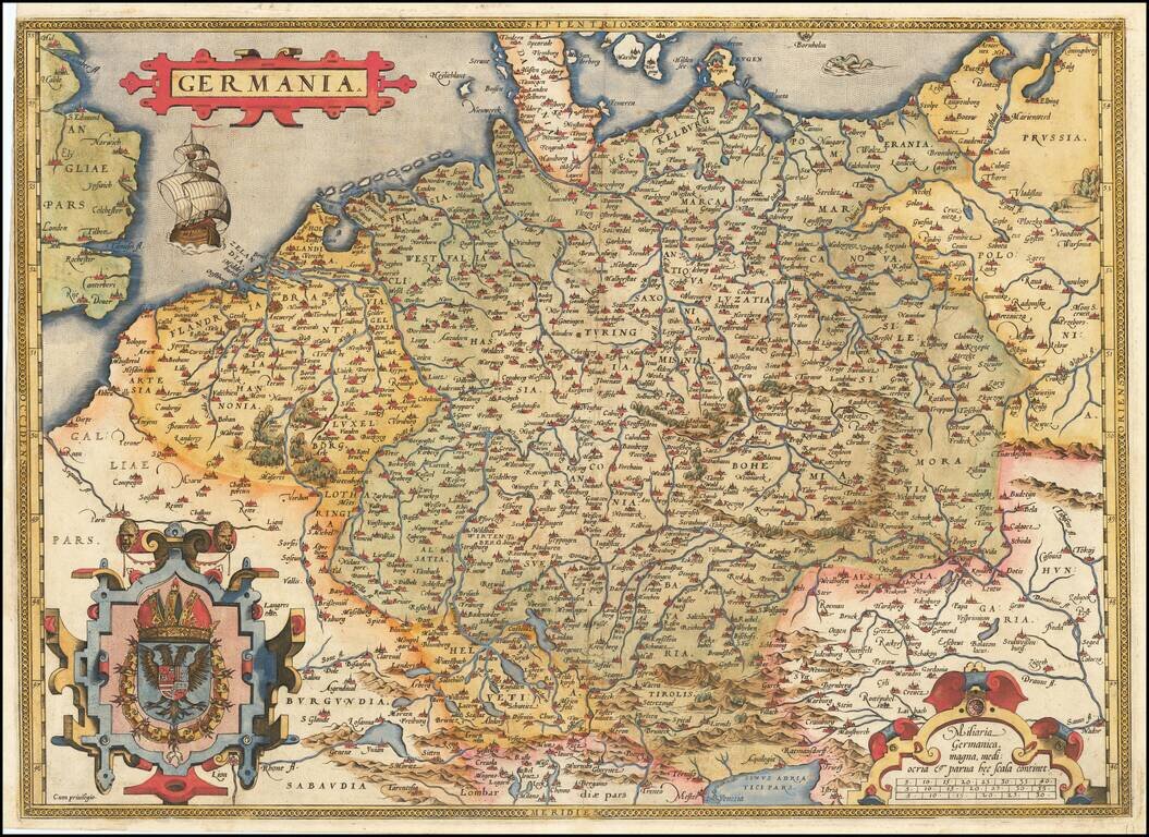
Fine old example of Ortelius' map of the German Empire, from his Theatrum Orbis Terrarum, the first modern atlas of the world. The map extends from The English Channel to the Baltic, the Vistula and Poland in the northeast, Budapest, Venice and the...
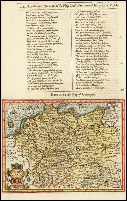
Decorative map of the German Empire, from the Low Countries to Prussia, Poland, Hungary, Austria and Switzerland. Decorative cartouche, sailing ship and coat of arms. From the 1625-26 edition of Purchas His Pilgrims, one of the seminal early 17th...
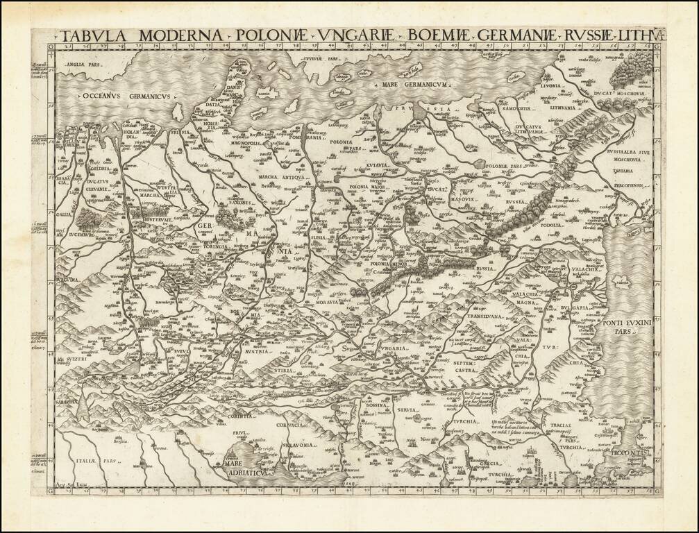
First State of one of the Earliest Modern Maps of Central and Eastern Europe A fine example of this rare and important map of Central and Eastern Europe, published by Antonio Salamanca in Rome. The map is derived from the iconic manuscript map of...
![Pomeraniae, Wandalicae Regionis Typ [with] Livoniae Nova Descriptio [with] Ducatus Oswieczensis, et Zatoriensis, Descriptio](/map/small/43172.jpg)
Finely colored example of Ortelius' maps of Pomerania, Latvia and part of Southern Poland above the Carpathian Mountains, from Ortelius Theatrum Orbis Terrarum.