Map size in jpg-format: 57.1192MiB
Click to open in high resolution (open in new tab).
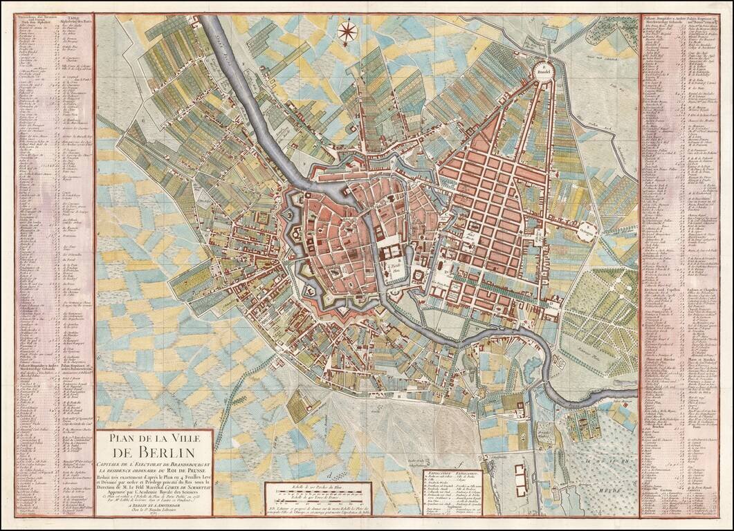
Fine plan of Berlin, reduced from Von Schmettau's 4 sheet plan of Berlin published in 1753.
The map includes an extensive key of public places, gardens, bridges, markets, churches and streets, etc. on either side of the map.
A finely execute map in attractive colors.
If you are a student, write to us in telegram: @antiquemaps and indicate what material you need and for what work you need a map in high detail. We are ready to provide material on special terms. For students only!


