
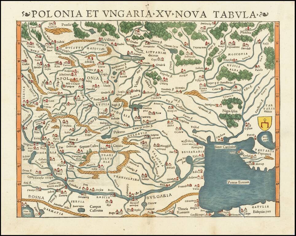
The Earliest Obtainable Map of Poland, Ukraine, Belarus, Hungary, etc. Rare early state of Munster's map of Poland, Lithuania, the Ukraine, Moscovy and the Balkans, extending from Prussia, Vilna and Smolensky in the north to Bosnia, Bulgaria,...
![[Poland, Croatia, Slovenia, Hungary, Serbia, Romania, Ukraine, Bulgaria] (La discrittione della Transylvania et parte del l'Ungaria, et il simil della Romania)](/map/small/59225.jpg)
Middle section of Paolo Forlani's rare 3-sheet map, covering South Poland, Croatia, Slovenia, Hungary, Serbia, Romania, Ukraine, Bulgaria, with Transylvania in the center. Krakow appears in the north, with the Danube River crossing from the northwest...
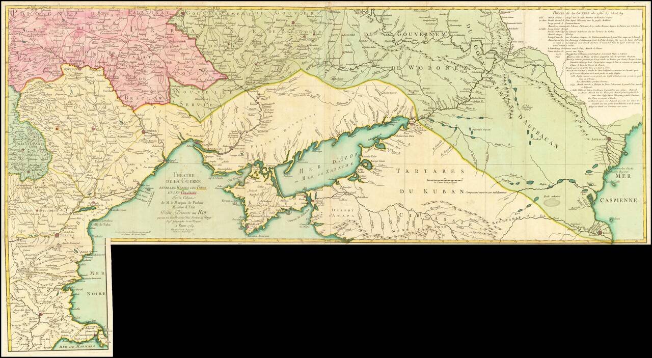
Fine old color example of this rare map illustrating the Theater of Russo-Turkish War (1768-1774). The map emphasizes the territories located on the north and west coasts of the Sea of Azov and the Black Sea and Crimea, namely Bulgaria, Romania,...
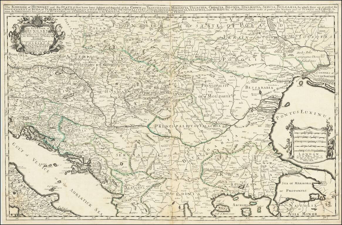
First State, from 1683, the Year of the Siege of Vienna. Rare, large engraved map of southeastern Europe, published by William Berry in London in 1683. The map was published at a pivotal point in the history of the region; in 1683, the Ottoman Empire...
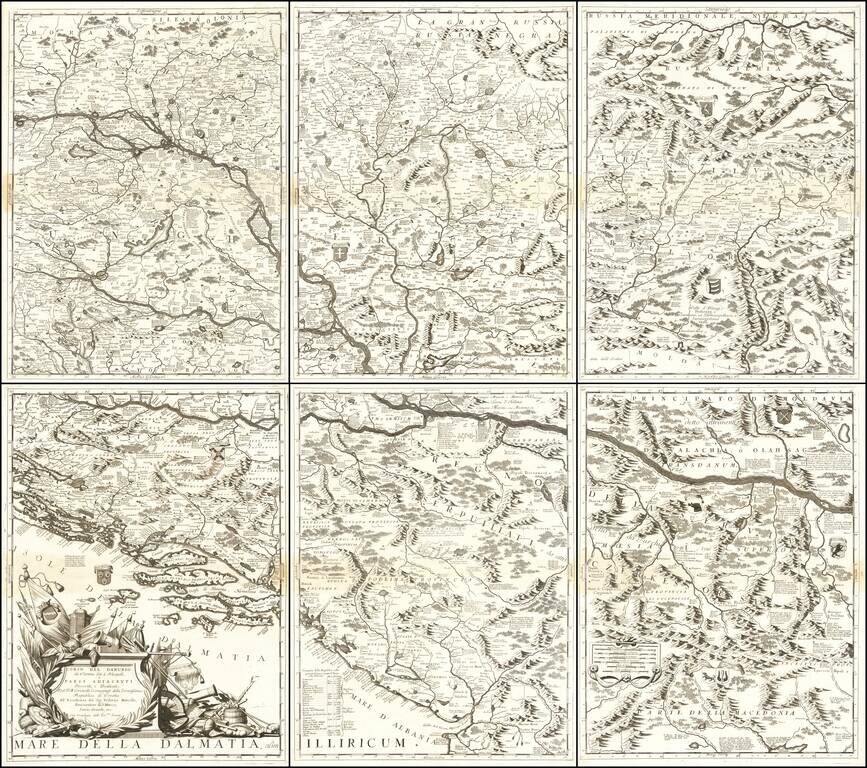
Monumental Six Sheet Map of the Danube Region Nice example of Vincenzo Maria Coronell's magnificent 6-sheet map of the course of the Danube River from Vienna to Nikopolje, published in Venice. The map is a remarkable compendium of information...
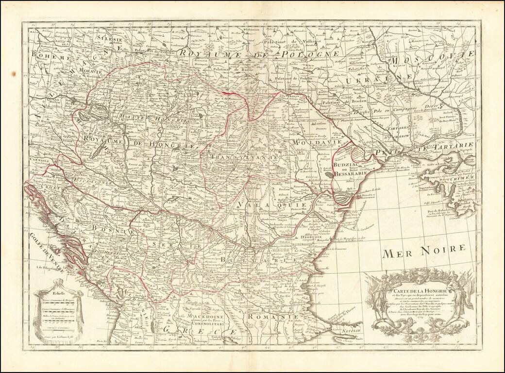
Detailed map of Southern Europe published by Guillaume De L'Isle. Shows Hungary, along with part of Dalmatia, Serbia, Macedonia, Romania, Constantinople, the Black Sea, Crimea, the Ukraine, Poland, Hungary, Transylvania, Moravia, Moldovia, the...
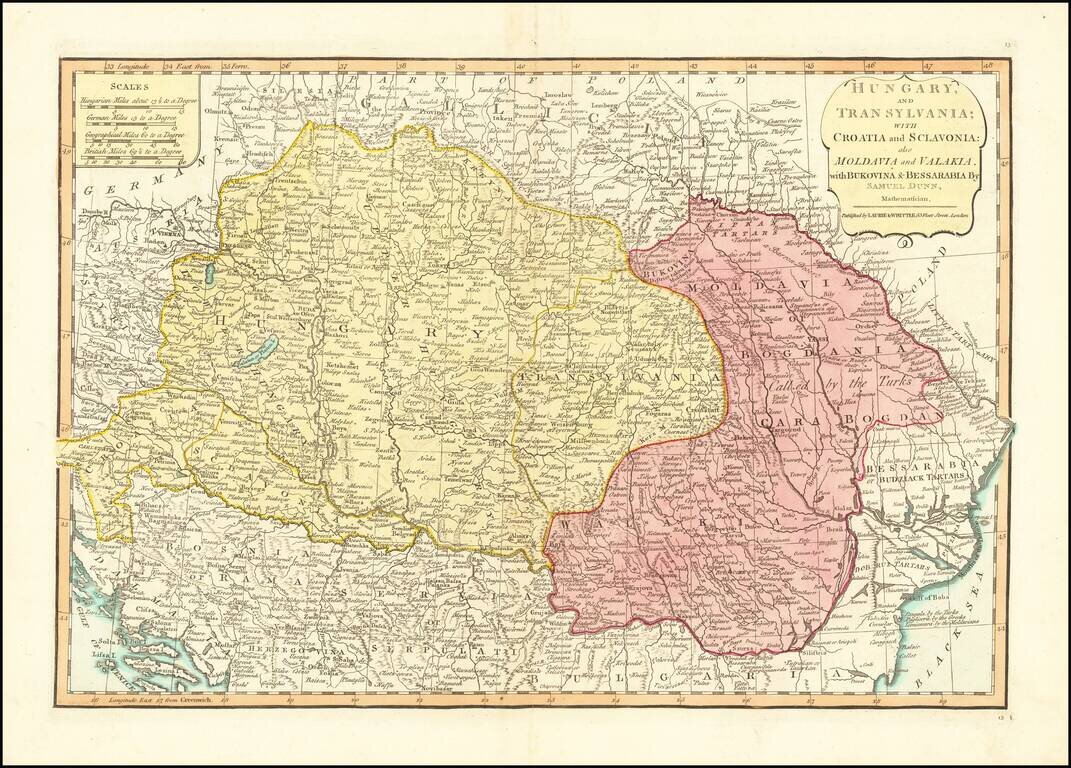
Detailed engraved map of the Balkans and Hungary, by one of the most important mapmaking firms of the end of the 18th century: Laurie & Whittle. The map shows Croatia, Serbia, Bosnia, Slovenia and the region extending east to Romania and the Black...
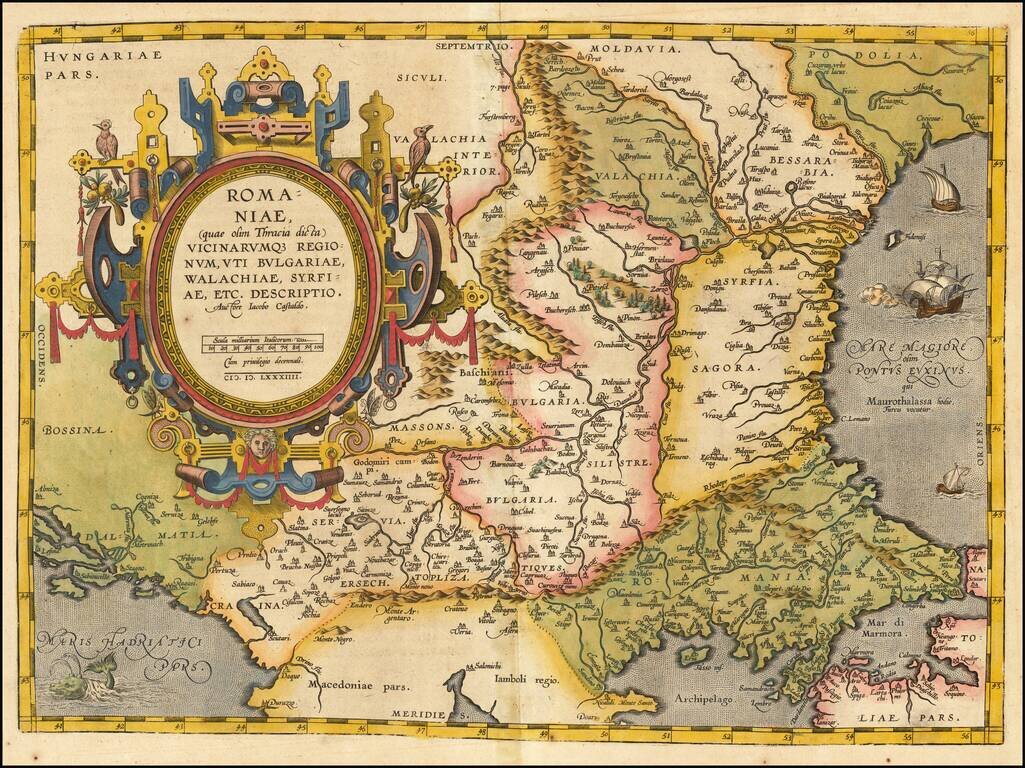
Striking example of Ortelius' map of Romania and contiguous regions west of the Black Sea and north of the Adriatic Coast. Countries located include Bessarabia, Valachia, Bulgaria, Moldova, Syrfia, Romania, Dalmatia and Servia. From Ortelius'...
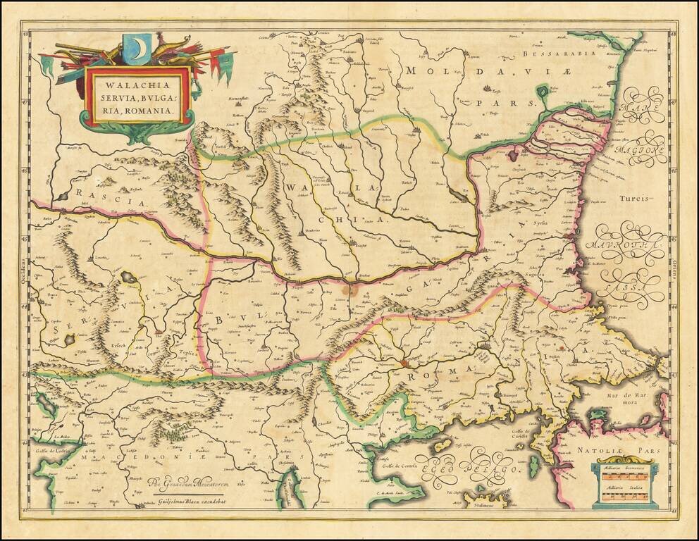
Nice old color example of Blaeu's map of the Lower Danube, Bulgaria, Romania, Serbia and Macedonia. Includes decorative cartouche, coat of arms, etc.
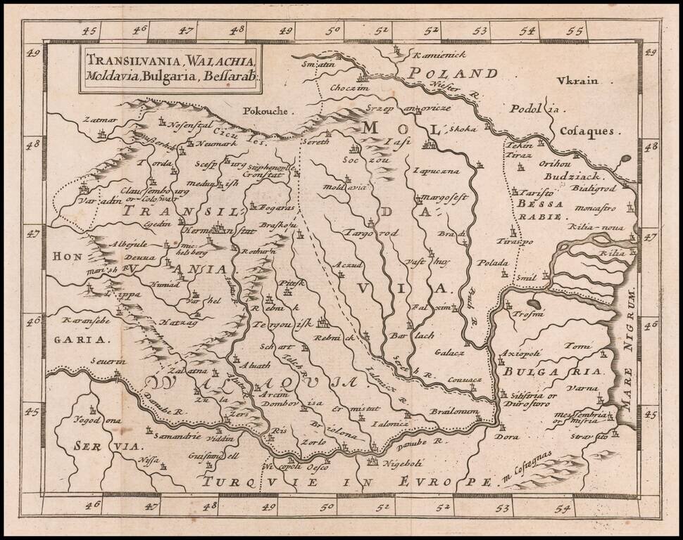
Rare Miniature English Map of Romania, Transylvania, Moldovia, and Bulgaria Rare map of Romania, Transylvania, Moldovia, and Bulgaria, published by Sir Jonas Moore in London. The map appeared in Moore's A New Geography. Many of the plates in the...
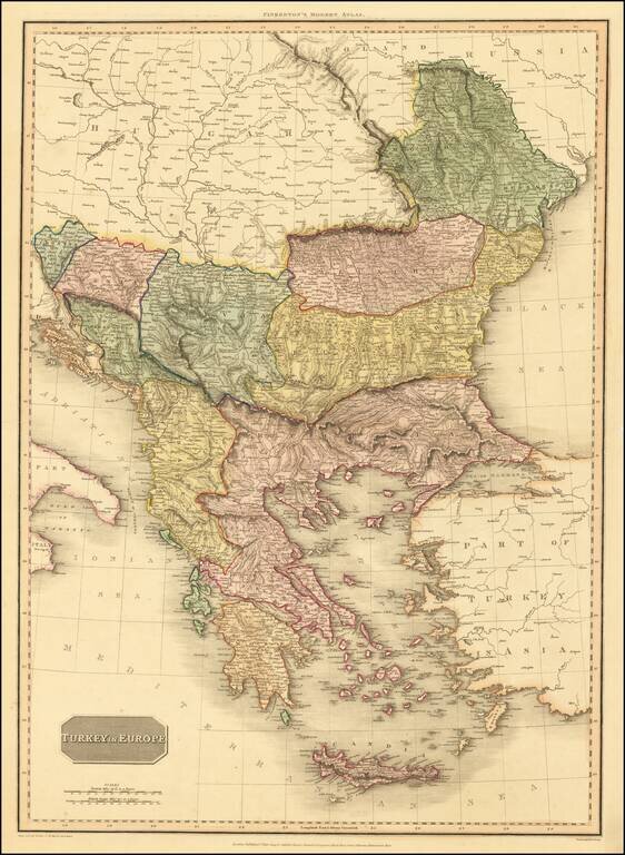
An excellent detailed regional map of the Balkans, Turkey and Greece, showing towns, roads, rivers, mountains, lakes, and other items of interest. Hand colored by regions.
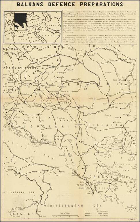
Balkans Related Anti-Nazi Propaganda Broadside Published in the British Empire Fascinating WWII broadside propaganda map, published in India, in order to keep the local populous informed about the War. The map describes Hitler's overtures to Tzar...