
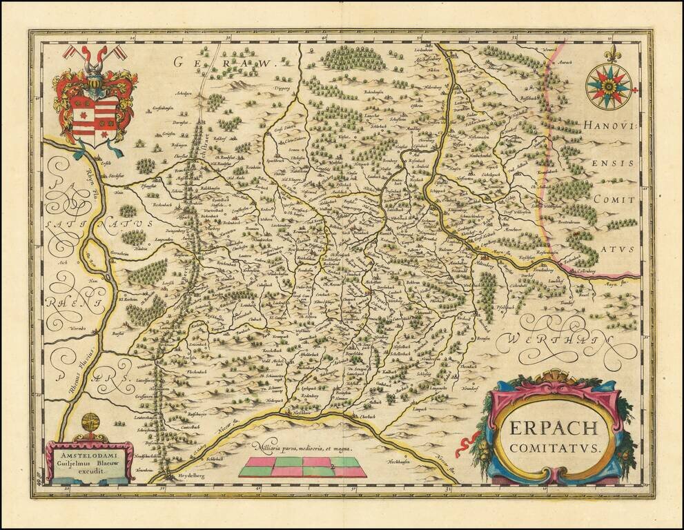
Old color example of Blaeu's regional map of Erpach, showing the region between the Rhine, Necar and Mayn River, including Heidelberg and Erpach. Other cities include Dorfenbach, Miltenberg, Amorbach, Werde Obernburg, Darmstadt, Erfelt, Pufunstatt,...
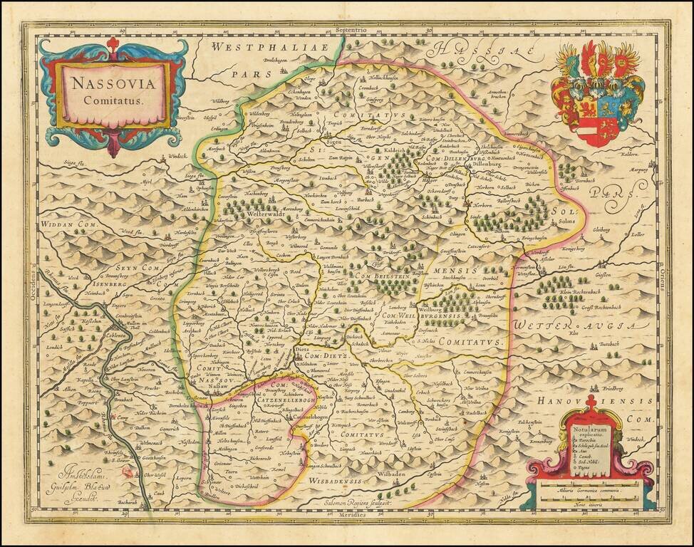
Finely detailed map of the County of Nassau, published by Blaeu. The map includes the towns of Nassau, Dietz, Siegen and Herborn.
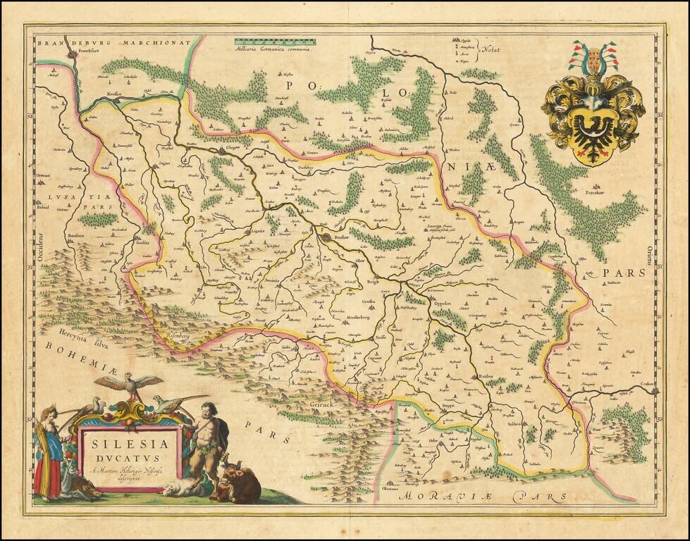
Nice example of Blaeu's map of Silesia, centered on Breslau. The map extends to Cracow in the southeast, and includes Racibórz, Glogaw, and Krosno. Follows the course of the Oder. Two cartouches and coat of arms.
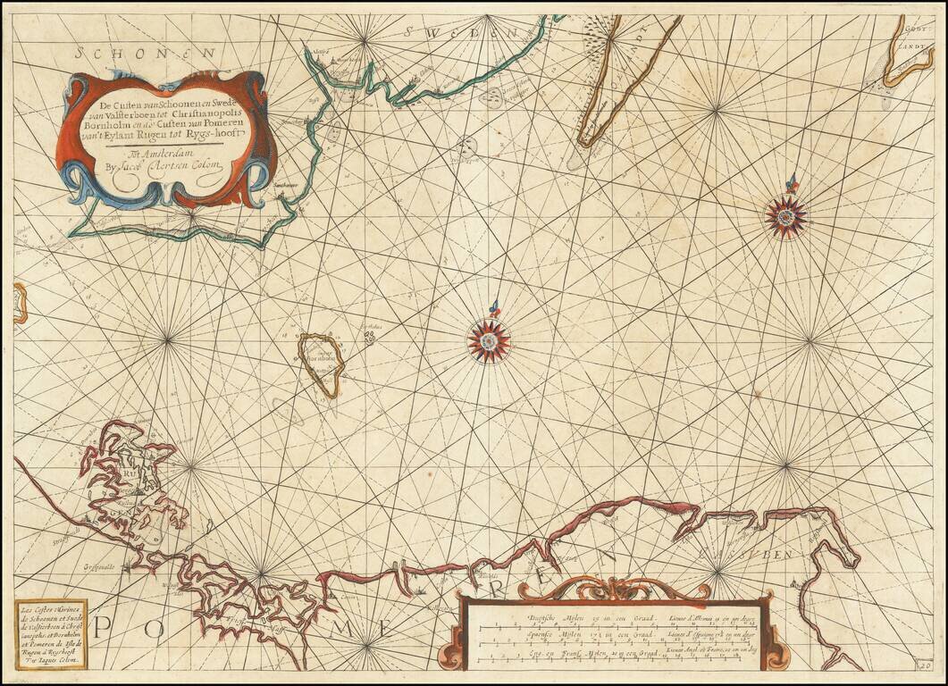
Rare early Dutch sea chart, pubished in Amsterdam by Jacob Colom. The map covers the coastlines of western Poland, Pomerania and part of southern Sweden. The chart appeared in one of the earliest Dutch Sea Atlases. The only example of the map we...
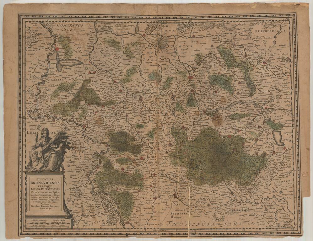
Rare early edition of CJ Visscher's regional map of Germany, centered on Braunschweig, Hannober, Hildesheim, Emberg, Northeim, etc.
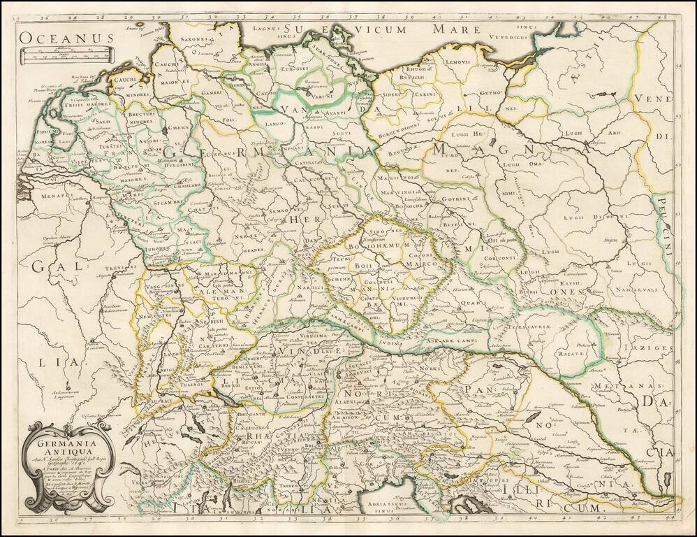
Tavernier and Sanson's rare 1641 double-page engraved map of classical Germany.
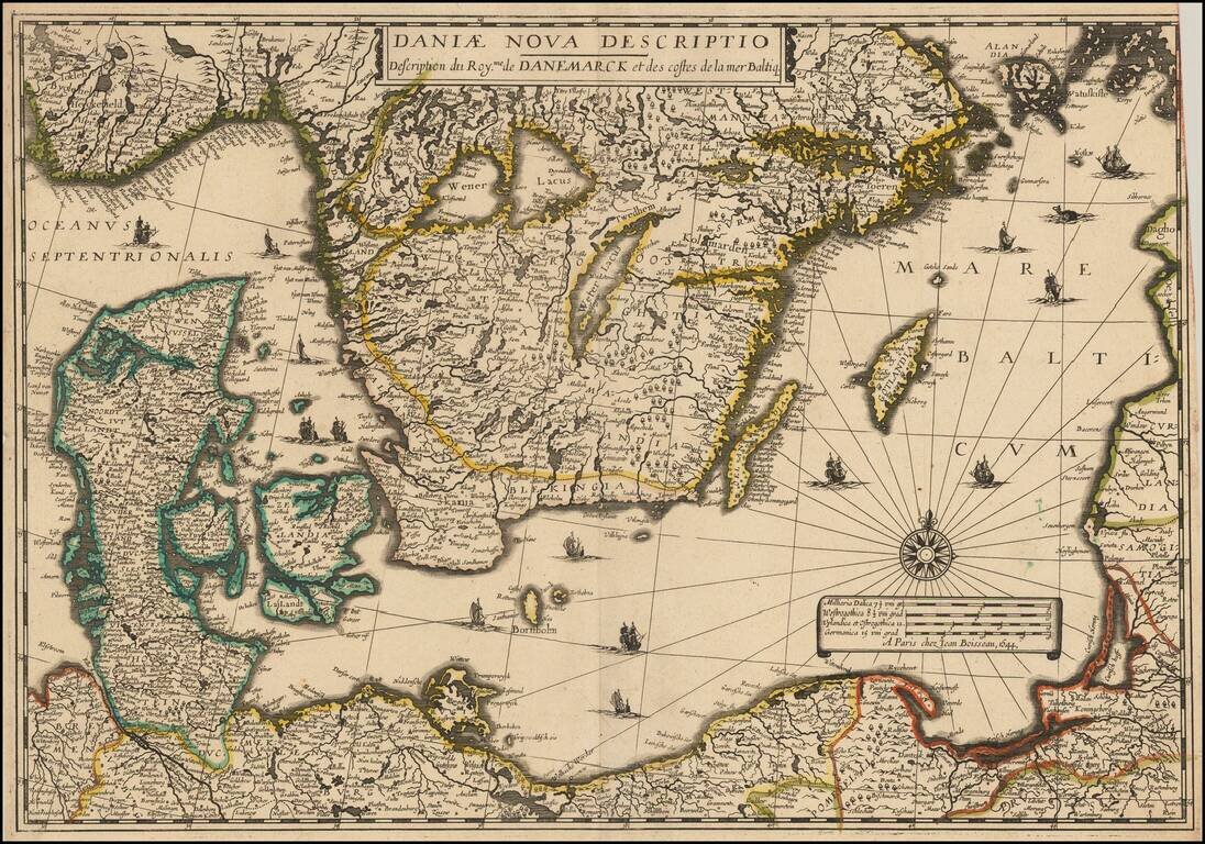
Rare separately issued map of Scandinavia and the Baltic Regions, published by Jean Boisseau. The map would later be issued by Langlois in Paris, circa 1660, with name "Mare Balticum" revised to "Mer Balticque." Not in Pastereau or Nordenskiold. We...
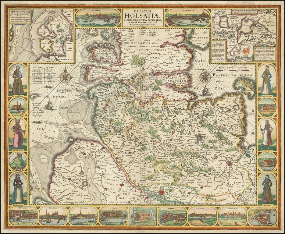
Decorative map of the Duchy of Holstein, engraved by Claus Janszoon Visscher. The map is flanked by images of costume and city views, with additional city views across the bottom, with 2 more at the top and two localized maps. An early state of the...
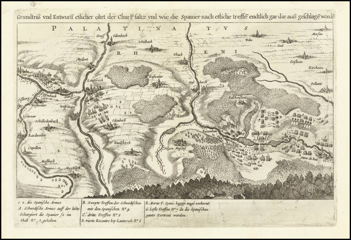
A Rare Example of a Forgotten Battle of the Thirty Years' War An antique map showing troop movements near Lautereck in the Palatinate of the Rhine. Text identifies the troops as Spanish and Swedish, and the location and period indicate that this is...
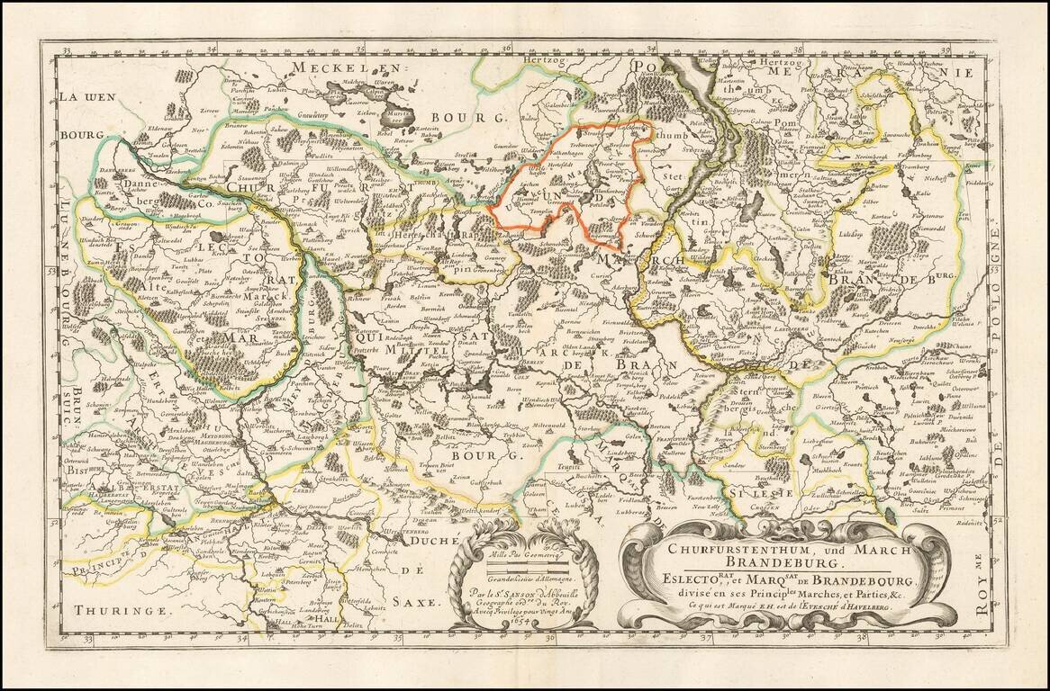
Nicolas Sanson's double-page engraved map of Bradenburg, with Berlin at the center. The map was published in Paris in 1654.
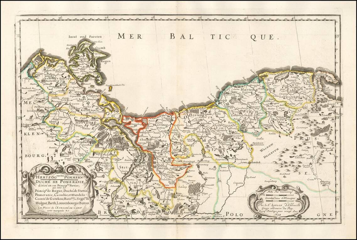
Nicolas Sanson's engraved map of Pomerania, straddling the modern border of Germany and Poland. The map was published in Paris in 1654.
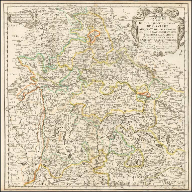
Nicolas Sanson's engraved map of Bavaria, published in Paris in 1655.
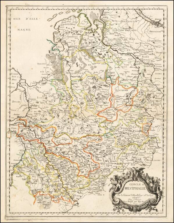
Nicolas Sanson's engraved map of the Circle of Westphalia, in present-day Germany. The map was published in Paris in 1659.
Nice example of G.P. Finckh's version of Philip Apian's 1568 map, the first printed map of Bavaria, Engraved by Ainling. Apian's map of Bavaria is considered to be a pioneering monument of modern cartography. In 1554, Duke Albrecht of Bavaria ordered...
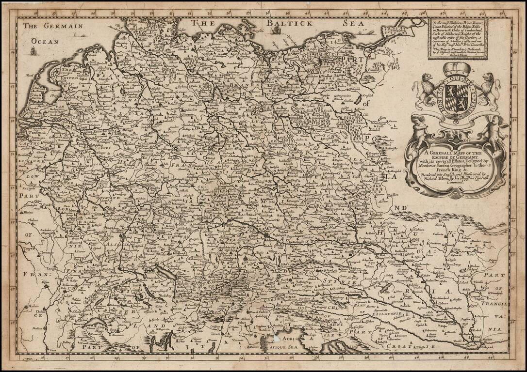
A striking dark impression of Richard Blome's scarce map of the German Empire, the earliest folio sized map of the region to be engraved in England. The map features an elaborate heraldic cartouche and a dedication to Prince Rupert, Count Palatine of...
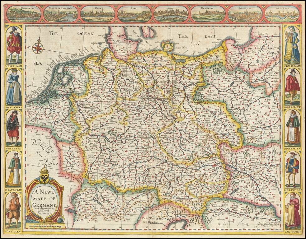
Nice example of Speed's map of the German Empire, extending from Poland in the Northeast to the Danube. Includes birdseye views of Heidelberg, Frankfurt, Vienna, Prague, Cologne, Nuremberg, Strassborg and Augsburg across the top and indigenous...