
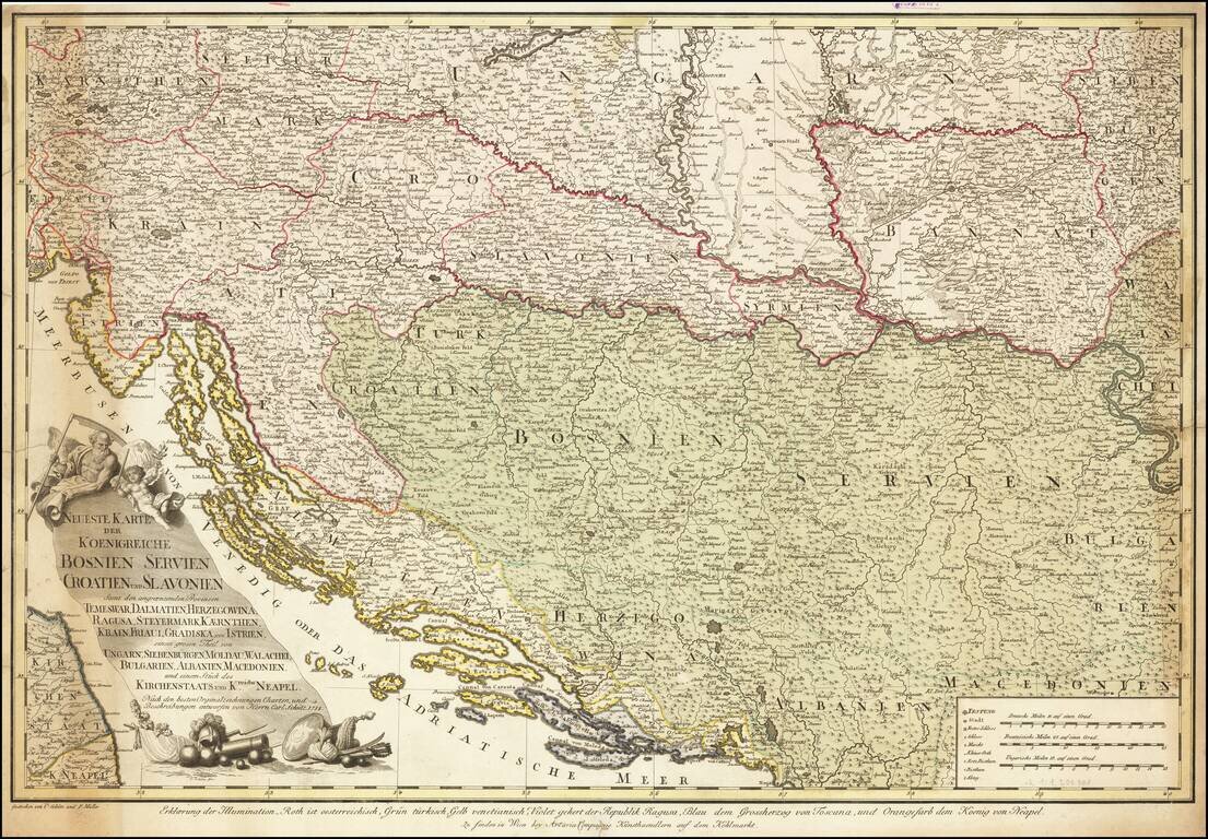
Extremely rare separately published map of the region bounded by Adriatic in the south and centered on the course of the Donau (Danube) River. The map is drawn from larger maps published General Bauer and F. Schmid, with credits for this map given to...
![[Poland, Croatia, Slovenia, Hungary, Serbia, Romania, Ukraine, Bulgaria] (La discrittione della Transylvania et parte del l'Ungaria, et il simil della Romania)](/map/small/59225.jpg)
Middle section of Paolo Forlani's rare 3-sheet map, covering South Poland, Croatia, Slovenia, Hungary, Serbia, Romania, Ukraine, Bulgaria, with Transylvania in the center. Krakow appears in the north, with the Danube River crossing from the northwest...
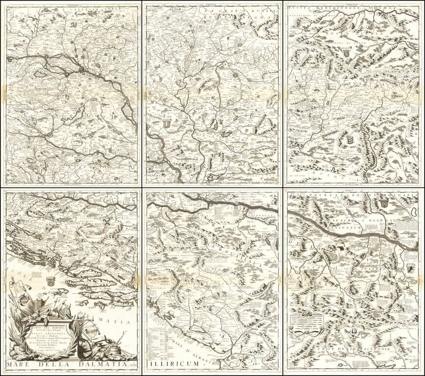
Monumental Six Sheet Map of the Danube Region Nice example of Vincenzo Maria Coronell's magnificent 6-sheet map of the course of the Danube River from Vienna to Nikopolje, published in Venice. The map is a remarkable compendium of information...
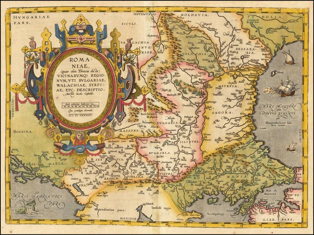
Striking example of Ortelius' map of Romania and contiguous regions west of the Black Sea and north of the Adriatic Coast. Countries located include Bessarabia, Valachia, Bulgaria, Moldova, Syrfia, Romania, Dalmatia and Servia. From Ortelius'...
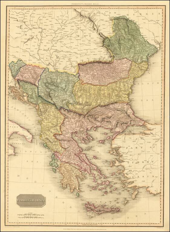
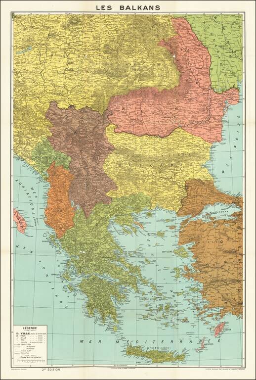
An excellent detailed regional map of the Balkans, Turkey and Greece, showing towns, roads, rivers, mountains, lakes, and other items of interest. Hand colored by regions.
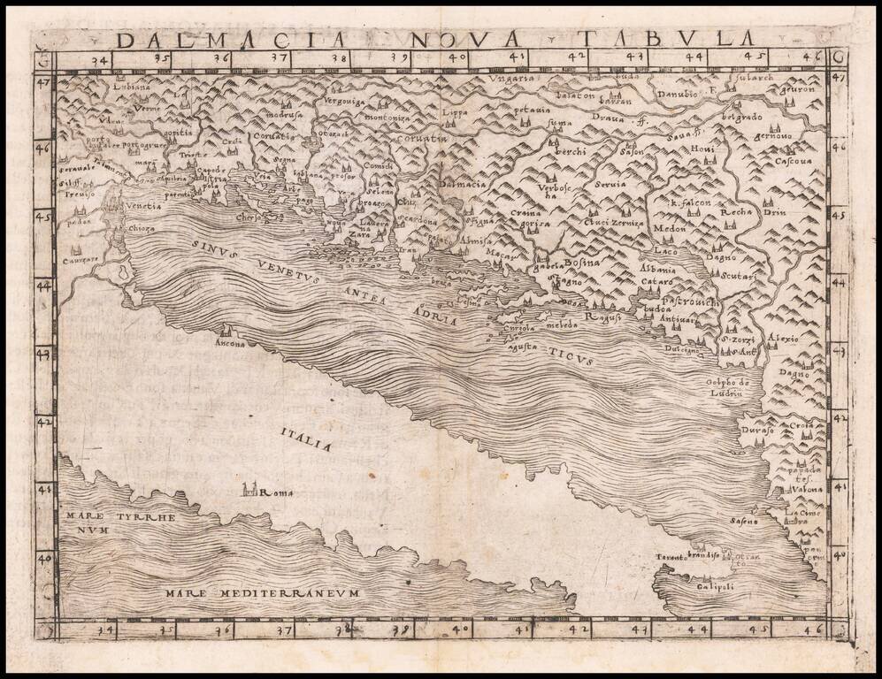
Nice example of Gastaldi's modern map of the coastal parts of Dalmatia, including parts of Slovenia, Croatia, Bosnia and Hezegovina, Montenegro, and Albania, along with portions of Venice and Istria.and the Adriatic Coast. The map is one of the...