

Willem Barentsz's Map of the Polar Regions, drawn from his observations during his third voyage of 1596-97 and engraved by Baptiste Van Deutecum. The Barentsz map of the polar regions is a major landmark in Arctic cartography, depicting the details...

Willem Barentsz's Map of the Polar Regions, drawn from his observations during his third voyage of 1596-97 and engraved by Baptiste Van Deutecum. The Barentsz map of the polar regions is a major landmark in Arctic cartography, depicting the details...

Henry Hudson's Final Sea Chart, One of the First Maps to Show Hudson Bay This remarkable chart illustrates the track of the fourth and final voyage of Henry Hudson in his hunt for a Northwest Passage. It was a landmark map in the exploration of the...
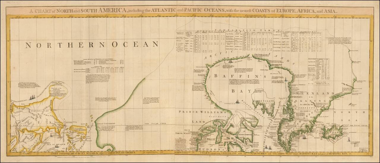
One of the Most Detailed and Important Map of the Americas made by a Scandalous Geographer This is a nice example of the northernmost sheets of 1775 edition of this important six sheet chart of North and South America, originally compiled by John...
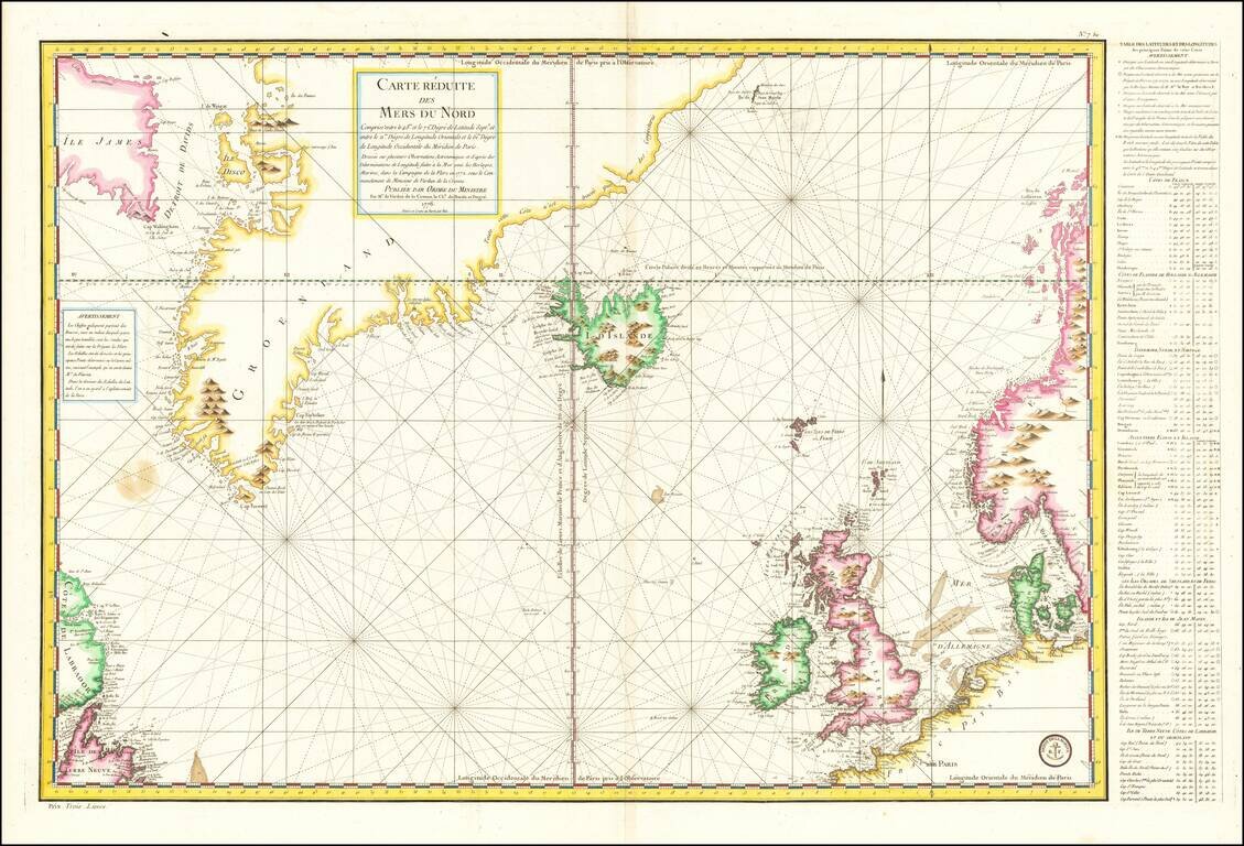
Late 18th Century Scientific Expedition In the North Atlantic Important mid-18th Century sea chart of the North Atlantic, published by the French Depot de la Marine. Centered on Iceland, the map extends from Labrador, Newfoundland, and Baffin Island...
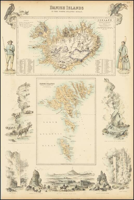
Two detailed maps (Iceland and the Faroe Islands) surrounded by decorative vignettes
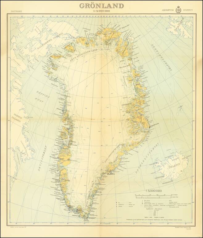
An attractive mid-century map of Greenland published by the Danish state-run cartographic institute. Greenland is shown in detail, and parts of Iceland, Baffin Island, and Svalbard are also shown. A legend is included, and the insignia of the...
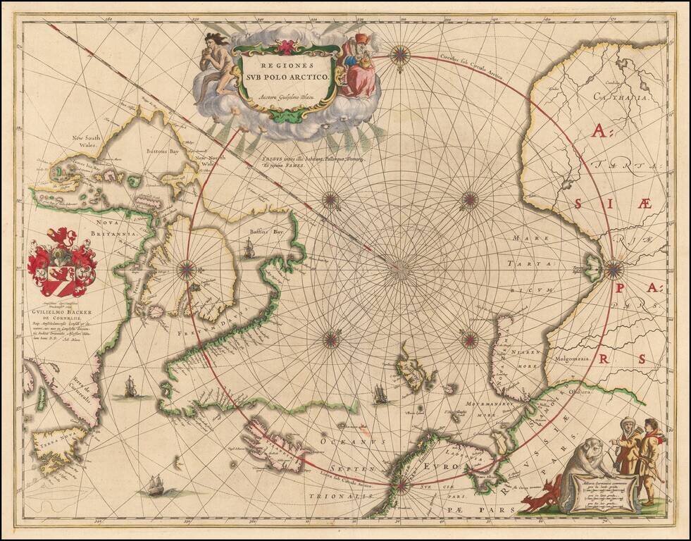
Nice example of the second edition of Blaeu's signature map of the North Polar Regions, with several wonderful cartouches and decorative coat of arms. Blaeu's decorative map of the North Pole, including Arctic North America, Scandinavia, and northern...
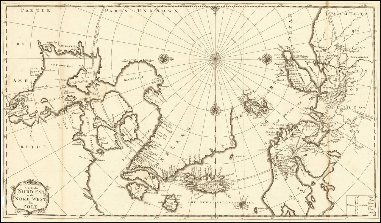
Fine Eighteenth-Century Map of the Arctic Elegant and finely-wrought map of “Northeast and Northwest of the Pole,” published by Amsterdam-based French scholar and mapmaker Jean Frédéric Bernard. The map encompasses the polar region from Tartary...
Decorative map Europe, Iceland and part of Greenland, with sea monsters and land creatures in the sea and on land. Large decorative cartouche and characters. Scherer's Atlas Novus was a 7 volume compendium which demonstrated his unique style and...

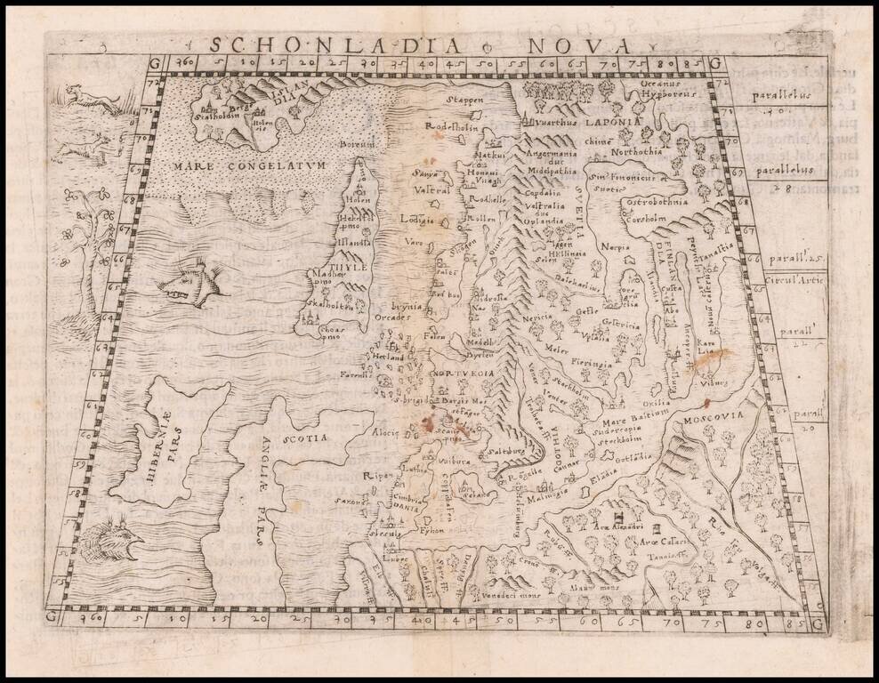
Rare Early Map of Northern Europe Important early map of Northern Europe, Scandinavia and the British Isles, which first appeared in the 1507-1508 Rome edition of Ptolemy's Geography, Claudii Ptholomei Alexandrini. Cosmographia..., created under the...
Important early modern map of Scandinavia, Iceland, and the Baltic, published in Venice by Giacomo Gastaldi. Gastaldi's modern map of Scandinavia and environs "built upon previous publications, in particular, the representation was based on the map of...
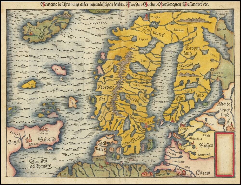
Second edition of Munster's map of Scandinavia, first issued in 1545 to replace the very rare first edition of the map, which appeared in only the first three editions of Munster's Geographia. Munster's first map relied upon the cartography of Jacob...
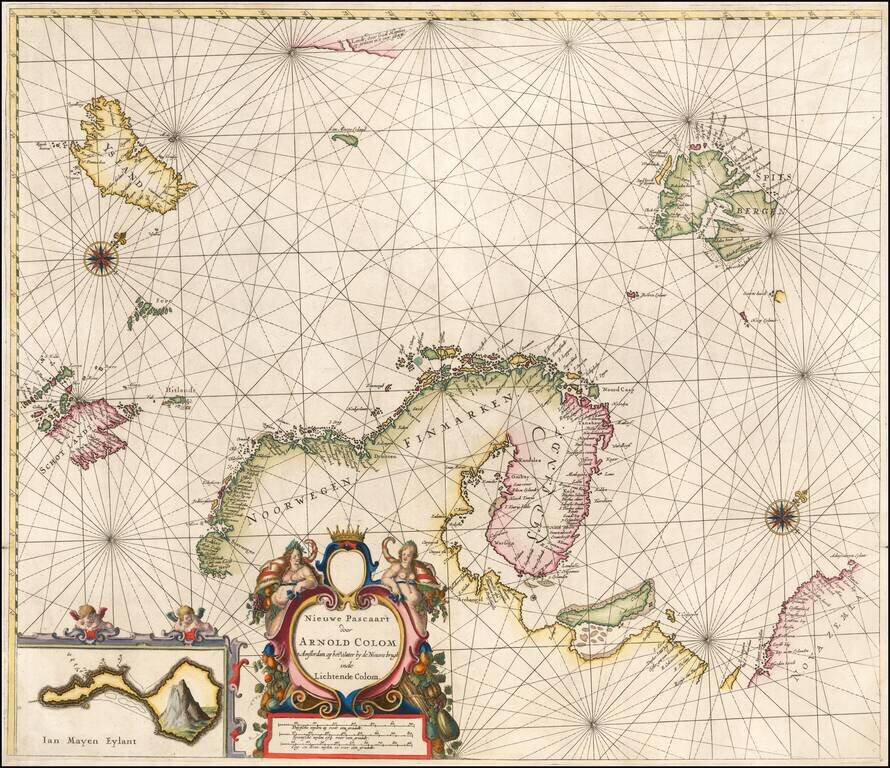
Rare sea chart of the Scandinavia, extending from Iceland to Spitzberg and Nova Zembla. Of note, this is one of, if not the earliest appearance of the reference to the sighting of land on the East Coast of Greenland by Gael Hamkes in 1654. Includes a...
![Norway and Sweden with their Dependancies [Inset map of Iceland]](/map/small/70559.jpg)
Detailed map of Scandinavia, with a table listing the dependancies. Robert Wilkinson was active in London as a cartographic publisher from 1785 to 1825. He produced a number of nice works, including a General Atlas and a re-issuance of Bowen &...
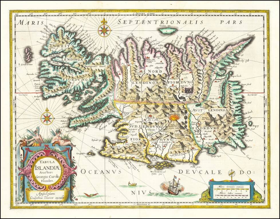
Fine old color example of Blaeu's map of Iceland. A stunning map, including an erupting volcano, sea monsters, sailing ships, decorative cartouches, compass rose and the spectacular landscape of Iceland. Carolius used Mercator's version of Bishop...