Map size in jpg-format: 1.85349MiB
Click to open in high resolution (open in new tab).
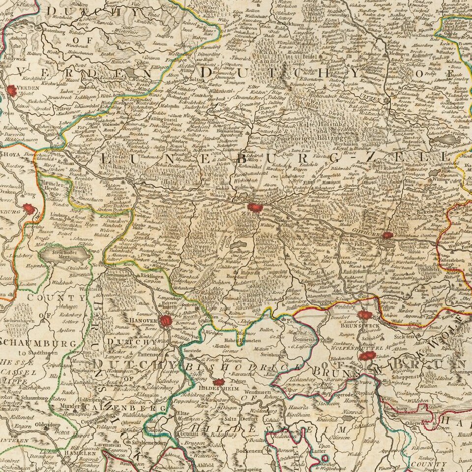
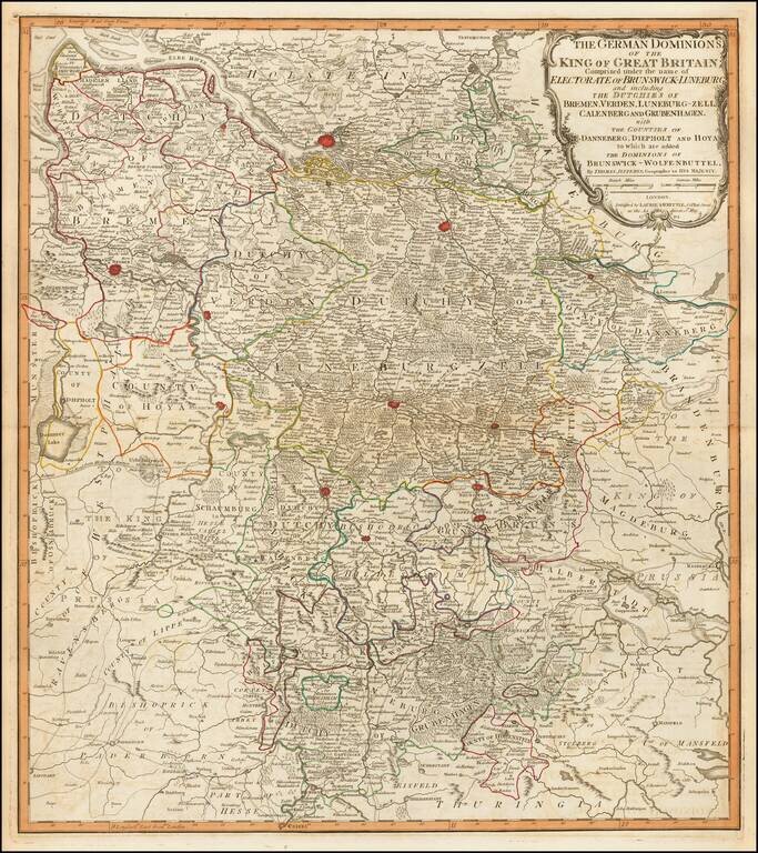
Fine engraved map of the territory in the west of Germany that constituted some of the inherited lands of George III.
The chief cities on the map are Hamburg, Bremen, and Hanover, although many others are also shown.
Laurie & Whittle
Robert Laurie (ca. 1755-1836) and James Whittle (1757-1818) formed their Fleet Street, London-based firm upon the 1794 death of their employer Robert Sayer, himself one of the dominant print and mapmakers of the last half of the 18th century.
Laurie & Whittle started managing Sayer's business as early as 1787. They took over all managerial duties when Sayer's health flagged in 1792, and they changed the imprint in 1794 upon his death. Sayer left the two a 21-year lease on the shop (at £100 a year) and on Sayer's Bolt Court premises, as well as an option to acquire stock and equipment at a preferential price of £5,000 payable over three years.
Robert Laurie retired from the firm in 1812, and his role was assumed by his son, Richard Holmes Laurie (1777-1858). The younger Laurie worked with James Whittle until the latter died in 1818. After R. H. Laurie died in 1858, Alexander George Findlay, FRGS (1812-1875) purchased the firm from his daughters. The firm continues today under another name, specializing in yachting charts.
Laurie & Whittle were prolific print and map publishers, and throughout their careers, they produced numerous very important and rare works. They carried on Robert Sayer's atlas business and were responsible for editions of The Complete East-India Pilot and The American Atlas.
A General Atlas, describing the Whole Universe [1797]
This map comes from Thomas Kitchin's A General Atlas. This atlas was conceived of by Thomas Jefferys in the 1760s. Following Jefferys' bankruptcy in 1766, the atlas was first completed by Robert Sayer in 1773. This was Robert Sayer's first terrestrial atlas. From 1794 the atlas was published by his successors Laurie & Whittle. Later editions tend to be more desirable. Thomas Kitchin's name appears on title pages even after his death in 1784. The maps are after a variety of makers such as d'Anville, Roberts, Dunn, Rocque, Delarochette, Rennell, Zannoni, Dury, Cook, Vancouver, Perouse and others.
This map is from the 1797 edition of the atlas. This atlas was later expanded and replaced by Laurie & Whittle's A New Universal Atlas.
Laurie & Whittle refers to the partnership of Robert Laurie (1755?-1836) and James Whittle (1757-1818), engravers and map publishers. Both men were employed by Robert Sayer (ca. 1724-1794), one of the most prominent British publishers and map sellers of the eighteenth century. Sayer died in 1794 and his business was taken over by his assistants. The two worked together as Laurie & Whittle until 1812, when Laurie retired. They were especially known for publishing sea charts and maritime atlases. From 1812-1818, when he died, Whittle worked with Laurie’s son, Richard Holmes Laurie, as Whittle & Laurie. After 1818, the firm was known as R. H. Laurie, even though Richard died in 1858. Later, the firm was managed by Laurie’s draughtsman, Alexander George Findlay, and, later, Daniel and William Kettle.
If you are a student, write to us in telegram: @antiquemaps and indicate what material you need and for what work you need a map in high detail. We are ready to provide material on special terms. For students only!


