

Striking full color example of this marvelous map of Germany. Showing vignettes of Coburby, Cologne on the Rhine, Dresden, The Palace at Saxe Gotha, Luther's House, Silver Mines in the Hartz Mtns, and Guttenberg, Faust and Schoffer portraits....
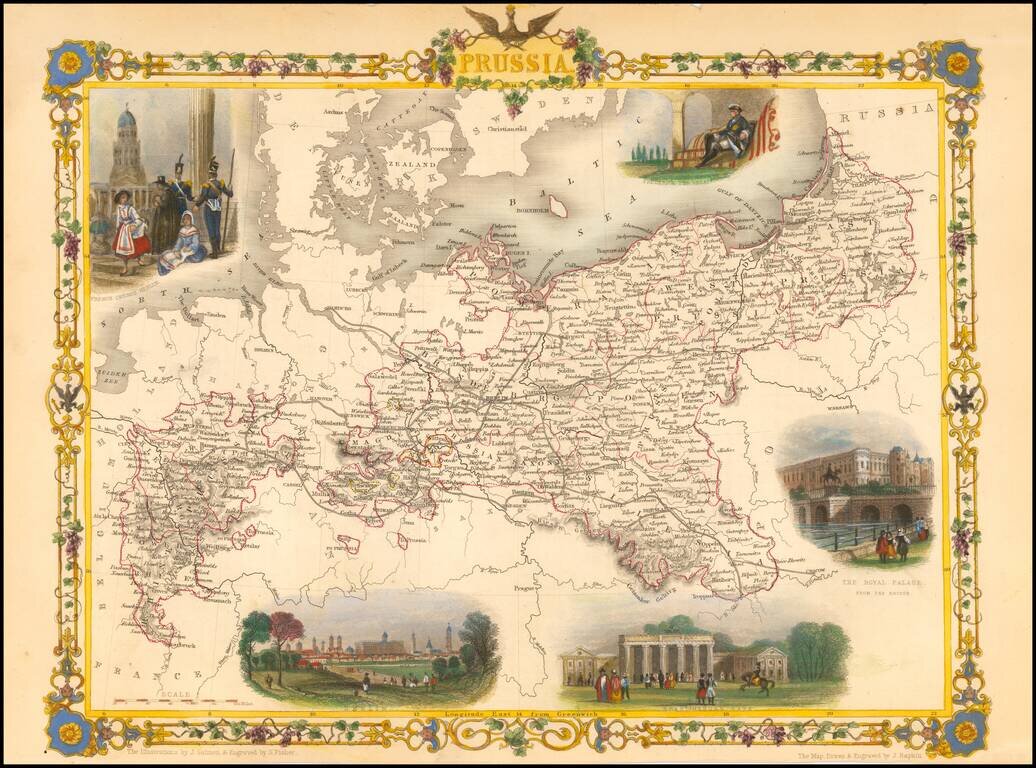
Stunning full color example of this marvelous map of Pussia, surrounded by decorative vignettes. Includes decorative vignettes showing French Church Berlin, Frederick the Great, The Royal Palace, Berlin, and Bradenberg Gate. Engraved for R....
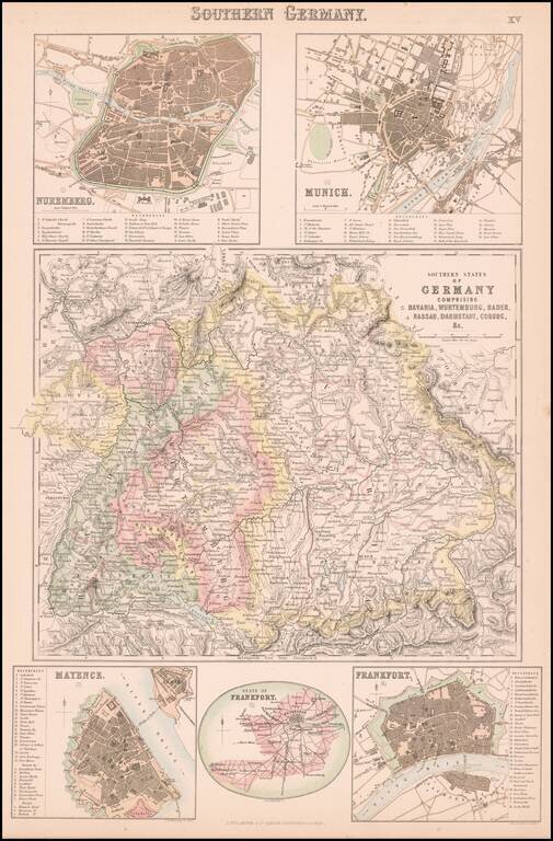
Detailed map of central and northern Germany, with 5 detailed inset plans. The plans include Nuremberg, Munich, Mayence, Frankfort and State of Frankfort.
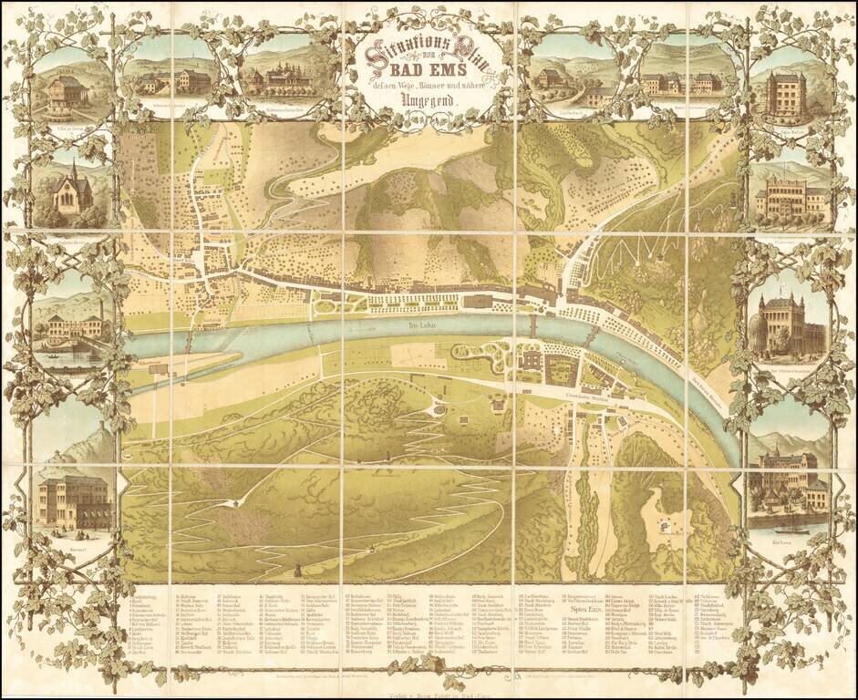
An Important 19th Century German Spa Town -- Host to Czars and other Nobility Rare separately published map of the spa town of Bad-Ems, 5 miles west of Koblentz. The map consists of elegant green spaces, bath houses and the main road along the north...
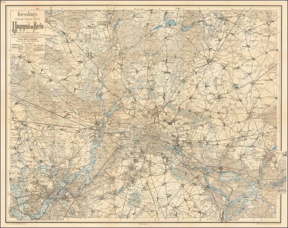
Detailed map of the area around Berlin. The map extends to Potsdam, Cremmen, Oranienburg, Biesenthal, Werneuchen, Rudersdorfer-Forst, Waltersdorf, and Teltow.
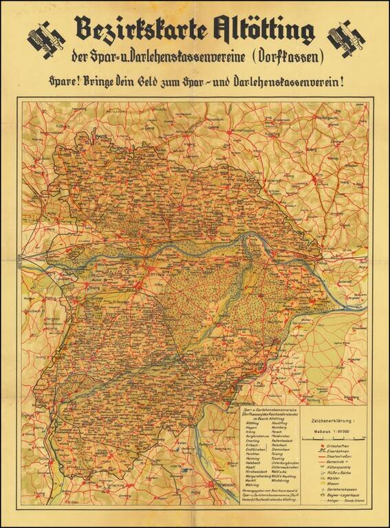
"Blood and Soil" Rare Nazi-era map of the area around Altötting in Bavaria, promoting the deposit of money in Savings and Loan Associations and Credit Unions. This map is part of the ideological propoganda war of "Blood and Soil" waged on the...
![(Second World War - Nazi Germany) L'Allemagne Paradis du Tourisme. [Germany The Paradise of Tourism.]](/map/small/63210.jpg)
Striking propaganda and travel map of Germany, published by the Reichsbahnzentrale fur den Deutschen Reiseverkehr and the German Railways Information Bureau. Text, map, and graphics on the verso. Includes decorative border alternating crests and "La...
![[Uniforms and Insignia of the German Army] Форма Обмундирования и Знаки Различия Германской Армии](/map/small/67803.jpg)
A very rare pre-World War II Soviet poster of Nazi-era German military uniforms. Underneath the title is an elaboration of colors used on the strap edging and buttonholes of troop uniforms, depending on their area of service. From left to right:...
![[Fascist Organizations of Germany] Фашистские Организации Германии](/map/small/67801.jpg)
One of the Most Dramatic Soviet Cartographic Appraisals of Nazi Germany. A fascinating Soviet poster map documenting the "Fascist Organizations of Germany", recording their structures, uniforms, and locations within the country, prior to the Second...
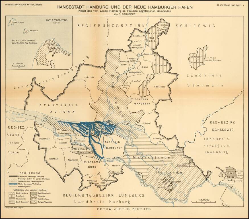
Detailed map of the area around the city of Hamburg. The map illustrates the growth of the various regions of this Hanseatic port, on the eve of World War II. The map translates as follows: Hanseatic City of Hamburg and the New Hamburg Harbor...
![[Second World War - Battle of Berlin] Großer Silva-Stadtplan von Berlin](/map/small/63107.jpg)
Hand-Annotated Map of the Battle of Berlin, Showing the Progress of the 89th Armenian Rifles through the City, to the Reichstag. From the Personal Papers of the Major General Who Led the 89th Rifles' Assault on Berlin. An excellent Battle of Berlin...
![(Second World War - Allied Bombing of Germany) Offensive Aerienne des Allies contre l'Allemagne Jusqu'au 1 Fevrier 1941 [Allied Air Offensive against Germany Up To January 1st 1941]](/map/small/67411.jpg)
Broadside showing the location of bombing runs of the Allied bombers in Germany up to January 1, 1941. Inset map shows the heavy concentration of bombs in the Ruhr Valley, with a key locating the different types of facilities being bombed:...
![(Second World War - First Soviet Breakthrough into Germany) Генеральный Штаб Красной Армии - (Фюрстенвальде) | (Франкфурт) [General Staff of the Red Army - (Fürstenwalde) | (Frankfurt)]](/map/small/63108.jpg)
Manuscript-Annotated Map Showing Soviet Forces Entering Germany for the First Time! A fantastic map showing the first Soviet breakthrough into Germany-proper, during the leadup to the Battle of Berlin and the closing stages of the Vistula-Oder...
![(Second World War - Battle of Berlin) Генеральный Штаб Красной Армии Берлин-7 [General Staff of the Red Army Berlin-7]](/map/small/64471.jpg)
Detailed Soviet 1:100,000 map of Berlin, used during the Red Army encirclement of the city in the Battle of Berlin. The map covers several hundred square kilometers around Berlin, at the center is the city, labeled in Russian ("Берлин"). To the...
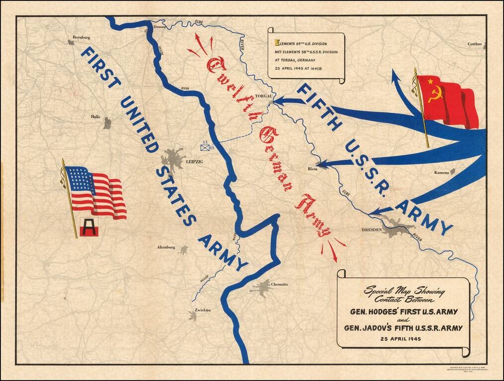
A Map Celebrating Elbe Day -- World War II Fine thematic map showing the progress of the American and Russian Forces against the last remnants of the German Army, published on Elbe Day. The two forces are shown moving toward each other, superimposed...
![(Second World War - Eastern Front) [The Soviet Encirclement of Konigsberg]](/map/small/65659.jpg)
Color-printed German map of East Prussia, with extensive manuscript additions in a Soviet hand noting the troop movements during the East Prussia Offensive and encirclement of Konigsberg. The Red Army movements are shown in red pencil, Wehrmacht...