
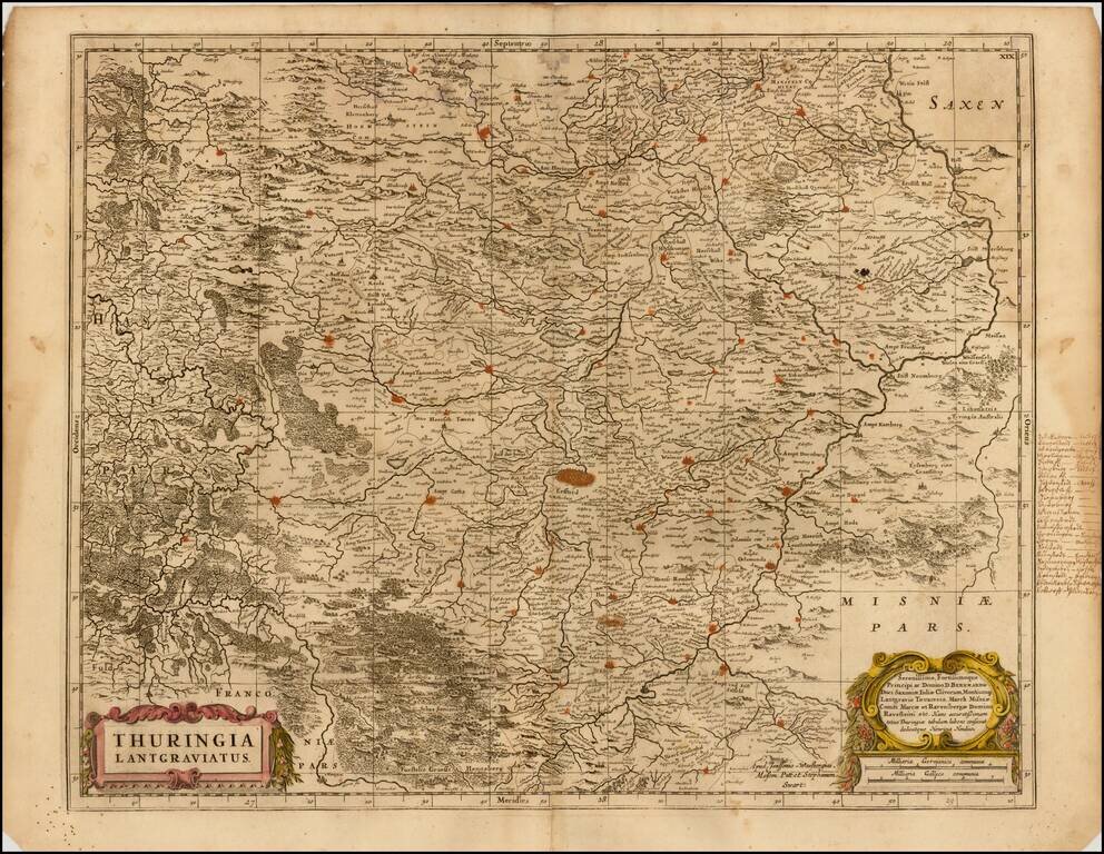
Detailed map of the region centered on Erfurt. Also includes Gotha, Weimar, Schwartzburg, Halle, Jena, Mulhausen, etc.
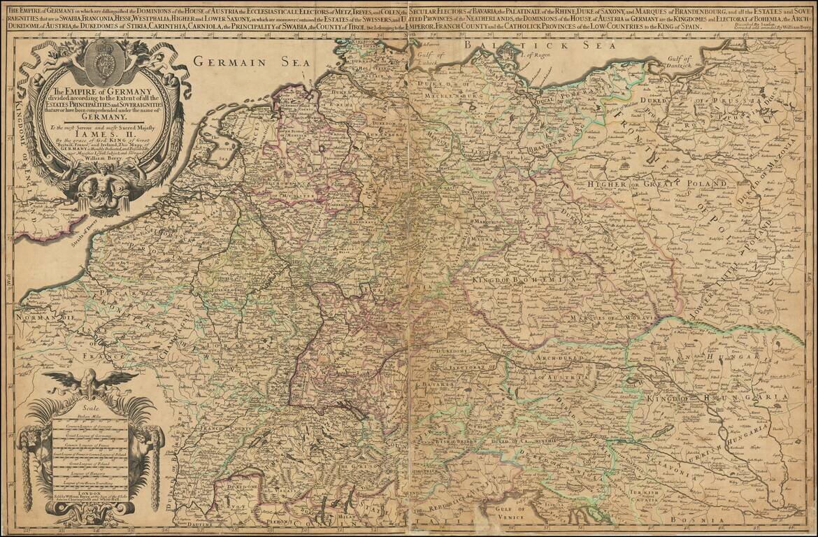
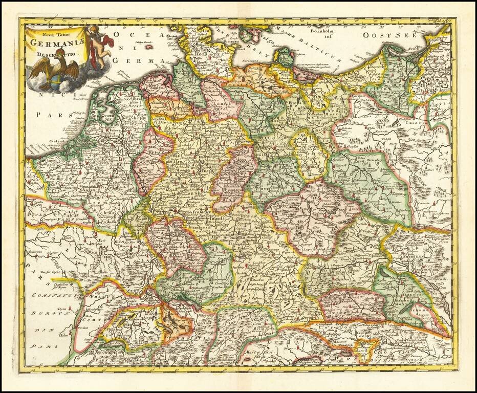
First State of Berry's Rare Map of Germany. Large-format engraved map of Germany, extending to Poland and the Low Countries, by one of London's premier 17th-century mapmakers, William Berry. Many of Berry's maps are dedicated to Charles II, however,...
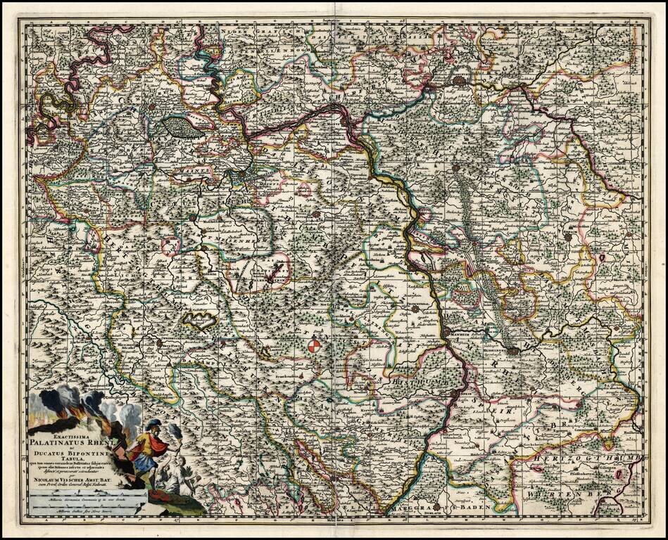
Old Color, gold highlighted example of this decorative map of a part of the Rhine region of Germany, including Frankfurt, Heidelberg, Manheim, Worms, Erpach and Maintz. Striking title cartouche. From a rare composite atlas by Abraham Wolfgang, with no...
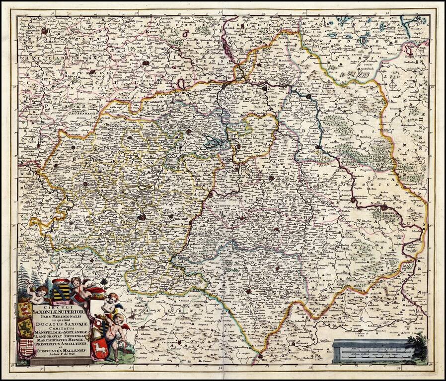
A detailed map of a region in eastern Germany. Cartouches depict coat of arms surrounded by cherubs. This map was issued in Wolfgang's "Atlas Minor" which is a compilation of maps originally issued by Blaeu, de Wit, Visscher and others.
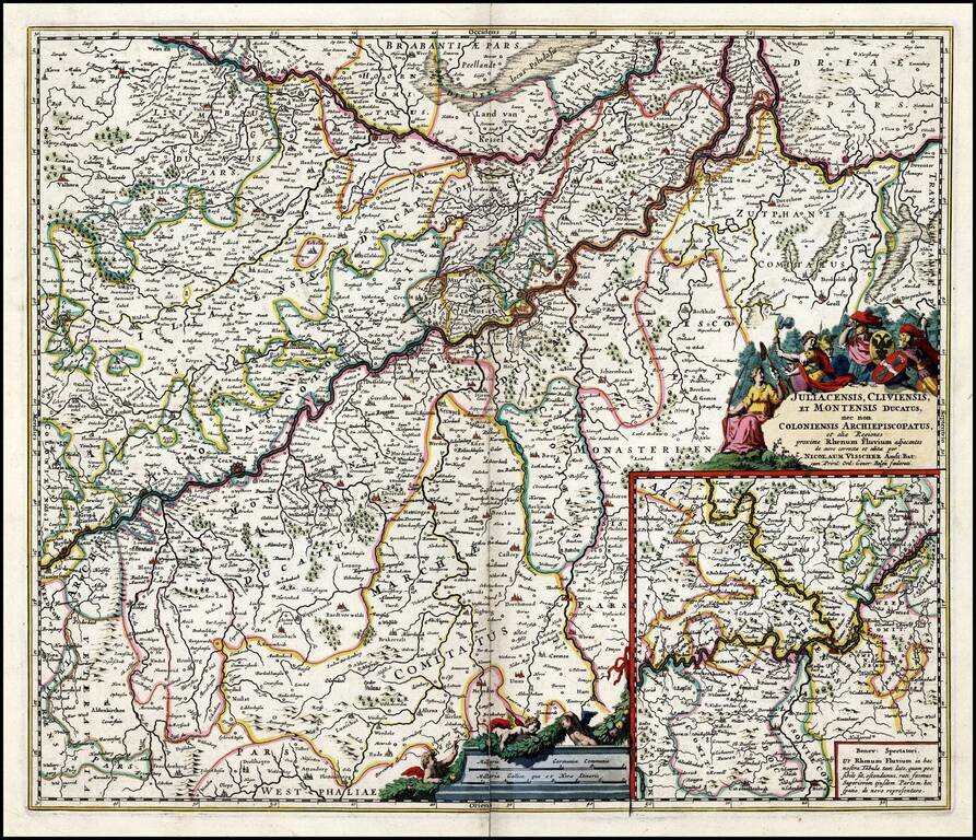
Old Color, gold highlighted example of this decorative map of western Germany, including Dortmund, Cologne, and the course of the Rhine as it winds into the eastern part of the Netherlands. West is at the top of the map. The title cartouche is...
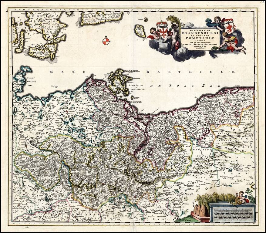
A detailed map of a region in Northern Germany, including Brandenburg and Pomerania. Cartouches depict coat of arms surrounded by cherubs, with a second cartouche at the bottom. This map was issued in Wolfgang's "Atlas Minor" which is a compilation...
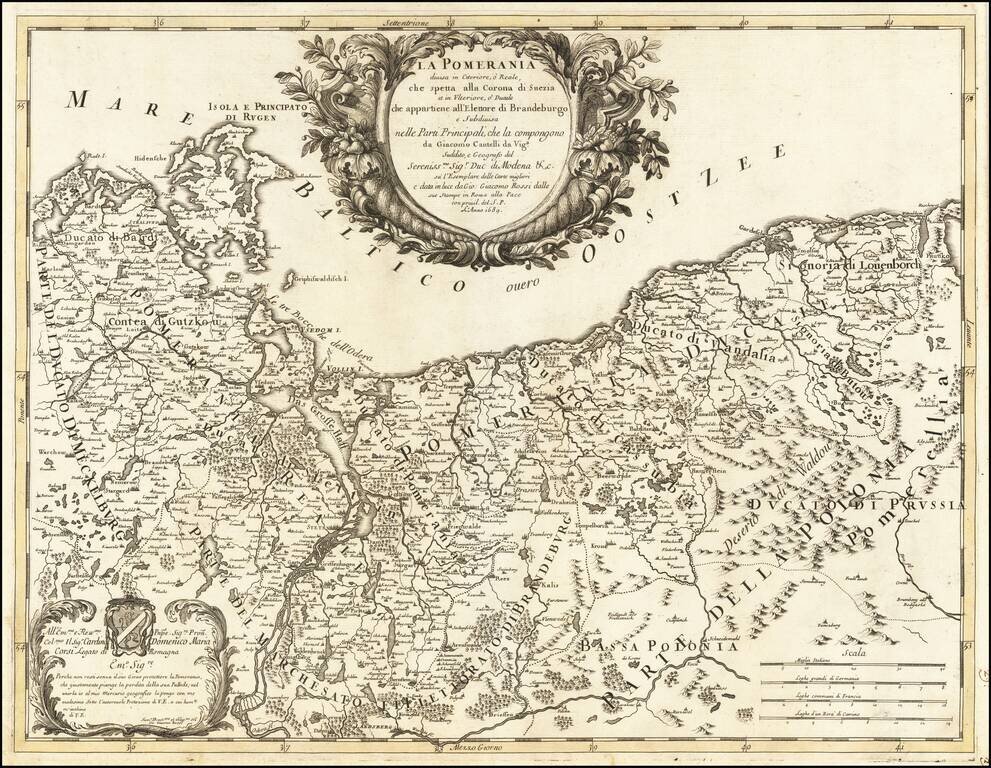
"Why would you not live without your joyous protector, O Pomerania, region that justly mourns the loss of its Palatine?" A scarce map of Pomerania, stretching along the coast from present-day eastern Germany to the outskirts of Gdansk in modern...
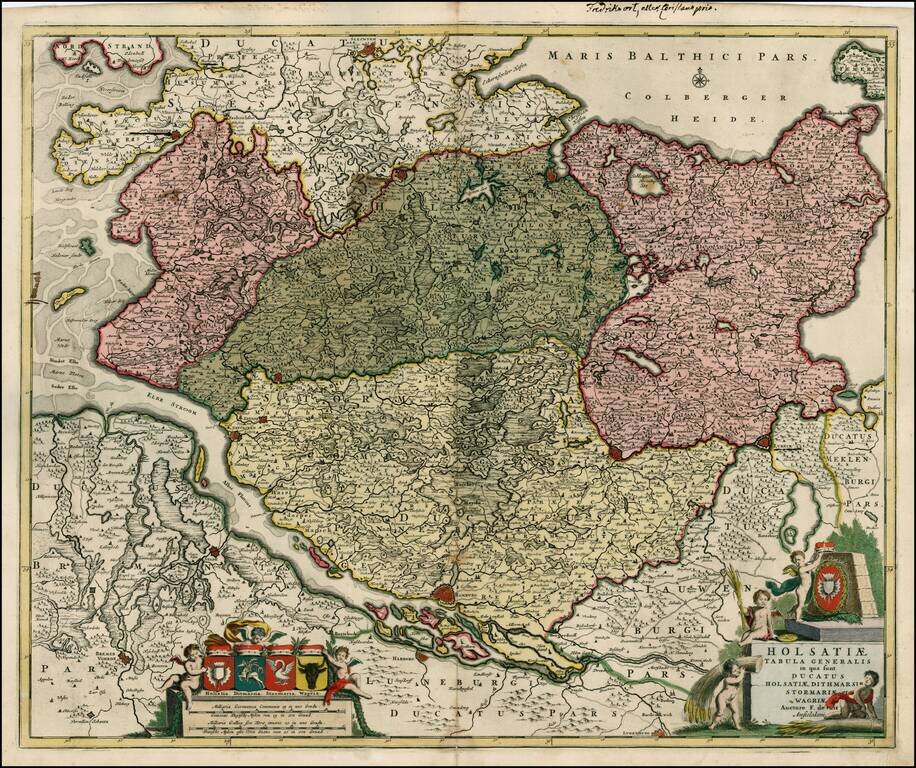
Striking large map, centered on the Hamburg region, showing towns roads, rivers, lakes, islands, etc. Extends north to Sleswygh and east to Lubeck. Large decorative cartouche with a large coat of arms and smaller coats of arms at the top, for each of...
Interesting map of the Holy Roman Empire, including Germany, Poland, Lithuania, the Low Countries, Austria, Hungary, etc. From Cluverius' Introductio in Universam Geographiam (first issued in 1629) and re-issued many times over the next 100 years,...
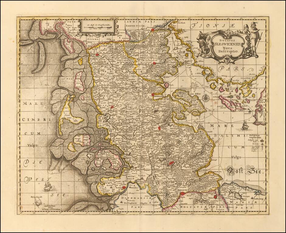
Nice example of Valk & Schenk's detailed map of the Schleiswig-Holstein region, published in Amsteram. Extends from Tonningen, Rendsberg and Kiell in the south to Colding, Rypen and Hadersleben in the north. Other larger towns include Sleswich,...
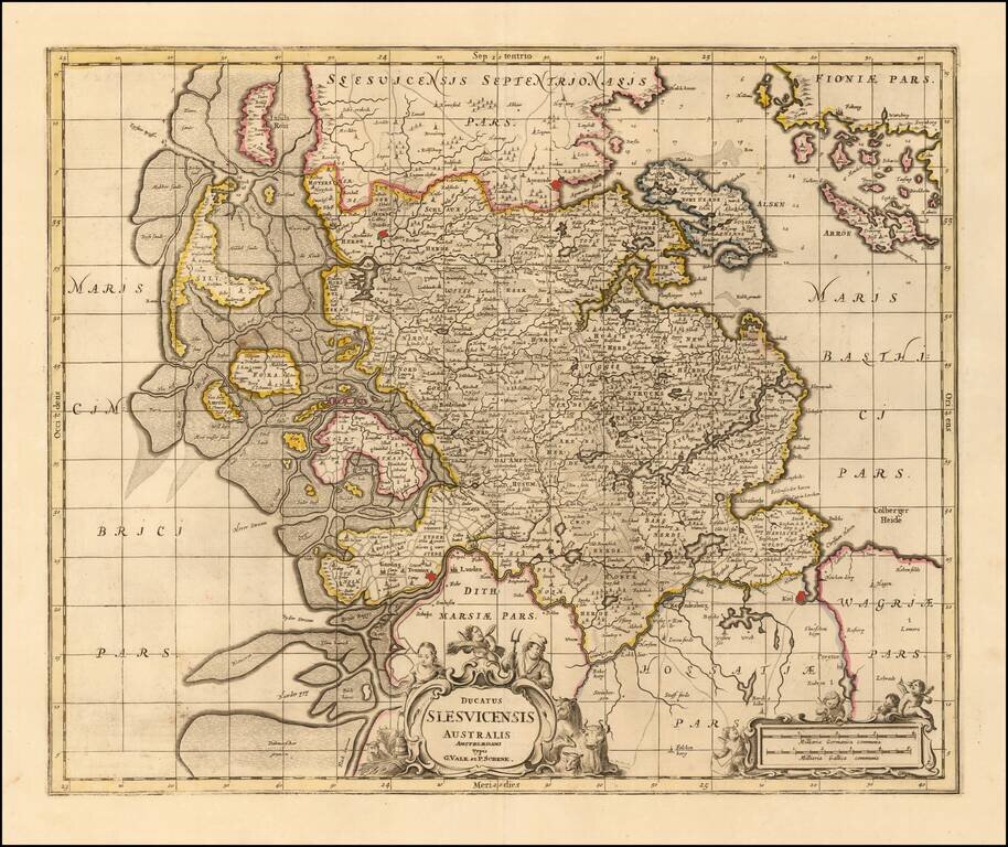
Nice example of Valk & Schenk's detailed map of the Southern part of Schleiswig, published in Amsterdam. Extends from Tonning and Kiell in the south to Tonder and Apenrade in the north. Other larger towns include Sleswich. The detailed depiction...
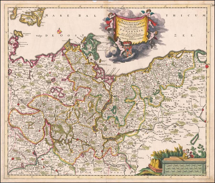
Fine old color example of Theodore Danckerts rare map the Brandenburg and Pomerania regions, published in Amsterdam. Extends east to Dantzig (Gdansk) and Chelm in Poland, to Donneberg and Magdeburg in the west. Cartouches depict coat of arms...
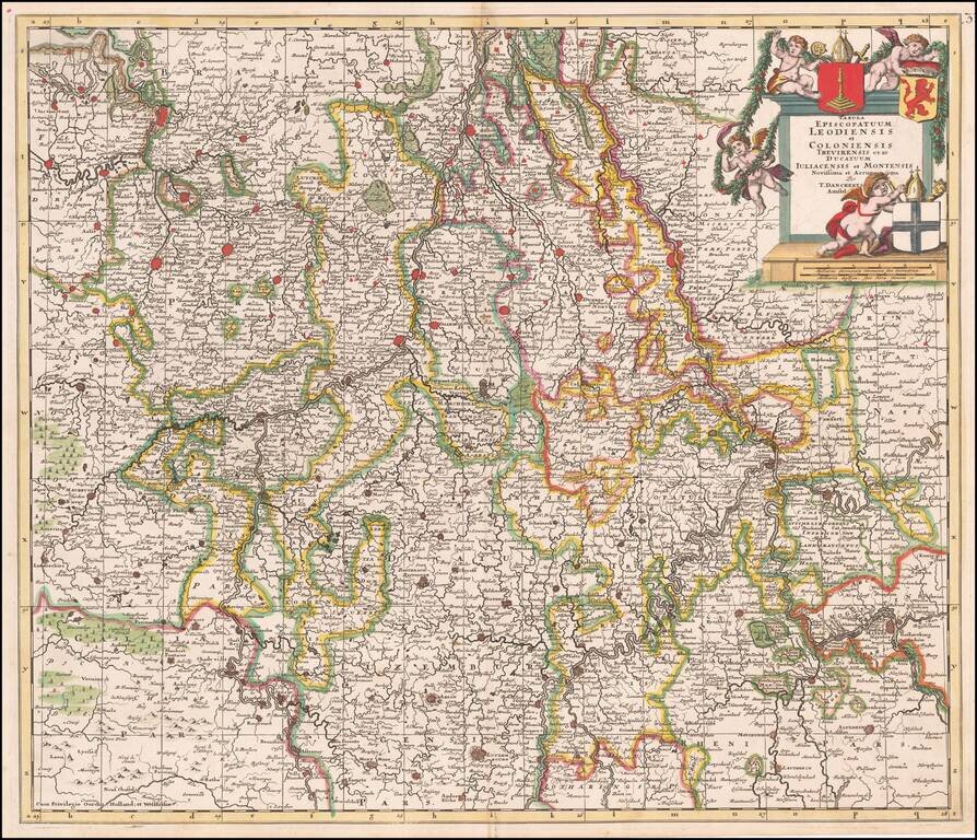
Fine old color example of Theodore Danckert's rare map of the area of the Lower Rhine and Maas Rivers. Major towns on the map include Cologne, Aachen, Bonn, Brussels, Antwerp, Liege, Ghent, Louven, Mechelen, Maastricht, Roermonde, Trier, Coblentz,...
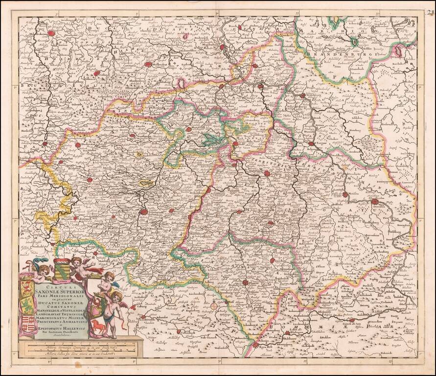
Fine old color map of parts of northcentral and eastern Germany, published by Justus Danckerts. Large cities on the map include: Erfurt Hall Leipzig Dresden Mansfeld Wittenburg Halberstat Magdeburg Mulhausen
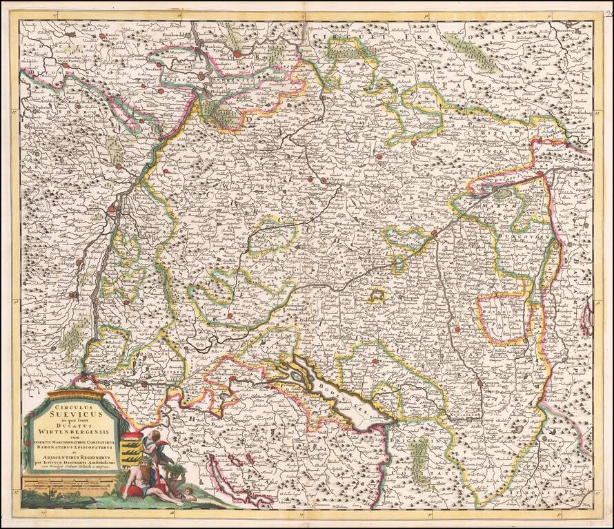
Antique Map of Souabia and Environs Detailed early map of Souabia.
![Hanc Ger[maniae et P]oloniae de[s ... ]em Serenissim [P]otentissimi Poloniae Regi August offert et inscribit Petrus Schenck](/map/small/64898.jpg)
With Portrait of the King of Poland and Lithuania Large engraved antique map of Poland, Lithuania and the Holy Roman Empire, by one of Amsterdam's most important mapmakers, Peter Schenk. The map includes a portrait of King Augustus II the Strong,...