
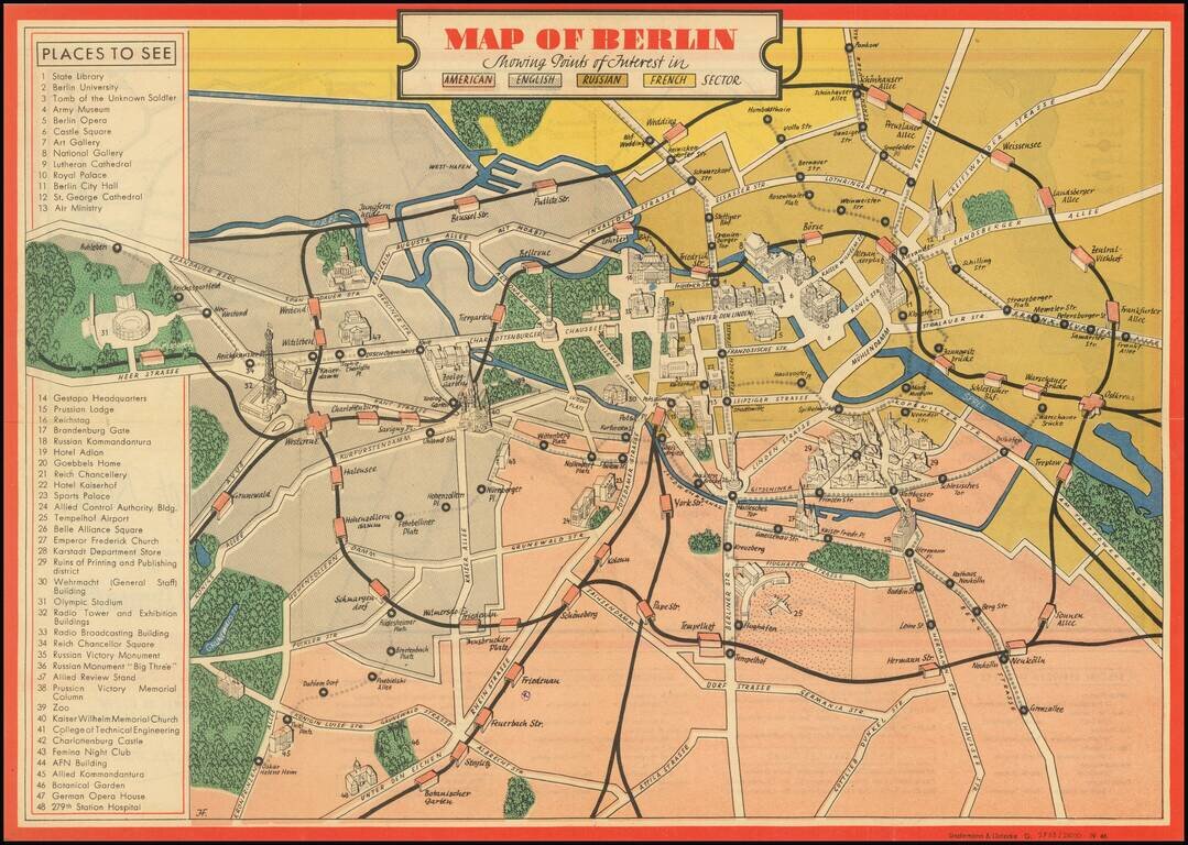
An attractive vintage pictorial map of Berlin during the earliest days of Allied occupation, preserving a rare view of the city prior to the building of the Berlin Wall. The front of the work depicts the heart of Berlin and its surroundings, stretching...
![[Battle of Berlin] План г. Берлин 1:25000](/map/small/68524.jpg)
"The Victory Map". The Official Soviet Map Used in the Battle of Berlin, April 1945. This is a color-printed folding map of Berlin, issued by the Soviet Union in 1945, shortly before the Fall of Berlin. Many examples of this map were used by...
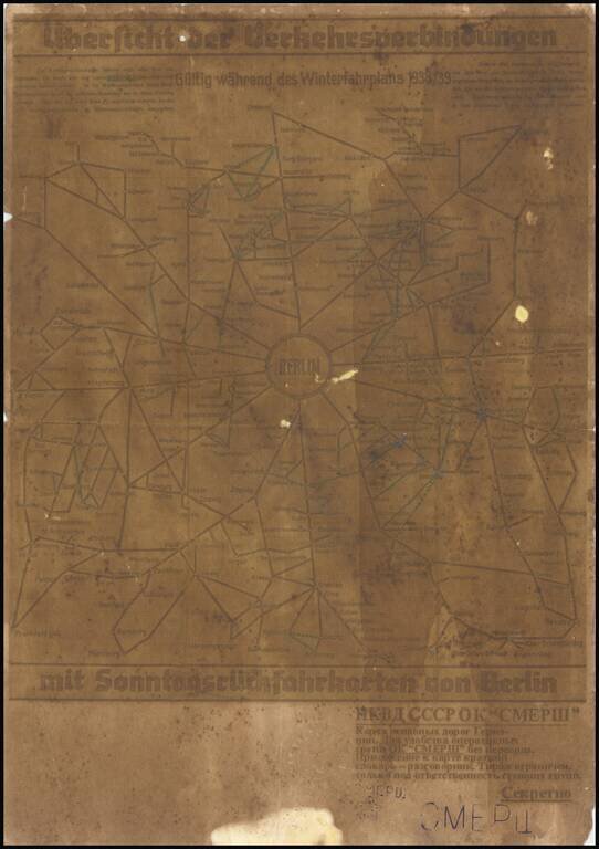
A fascinating relic of mapmaking on the Eastern Front of World War II, being a field-printed map of Berlin and the surrounding area produced for one of the most infamous groups involved in the Second World War, the Отдел Контрразведки...
![[Pan American Airways Advertising Map -- Occupied Germany] Reise-Und Transport Verkehrskarte von Deutschland Mit Strassen- Und Eisenbahnmetz Zonen - Und Landergrenzen](/map/small/67100.jpg)
Promoting Pan American World Airways This colorful and attractive map depicts Germany and Central Europe in the immediate wake of World War II. The Allied Powers (United States of America, France, United Kingdom, and the Soviet Union) met at the...
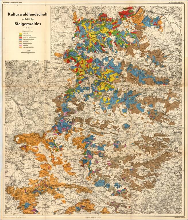
Cultural forest landscape in the Steigerwald of Germany, between Wurzberg and Nuremberg The map is color coded to show the predominant trees in each region.

Attractive print showing the hiking trails around Nesselwang and Wertarch in the Allagäu region of Swabian Bavaria. The area is shown from an aerial viewpoint, and was likely based off early aerial photographs. The region is one of the most...
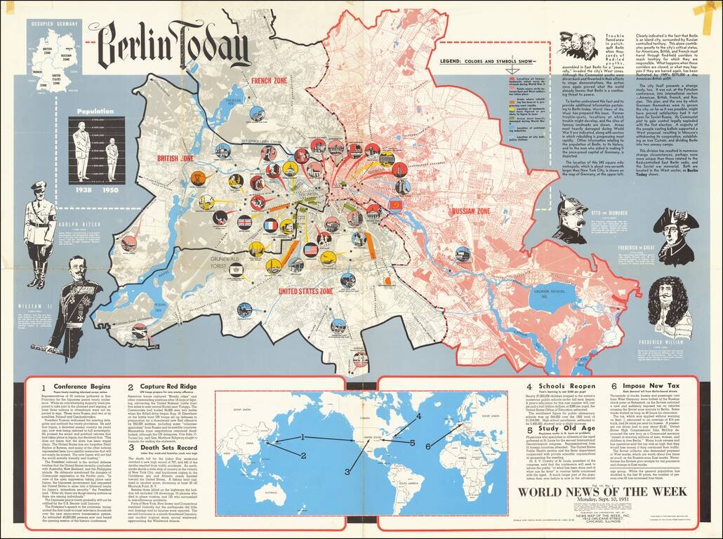
This is a detailed map of Greater Berlin, divided into its four occupied zones. Made at a time when the Cold War was at one of its many peaks, some recent conflicts had led to renewed public interest in the city, which had been the subject of its...
![Beverly Hills Farmer's Almanack Map Part One [and] Beverly Hills Farmer's Almanack Map Part Two](/map/small/64161jc.jpg)
"A Compilation of Fashionable Merchants Serving The Beautiful People" Whimsical promotional map of Beverly Hills, which appeared in the 1974 Beverly Hills Farmer's Almanack. Two marvelous whimsical maps of Beverly Hills, surrounded by advertising and...
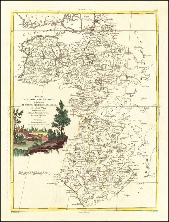
Antique engraved map of the Duchies of Livonia and Estonia, and the Governments of Novgorod, Belgorod, and Kiev. The map was published by Antonio Zatta in Venice in 1782.
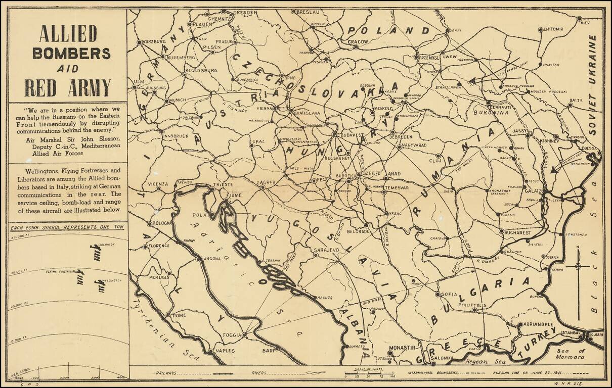
Anti-Nazi Propaganda Broadside Published in the British Empire Fascinating WWII broadside propaganda map, published in India, in order to keep the local populous informed about the War. The map provides a graphic overview of the Allied bombing...
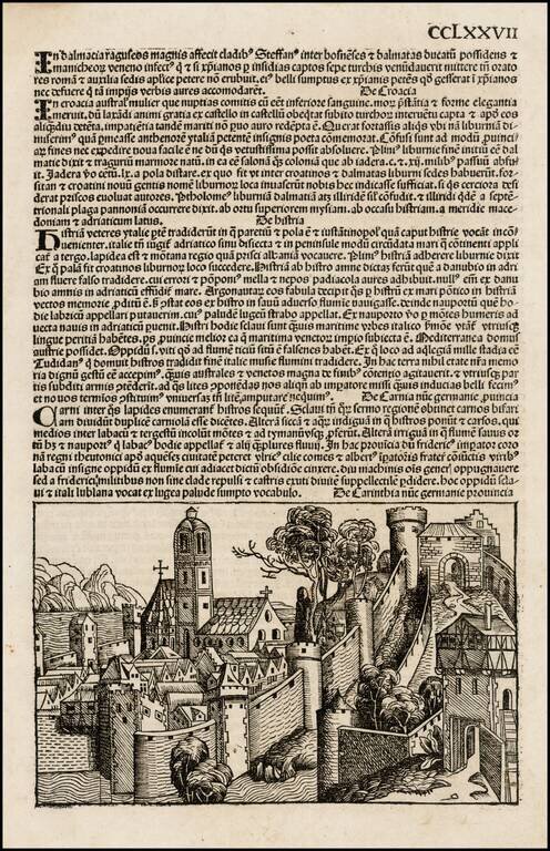
Nice example of Schedel's mythical view of the City of Carinthia, published in 1493. Hartmann Schedel's Liber Chronicarum: Das Buch der Croniken und Geschichten (commonly referred to as the Nuremberg Chronicle, based upon the city of its publication),...
Nice example of Schedel's mythical view of the City of Carinthia, published in 1493. Hartmann Schedel's Liber Chronicarum: Das Buch der Croniken und Geschichten (commonly referred to as the Nuremberg Chronicle, based upon the city of its publication),...
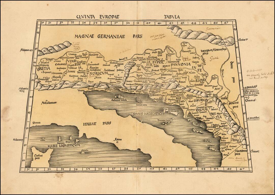
Nice example of Martin Waldseemuller's map of the region between the Danube River and the Adriatic Sea from the 1513 edition of Waldseemuller's Geographia. The map extends from Italy and the Adriatic Sea in the South to Austria, Croatia, Slovenia,...
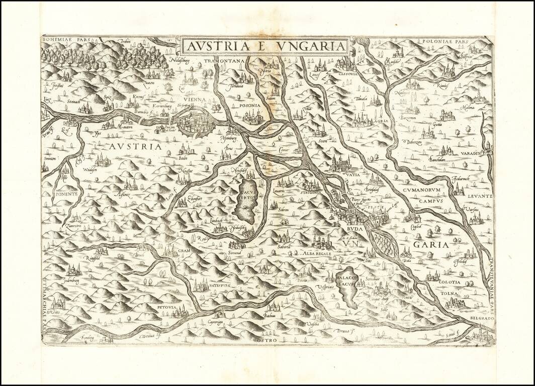
First State of Lafreri's Rare Map of Austria & Hungary Rare of the Austria and Hungary, published in Rome by Antonio Lafreri. The present map is among the earliest obtainable modern maps of Austria and Hungary. Based upon an early map engraved...
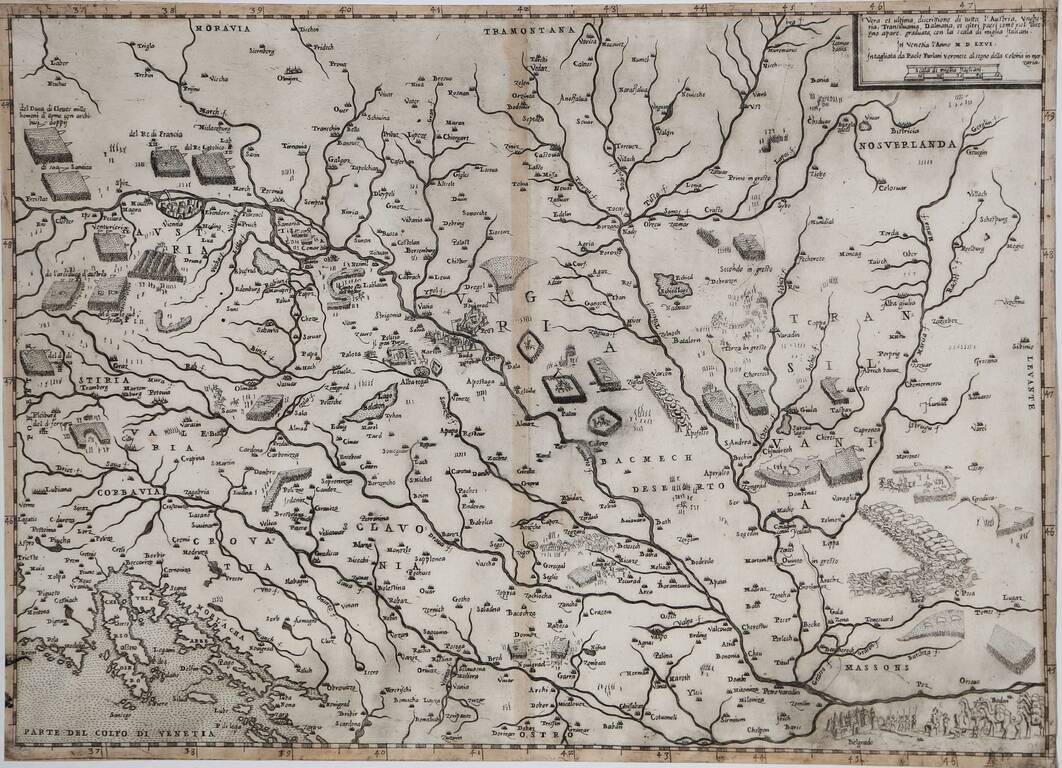
Rare Early Lafreri School Map of Hungary, Austria and the Balkans Region Nice example of Paolo Forlani's rare map of Austria, Hungary, Transylvania and adjacent regions. The map depicts the military activities in the region, between the...
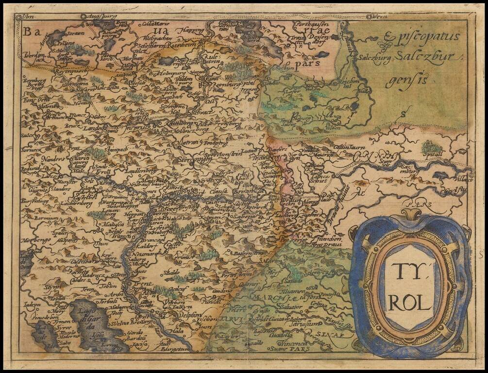
Rare modern map of the Tyrol region, extending from Lago di Garda and Vincenzo in the south to Innsburck, Kitzbuel and Villach in the north, published in Cologne by Johannes Metellus in 1579 in fine original color. The map is one of the earliest...