
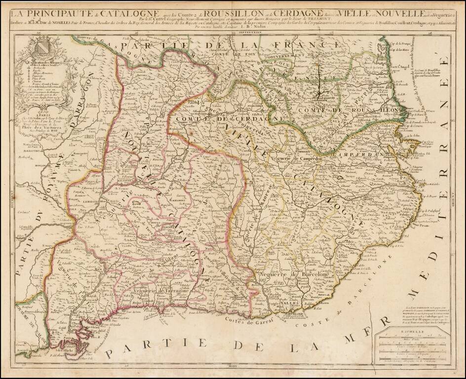
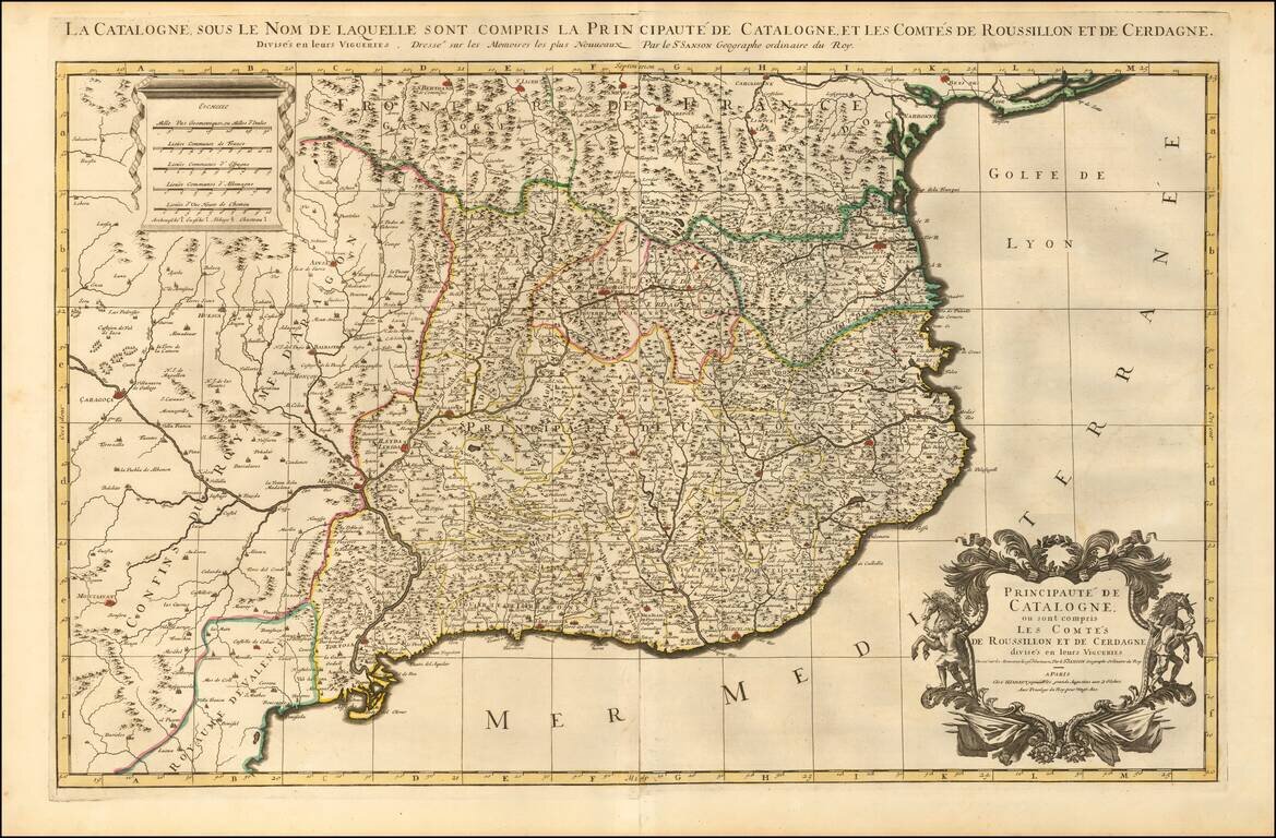
Detailed 17th Century map of Catalonia and Roussillon, by Jean-Baptiste Nolin, based upon an early map by Cantelli, which was thereafter revised by Tillemont. The map is finely detailed, showing towns, roads, rivers, mountains, lakes, cities, bays,...
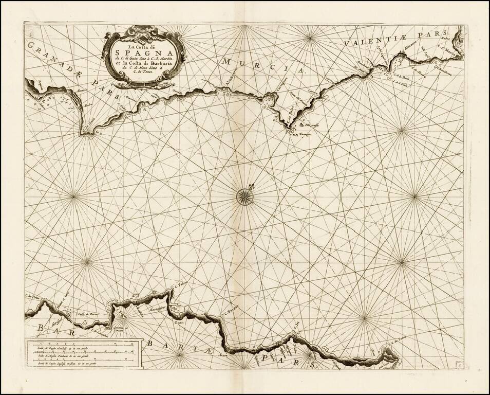
Fine chart of the Mediterranean coastline of part of Spain and North Africa, which appeared in Volume 1 of Coronelli's Corso Geographico, published in Venice. The chart covers the coast of Granada, Murcia, and Valencia, along with the contiguous...
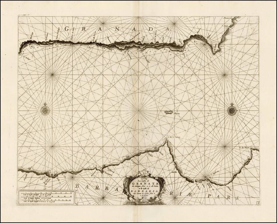
Fine chart of the Mediterranean coastline of part of Granada and North Africa, which appeared in Volume 1 of Coronelli's Corso Geographico, published in Venice. The chart covers the coast of Granada, from Malaga to Carboneras and the contiguous...
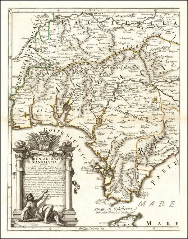
Western sheet of the Cantelli-Rossi map of Andalucia and Granata, based upon the work of Cantelli da Vignola and engraved by Aubrey Barbey, who apparently engraved a number of maps for Rossi. The map shows most of Andalucia and includes the...
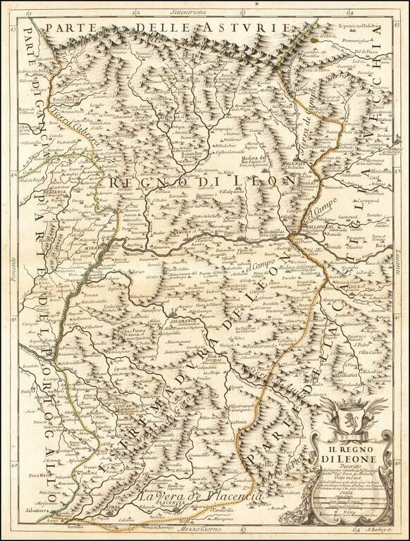
Antique engraved map of part of the Spanish region of Asturias, published by Giacomo and Domenico de Rossi in their Mercurio Geografico in Rome in 1696. The cartouche at the lower right aptly features the Leonese coat of arms with a rampant lion. The...

Antique engraved map of the Kingdom of Aragon. The map was published in Rome in 1696 by Giacomo Cantelli da Vignola and Giacomo Giovanni Rossi. The map shows the Aragon region in northeast Spain, roughly centered on Zaragosa ("Saragoza"). The map...
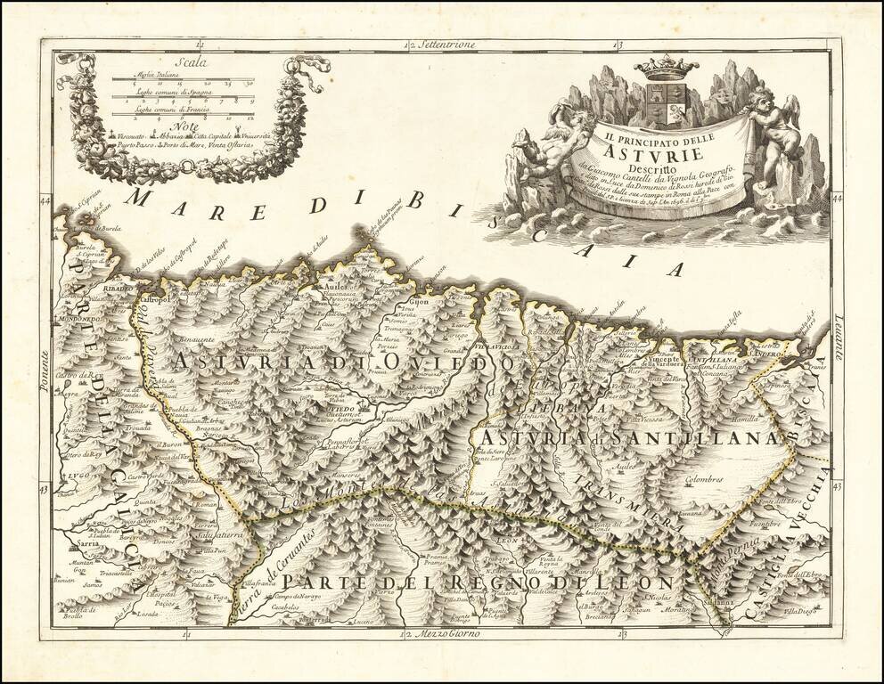
Finely engraved map of the Principality of Asturias on the northern Spanish coastline, based upon the work of Cantelli da Vignola and engraved by Aubrey Barbey, who apparently engraved a number of maps for Rossi. Divided into Asturia di Oviedo and...
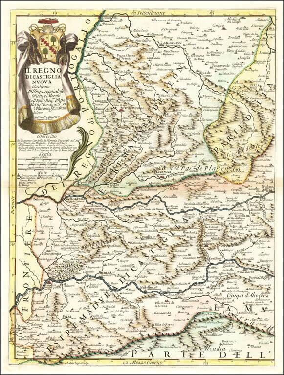
Antique engraved map of the Kingdom of New Castille. The map was published in Rome in 1696 by Giacomo Cantelli da Vignola and Giacomo Giovanni Rossi. The map is centered on The Tagus or Tajo River and includes Badajoz, Alcantara, Plancencia, and...
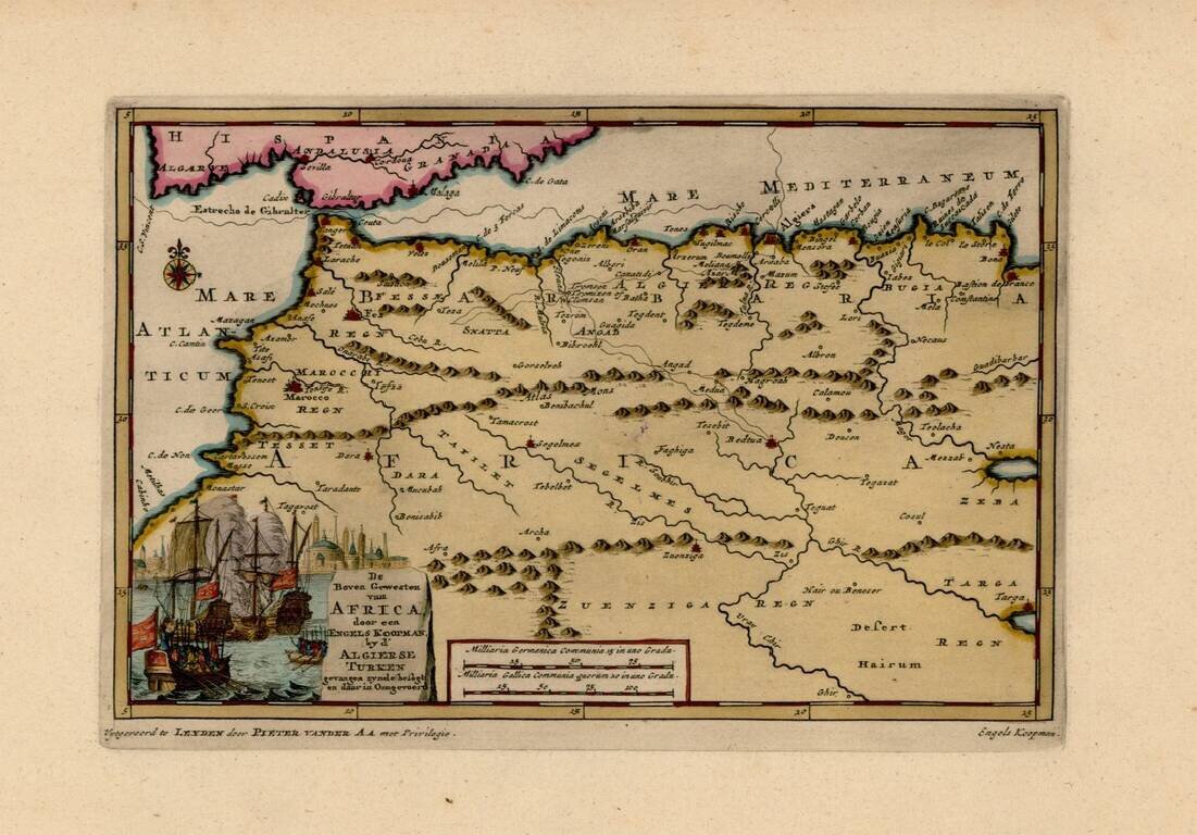
Interesting map of the Western Mediterranean and contiguous parts of Spain and North Africa, showing the tracks of Engels Koopman in 1648. The map offered here was used by Vander Aa to illustrate a Dutch Translation of Koopman's travels in the region...
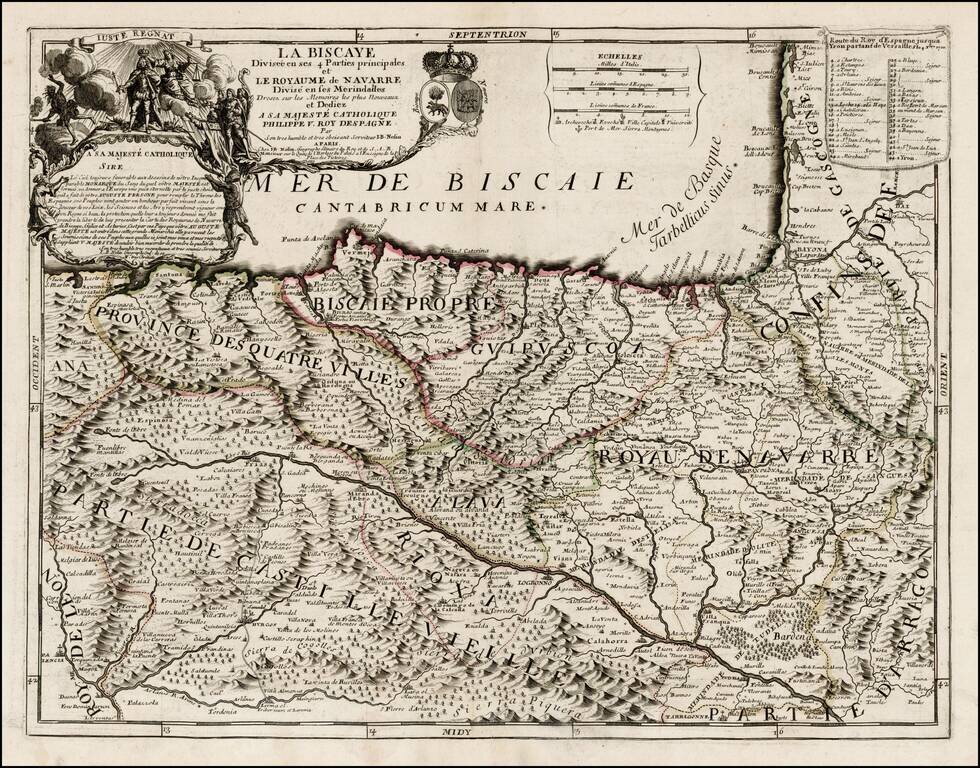
First state of this rare map of Biscaya and Navarra, likely offered originally as a separately issued map and primarily bound into composite atlases of the period. Includes a striking dedication cartouche to Philip V of Spain, with the young King shown...
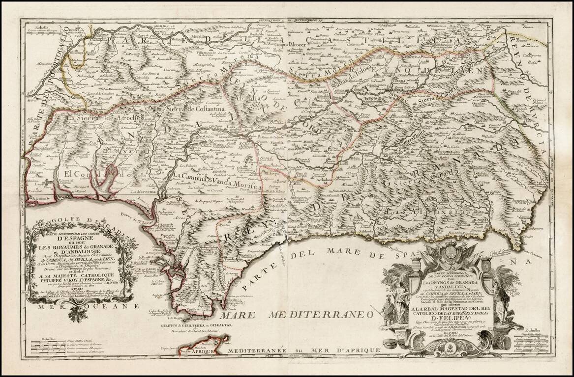
First edition of Nolin's rare 2 sheet map of southern Spain, published in Paris. Two title cartouches, with titles in French and Spanish, coats of arms, etc. Includes fantastic topographical detail. Later editions were issued until about 1760.
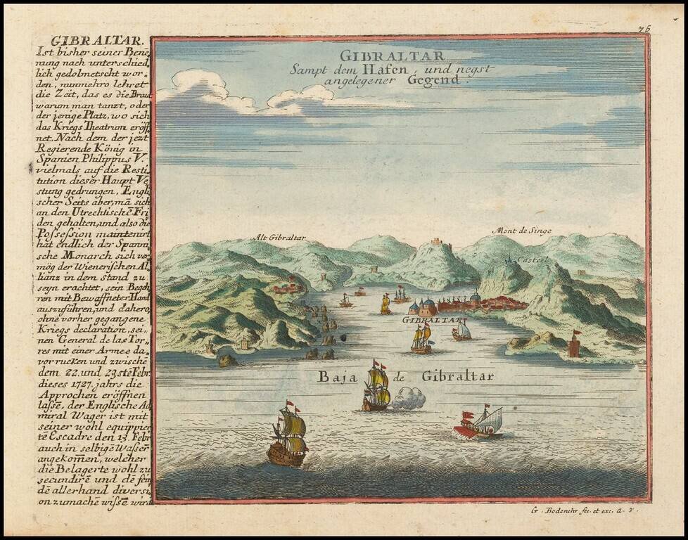
Detailed view and plan of the the Harbor and Fortifications at Gibraltar, published by Gabriel Bodenehr.
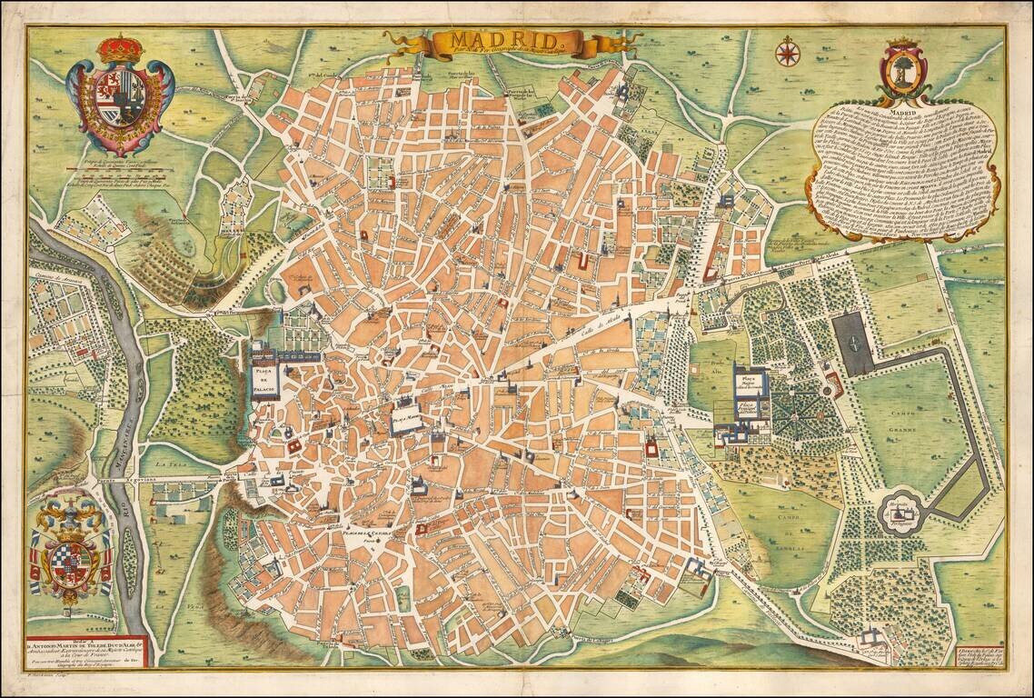
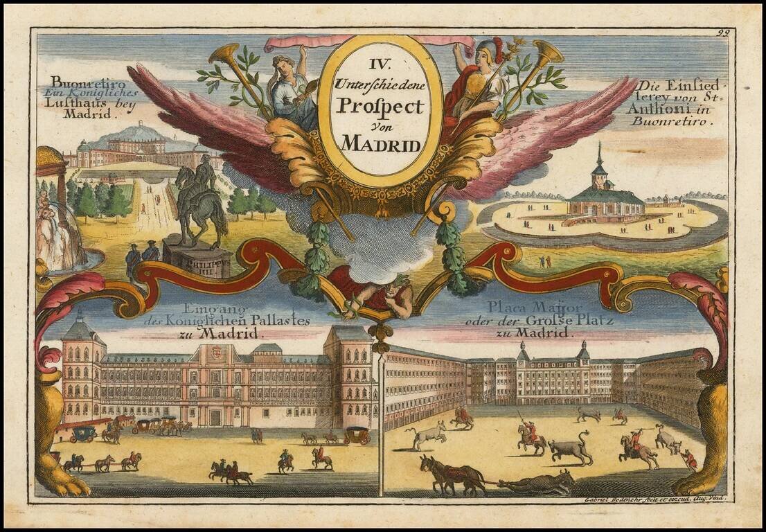
Rare first edition of Nicolas De Fer's plan of Madrid, with a key showing 26 places of interest. Early 18th Century plans of Madrid are relatively uncommon. Nice dark impression. From the first edition of De Fer's Atlas Curieux.
Striking large and highly detailed map of Catalonia, with a large decorative cartouche and a scale of distance. In addition, there are 4 separate sheets, each with an accompanying set 8 town plans and birdseye views, including Roussilon, Perpignan...
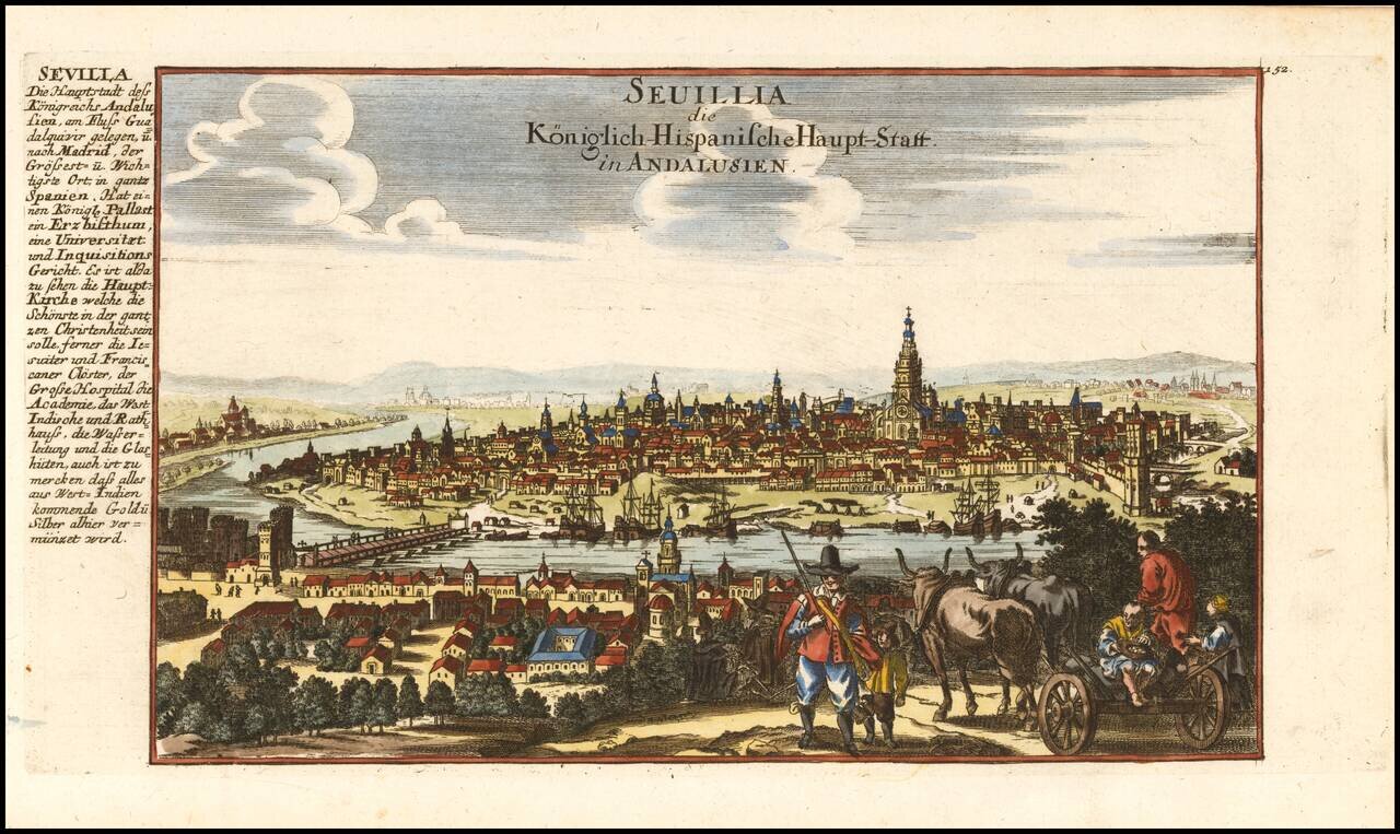
Decorative view of the city of Sevilla in Andalucia, published by Gabriel Bodenehr.