
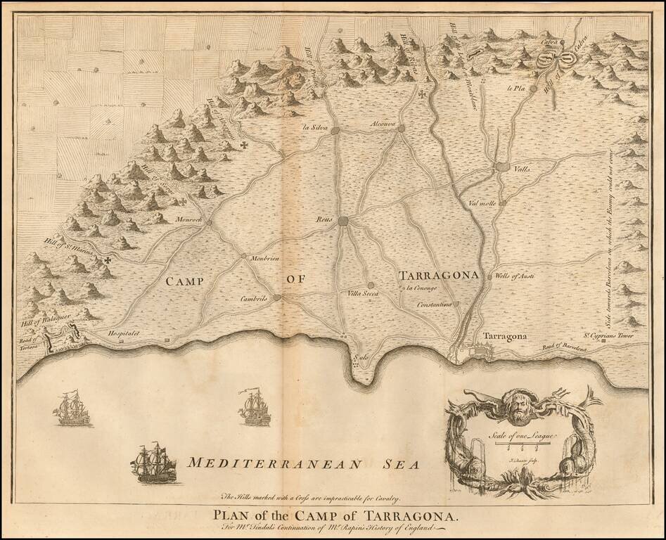
Fine map of the area around Tarragona, in Spain, during the War of the Spanish Succession, from Rapin & Tindall's History of England. The War was an attempt by the joint Anglo-Dutch forces under Admiral Rooke to capture a Spanish treasure fleet...
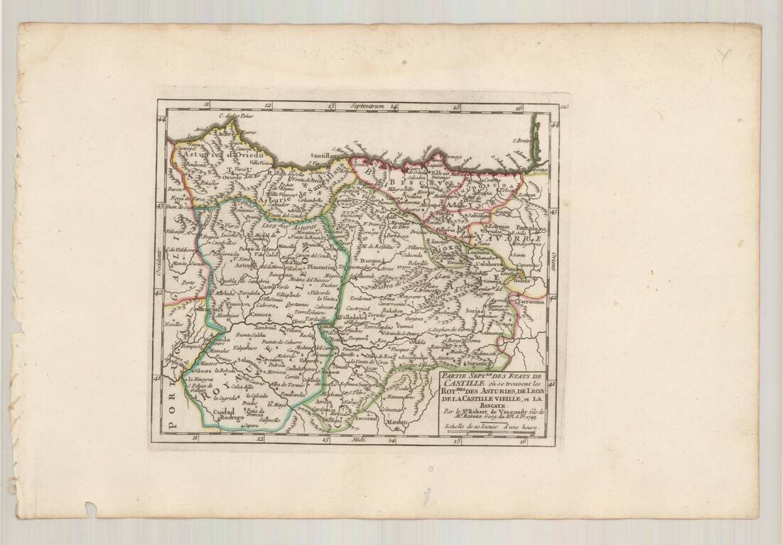
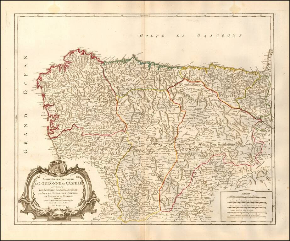
Detailed map of the Castille and the Kingdoms of Asturias, Leon, Old Castille and Biscaya, from De Vaugondy's Atlas Portatif.
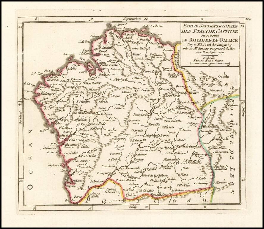
Detailed map of Galicia, published in Paris by the Robert de Vaugondy family of mapmakers.
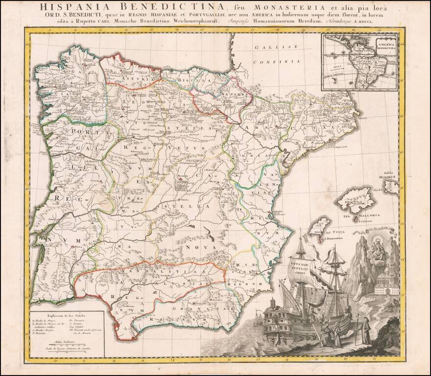
Interesting and highly decorative map of Spain and Portugal, with a large inset of Central and South America. The map illustrates the various Benedictine Monasteries on the Iberian Peninsula and in South America.
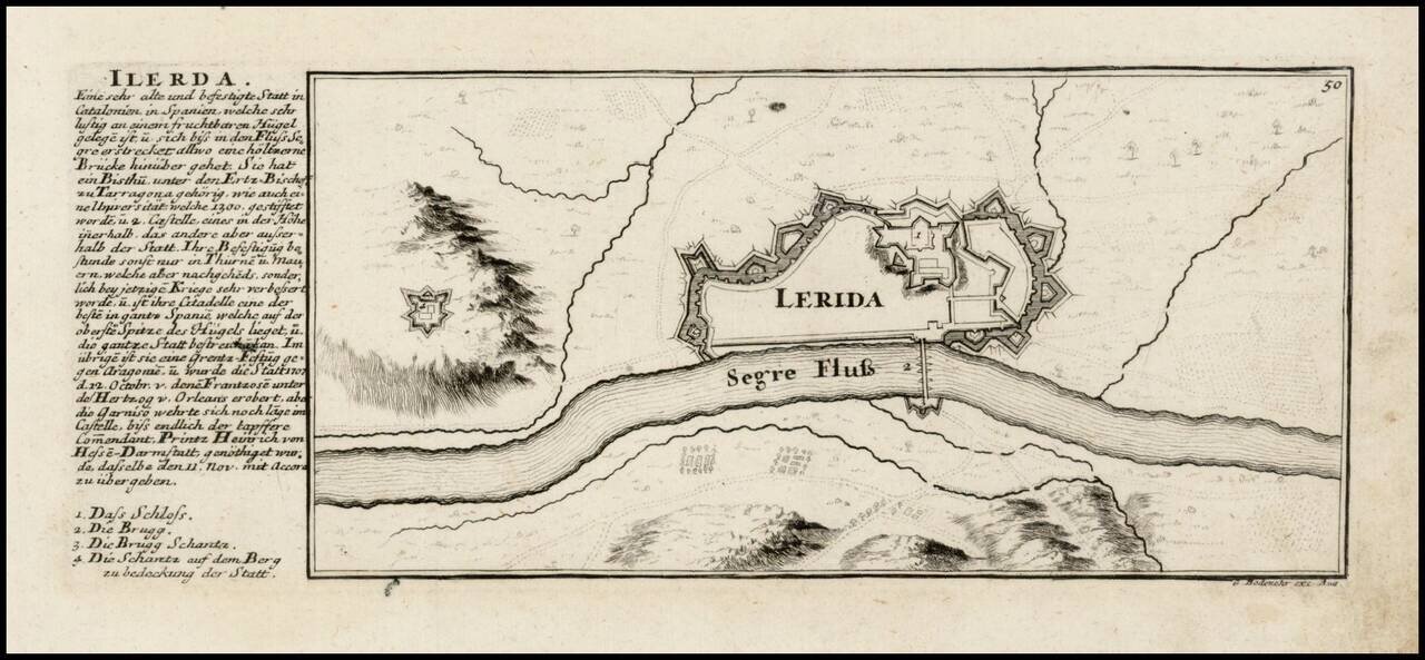
Plan of the fortifications of Lerida on the Serge River, with text at the left side with a text about the city and a legend, published in Bodenehr's Curioses Staats und Kriegs Theatrum. The Bodenehr family of engravers and publishers of Augsburg began...
Decorative and highly detailed map of Northwestern Spain, including Biscaya, Gallicia, Leon, Asturias, Old Castille, and New Castille. A finely detailed map, with decorative cartouche.
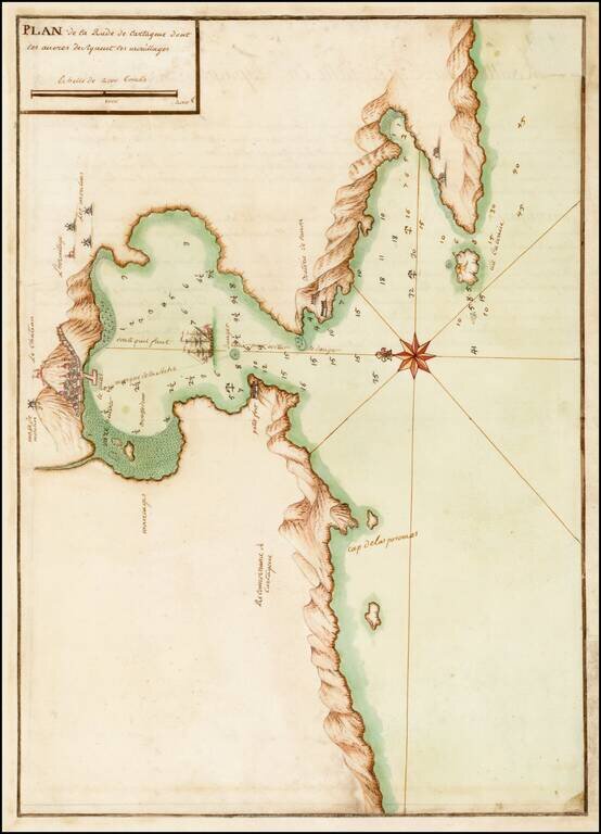
Fine early manuscript map of the Harbor at Cartagena, prepared by an skilled French mapmaker. Although anonymous, the level of detail and beauty force the belief of it having been made by a skillful artist; French sailors made the map, possibly after...
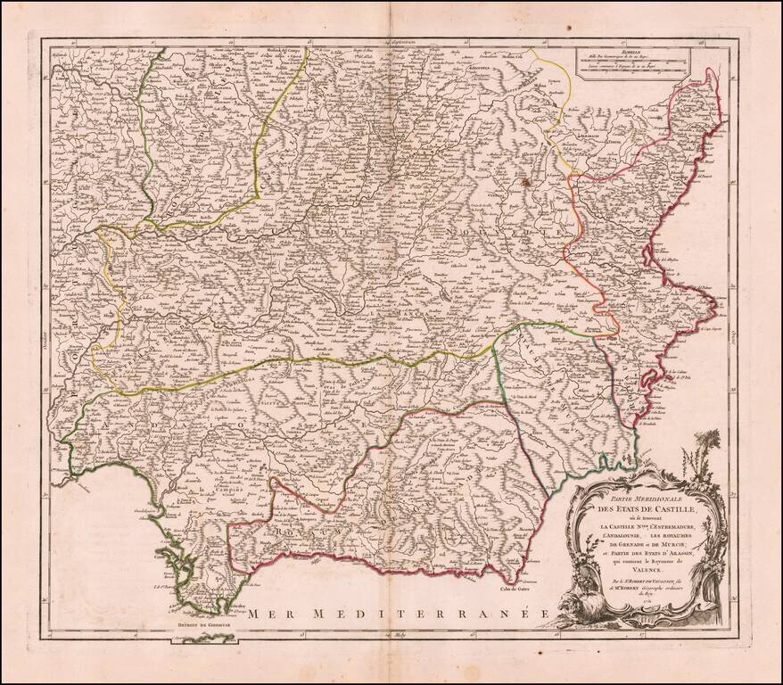
Decorative and highly detailed map of Southwestern Spain and including a decorative cartouche.
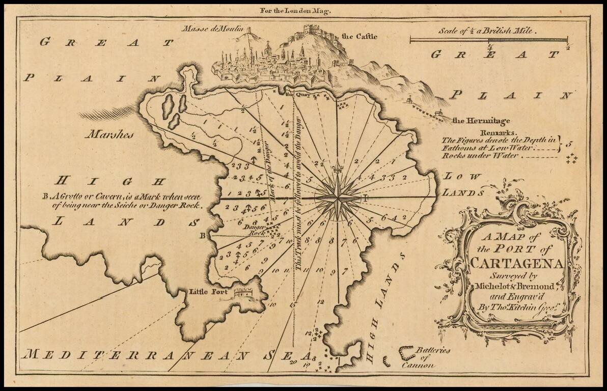
Detailed map of the port of Cartagena, Spain, published in the London Magazine. Cartagena was, at the time, one of the most important ports for the Spanish Royal Navy.
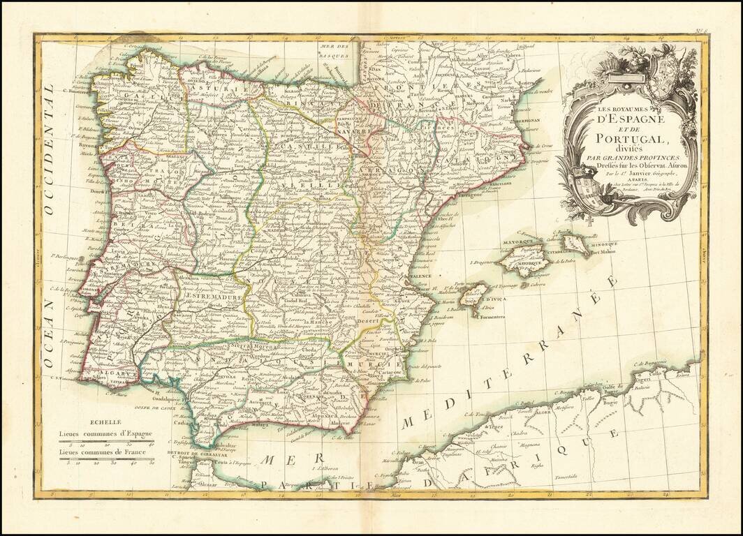
Attractive map of the Iberian Peninsula, colored by province in outline color. Includes the Balearic Islands. Shows towns, rivers, lakes, islands, mountains, etc. Large decorative cartouche.
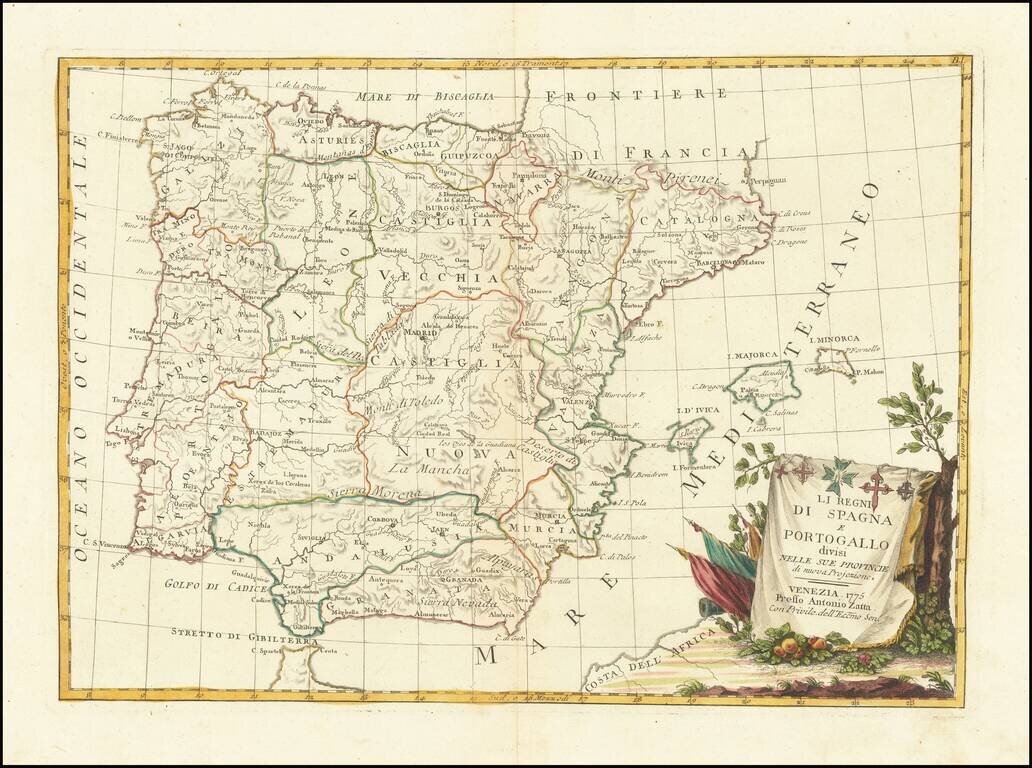
Detailed map of the Iberian Peninsula, published in Venice by Zatta. Very interesting early map, with nice detail. Decorative title cartouche. From Zatta's monumental Altante Novissimo, one of the last great decorative atlases of the 18th Century.
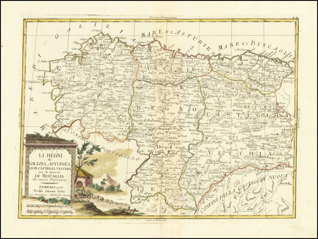
Detailed map of northern Spain, from the Basque Region to Galicia. Very interesting early map, with nice detail. Decorative title cartouche. From Zatta's monumental Altante Novissimo, one of the last great decorative atlases of the 18th Century.
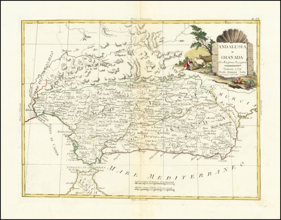
Detailed map of Granada and Andalucia. Very interesting early map, with nice detail. Decorative title cartouche. From Zatta's monumental Altante Novissimo, one of the last great decorative atlases of the 18th Century.
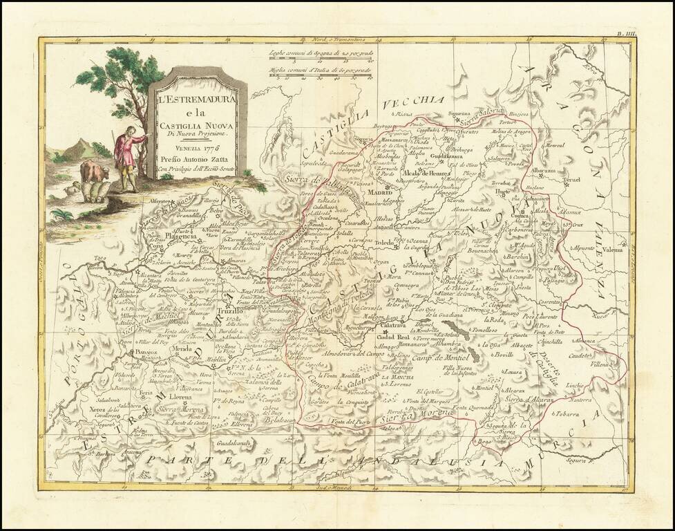
Detailed map of Castille and Extremadura, published by Zatta in Venice. Major Cities include Madrid, Toledo, Ciudad Real, Getafe, Palsencia, Badajoz, Caceres and Merida. Very interesting early map, with nice detail. Decorative title cartouche. From...
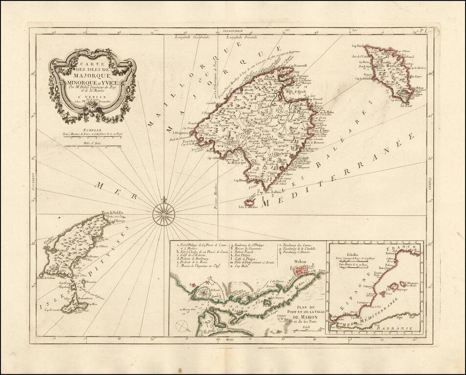
Nice example of the Paolo Santini edition of Nicolas Bellin's map of the Balearic Islands. Includes a map of Mahon Harbour and the position of the islands against the coast of Spain. A fine highly detailed map of Majorca, Menorca and Ibiza.
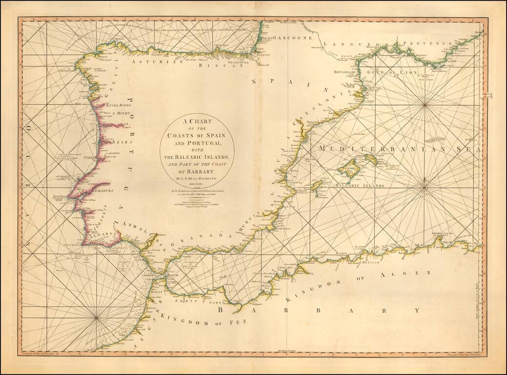
Detailed sea chart of the Balearic Islands, Spain, and Portugal. The chart extends to Provence and much of the Barbary coast to Bona. Good detail along coastal areas including the Straits of Gibraltar.