
![Hispanicae Regionis Nova Descriptio [Spain & Portugal]](/map/small/58846.jpg)
The first state of Munster's map of the Iberian Peninsula, one of the earliest obtainable maps of Spain and Portugal. The map shows cities, rivers, mountain ranges, the Balleric Islands and other details. The map is unchanged from the 1540 edition....
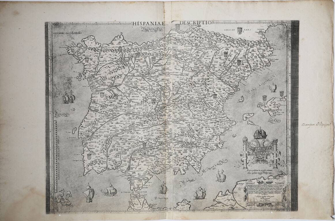
First State of Luchini's Map of Spain A magnificent example of the first state, of three. The map of the Iberian Peninsula by Vincenzo Luchini, based on the Virko Paletin model. The map is a faithful copy of the "Nova Hispania Descriptio" by...
![Burgos celebris et antiqua Hispaniae civiatas, quae Auca, Bravum, Masburgi, Liconiturgis habet [with] Sanct. Sebastianum vulgo Donostien ad mare Oceanum insigne regni Guipuzcoa oppidum](/map/small/60695.jpg)
Nice example of Braun & Hogenberg's views of San Sebastian and Burgos, from Braun & Hogenberg's Civitatus Orbis Terrarum, the most important book of town plans and views published in the 16th Century. The foreground shows various city...
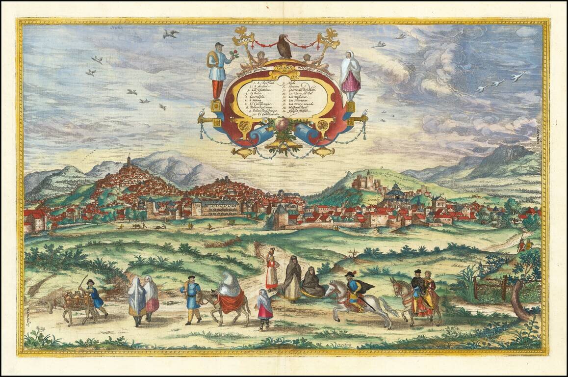
Finely colored example of Braun & Hogenberg's view of Granada, from Braun & Hogenberg's Civitatus Orbis Terrarum, the most important book of town plans and views published in the 16th Century. Fine early view of the Spanish city of Granada as...
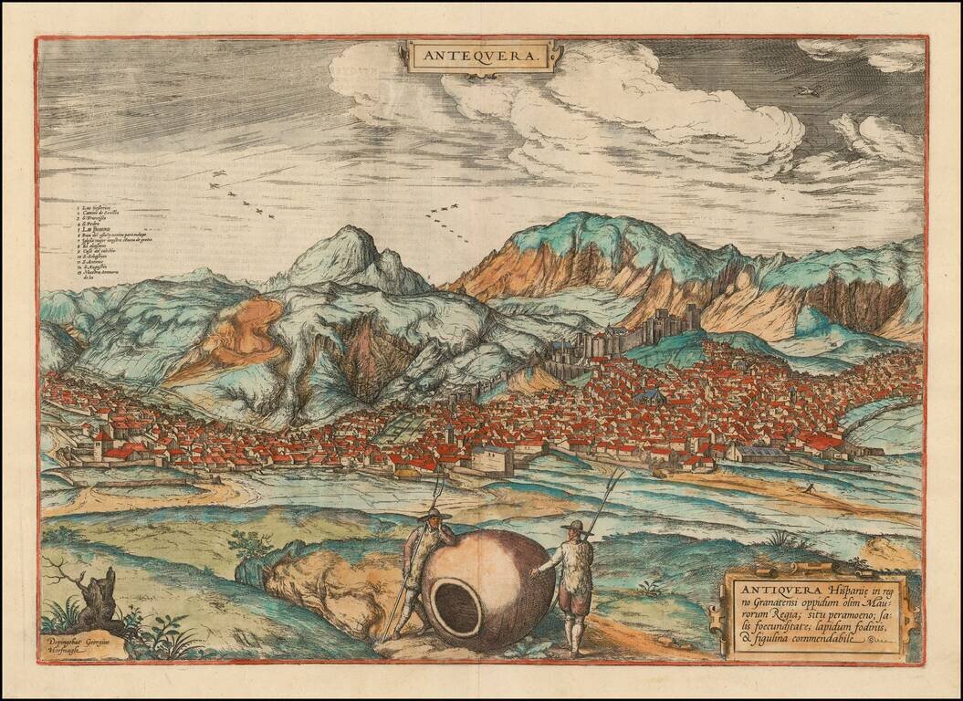
Old color example of Braun & Hogenberg's view of Antiquera, from Braun & Hogenberg's Civitatus Orbis Terrarum, the most important book of town plans and views published in the 16th Century. A fine view of Antequera, with the Sierra de los...
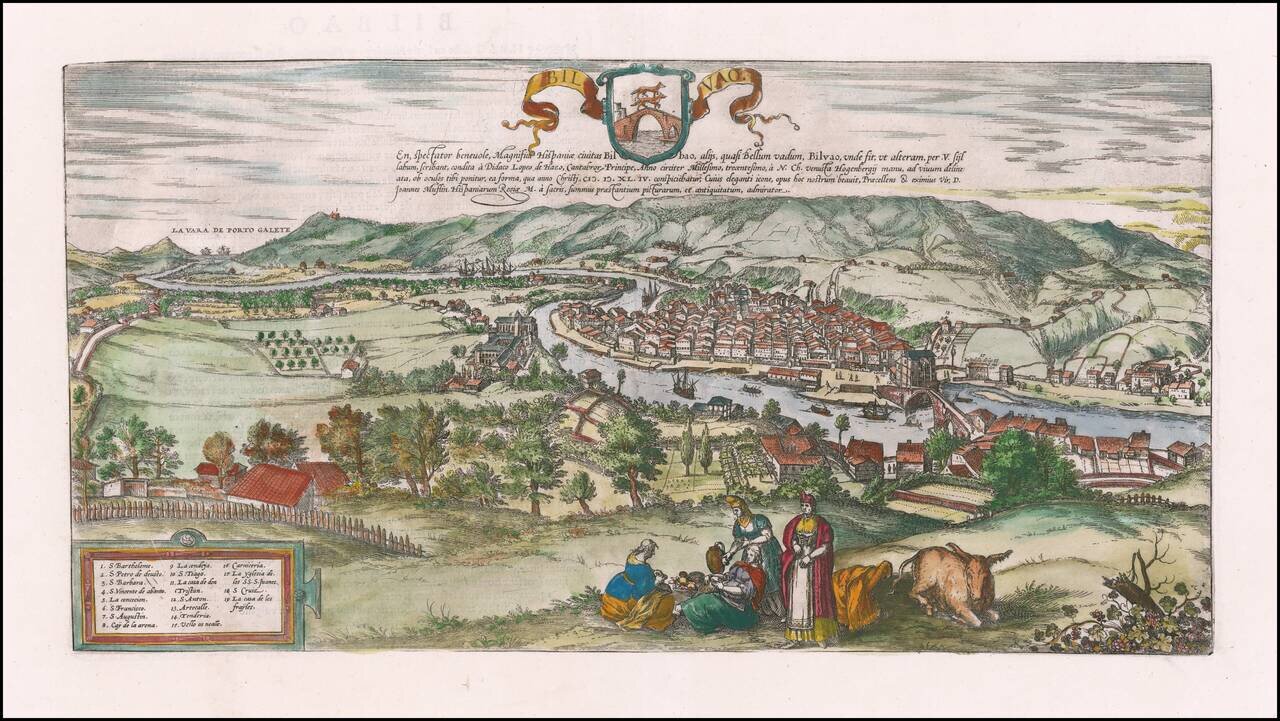
Nice example of Braun & Hogenberg's view of Bilbao. The view shows Bilbao from the southeast; in the distance the town of Portugalete can be seen on the estuary of the Nervion in the Bay of Biscay. Diego López V de Haro founded Bilbao on June 15,...
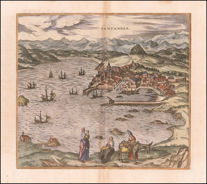
Nice example of Braun & Hogenberg's view of Santander. Santander and its surrounding bay are shown from the northeast. The image is dominated by the harbor, which indicates the importance of this city for trade in the region of Cantabria; after...
![Barcelona [with] Eciia](/map/small/62333.jpg)
Nice example of Braun & Hogenberg's view of Barcelona, with the plan of Eciia below. From Braun & Hogenberg's Civitatus Orbis Terrarum, the most important book of town plans and views published in the 16th Century.
![Toletum . . . [with] Vallisoletum](/map/small/65199.jpg)
Finely colored example of Braun & Hogenberg's view of Toledo and Valladolid. From Braun & Hogenberg's Civitatus Orbis Terrarum, the most important book of town plans and views published in the 16th Century.
![[Basque Coast] Die Zee Custen van Biscaijen tuschen Laredo en Sentillana soe hem dat Selue landt all daer vertthoornt enn opdoet . . . 1583](/map/small/61468.jpg)
Striking full color example of Wagenhaer's map of the northwestern coast of Spain, from Lhanes to Laredo, centered on the Santander Region. Includes 2 sea monsters, 2 sailing ships, a compass rose, and 2 decorative cartouche, soundings, and...
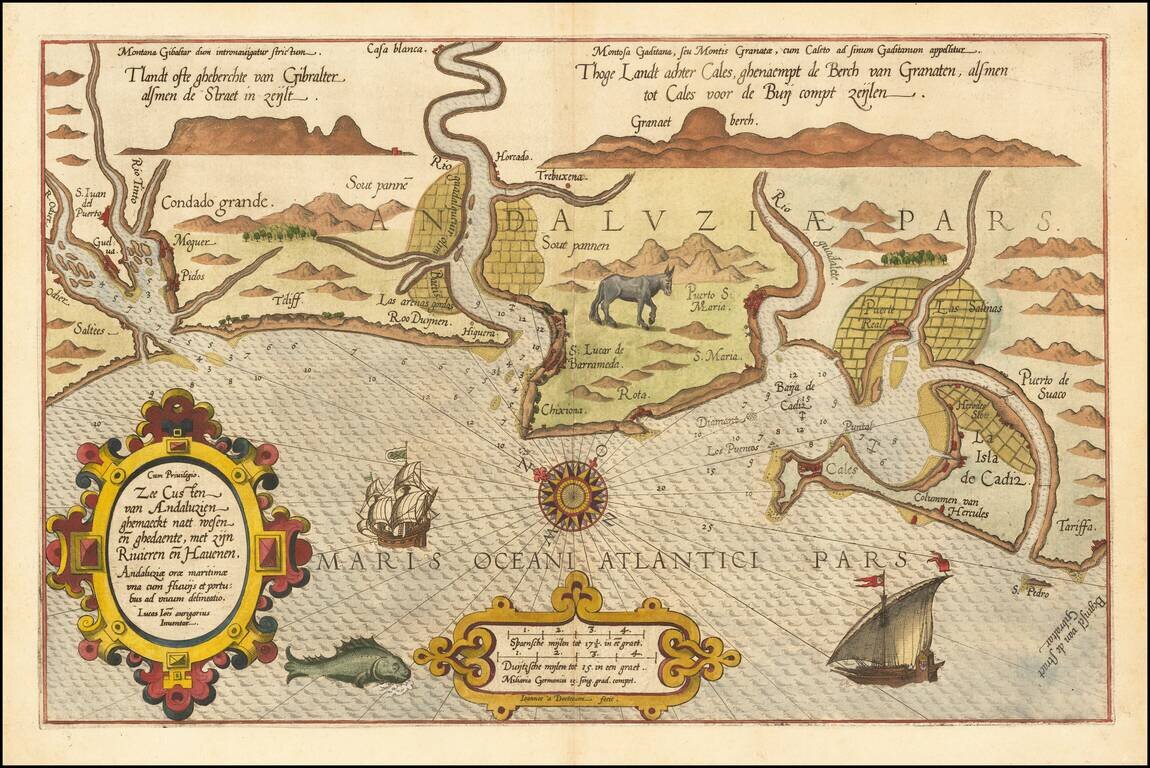
Striking full color example of Wagenhaer's map of the southwestern coast of Spain, including the Bay of Cadiz. Extends inland to Sevilla and south to Cadiz, with northeast at the top of the map. Includes a sea monster, 2 sailing ships, a compass...
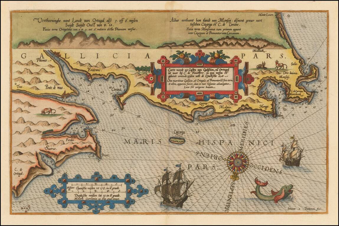
Beautifully hand-colored example of Waghenaer's map of the Galician Coastline, from Cape de Ortegal in the east, to Monte Louro and Cape Finisterre in the west, centered on Coruna, Malpica de Brigantinos and Ferrol. Lucas Waghenaer was a Dutch pilot...
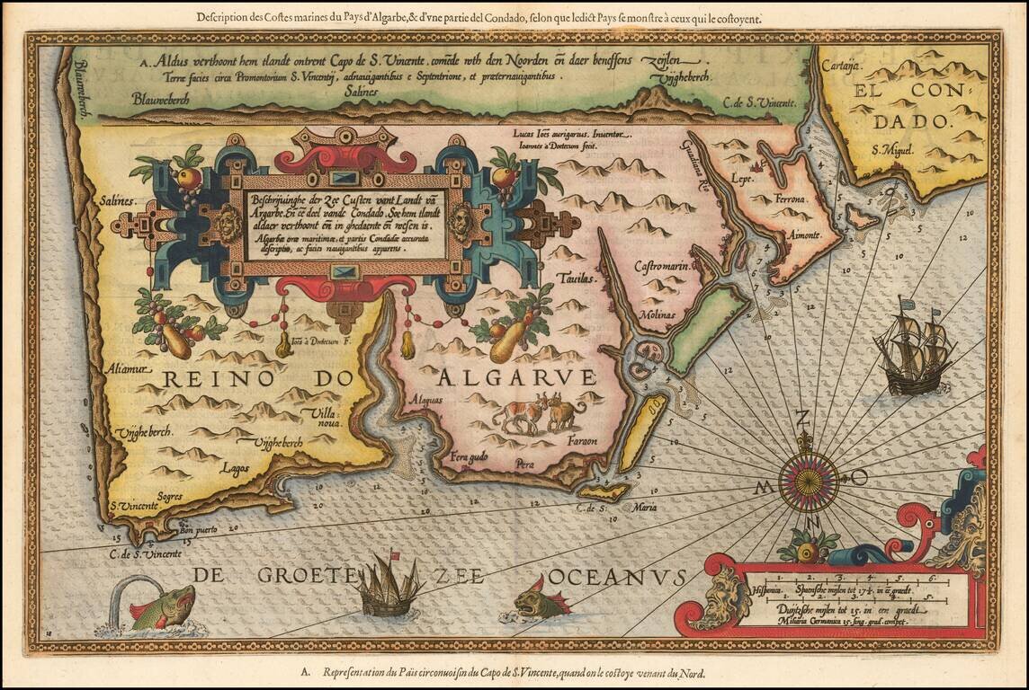
Striking full color example of Wagenhaer's map of the Algarve coastline, extending from just north of Sines in Portugal and the Lagos area to the Rio de Piedras area in Spain. Wagenhaer was a Dutch pilot who produced the first set of effective...
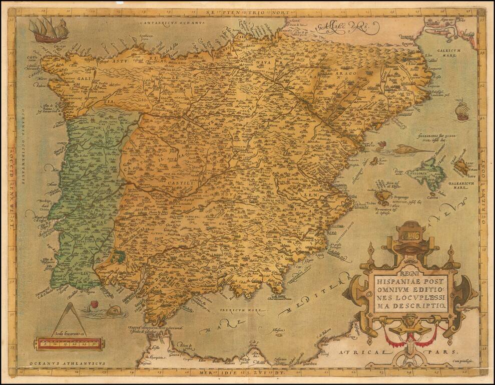
Ortelius’ Detailed Map of the Iberian Peninsula from the World’s First Modern Atlas Striking example of Abraham Ortelius' map of the Iberian Peninsula, from his influential Theatrum Orbis Terrarum, the first modern atlas of the world. The map is...
![Hispalensis Conventus Delineatio [Andalusia]](/map/small/60160mp2.jpg)
Gorgeous map of Andalusia, extending from Las Sierras de Ronda to Corduba and Sierra Morena to El Cerro and Aroche to Castromarin and Lepe, centered on Sevilla, with the Bay of Cadiz at the lower center. Three cartouches and a naval battle are shown,...
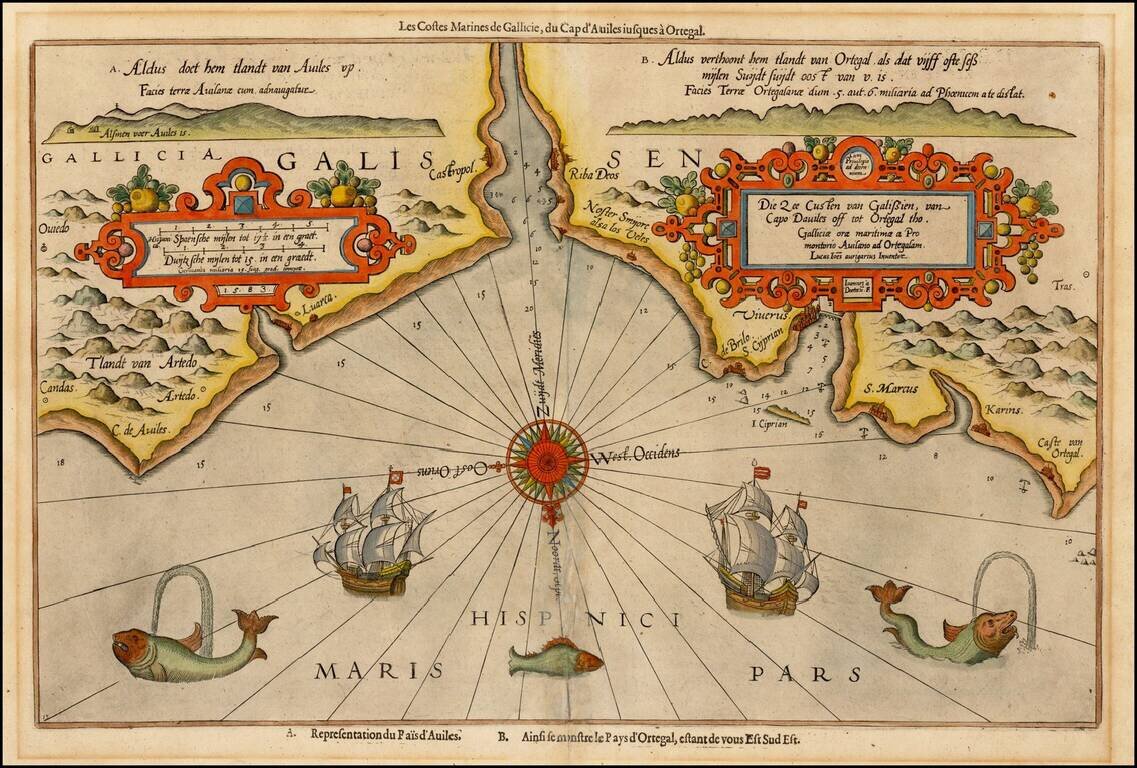
Decorative example of Wagenhaer's map of the northwestern coast of Spain, from Ortiguera to Cape Aviles. The chart is one of Waghenaer's most decorative productions, with 3 sea monsters, 2 sailing ships, a compass rose, and 2 decorative cartouches,...