logo

1700. La Biscaye Divisee en ses 4 Parties principales et Le Royaume de Navarre Divise en ses Merindades . . . 1700

  • La Biscaye Divisee en ses 4 Parties principales et Le Royaume de Navarre Divise en ses Merindades . . . 1700

La Biscaye Divisee en ses 4 Parties principales et Le Royaume de Navarre Divise en ses Merindades . . . 1700 information:

Year of creation: 
Resolution size (pixels): 
 4920x3855 px
Disk Size: 
 5.29257MiB
Number of pages: 
 1
Place: 
 Paris
Author: 

Print information. Print size (Width x height in inches):
Printing at 72 dpi 
  68.33 х 53.54
Printing at 150 dpi 
 32.8 х 25.7
Printing at 300 dpi 
 16.4 х 12.85

An example of detailing the file of this map of in a printable high-resolution:

Click to open in high resolution (open in new tab).
Attention! this is just the central piece (central area 960x960 px) of the map file!
This is an example, so that you can see and study the level of detail of a given map. The entire Map will be fully available after payment!

La Biscaye Divisee en ses 4 Parties principales et Le Royaume de Navarre Divise en ses Merindades . . . 1700

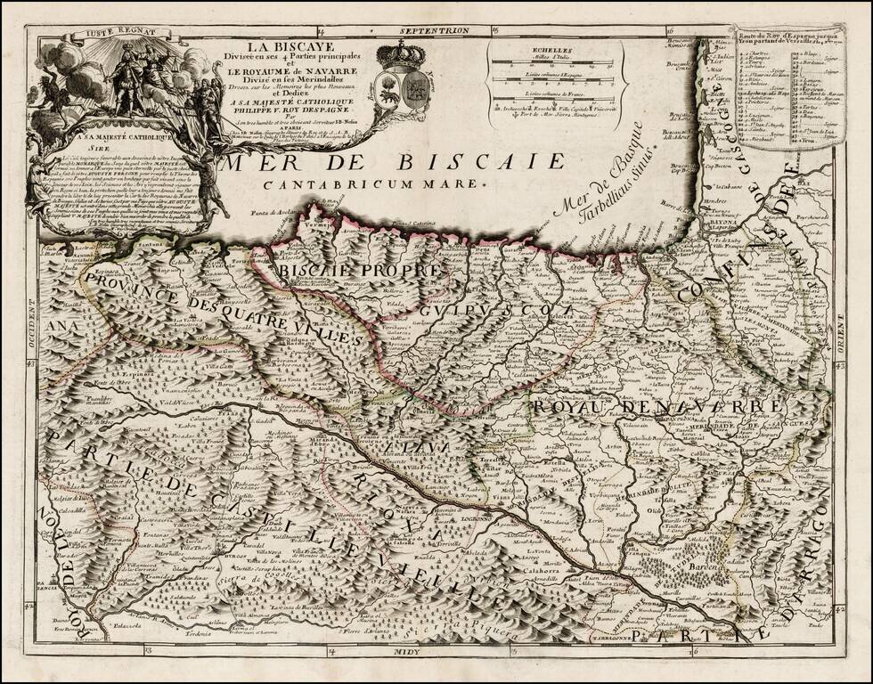
First state of this rare map of Biscaya and Navarra, likely offered originally as a separately issued map and primarily bound into composite atlases of the period.

Includes a striking dedication cartouche to Philip V of Spain, with the young King shown in full-length illustration. Decorative cartouches and coat of arms of Bay of Biscay and Navarre. The map is beautifully engraved and exhibits the detail and fine craftsmanship which is characteristic of Nolin's work.


Special conditions for students!

If you are a student, write to us in telegram: @antiquemaps and indicate what material you need and for what work you need a map in high detail. We are ready to provide material on special terms. For students only!

Item information:

Year of creation:
Size:
4920x3855 px
Disk:
5.29257MiB
Number of pages:
1
Place:
Paris
Author:
Jean-Baptiste Nolin.
$14.99

Related item