
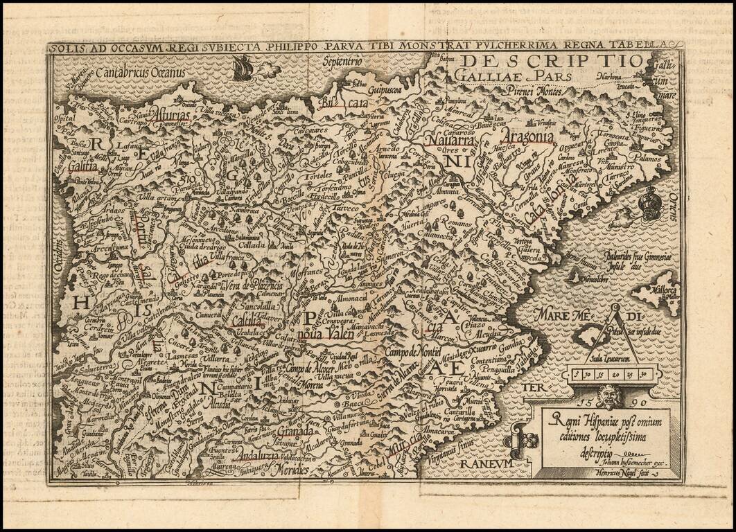
Scarce 16th century map of Spain, pubilshed by Bussemacher in Cologne. One of the earliest obtainable modern maps of Spain.
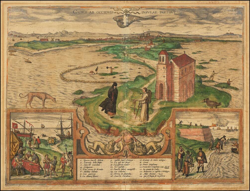
Columbus's Point of Departure Important early view of Cadiz, focused on the chapel of San Sebastian in the foreground with the city in the background. The plate shows Cadiz seen across the narrow peninsula from the Atlantic. In the foreground stands...
![Hanc Insulam Perlustrabat . . .[Bay of Cadiz] [with] Carpetaniae . . . 1584 [Toledo] [with] Guipuscoae Regionis Typus. . .](/map/small/65037.jpg)
Finely colored example of Ortelius' striking regional map of Spain, showing the Island and Bay of Cadiz, the departure point for Columbus and many other important voyages to the New World during the great age of Spanish exploration. The primary map...
![[Algarve to Marbella] Afbeeldinghe der Zeecusten, tusschen de C. de S. Vincente en de Strate van Gibraltar: als een deel van Algarve, de groote Condaet, en de custen van Andalusien, vertoonende de rechte gelegentheijt aller Rivieren, Havenen, en Reeden](/map/small/62096.jpg)
Early Sailing Chart of The Southern Spanish Coastline -- Algarve to Cadiz and Marbella Rare sea chart showing the southern Spanish Coastline. The chart appeared in J Blaeu's Het Licht der Zee-vaert , first published in 1608. The charts for this...
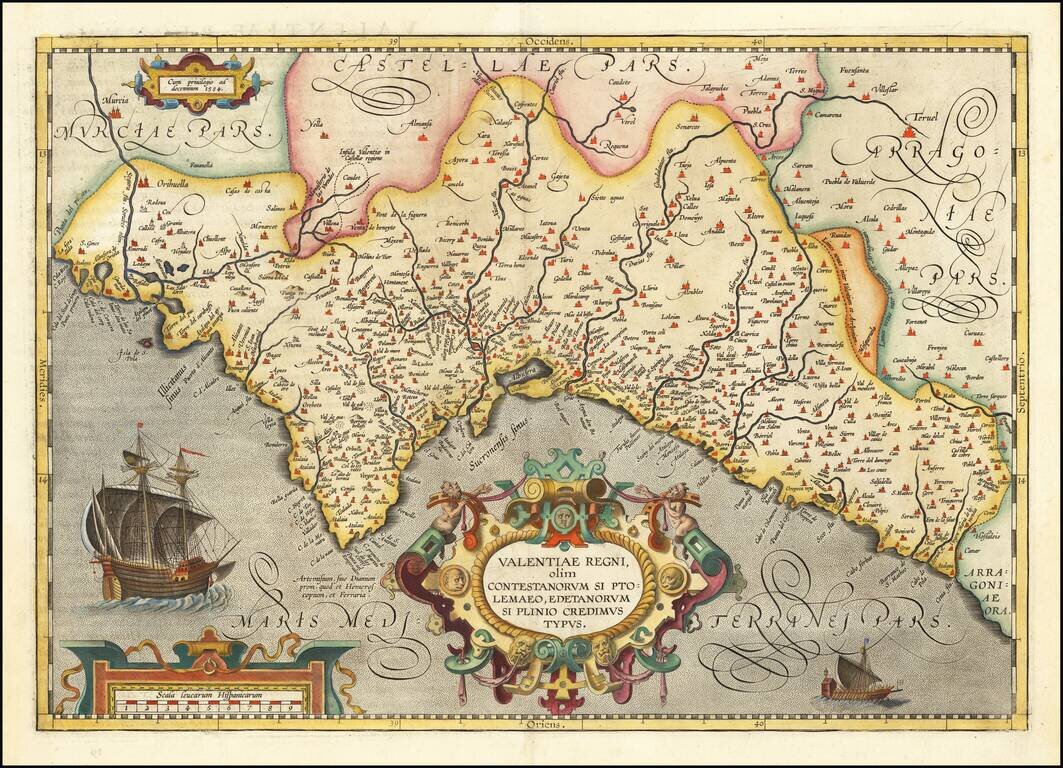
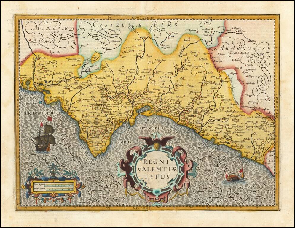
Old color example of this very rare edition of Ortelius' map of Valencia, which appeared only in the 1584 edition and in a very few examples of the 1592 edition, The map extends from Murcia and Orihuella to the Cenia River and extending inland to...
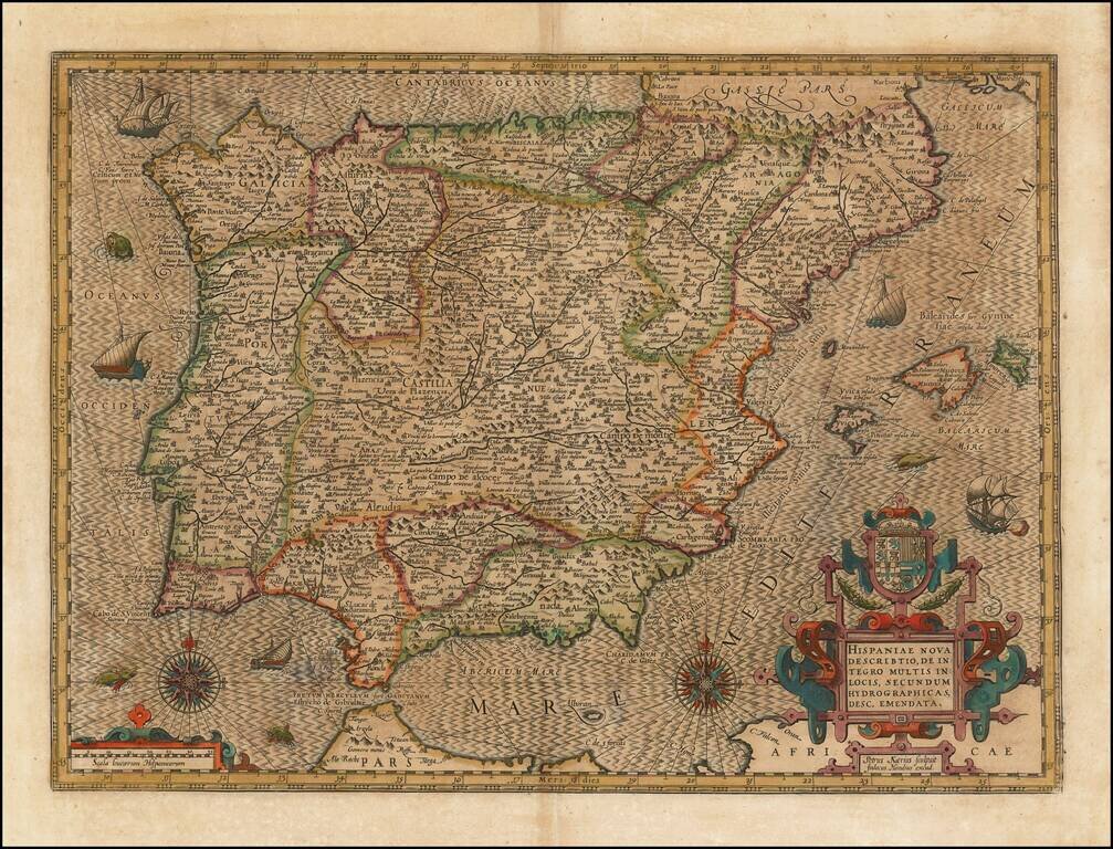
Striking example of the Kaerius-Hondius map of Spain and Portugal. The map includes a striking coat of arms, 2 compass roses, sailing ships and sea monsters, along with Hondius' unique style for engraving the ocean. A gorgeous dark impression of this...
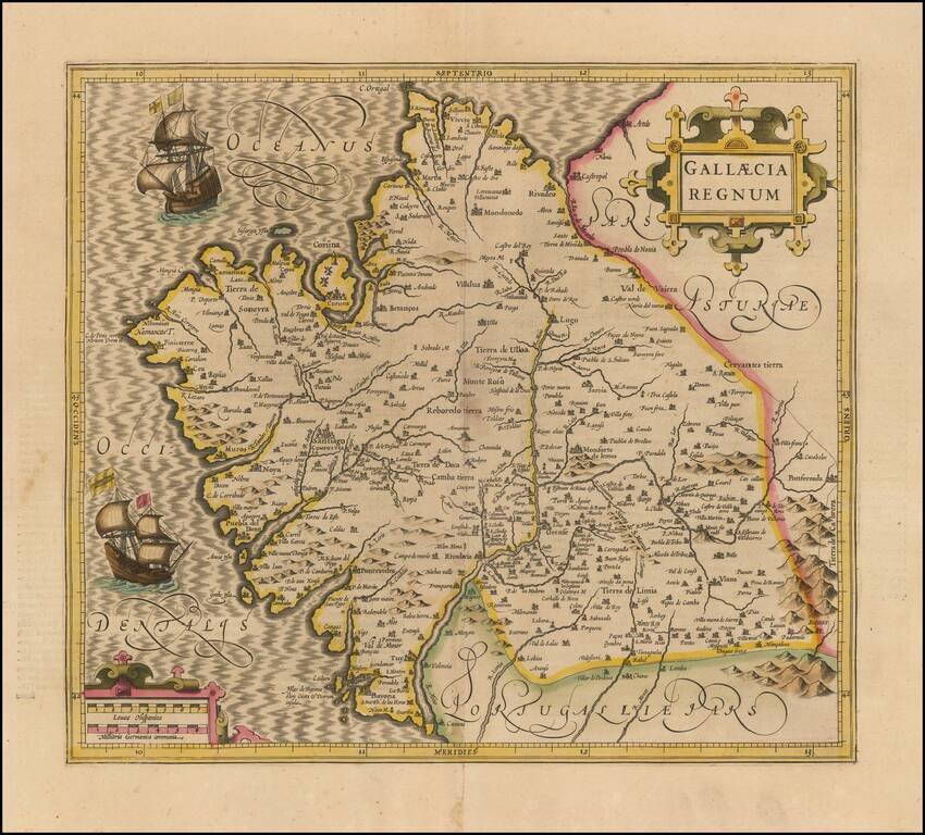
Old Color example of Mercator's map of Gallica. Beautiful map of the northwestern coast of Spain, extending from the Asturias de Oviedo region and Aviles in the northeast to Bayona and the Portuguese border on the south, centered on Santiago di...
Fine old color example of Hondius' map of the Valencia, from his Atlas Sive Cosmographia. . . . Includes a decorative cartouche, scale of miles, sailing ship and sea monster.
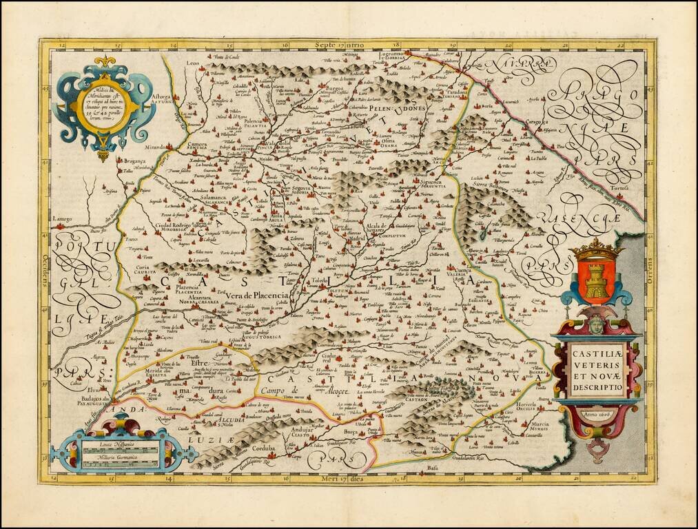
Fine example of Jodocus Hondius' map of Castille, first published in Amsterdam in 1606. The map provides a fine view of early 17th Century Castille, centered on Madrid and Toledo. The map is illustrated with decorative catouches and a coat of arms.
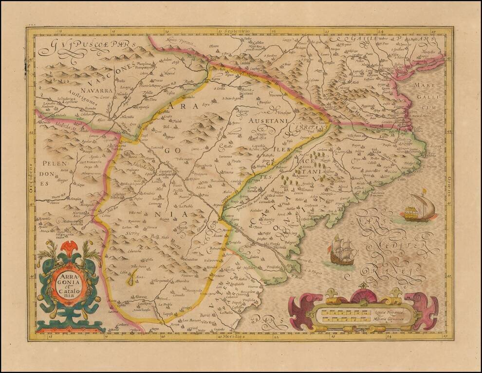
Nice old color example of the Mercator-Hondius map of Catalonia and Aragon. Includes a sea monster, sailing ship, and two decorative cartouches.
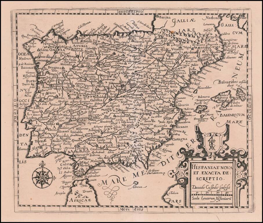
Scarce map of Spain & Portugal, published in Frankfurt by David Custodis (Custos). The map is scarce on the market. This is the first example we have offered in more than 20 years.
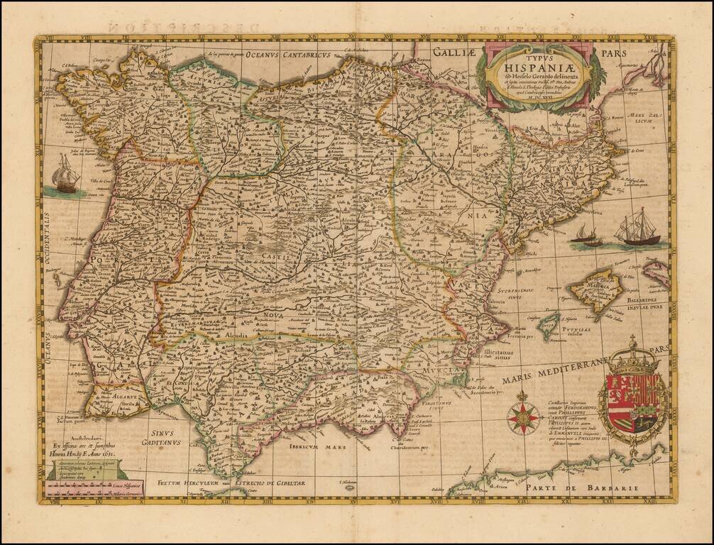
Nice example of Hondius' map of Spain, first issued in 1631. This map replaced the prior Mercator-Hondius map, which was first issued about 1606. The map includes 4 sailing ships, a compass rose, decorative cartouche and ornate coat of arms.
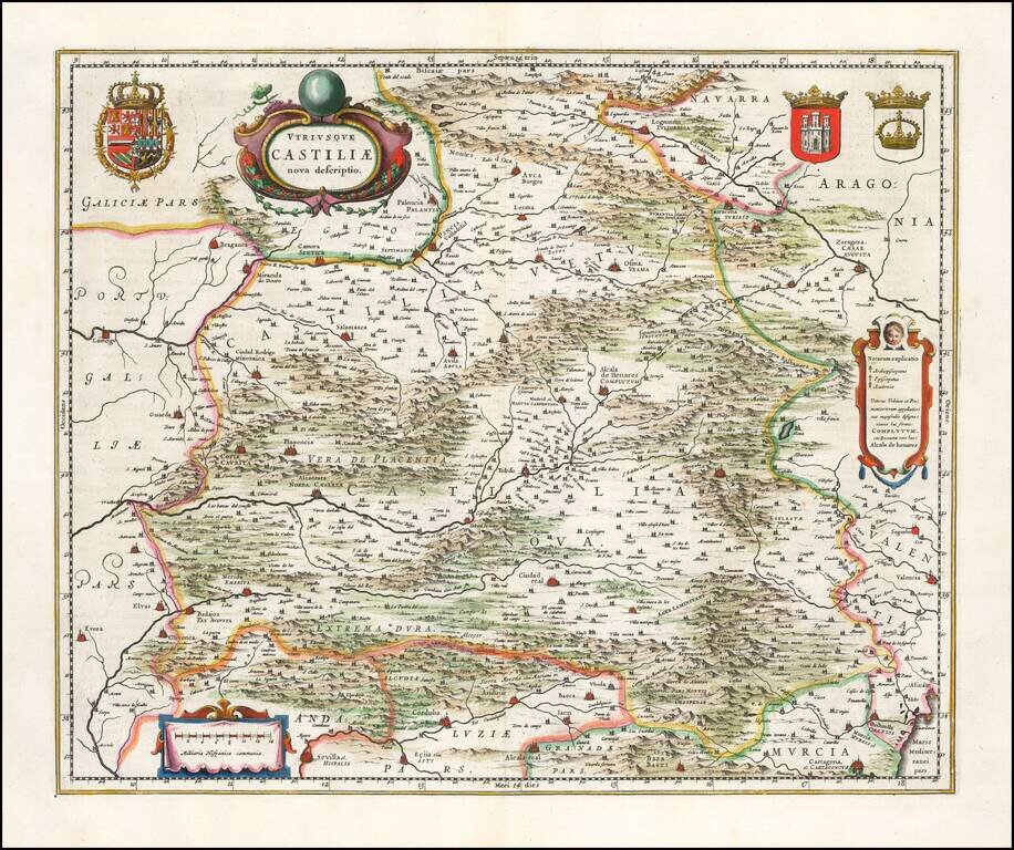
Ornate and richly embellished map of Castille, showing Zaragoza, Valencia, Alicante, Cartagena, Madrid, Cordoba, Sevilla, Salamanca, Palencia, Segovia, Toledo, Cuenca, Granada, etc. Includes 3 decorative cartouches and 3 large coats of arms. Nice wide...
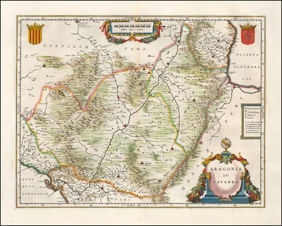
First edition of Blaeu's decorative map of Aragon & Navarra, centered on Zaragoza, and showing Pamplona, Bayonne, Logronno Alcala de Henares, Huesca, Venasque, etc. Roman names shown for major cities. Two large decorative cartouches and two coats...
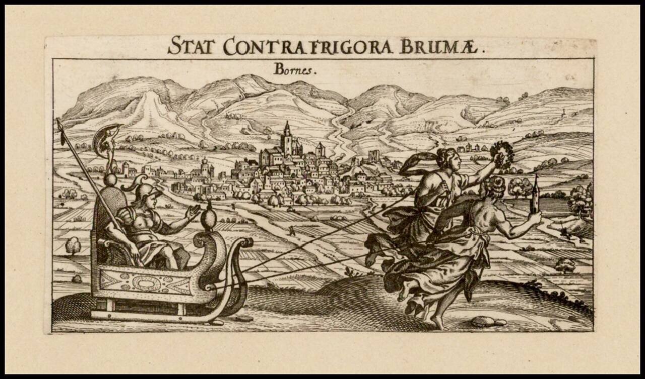
Rare view of the Spanish town of Bornos, to the east of Jerez, published in Nurember by Meisner.

Striking birdseye view of Burgos, from Merian's Neuwe Archontologica Cosmica . . ., published in 1638. Shows town and hillside, buildings, churches, etc.