logo

1696. Il Regno di Castiglia Nuova . . . 1696

  • Il Regno di Castiglia Nuova . . . 1696

Il Regno di Castiglia Nuova . . . 1696 information:

Year of creation: 
Resolution size (pixels): 
 10491x13874 px
Disk Size: 
 39.2121MiB
Number of pages: 
 1
Place: 
 Rome

Print information. Print size (Width x height in inches):
Printing at 72 dpi 
  145.71 х 192.69
Printing at 150 dpi 
 69.94 х 92.49
Printing at 300 dpi 
 34.97 х 46.25

An example of detailing the file of this map of in a printable high-resolution:

Click to open in high resolution (open in new tab).
Attention! this is just the central piece (central area 960x960 px) of the map file!
This is an example, so that you can see and study the level of detail of a given map. The entire Map will be fully available after payment!

Il Regno di Castiglia Nuova . . . 1696

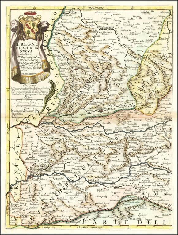
Antique engraved map of the Kingdom of New Castille. The map was published in Rome in 1696 by Giacomo Cantelli da Vignola and Giacomo Giovanni Rossi.

The map is centered on The Tagus or Tajo River and includes Badajoz, Alcantara, Plancencia, and Slamanca.

Shirley (BL Atlases) T.ROSS-1d #71.

Special conditions for students!

If you are a student, write to us in telegram: @antiquemaps and indicate what material you need and for what work you need a map in high detail. We are ready to provide material on special terms. For students only!

Item information:

Year of creation:
Size:
10491x13874 px
Disk:
39.2121MiB
Number of pages:
1
Place:
Rome
Author:
Giacomo Giovanni Rossi. Giacomo Cantelli da Vignola.
$14.99

Related item