logo

1696. Il Principato Delle Asturie Descritto . . . 1696 . . .

  • Il Principato Delle Asturie Descritto . . . 1696 . . .

Il Principato Delle Asturie Descritto . . . 1696 . . . information:

Year of creation: 
Resolution size (pixels): 
 13451x10409 px
Disk Size: 
 37.6482MiB
Number of pages: 
 1
Place: 
 Rome

Print information. Print size (Width x height in inches):
Printing at 72 dpi 
  186.82 х 144.57
Printing at 150 dpi 
 89.67 х 69.39
Printing at 300 dpi 
 44.84 х 34.7

An example of detailing the file of this map of in a printable high-resolution:

Click to open in high resolution (open in new tab).
Attention! this is just the central piece (central area 960x960 px) of the map file!
This is an example, so that you can see and study the level of detail of a given map. The entire Map will be fully available after payment!

Il Principato Delle Asturie Descritto . . . 1696 . . .

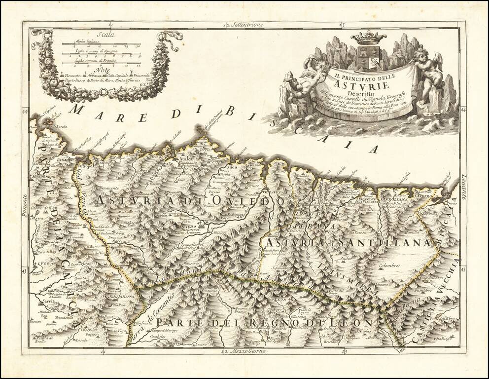
Finely engraved map of the Principality of Asturias on the northern Spanish coastline, based upon the work of Cantelli da Vignola and engraved by Aubrey Barbey, who apparently engraved a number of maps for Rossi.

Divided into Asturia di Oviedo and Asturia di Santaillana, the map illustrates an exceptional topographical style which characterizes the work of Rossi in this period.

Puertas-Mosquera (mapas), Nr. 139. Institut Cartographic de Catalunya #12 (on line).

Special conditions for students!

If you are a student, write to us in telegram: @antiquemaps and indicate what material you need and for what work you need a map in high detail. We are ready to provide material on special terms. For students only!

Item information:

Year of creation:
Size:
13451x10409 px
Disk:
37.6482MiB
Number of pages:
1
Place:
Rome
Author:
Giacomo Giovanni Rossi. Giacomo Cantelli da Vignola.
$14.99

Related item