
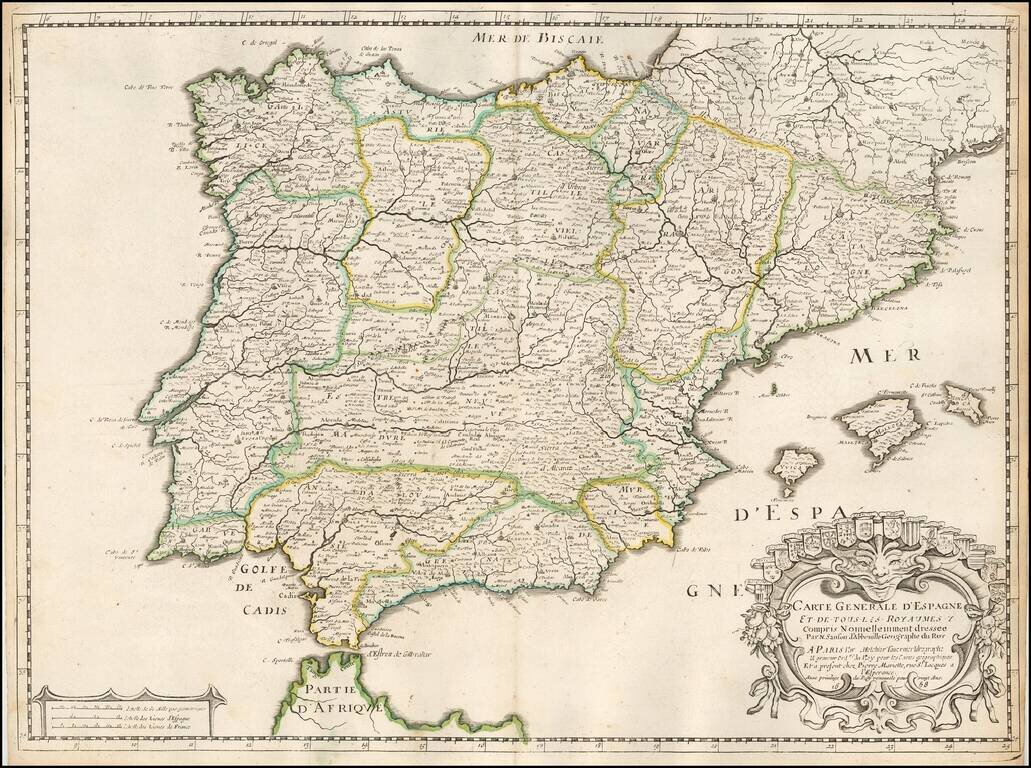
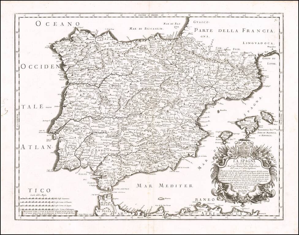
Nicolas Sanson's double-page engraved map of the Iberian Peninsula, with Spain, Portugal, and Balearics. The map was published in Paris in 1658.
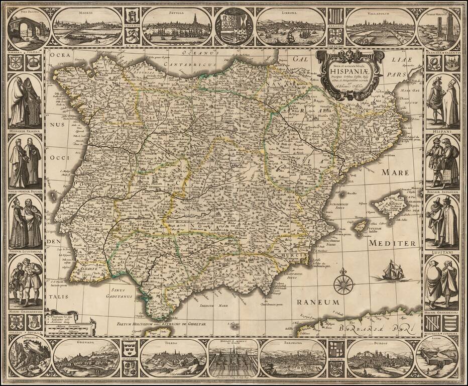
Rare separately issued map of the Iberian Peninsula, published in Amsterdam by Nicholas Visscher in 1660. The map is embellished with city views across the top: Madrid Sevilla Lisbon Valladolid Burgos Barcelona Toledo Granada At the...
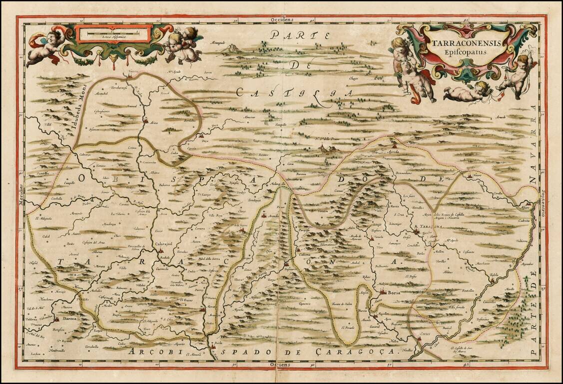
Scare regional map of Spain, which appeared only in the late editions of Blaeu's Atlas Maior. Fine old color example.
![[Heightened with Gold Leaf!] Episcopatus Balbastrensis, Ribagorca Comit et Sobrarbe cum Adjecentibus](/map/small/69195.jpg)
Fine old color, gold heightened example of Blaeu's map of the Spanish Pyrenees Mountains, Huesca etc. The map is oriented with west at the top, and is centered on the town of Barbastro, in Huesca.
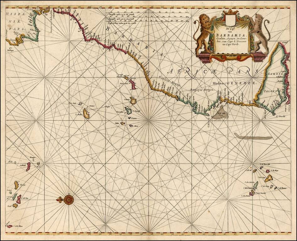
Detailed sea chart of the Iberian Peninsula and the Northwest Coast of Africa, extending to the Cape Verde Island and Gambia. Pieter Goos was one of the leading Dutch chart makers of the period.
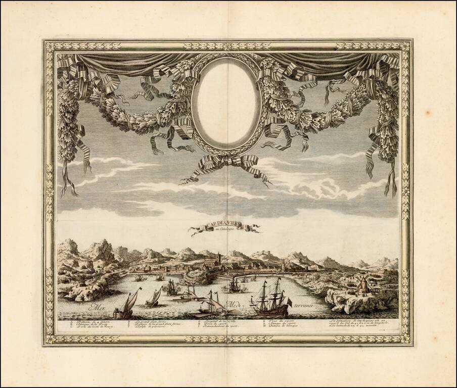
A rare view of Cadaqués by Sébastien Pontault de Beaulieu, depicting the action around the fortress of Cap de Quiers in Catalonia during the Franco-Spanish War. Cadaqués is today one of the northernmost natural habors on the Catalan Coastline, just...
![[Toledo] Tollede](/map/small/62195.jpg)
Toledo Rarity Rare early view of Toledo, Spain, published in Paris by Jollain. Includes an explanation of Toledo in Latin, French and Spanish.
Detailed map of Spain, Portugal and the Balearic Islands, from Rossi's Mercurio Geographico. Remarkable highly detailed map, engraved by Giorgio Widman. Shows tribal regions, towns, rivers, lakes, mountains, islands, bays, rivers. and many other details.
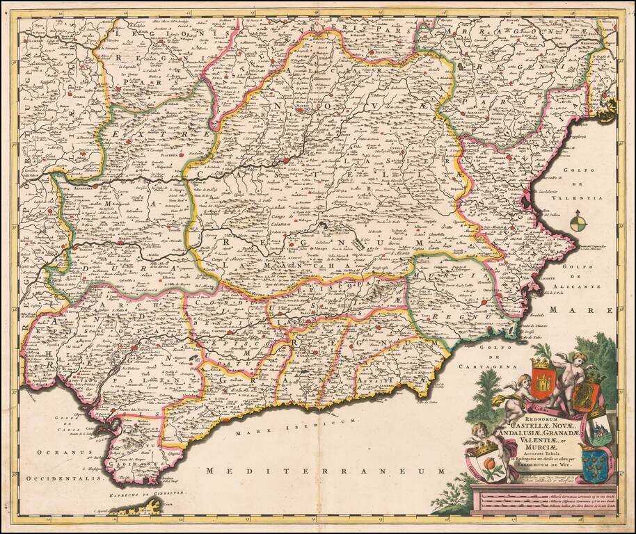
Decorative and highly detailed map of Southern Spain, extending from Salamanca and Segovia in the North, to the Gulfs of Valentia, Alicante and Cartgena in the east, the Straits of Gibralter in the South, and Portalegre, Alcantara and Merida in the...
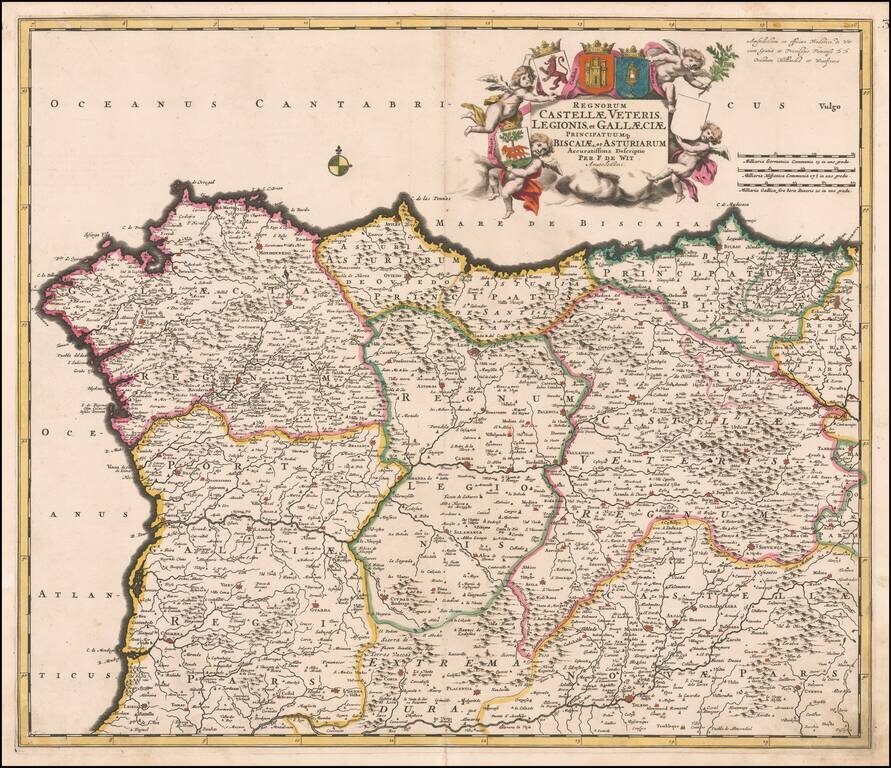
Decorative and highly detailed map of Northern Spain, extending from Galicia in the west to the Basque Country in the east. Major cities include Bilbao, San Sebastian, Santiago di Compstella, Pontevedra, Finisterre, Coruña, Ferrol, Aviles, Oviedo,...
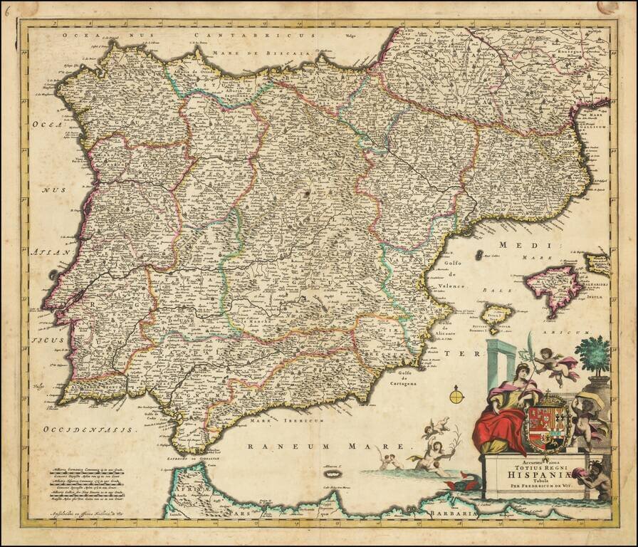
Striking full color example of this rare map of Spain, Portugal and the Balearic Islands, published by Frederick De Wit in Amsterdam. The map is colored by the various kingdoms. Includes an ornate title cartouche, with large coat of arms, sea...
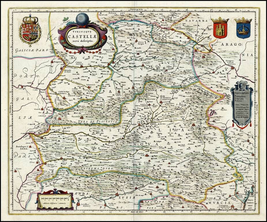
Gold highlighted, old color example of Blaeu's map of Castile, showing Zaragoza, Valencia, Alicante, Cartagena, Madrid, Cordoba, Sevilla, Salamanca, Palencia, Segovia, Toledo, Cuenca, Granada, etc. Includes 3 decorative cartouches and 3 large coats of...
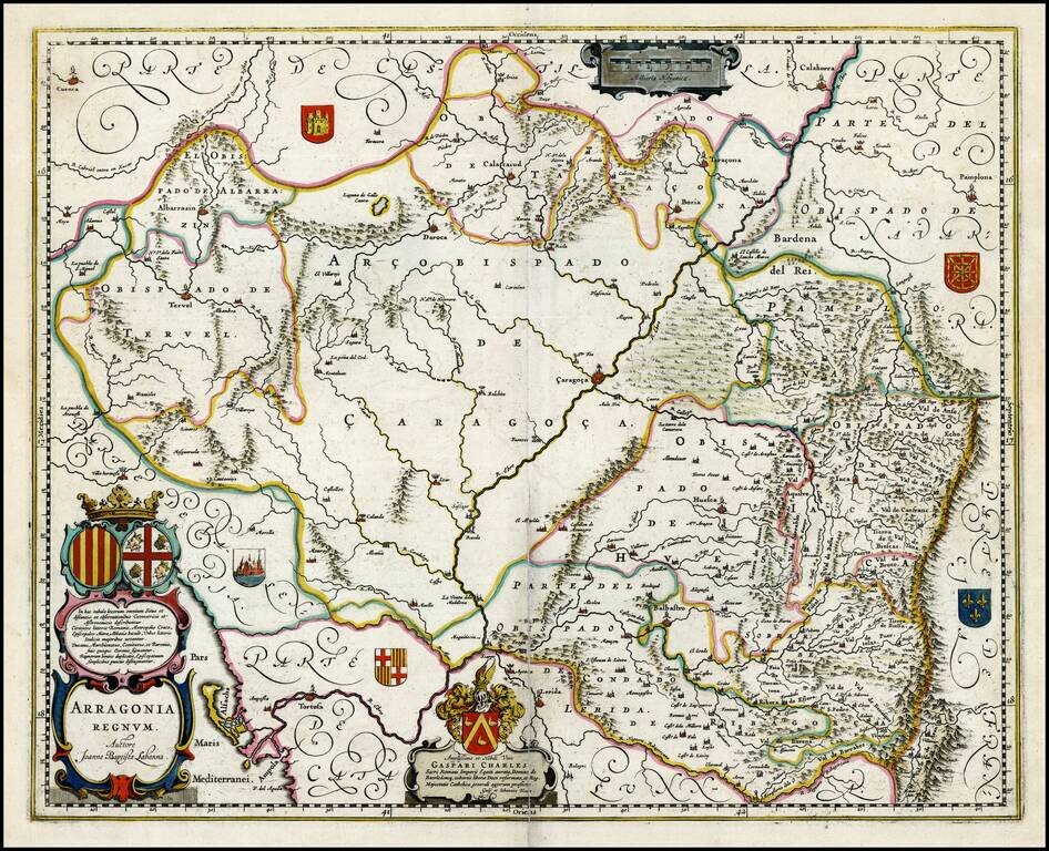
Fine old color, gold highlighted example map of Blaeu's map of Aragon, centered on Zaragoza and extending to Balbasdtor, Huesca, Calataiud, Tortosa, Tervel, Albarrazin, Cuenca etc. Shows towns, rivers, mountains, lakes, valleys, etc. Includes 2 Large...
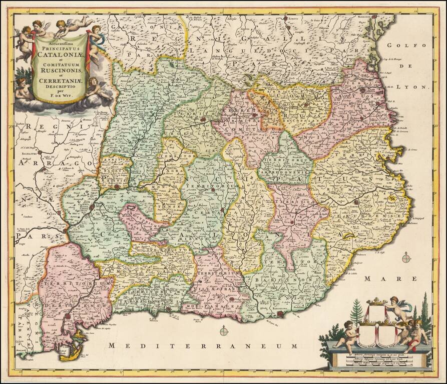
Fine old color example of this scarce map of Catalonia by Frederick De Wit. Decorative cartouche. Original color with gold leaf highlights.
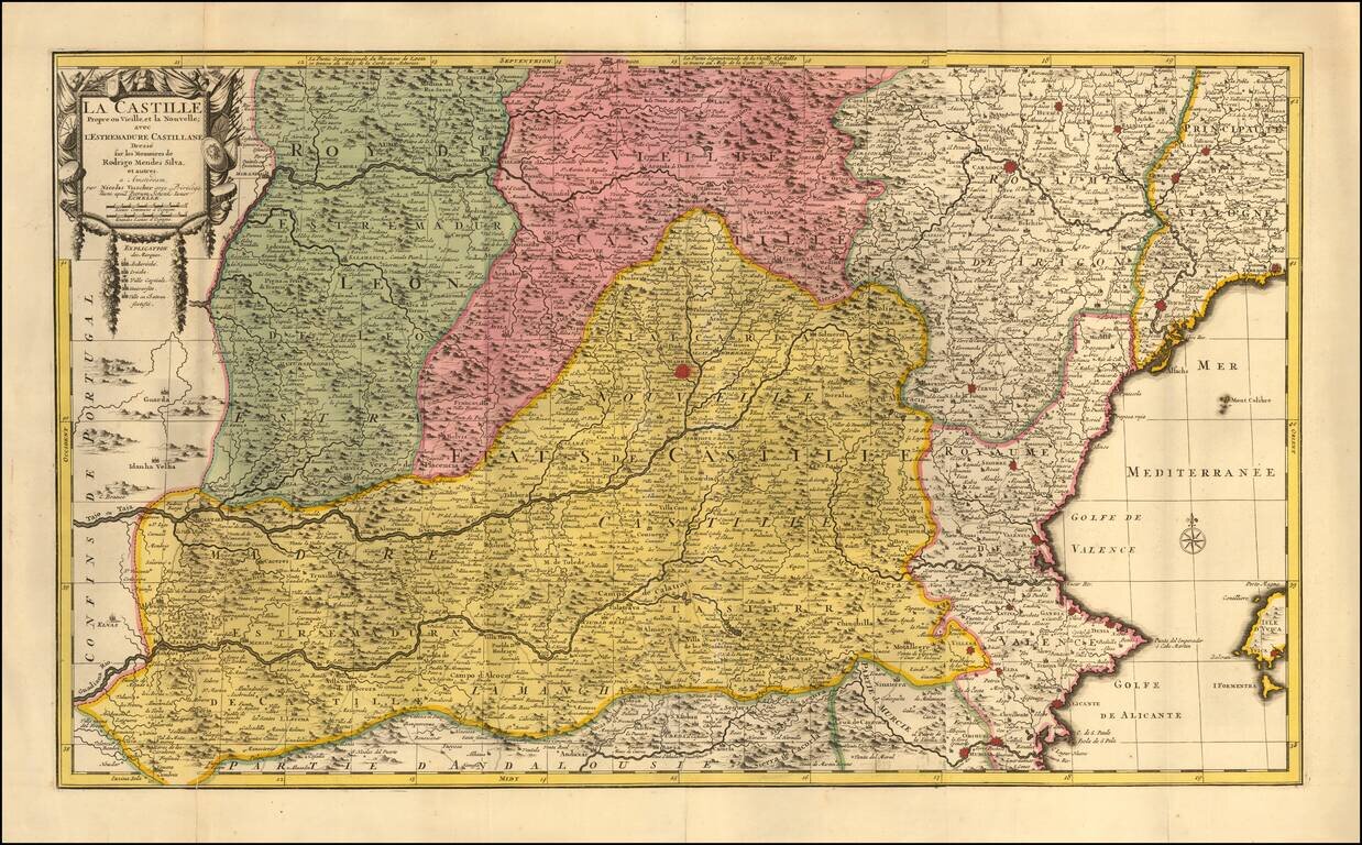
Scarce detailed map of Castille, centered on Madrid. The map includes excellent detail in the region, including early roads. A fine old color example.
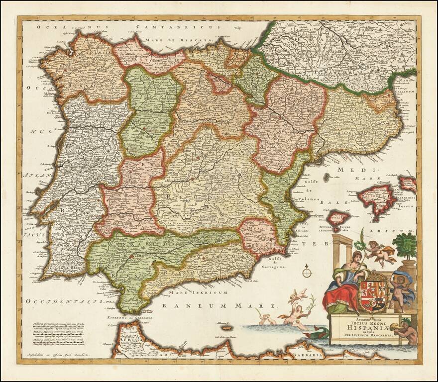
Striking full color example of this rare map of Spain, Portugal and the Balearic Islands, published by Justus Danckerts in Amsterdam. The map is colored by the various kingdoms. Includes an ornate title cartouche, with large coat of arms, sea...