Map size in jpg-format: 4019320B
Click to open in high resolution (open in new tab).

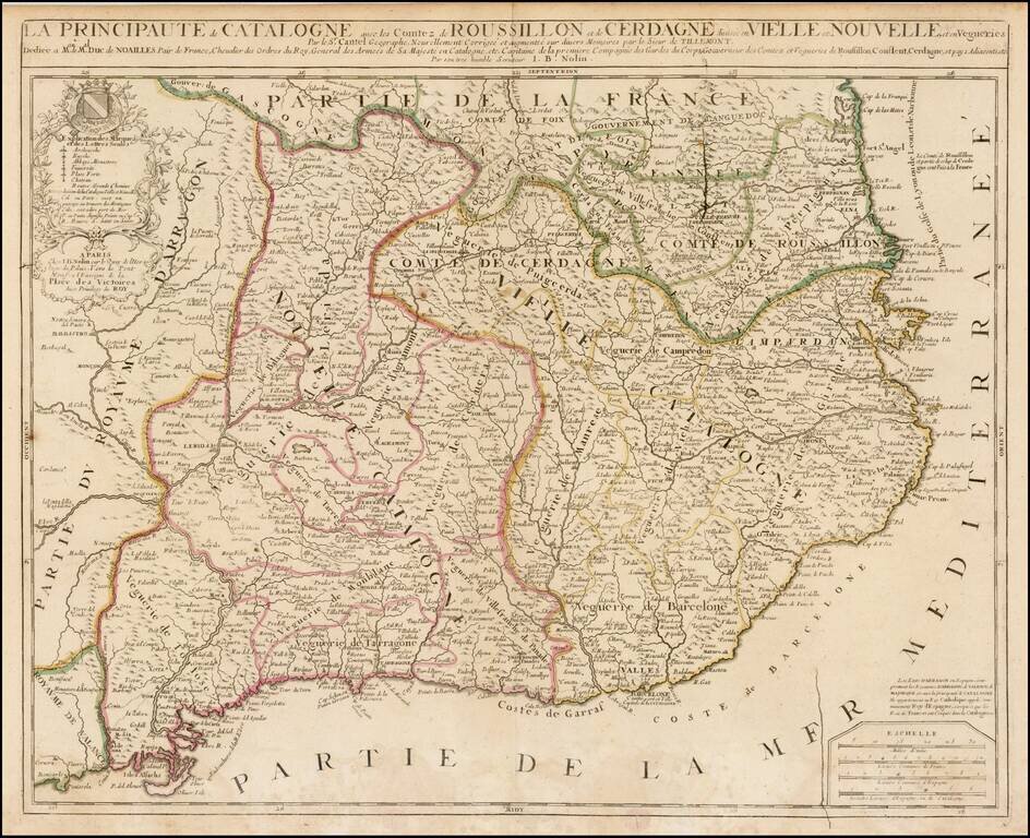
Detailed 17th Century map of Catalonia and Roussillon, by Jean-Baptiste Nolin, based upon an early map by Cantelli, which was thereafter revised by Tillemont.
The map is finely detailed, showing towns, roads, rivers, mountains, lakes, cities, bays, islands, castles and a host of other details.
This was apparently a later issue of the map, as the printing plate shows signs of wear and cracking.
If you are a student, write to us in telegram: @antiquemaps and indicate what material you need and for what work you need a map in high detail. We are ready to provide material on special terms. For students only!
![(Pro-Spanish Republic Political Broadside) [Lift The Embargo Against The Spanish Republic] President Roosevelt says . . .](/map/small/50218.jpg)

