Map size in jpg-format: 28.5266MiB
Click to open in high resolution (open in new tab).
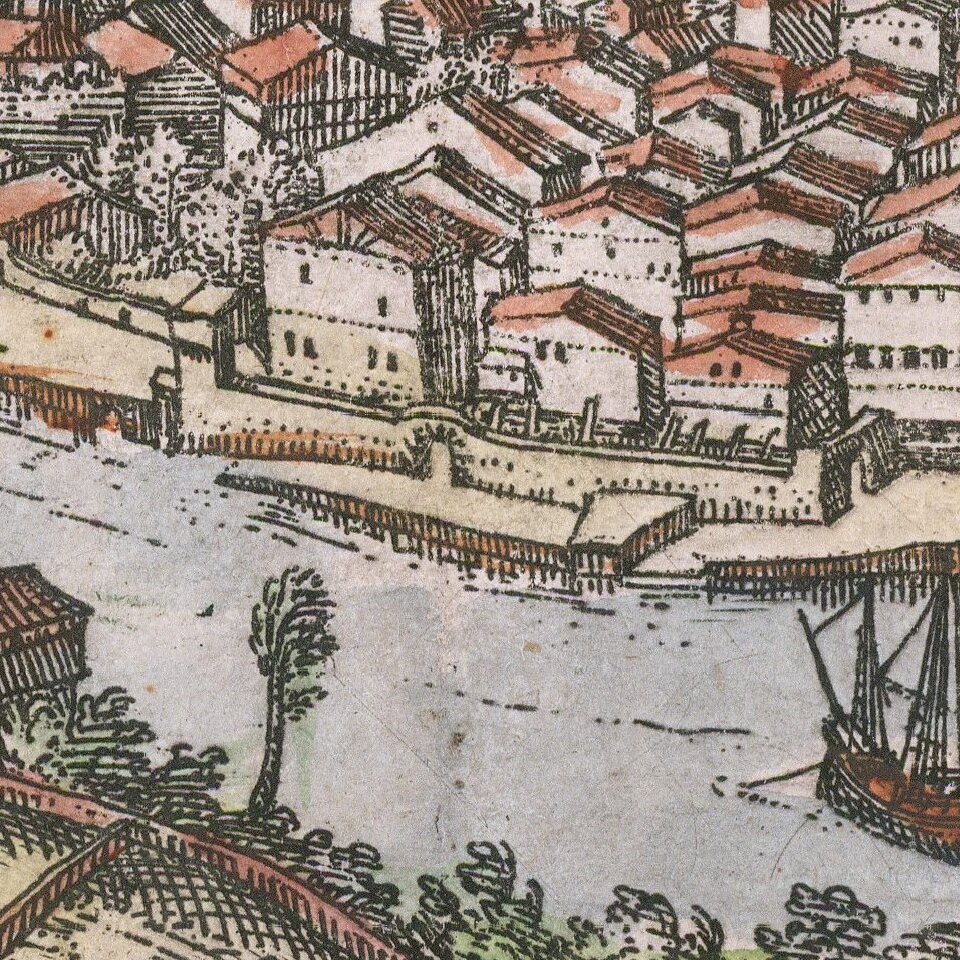
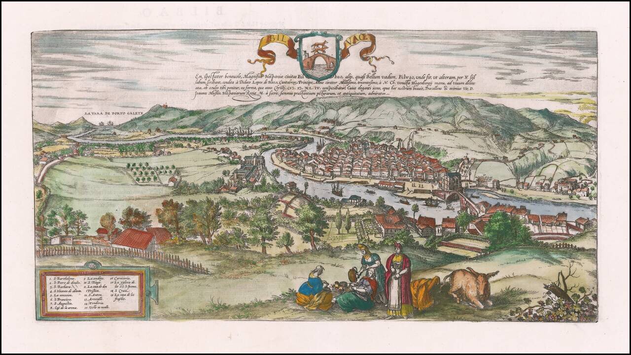
Nice example of Braun & Hogenberg's view of Bilbao.
The view shows Bilbao from the southeast; in the distance the town of Portugalete can be seen on the estuary of the Nervion in the Bay of Biscay. Diego López V de Haro founded Bilbao on June 15, 1300. The bay known as Ria cuts deep into the land and links Bilbao with the Gulf of Biscay via Portugalete. It is navigable due to its depth, which made it possible to build a harbor in Bilbao that offered far better protection than coastal harbors, and led to the town becoming one of Castile's trade centers; in particular, Merino wool was exported to northern Europe from here.
The church of San Anton adjoins the San Anton bridge (on the right). The Gothic cathedral of Santiago is visible in the middle of the city.
Georg Braun (1541-1622) was born and died in Cologne. His primary vocation was as Catholic cleric; he spent thirty-seven years as canon and dean at the church St. Maria ad Gradus, in Cologne. Braun was the chief editor of the Civitates orbis terrarum, the greatest book of town views ever published. His job entailed hiring artists, acquiring source material for the maps and views, and writing the text. In this role, he was assisted by Abraham Ortelius. Braun lived into his 80s, and he was the only member of the original team to witness the publication of the sixth volume in 1617.
If you are a student, write to us in telegram: @antiquemaps and indicate what material you need and for what work you need a map in high detail. We are ready to provide material on special terms. For students only!
![(Pro-Spanish Republic Political Broadside) [Lift The Embargo Against The Spanish Republic] President Roosevelt says . . .](/map/small/50218.jpg)

