Map size in jpg-format: 22.0396MiB
Click to open in high resolution (open in new tab).

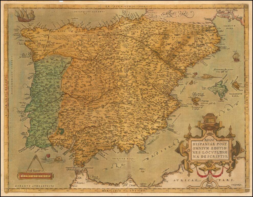
Ortelius’ Detailed Map of the Iberian Peninsula from the World’s First Modern Atlas
Striking example of Abraham Ortelius' map of the Iberian Peninsula, from his influential Theatrum Orbis Terrarum, the first modern atlas of the world.
The map is closely centered around the peninsula itself, with a sliver of Northern Africa included to the south. The Balearic Islands are also present, in the Mediterranean to the east. The interiors of Portugal and Spain are littered with place names; each settlement is noted with a building symbol. Rivers and mountains are also detailed.
Ortelius’ characteristic strapwork design ornaments the title cartouche, which is in the bottom right corner. In the lower left is a scale, which is topped with a large pair of dividers. A huge swordfish guards (or menaces?) the Balearic Islands, while another sea monster approaches the Strait of Gibraltar from the west. In the upper left corner is a ship in full sail, with another to the right side of the map.
Ortelius was famous for his wide consultation of sources with which he made his own representations. This map is closely related to map of the botanist Carolus Clusius, also known as Charles de l'Escluse, who published a six-sheet map of Spain, Hispaniae nova descriptio (1569-1571).
This map appeared in four states, although it was altered relatively little over the course of its publishing history, which lasted from 1570 to 1612 with regard to Ortelius’ atlas.
This example is a fine example of a second state and would make a nice addition to any collection of Iberian Peninsula or Ortelius maps.
If you are a student, write to us in telegram: @antiquemaps and indicate what material you need and for what work you need a map in high detail. We are ready to provide material on special terms. For students only!
![(Pro-Spanish Republic Political Broadside) [Lift The Embargo Against The Spanish Republic] President Roosevelt says . . .](/map/small/50218.jpg)

