
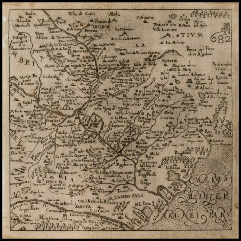
Scarce map of the area around Rome, from Francesco Scoto's Itinerario, published in 1670.
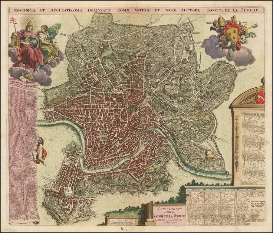
Striking example of this rare decorative plan of Rome, published in Amsterdam by Jacob de la Feuille, likely from the same plate as Joannes De Ram. This fine map of Rome is based on Giovanni Battista Falda's influential wall map. It provides...
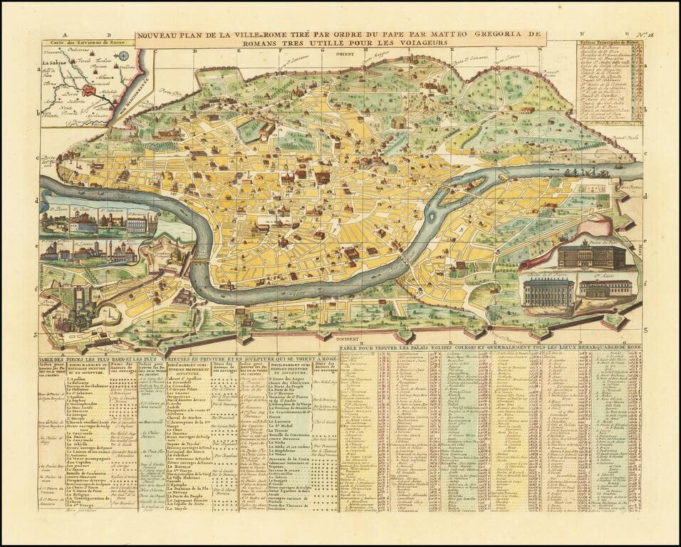
A decorative map of Rome, with inset views of ten major churches and structures, including St. Peter's and the Vatican. A key identifies a number of buildings, which are shown on the map. Other insets as well as text add further information to the...
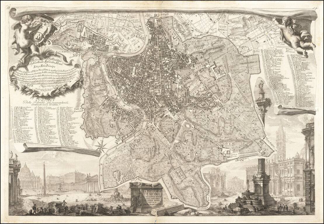
Highly detailed plan of Rome with substantial notes concernign locations of the various buildings, streets, gardens, colleges, churches etc. A finely engraved map from Chatelain's monumental 7 volume Atlas Historique, one of the most famous and...
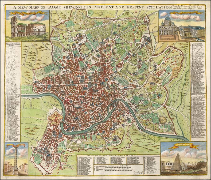
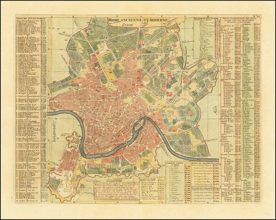
Finely colored and highly detailed map of Rome. Includes 4 vignettes showing the Coliseum, St. Peters, The Sepulcher of Caijus Cestus, and Trajan's Pillar. The keys to the map identify 155 Churches, Parishes, Monasteries, etc., 56 Palaces and Colleges...
Piranesi's Map of Rome Nice example of this celebrated plan of Rome, engraved by Giovani Battista Nolli and Charles Nolli, with decorative elements engraved by Giovanni Battista Piranesi. The map shows the center of Rome in great detail, lying on a...

Fine example of Piranesi's remarkable modern map of Rome, dedicated to Pope Clement XIV. First issued in 1774, the map is oriented with south at the top. Piranesi's remarkable large format map shows the modern city of Rome within Aurelian Walls,...
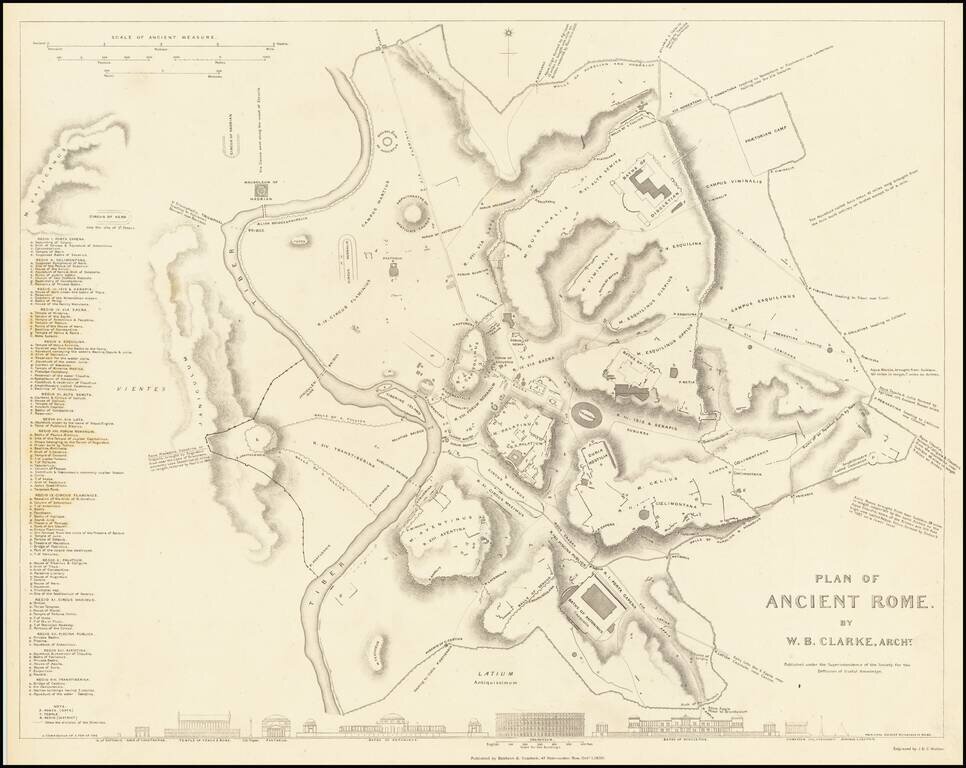
This is a fabulous town plan of Ancient Rome, including a description and location of many of the ancient walls and buildings that made up the city. This view of the imperial city strips away the many layers of later development, allowing the viewer to...
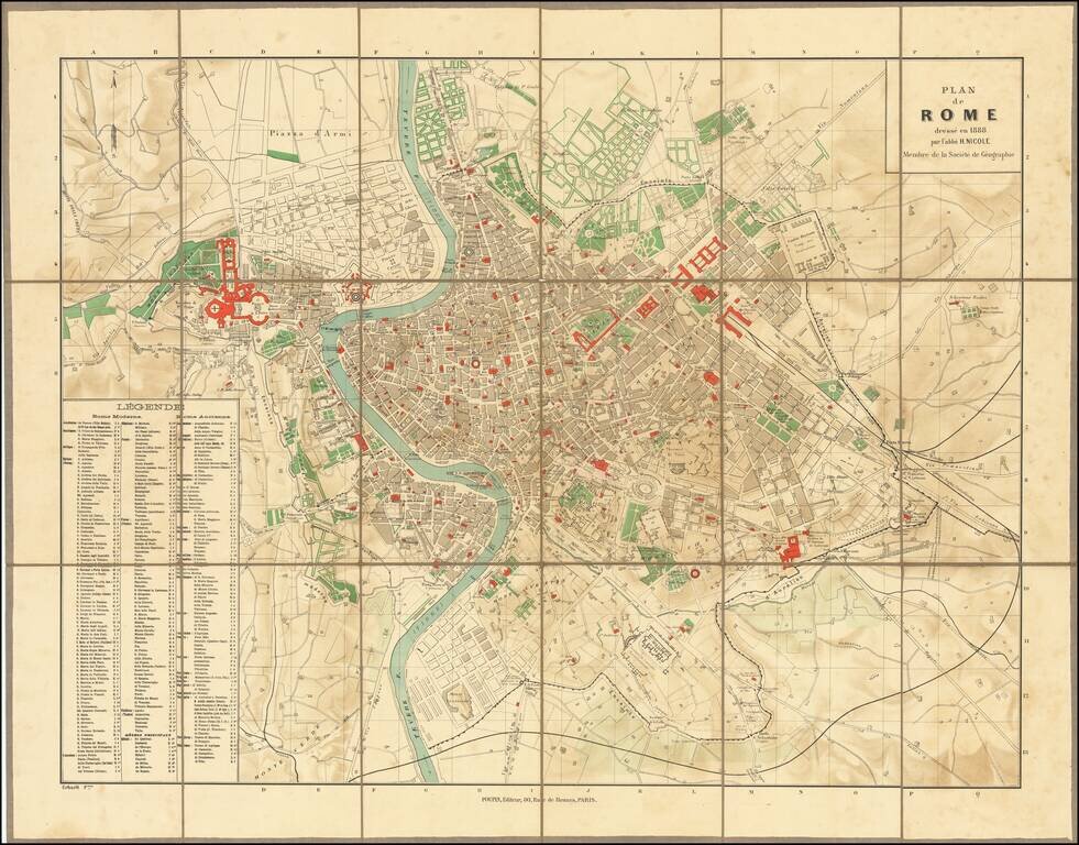
Highly detailed plan of Ancient and Modern Rome, published in Paris. The map is credited to "l'abbe H. Nicole," a member of the French Geographical Society, but we are unable to locate the Abbey. The key locates hundreds of important ancient and...
![[Expanding Rome To the Sea] Progetto per l'espansione di Roma al Mare dell'architetto Dario Carbone](/map/small/63570.jpg)
A fascinating set of maps and profiles, showing a proposal for developing the areas surrounding the Tiber River and for the expansion of Rome toward the sea, 1912, by Dario Carbone. As noted by Lina Malfona in Between Rome and the Sea: Ancient &...
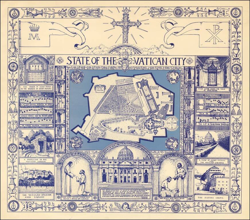
Fine large format pictorial view of the Vatican, surrounded by religious themed vignettes. We were not able to locate information on the artist, other than credits for other illustrations done in the mid-1970s.
![Venecie [Venice]](/map/small/47592.jpg)
Nice example of Hartmann Schedel's incunable view of Venice from the Latin edition of Schedel's Liber Chronicum, perhaps the single most influential secular illustrated book of the 15th Century and one of the landmark printed works of the 15th...
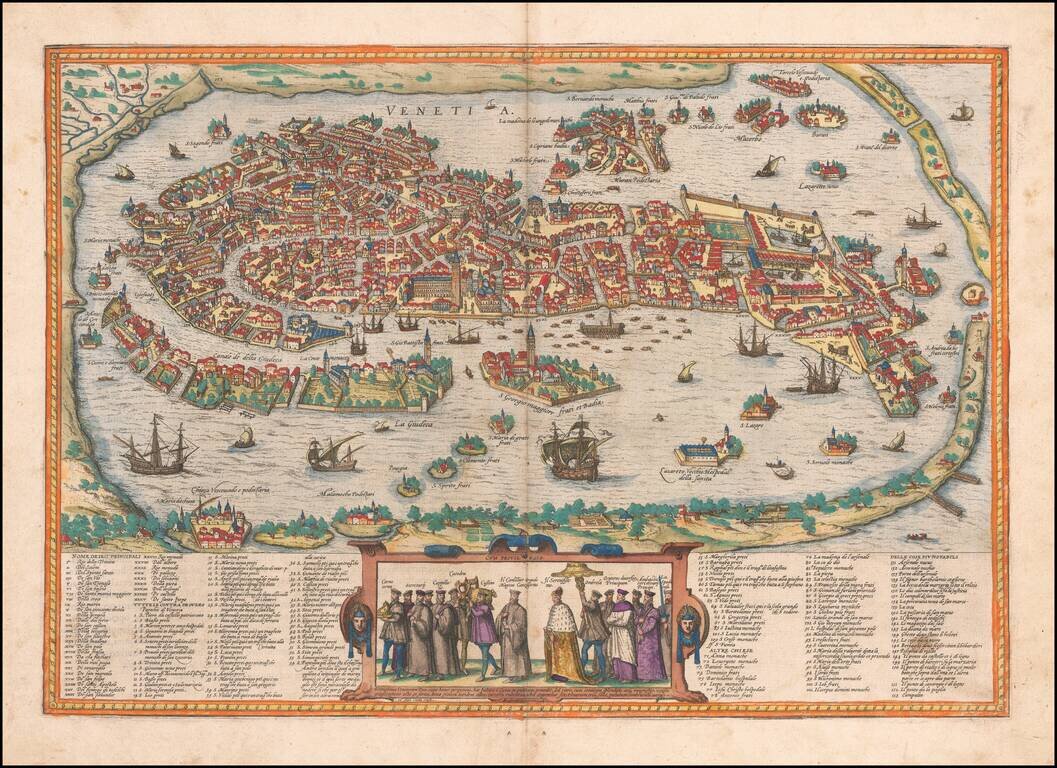
Striking example of Braun & Hogenberg's view of Venice, one of the most highly sought after 16th Century views of the City. Includes a key with over 150 placenames. Important early view of Venice, from Braun & Hogenberge's Civitatus Orbis...
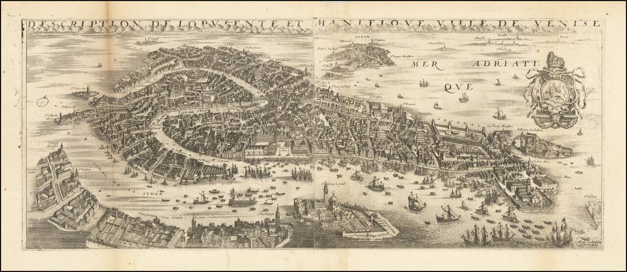
This a rare view of Venice from the French atlas maker and royal cartographer Jean Boisseau. The stunning view presented shows the city of the Doges in a magnificent bird's eye format, focusing on the main island and surrounding islets, but with the...
![[Venice] Venetia](/map/small/42498.jpg)
Late example of Stefano Scolari's map of Venice, first published in 1597. The map is based upon the Bernardo Salvioni (1597) plan of Venice. This gorgeous bird's-eye view of Venice gives a taste of how this city existed during the seventeenth century....
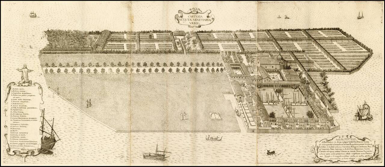
Fine example of this striking view of the island of Vignole and its Monastery, built in 1422. Fine bird's-eye view of the formerly famous monastery with all the gardens and greens, mostly demolished within the last 200 years. The view was engraved by...