Map size in jpg-format: 826513B
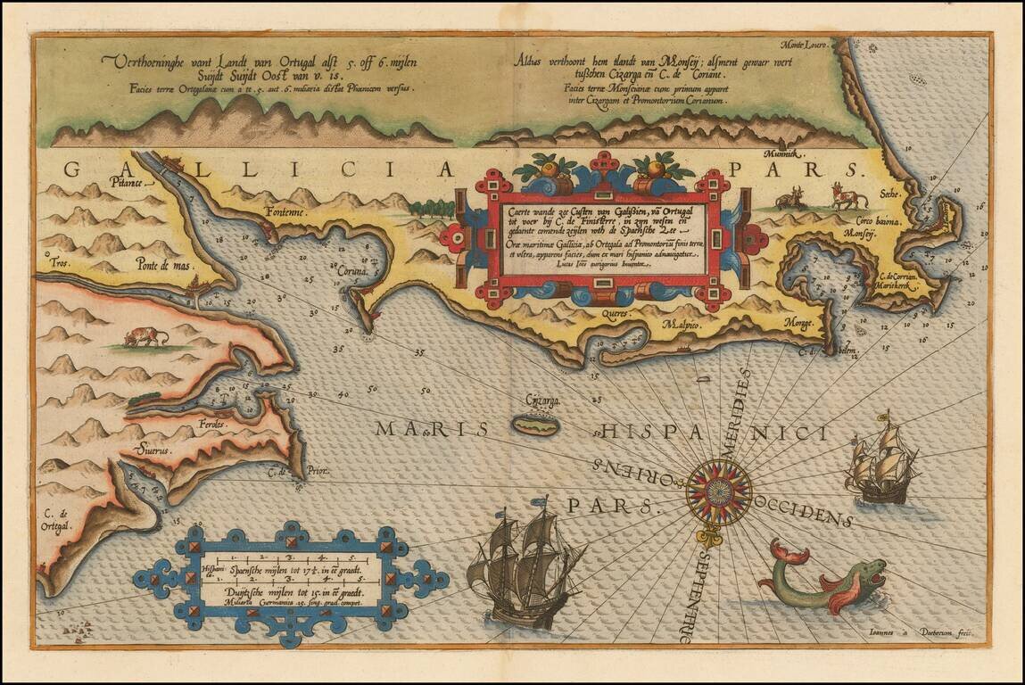
Beautifully hand-colored example of Waghenaer's map of the Galician Coastline, from Cape de Ortegal in the east, to Monte Louro and Cape Finisterre in the west, centered on Coruna, Malpica de Brigantinos and Ferrol.
Lucas Waghenaer was a Dutch pilot who produced the first set of effective navigational charts, under the title Spiegel der Zeevaerdt. These gorgeous charts, engraved by Baptist and Jan van Doetecum, embody the latest contemporary knowledge of navigation and position finding and set the standard which was followed for more than a century. Waghenaer's charts are magnificent works of art, which are highly sought after by collectors.
An essential map for collectors of the region and the earliest decorative sea chart of the region.
Includes highly decorative sail ships and sea monsters.
If you are a student, write to us in telegram: @antiquemaps and indicate what material you need and for what work you need a map in high detail. We are ready to provide material on special terms. For students only!
![(Pro-Spanish Republic Political Broadside) [Lift The Embargo Against The Spanish Republic] President Roosevelt says . . .](/map/small/50218.jpg)

