
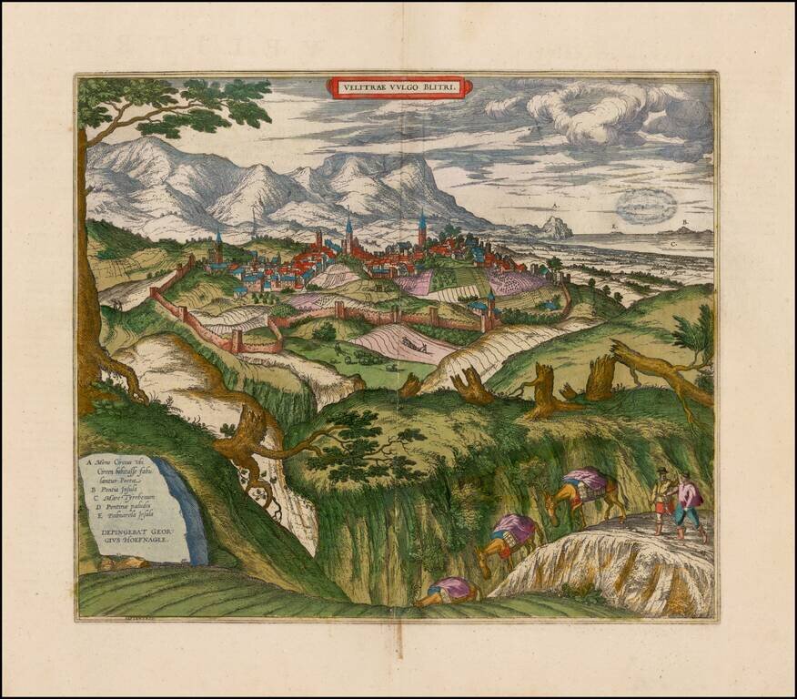
Decorative birdseye view of Velletri from Braun & Hogenberg's Civitatus Orbis Terrarum. Fine view from the northwest of Velletri and the hills around Coru. On the right the Pontine marshes (D) can be seen, and in the distance Capo Circeo (A) and...
![[Siena] Sienne Ville de la Toscane, Elle est Capitale du Sienois . . .](/map/small/70587.jpg)
One of the Earliest Obtainable Large Plans / Views of Siena Fine early bird's-eye view of Siena, published by Pierre Mortier in his Nouveau Theatre de Toute L'Italie in 1704. Mortier's view shows the a fortified hill town, including the principal...
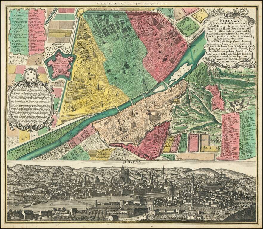
Fine old color example of Seutter's decorative and highly detailed plan of Florence, with a striking view of the City below. The view below the map shows the city from the far side of the Arno, with the Duomo in the center.
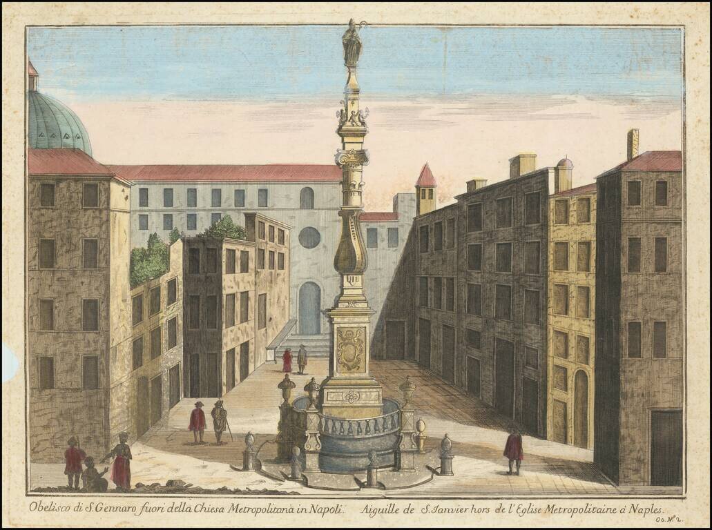
Nice early image of the Obelisk of San Gennaro in Naples. The Obelisk of San Gennaro (begun 1636, completed 1650) is located in the square dedicated to Cardinal Sisto Riario Sforza. It is the work of Cosimo Fanzago, perhaps the greatest architect of...
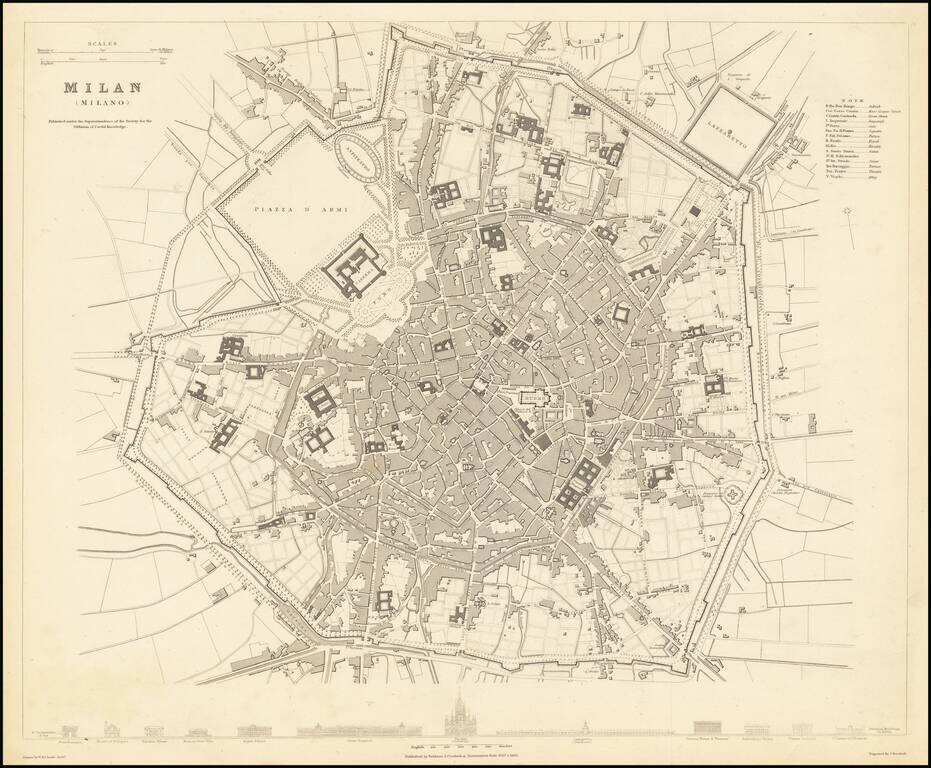
A detailed town plan of Milan, showing the fortified walls, city gates, inner ring, important public buildings, squares, and much more. Across the bottom lies a comparison of twelve of the most important public buildings in Milan, drawn to scale. This...
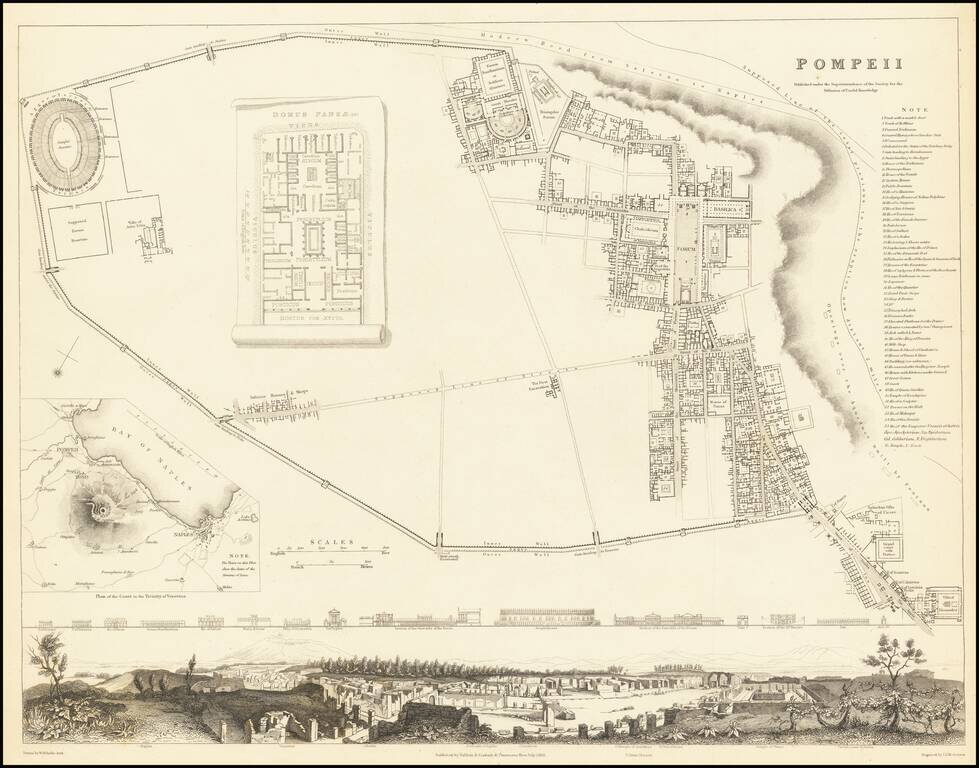
Fabulous town plan of Pompeii, with a large birdseye view of the town and profiles of 15 prominent buildings. Inset map of Mt. Vesuvius and a plan of the Domus Pansae. One of the best 19th Century English town plans to appear in a commercial atlas.
![Turin [Torino]](/map/small/67906.jpg)
A fabulous town plan of Torino which includes three vignettes showing the Church of La Superga, a view of Turin, and the Royal Palace. The city is attractively laid out, with a grid-like structure and a citadel laying outside of the city walls. This is...
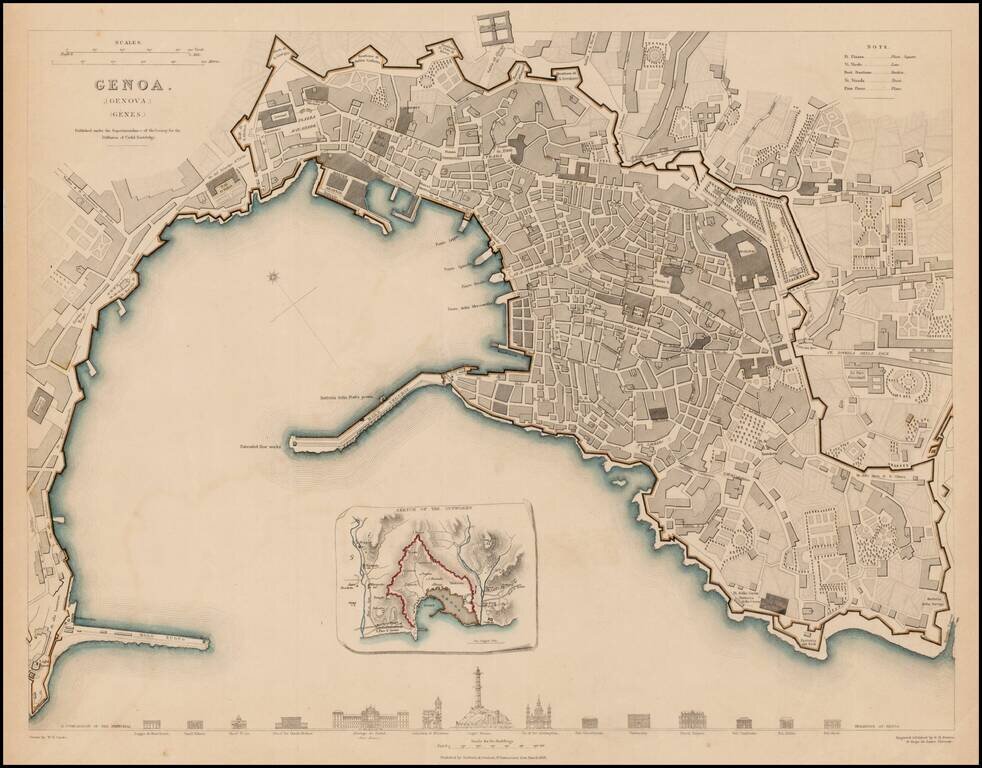
Detailed plan of Genoa, with an inset plan of the Outworks. Includes profiles of 14 prominent buildings. One of the best 19th Century English towns plans to appear in a commercial atlas.
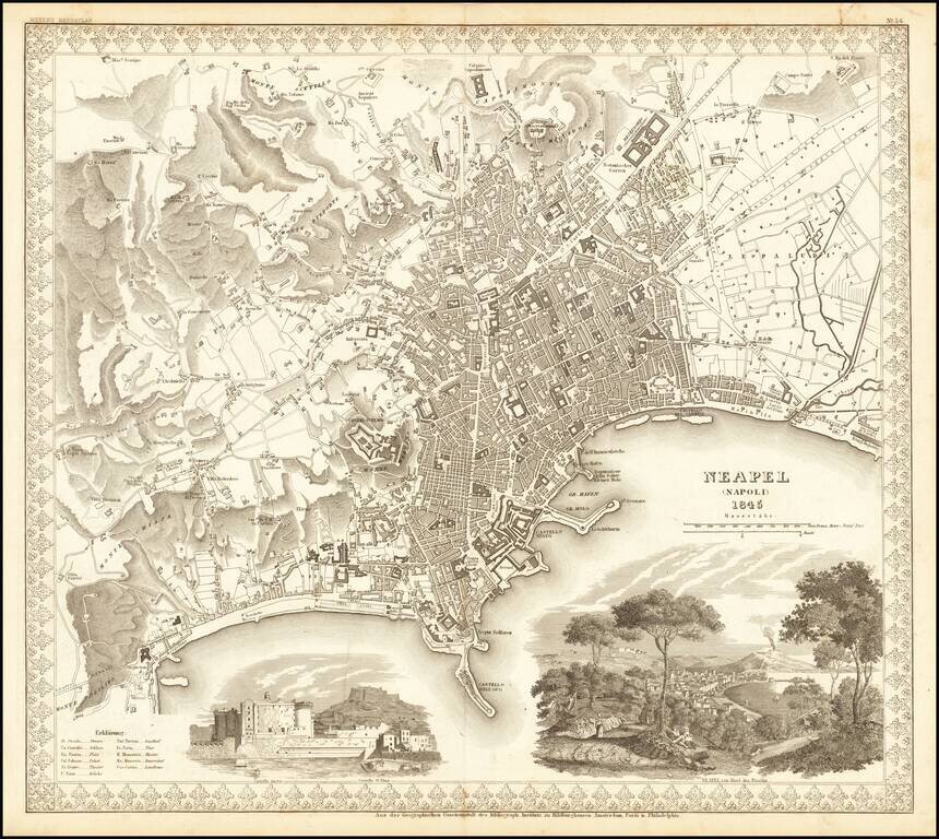
Decorative plan of Naples, published by Meyer. Includes two large vignettes, showing the Castello St. Elmo and a view of Naples and the Harbor from a neighboring hillside, with a volcano erupting in the background.
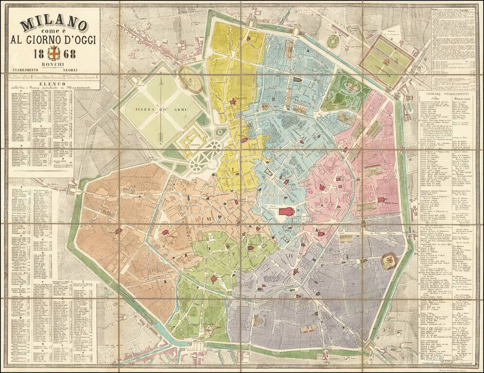
Modern Milan -- With Architectural Facades of Major Buildings Illustrated Rare map of Milan, published in Milan in 1868, in the style of the maps of Paris of the time, embellished with vignettes of major buildings. Sold in the shop of the Ronchi...
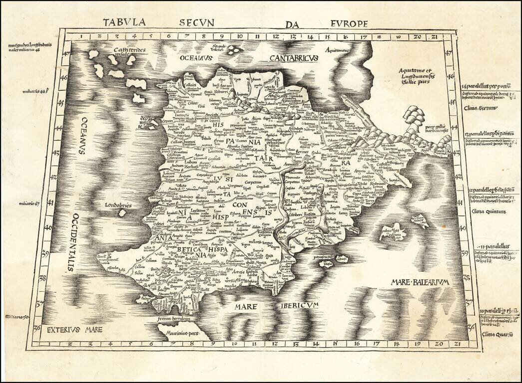
Nice example of Martin Waldseemuller's map of the Iberian Peninsula from the 1513 edition of Waldseemuller's Geographia.
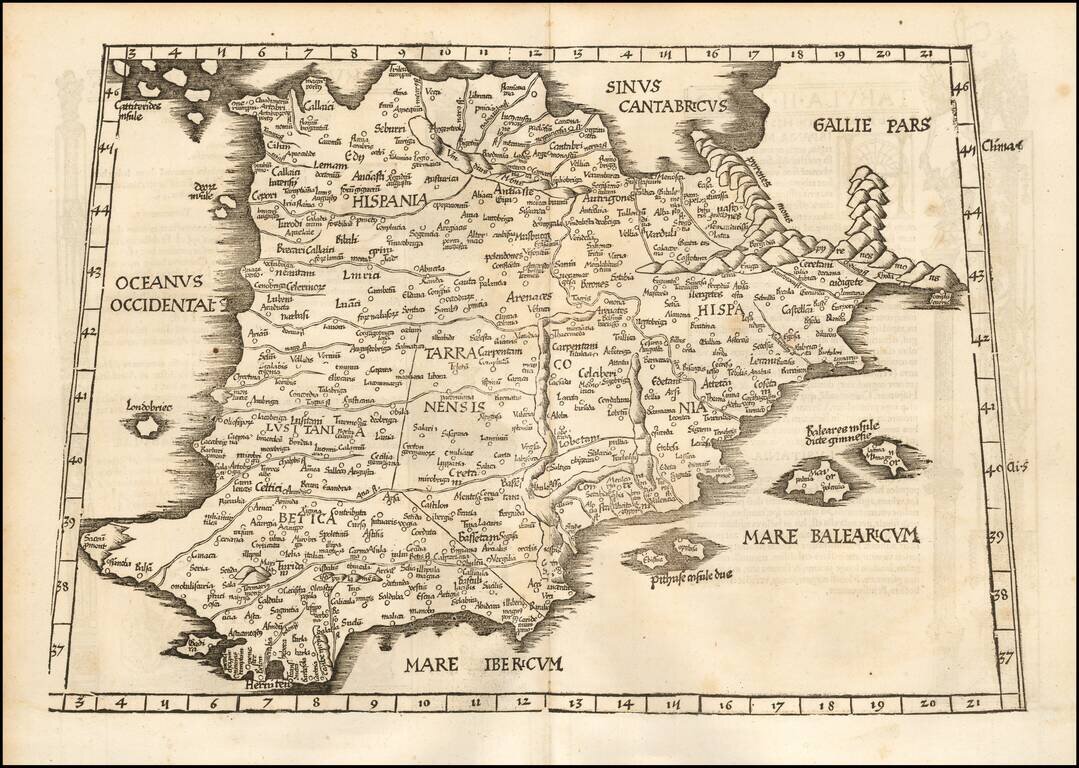
Nice example of Fries map of the Iberian Peninsula. First published in Strasbourg by Johannes Gruninger in 1522, Fries map is based upon Waldseemuller's map of 1513.
Good example of the 1525 edition of Lorenz Fries modern map of the Spain & Portugal. First published in Strasbourg by Johannes Gruninger in 1522, Fries' map is based upon Waldseemuller's map of 1513.
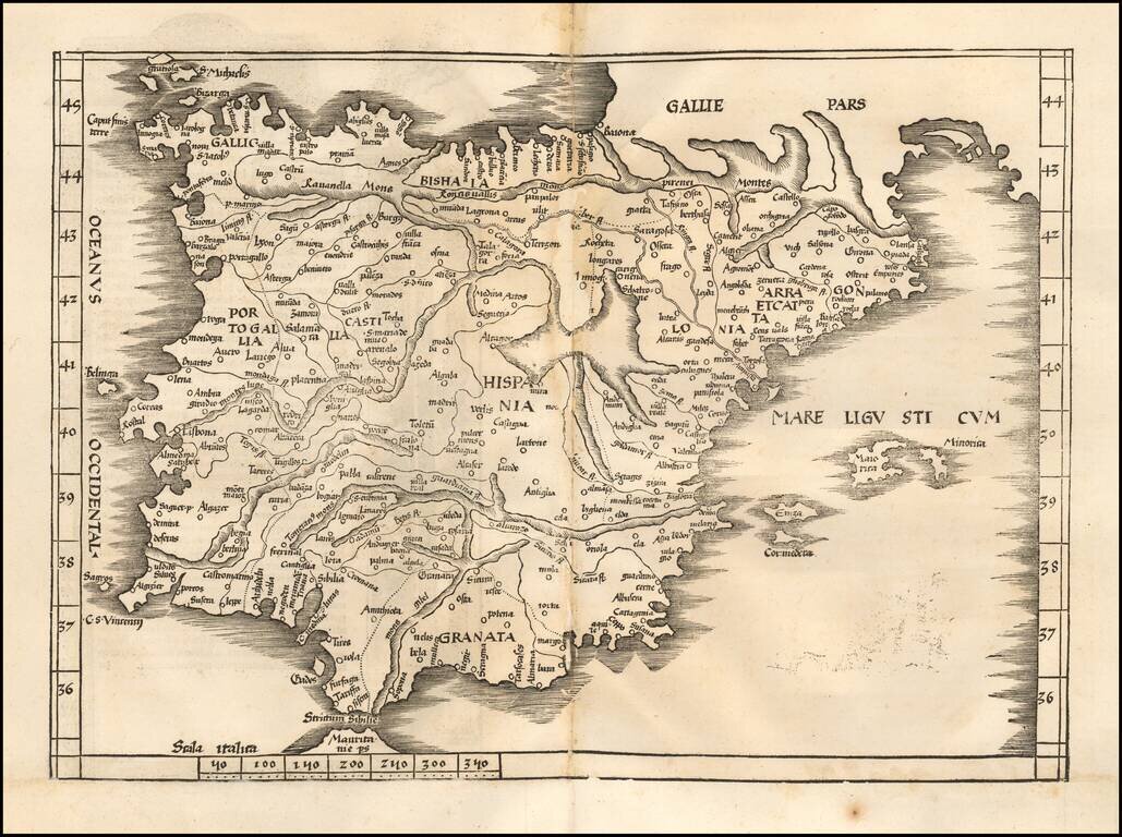
Nice example of Gastaldi's modern map of Spain & Portugal, one of the earliest modern maps of the Iberian Peninsula, from Gastaldi's Geografia di Claudio Ptolemeo Alexandrino . . . , published in Venice in 1548. The map is almost certainly drawn...
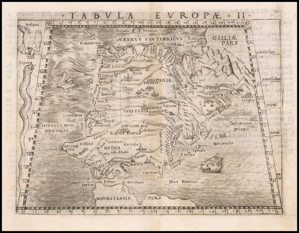
Nice example of Gastaldi's map of Spain & Portugal Peninsula, from Gastaldi's Geografia di Claudio Ptolemeo Alexandrino . . . , published in Venice in 1548. Giacomo Gastaldi is considered as the foremost Italian cartographer of the 16th century...
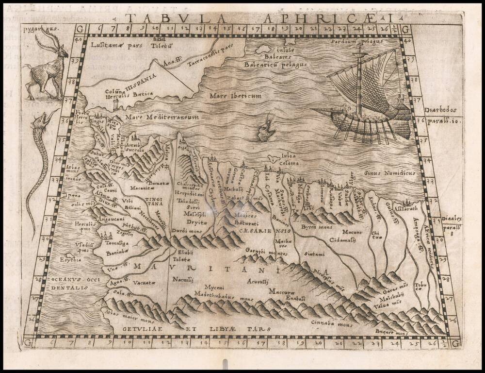
Early map of part of North Africa and Spain, primarily focusing on the region from modern day Morocco and the Balearic Islands to the Pilars of Hercules. Embellished is a saiing ship, sea monster and several curious animals. Gastaldi's atlas was the...