Map size in jpg-format: 3.17756MiB
Click to open in high resolution (open in new tab).
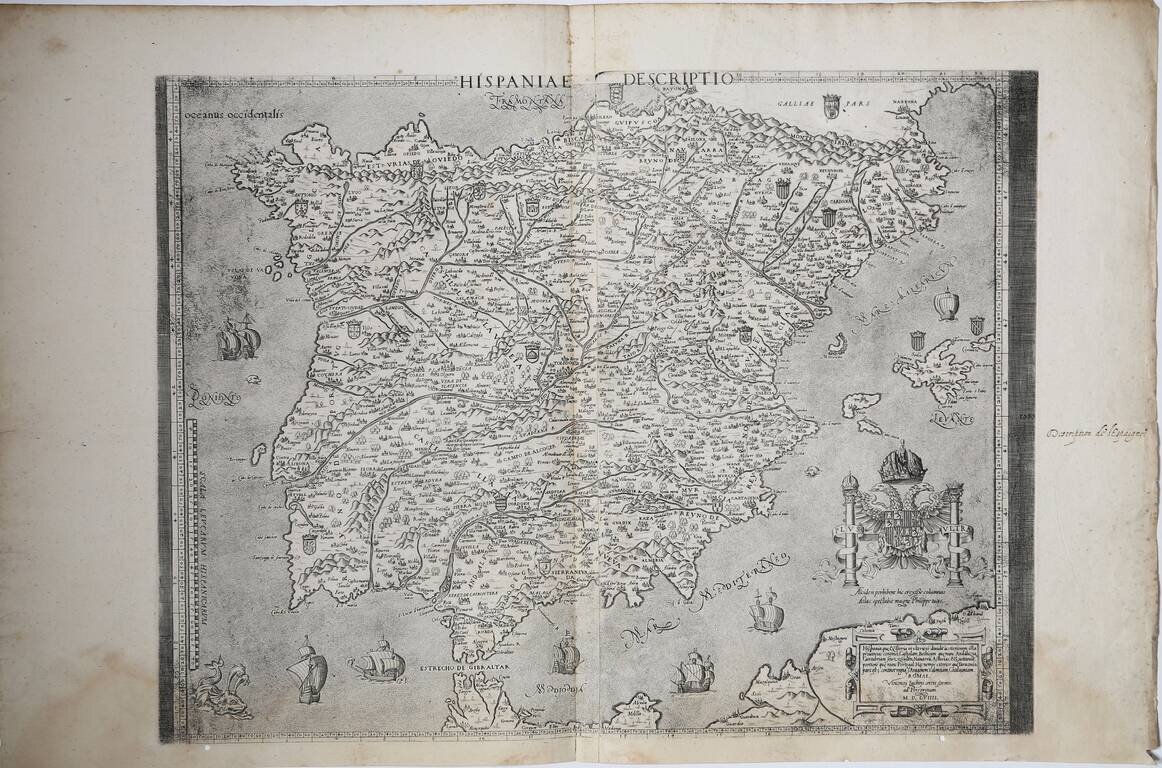
First State of Luchini's Map of Spain
A magnificent example of the first state, of three.
The map of the Iberian Peninsula by Vincenzo Luchini, based on the Virko Paletin model. The map is a faithful copy of the "Nova Hispania Descriptio" by Hieronimus Cook, published in Antwerp in 1553, in turn based on the work by Paletino.
In fact, the map has more in common with the Cook map. Both are engraved on copper and both have the same scale of miles and a large cartouche with the imperial shield of Charles V.
The copper plate was certainly in possession of Claudio Duchetti (probably through Lafreri in whose catalog a map of Spain is listed) and subsequently inherited by Giacomo Gherardi. The work, in fact, is included in the catalog drawn up on behalf of the widow Quintilia Lucidi (17-19 October 1598, n ° 418) where it is described as "doi fogli reali della spagna reale".
The plates were purchased by Giovanni Orlandi in 1602, which reprints them with the addition of his own address, and finally by the Flemish Hendrick van Schoel, author of a further edition which still bears the date of 1602 (but published after 1614).
Rarity
This the first state of three. All states are extremely rare.
If you are a student, write to us in telegram: @antiquemaps and indicate what material you need and for what work you need a map in high detail. We are ready to provide material on special terms. For students only!
![(Pro-Spanish Republic Political Broadside) [Lift The Embargo Against The Spanish Republic] President Roosevelt says . . .](/map/small/50218.jpg)

