Map size in jpg-format: 2.26079MiB
Click to open in high resolution (open in new tab).
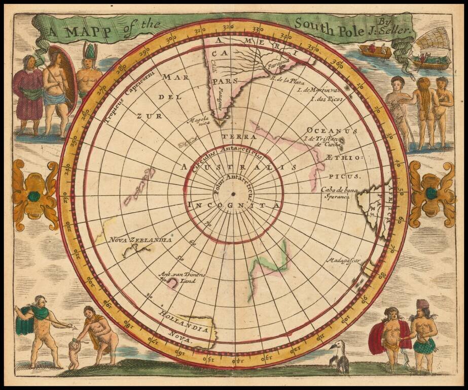
A 17th Century English South Polar Rarity
Rare miniature map of the South Polar region, from Seller's Atlas Maritimus.
Both the cartographic detail and embellishments are based upon the Hondius/Jansson map of the South Polar regions.
If you are a student, write to us in telegram: @antiquemaps and indicate what material you need and for what work you need a map in high detail. We are ready to provide material on special terms. For students only!
![[Eastern Hemisphere Globe Gores] (Nova et integra universi Orbis descriptio)](/map/small/54480.jpg)

