Map size in jpg-format: 4.87312MiB
Click to open in high resolution (open in new tab).
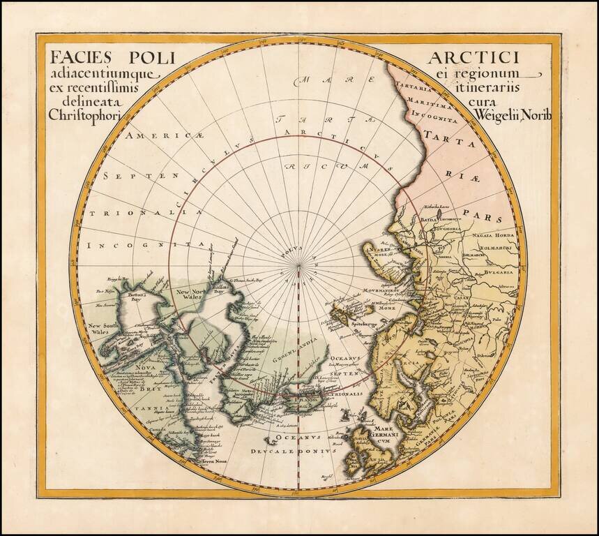
Interesting map of the North Pole from Davide Kohler's Descriptio Orbis Antiqui…published by Weigel in 1720.
The map shows the prevailing belief in a massive northern hemisphere, extending to Alaska, Canada, the British Isles, Scandinavia and Russia. An interesting retrospective projection.
If you are a student, write to us in telegram: @antiquemaps and indicate what material you need and for what work you need a map in high detail. We are ready to provide material on special terms. For students only!
![[Eastern Hemisphere Globe Gores] (Nova et integra universi Orbis descriptio)](/map/small/54480.jpg)

